
7 December 2022
The coastal section at Esterillos Oeste, Costa Rica
Posted by Callan Bentley
As mentioned, over Thanksgiving I got the opportunity to travel to Costa Rica, to the little beach town of Esterillos Oeste. I really enjoyed the sloths and toucans and geckos, but two of my favorite jaunts were solo explorations along a substantial wave-cut platform west of the town beach. These rocks are submerged at high tide, but exposed at low tide. The rock outcrops run for ~3.5 km along the beach, in a strip that’s about 200 m wide from the beach to the crashing waves at low tide. In exploring them, I found that many of the outcrops were slippery, coated with a gelatinous scuzz of biofilm. Twice, I nearly wiped out when attempting to cross a slick knoll. But I had such a good time, exploring solo on an unpopulated stretch of coast. That’s my idea of heaven: interesting rocks, no people, and just a few interesting birds for company (e.g., bare-throated tiger heron!!).
I have since learned that the formation is the Punta Judas Formation, and it has been determined to be middle Miocene in age. Apparently it contains a decent number of shark fossils, though I didn’t see any.
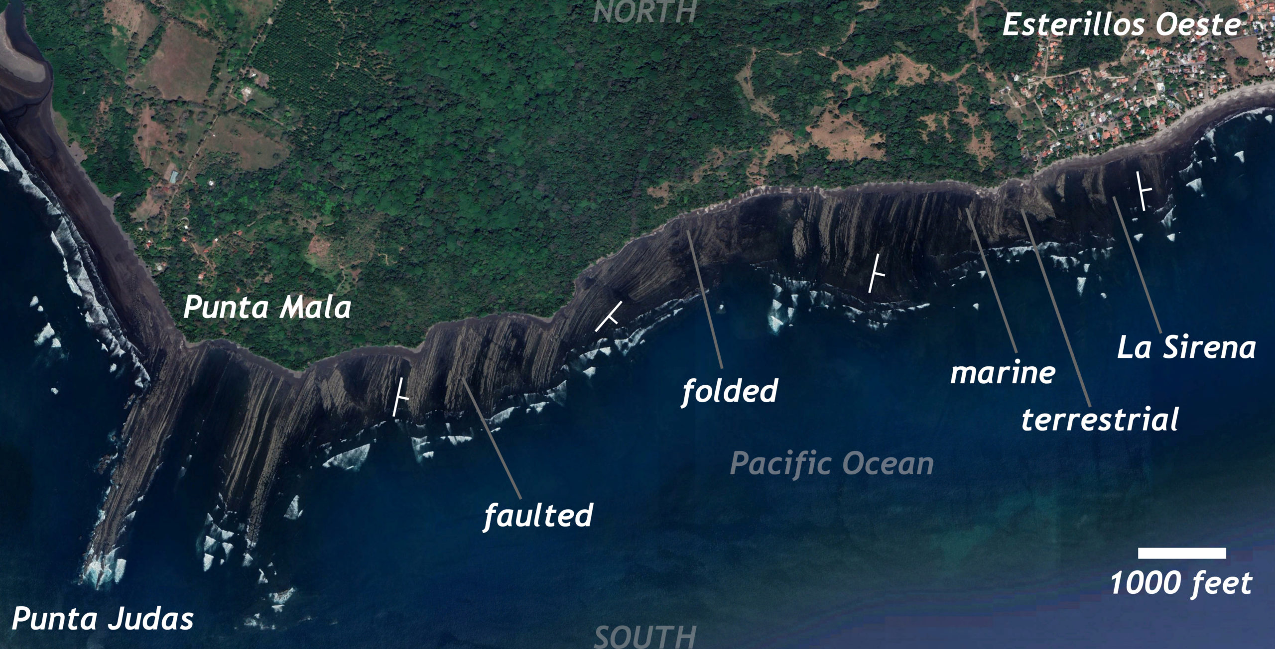
Let me recount the strata I observed, working my way westward from La Sirena, a statue of a mermaid where Esterillos’s beach turns to rock, heading down-section as I traveled further toward Punta Mala. Here’s a map showing the route. It’s an east-west section of coast, with the Pacific Ocean to the south. I’ve dropped on four strike/dip symbols showing the orientation of the strata, but caveat emptor: I didn’t do any systematic mapping or measuring of section.
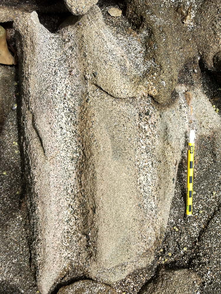
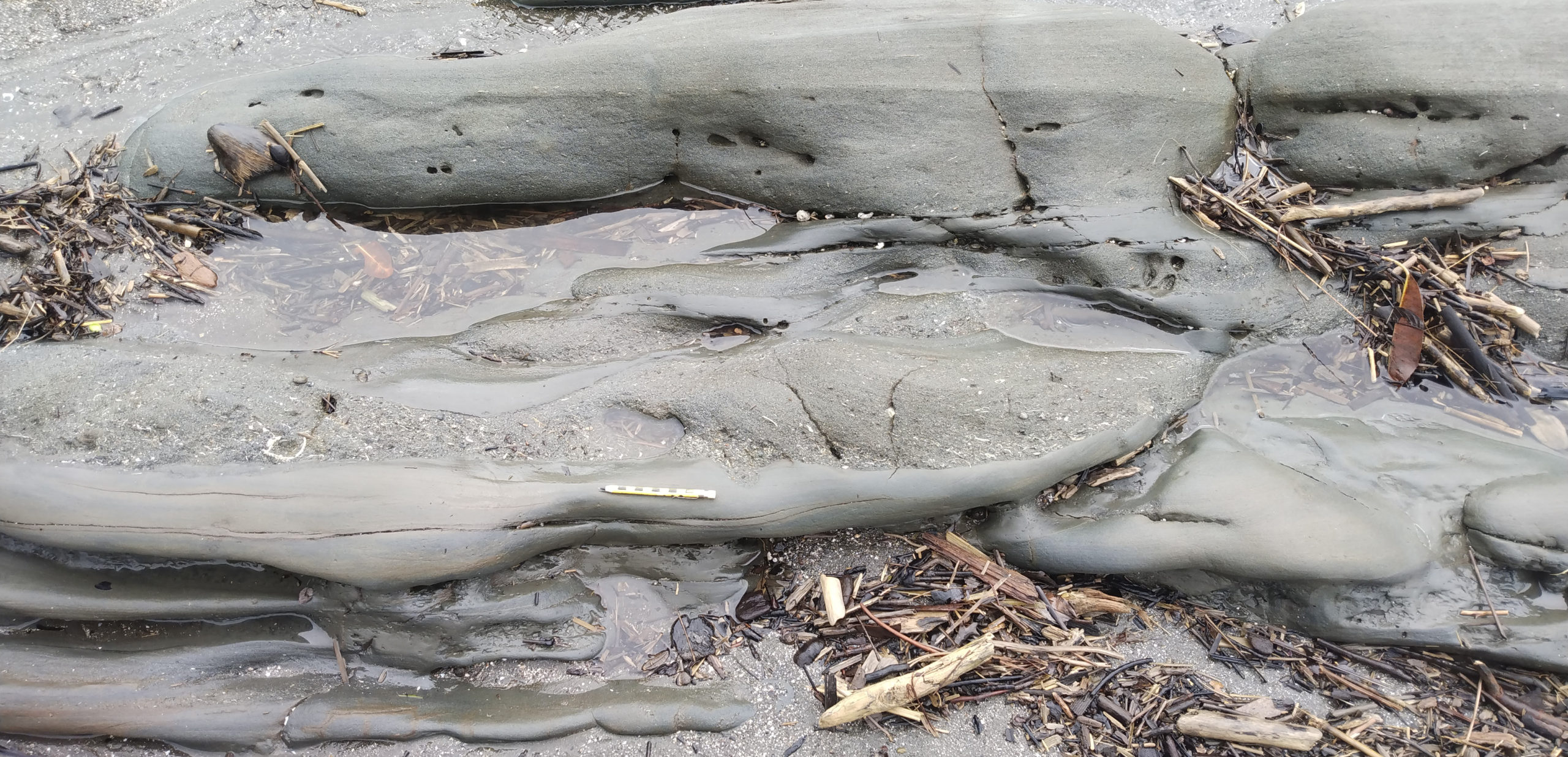
Let’s check out what I found in the easternmost outcrops (youngest strata). They were volcaniclastic sands, and I spotted a few planar cross-beds, but then I saw this:
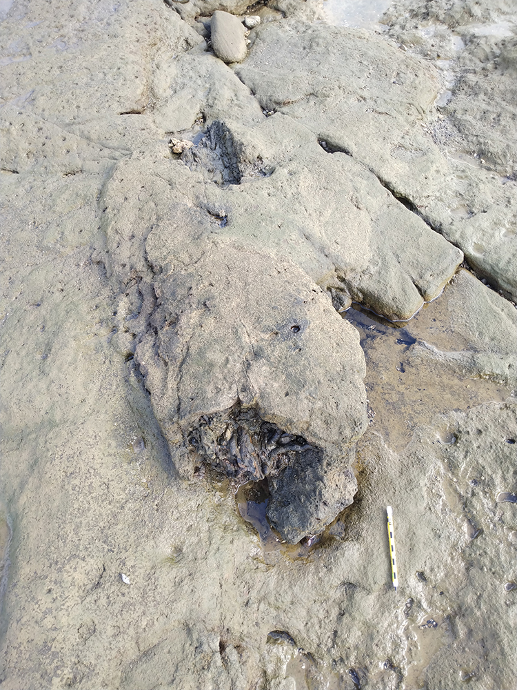
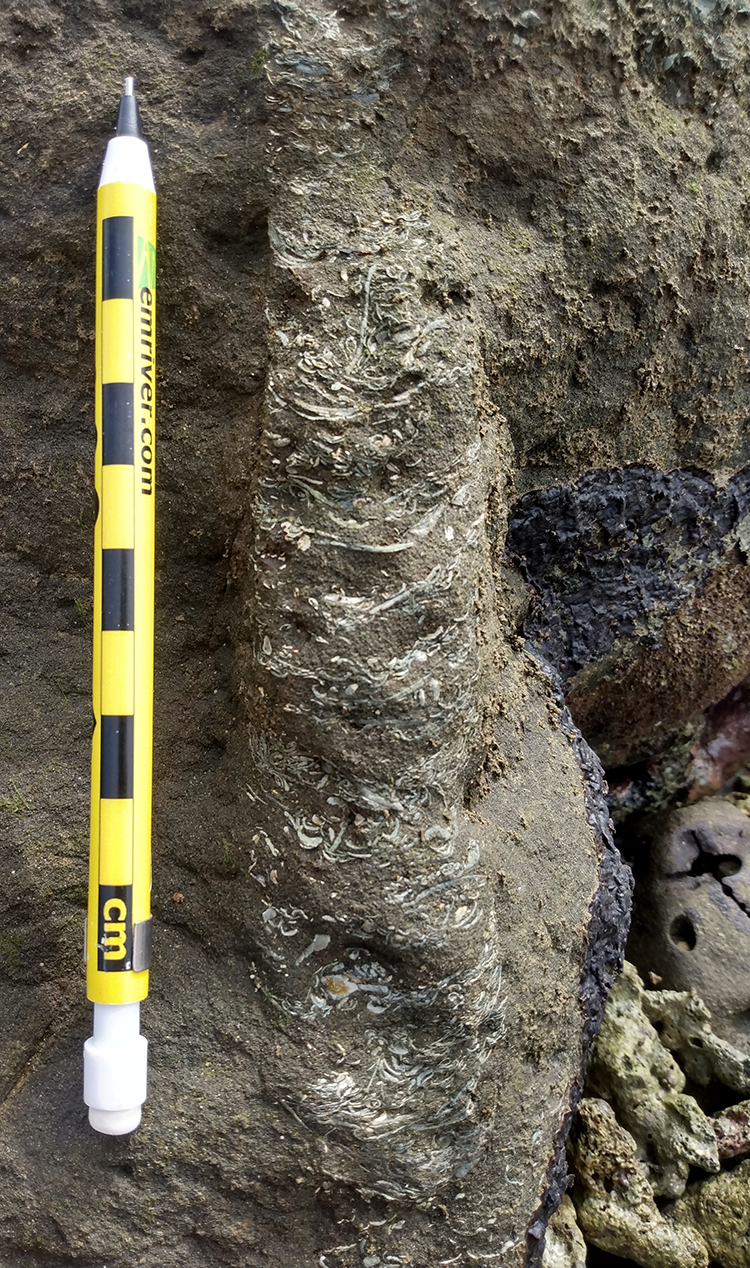
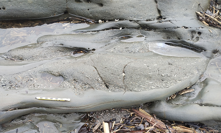
Here’s a close-up of that front section:
I’m pretty sure that’s a big fossil palm tree trunk! It was overall cylindrical and several feet long, and had these internal wiggly rootlet looking things. I wasn’t sure what I was getting into with exploring these strata, but the lack of shelly marine fossils, and then this tree trunk made me to provisionally interpret the easternmost (youngest) part of the section as terrestrial, or at least shoreline proximal (like a deltaic setting).
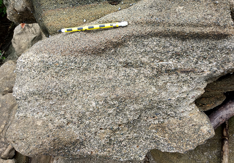
I don’t have a ton of photos of that easternmost section, but a short distance down-section, the strata looked like this:
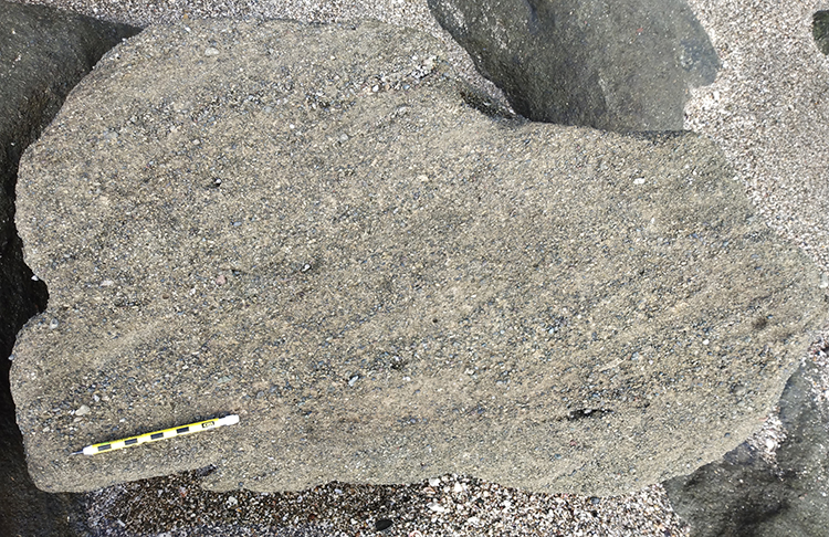
… thick beds of coarse sand and pebbles, with planar cross-beds.
A couple of graded beds (with “paleo-up” to the left):
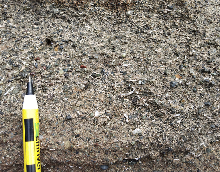
But is there any evidence of marine influence? …
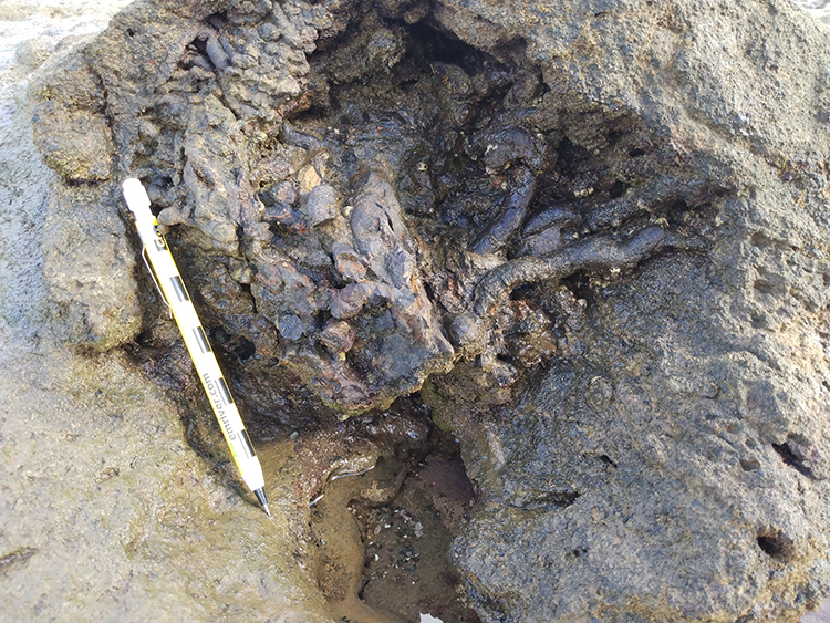
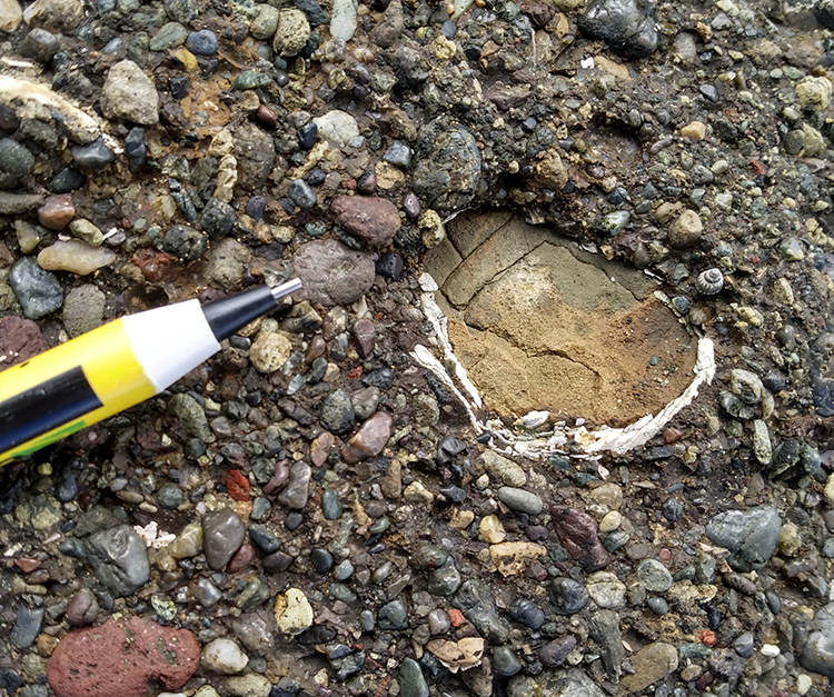
Closer up, I started to see what looked like shelly material beginning to show up not very far down into the section.
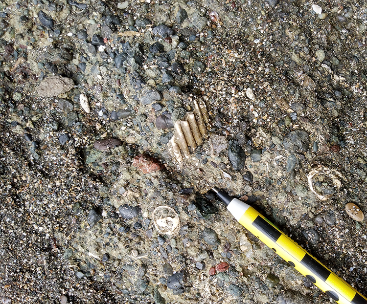
Okay, that’s for sure a fossil – a scallop, I guess?
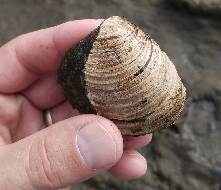
Here’s a bivalve (~clam) fossil in coarse volcaniclastic sediment, but filled with a body of much finer sediment.
And I was able to pluck one out:
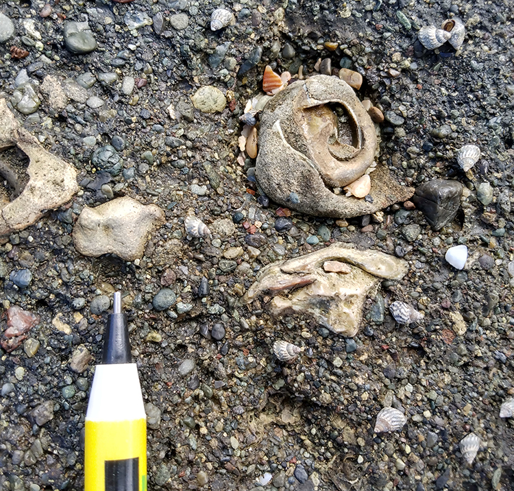
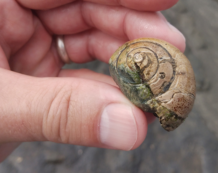
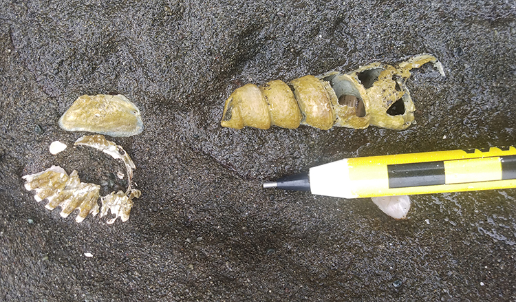
A suite of gastropod (snail) fossils:
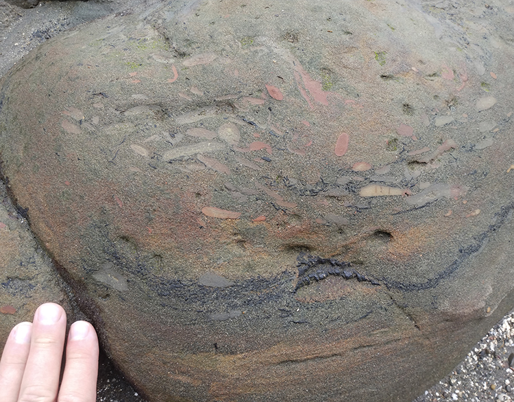
The sediment got finer: a mudrock. In it, there were also plenty of diagenetic features, like boxwork along joints, and these concretions:
This is neat example showing differential weathering of the concretions multiple concentric spheres:
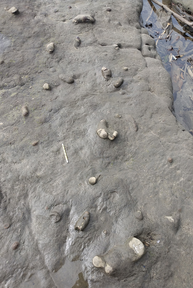
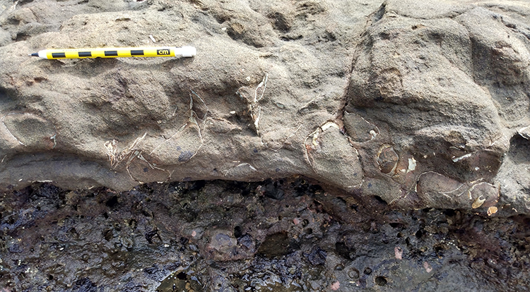
Then the sediments got coarse again, but a different kind of coarse… a bioclastic coarse:
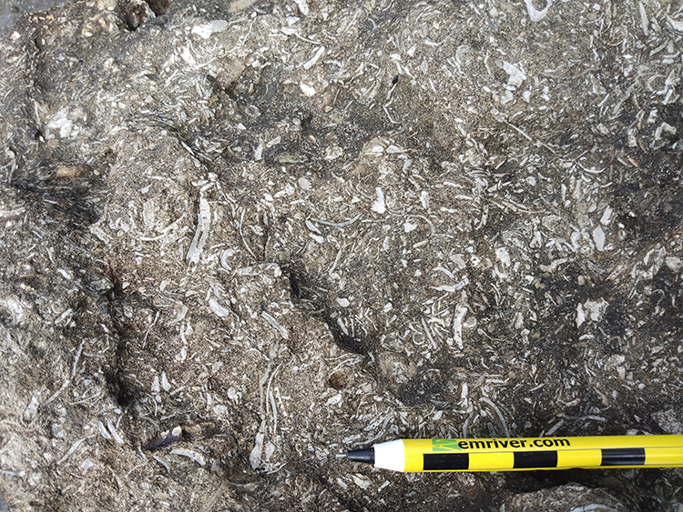
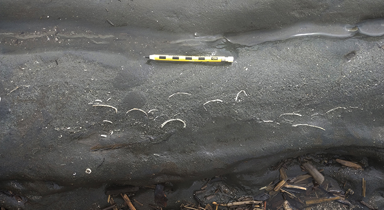
Then back to sand, but with shell-filled burrows, like this one (plan view):
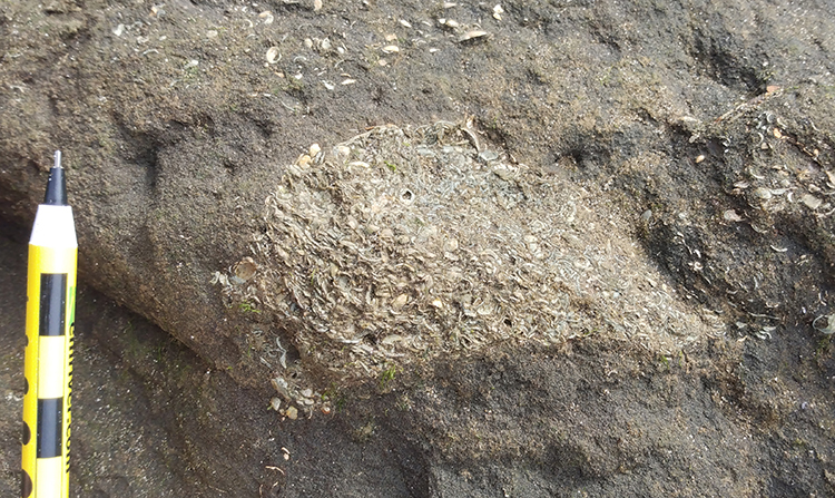
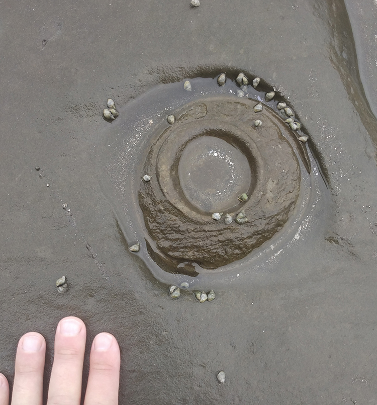
Or this one, which is pleasingly circular (despite being a bit submerged):
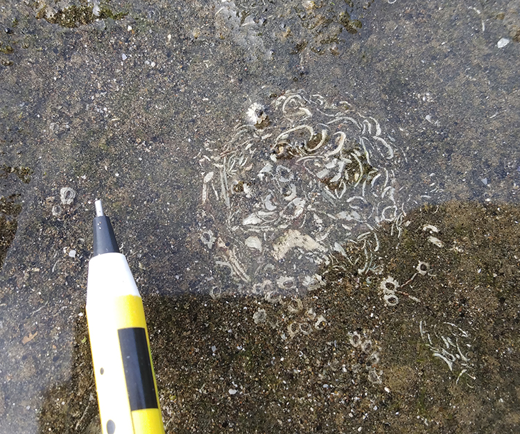
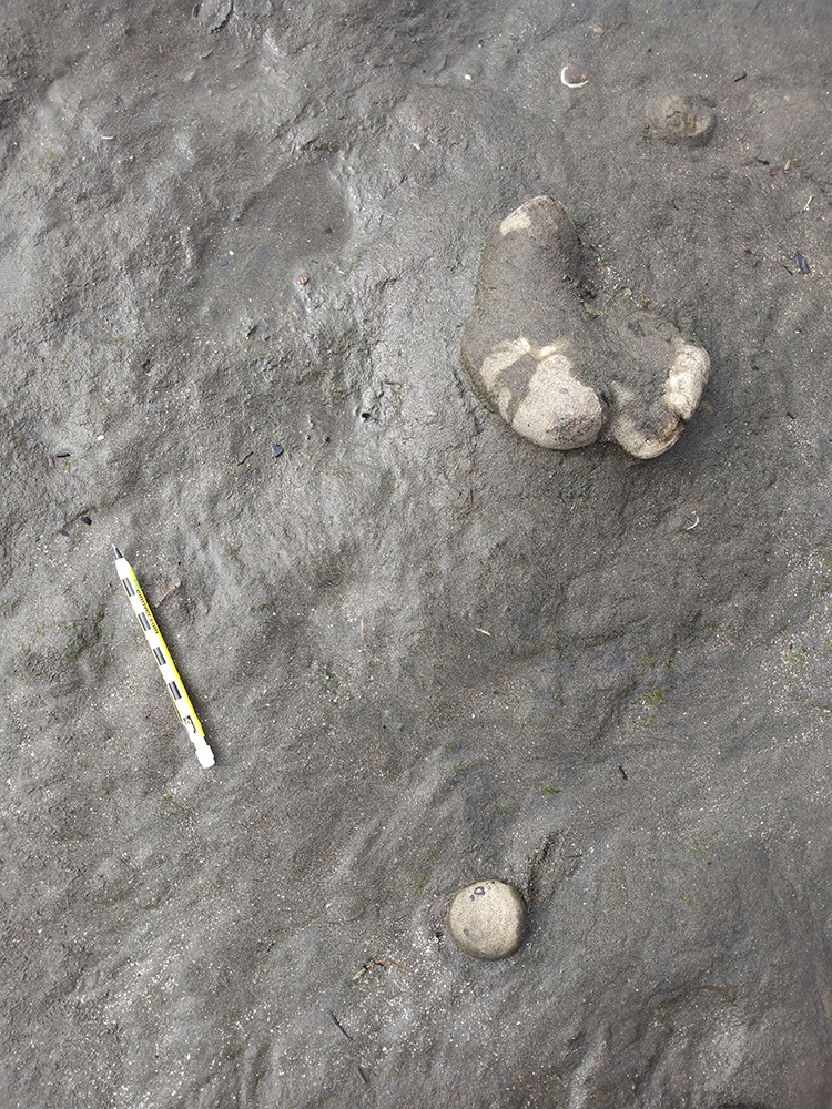
Or this one (side view):
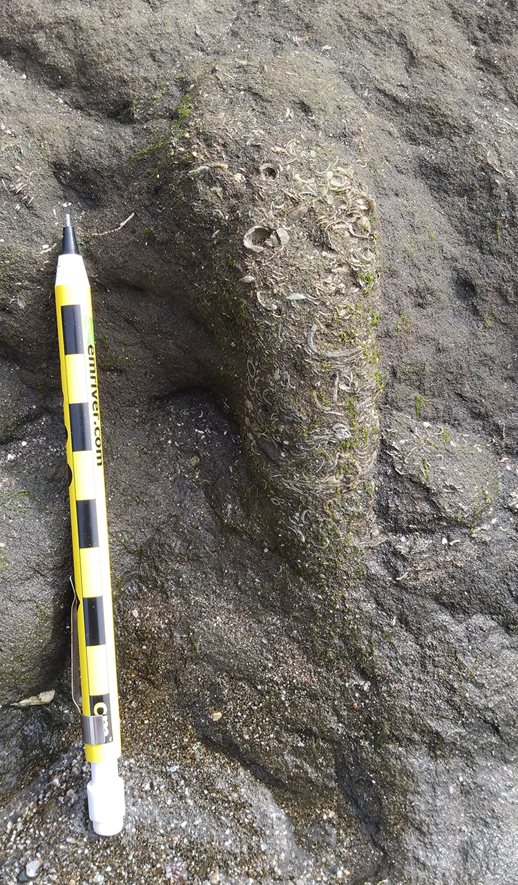
Or this one, which I love because its internal “fabric” shows backfilling, presumably as sediment was accumulating above and the burrow occupant had to keep up with the rising seafloor surface:
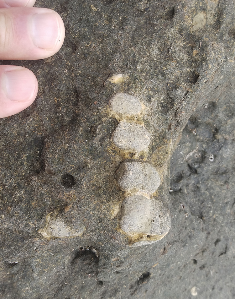
More sand, and with it another layer of buried bivalves, in this case (based on the articulation of the two valves) a group of clams that were buried alive:
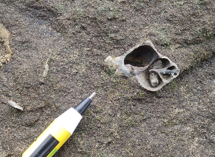
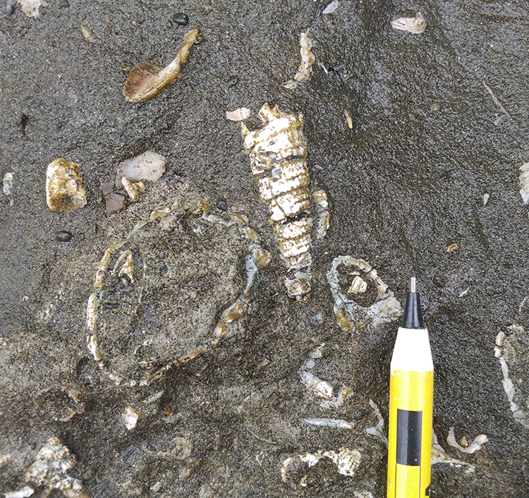
I found a few high-spiraled snails, Turitella or a related genus, presumably:
Two more examples, with original skeletal material:
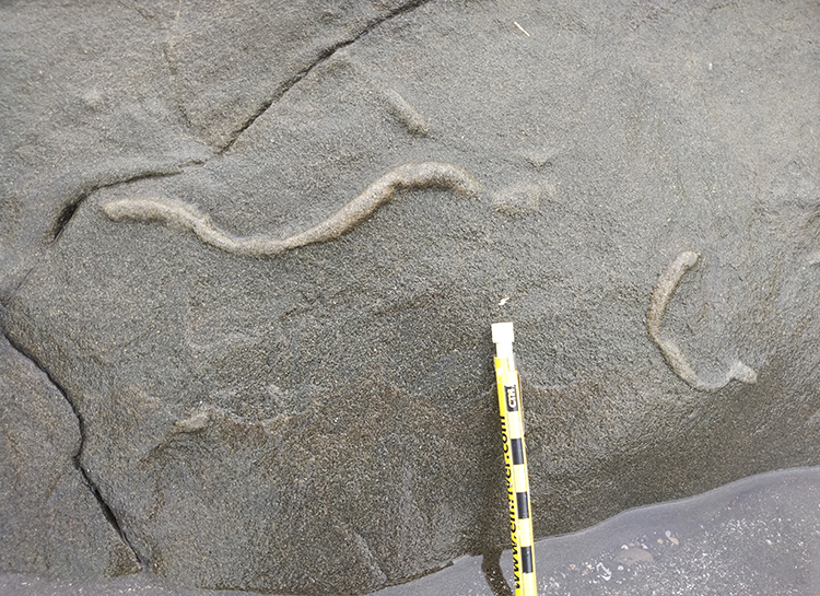
A few small diameter sinuous trace fossils:
Another primary sedimentary structure here: rip-up clasts of mud, set in a sandy matrix (with a fair amount of coalified plant scraps):
The story with the rip-ups is (1) initial low-energy deposition of mud followed by (2) a high-energy event that both (a) ripped up the mud in self-cohesive chunks and (b) entrained a lot of sand, mixing the two for the final deposit.
A similar story can be seen below, with a sandy layer between muddy layers, but here including some disarticulated bivalve shells as well. Notice how all the shells have a consistent orientation, concave-down: that’s another good paleo-up indicator:
Another primary sedimentary structure I saw in abundance, that served as a good indicator of marine sub-normal-wave-base conditions (but within reach of storm waves) and one that also serves as a paleo-up indicator, is hummocky cross-stratification:
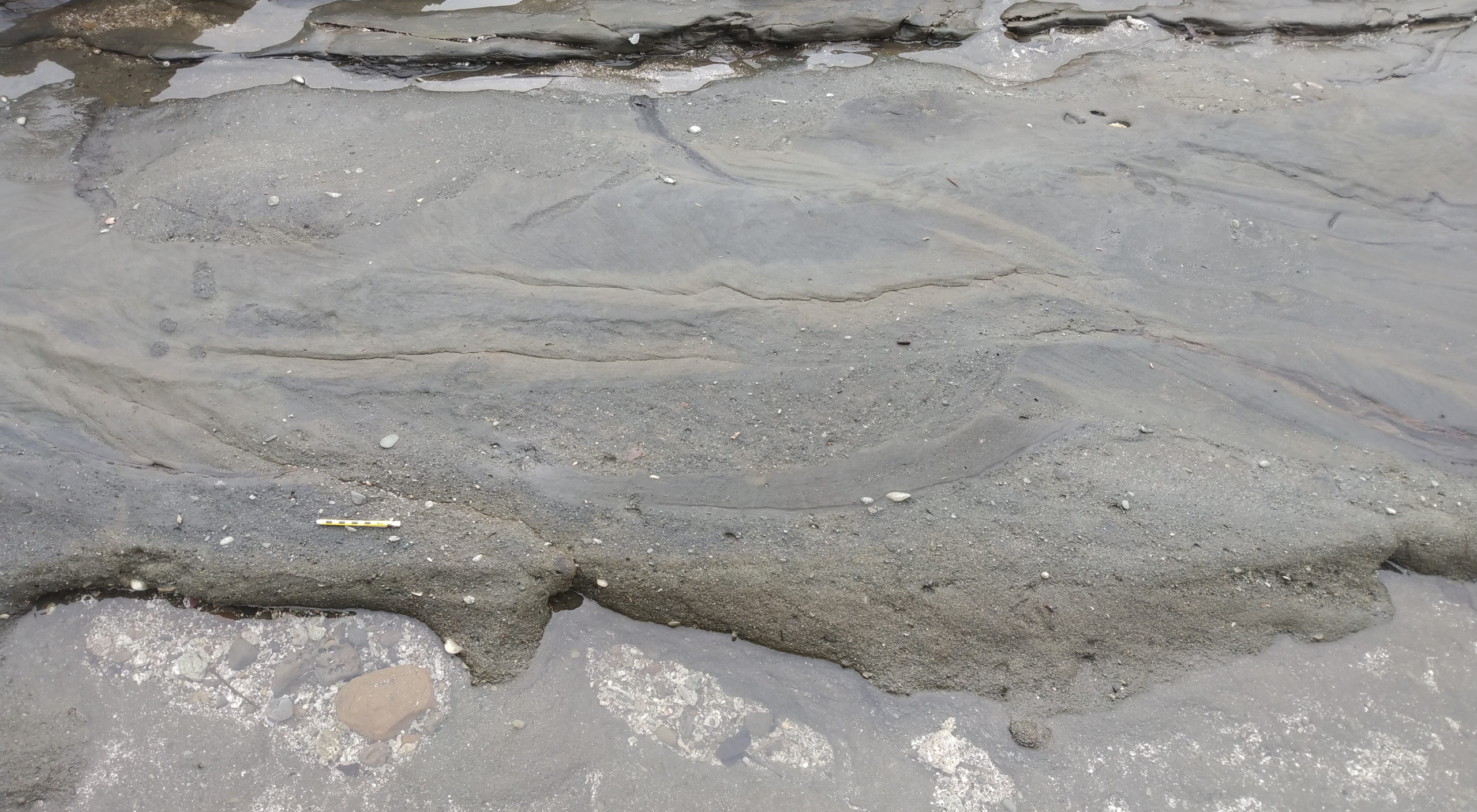 (Click to enlarge)
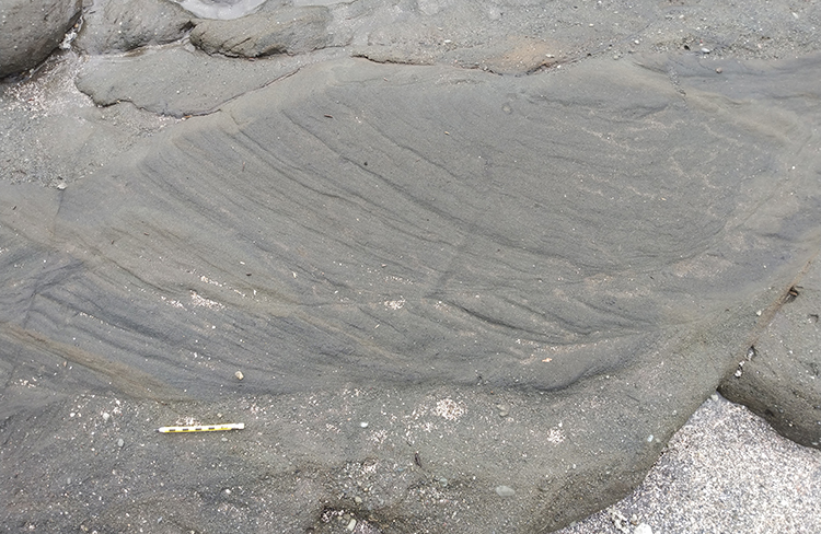
Here’s another example:
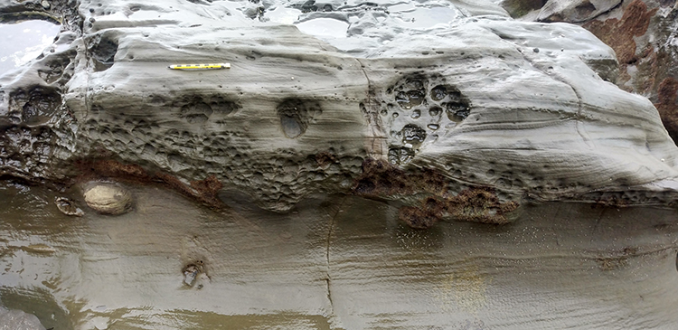
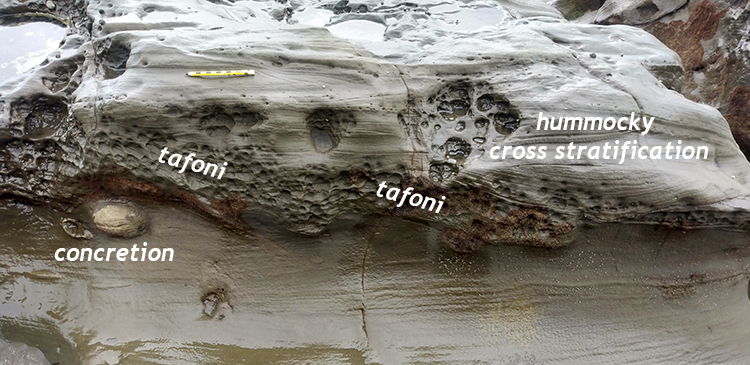
A neat outcrop showing hummocky cross-stratification (right), plus a concretion and the “tafoni” style of modern salt-enhanced weathering:
[Annotated:]
One more example, bearing a mix of shells and gray sand laid out in neat cross-laminations:
 (Click to enlarge)
Closer up, so you can see the internal cross-laminations, defined nicely by the shelly components of the sediment (cross-beds dip to the right, which is south in this case). Note also the more extremely incised “bite” just to the right of the pencil’s eraser-end, and how coarse the material filling that incision is:
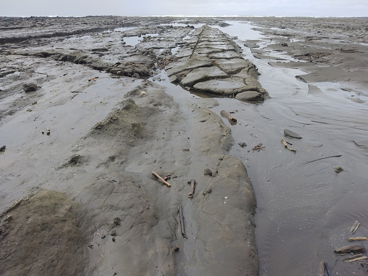
Finally, all of these *awesome* sedimentary layers were deformed. There were large-scale folds (as seen in the satellite image above), but also a substantial number of brittle faults with small offsets. Here’s one:
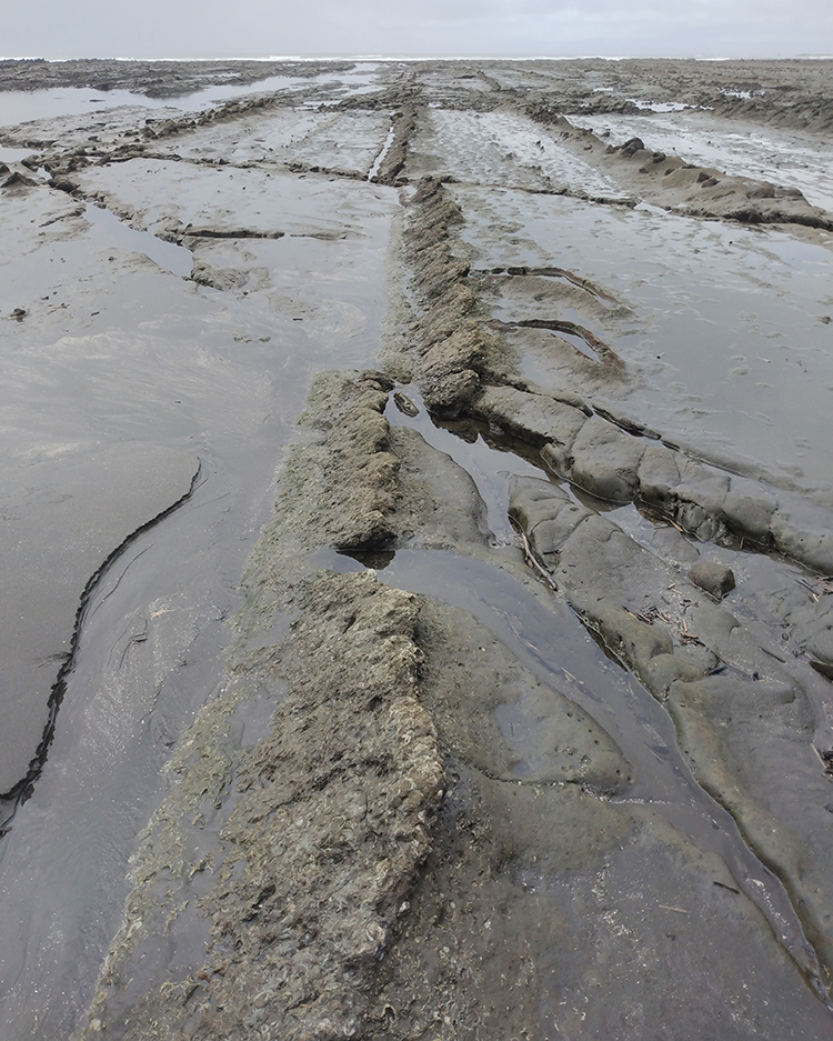
Here’s a conjugate pair of faults offsetting a shell-rich layer into a nice triangular pop-out structure that thickens the rock package east-west, and shortens it north-south. (The view here is looking south):
You can see these faults easily if you zoom into the Google Earth screenshot I provided earlier:
 (Click to enlarge)
Between the sedimentology, the fossils, the diagenetic structures, the structural deformation, and the modern weathering, this site was a real treat to explore. I wonder if I can take students there someday…? I think it would make an awesome intro mapping project.
 Callan Bentley is Associate Professor of Geology at Piedmont Virginia Community College in Charlottesville, Virginia. He is a Fellow of the Geological Society of America. For his work on this blog, the National Association of Geoscience Teachers recognized him with the James Shea Award. He has also won the Outstanding Faculty Award from the State Council on Higher Education in Virginia, and the Biggs Award for Excellence in Geoscience Teaching from the Geoscience Education Division of the Geological Society of America. In previous years, Callan served as a contributing editor at EARTH magazine, President of the Geological Society of Washington and President the Geo2YC division of NAGT.
Thank you so much for all the great photos and explanations – enlargements and annotations. They really help non-geologists like me to learn… Cheers, Marg
Dear Callan,
I think this post article is one of the best for this year. Thank you so much for keeping us vigilant and aware for all these geological epochs of time, that comes to our knowledge today, just in a couple of minutes. Allow me to say that you are definitely a kind of time compressor.
Thanks. I love writing posts like this – the past few years have been hard because of the lack of new content due to travel dropping to almost zero. I love visiting new places, exploring, and sharing what I find. I’m so grateful for your readership and your positive feedback on the blog!
Thanks for the write-up. Wife and I have been walking the sequence from the mermaid statue to Punta Mala and it’s fantastic but even better after reading your blog because now I know the formation name and the age. Very important to time arrival at Punta Mala to coincide with low tide so that you can walk (carefully) to the southern tip of the outcrop. Thanks again!