
18 March 2019
New discoveries in the Martinsburg Formation
Posted by Callan Bentley
Last Tuesday, the weather was great, and I was on spring break, so I didn’t have to teach. There are a bunch of local outcrops I’ve been meaning to suss out, and it seemed like the time was right. I contacted my colleague Russ Kohrs, a teacher at the Massanutten Regional Governor’s School for Environmental Science and Technology (and an instructor at Lord Fairfax Community College), and we set out for Page County, Virginia, to a stretch of the South Page Valley Road between Massanutten Mountain and the South Fork of the Shenandoah River:
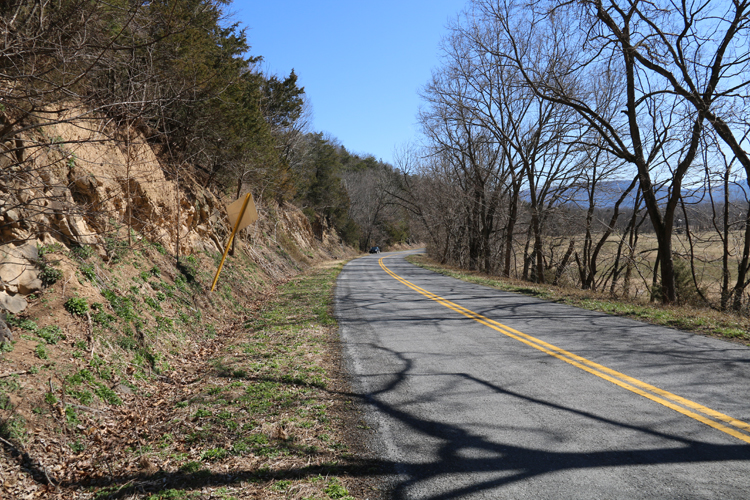
I’ve featured a field report from outcrops just up the road from this new site previously, but this was my first time stopping and “putting eyeballs on” the outcrops featured in today’s blog post.
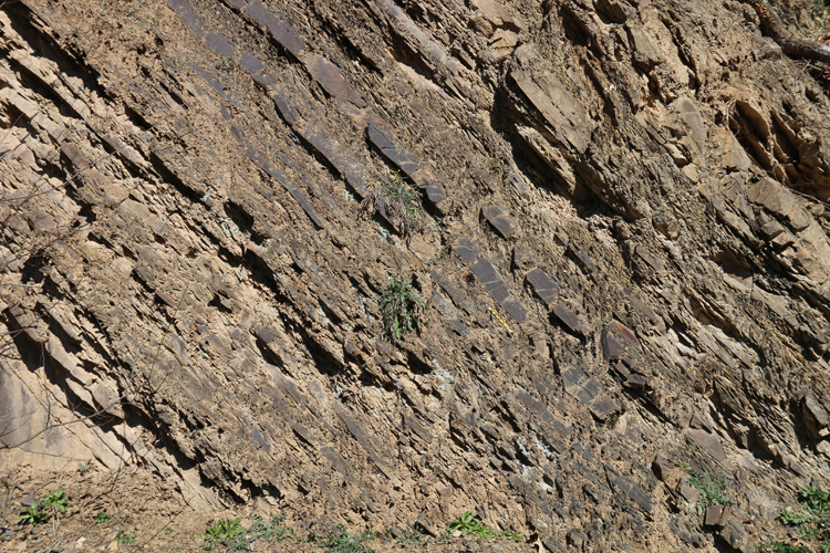
The Martinsburg Formation is a late Ordovician turbidite sequence, clastic sediments shed into deep water from a proto-Appalachian mountain belt. The source mountains were generated as an offshore volcanic island arc accreted to the ancestral North American continent (“Laurentia”) in an event dubbed the Taconian (or “Taconic”) Orogeny. The tectonic smash-up shoved rocks up into the air, making mountains, which erosion went to work tearing away at. The result was lots of mud and lots of sand, which was carried downhill (expending its potential energy) to be deposited on the seafloor.
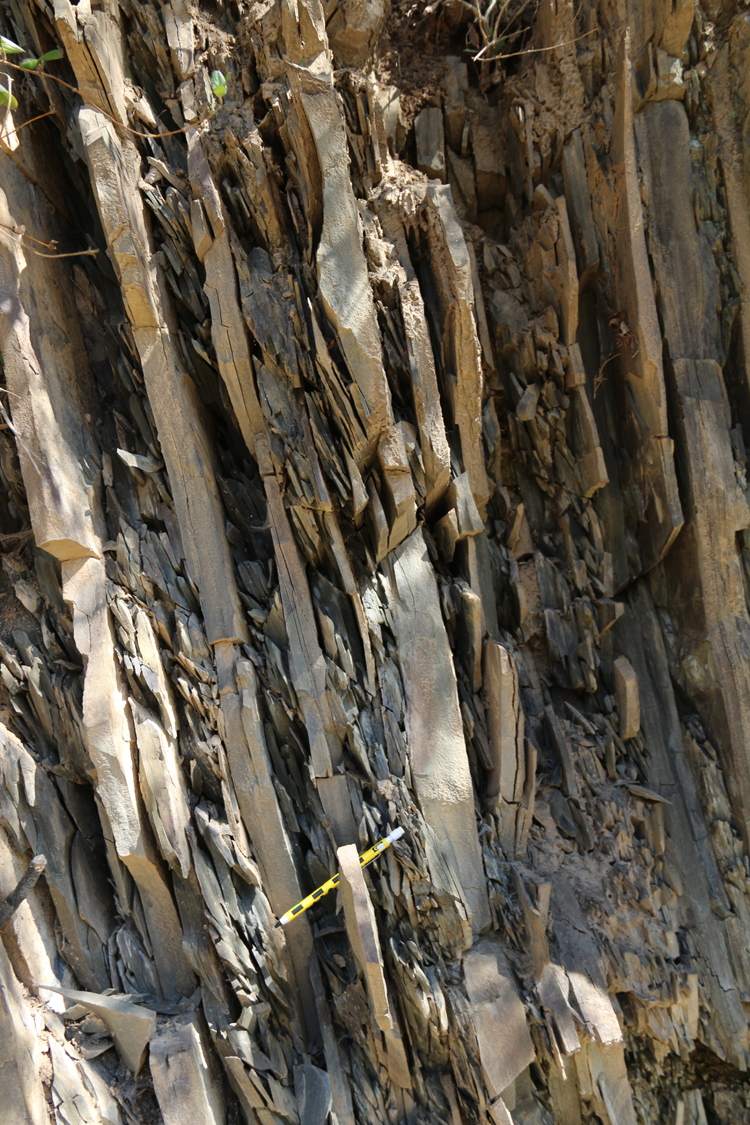
The result was a lot of sand and mud, today turned into lots of shale and graywacke:
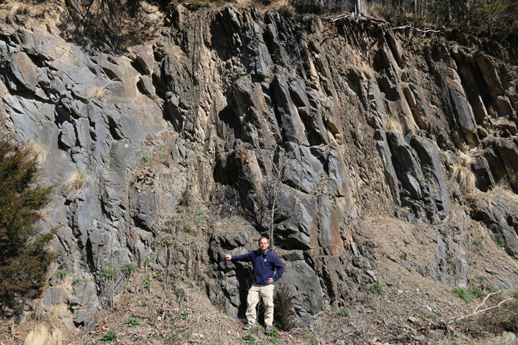
(Sense of scale: a heroic pose by Russ)
You’ll note these beds are not in their original ~horizontal orientation; they have been tilted and folded by subsequent mountain building; more on that in a moment…
For now, just appreciate that these rocks are made up of gazillions of tiny pieces of what used to be mountains – mountains that towered to the east over the Piedmont region, places like Washington, D.C., where one can examine their eroded roots today.
Deepwater packages of marine clastic sediment like the Martinsburg Formation are what alpine geologists call “flysch,” a word meaning essentially “mountain dandruff dumped in the sea next to the mountains.” (A companion term, “molasse,” translates to “mountain dandruff piled up on the land right next to the mountains.”)
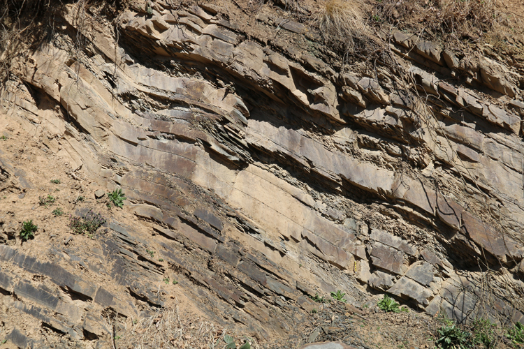
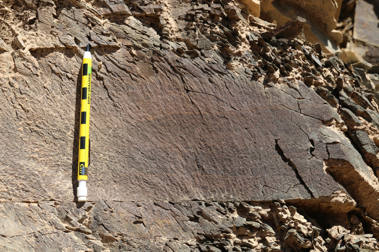
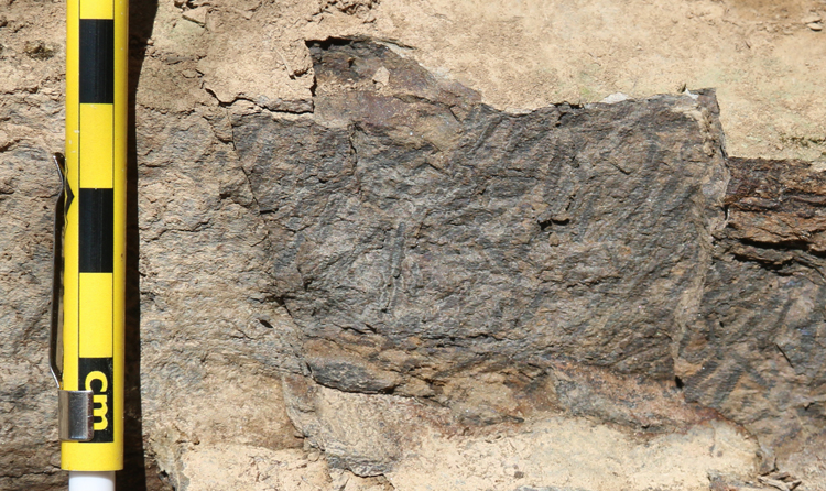
Here’s a particularly coarse section (that is to say, it has lots of sand):
Here’s a particularly muddy section (i.e., dominated by finer-grained sediments):
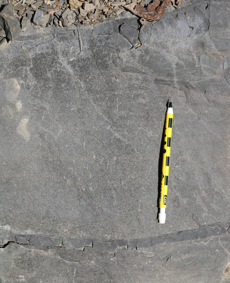
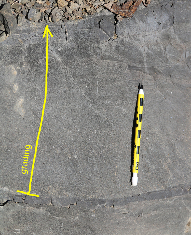
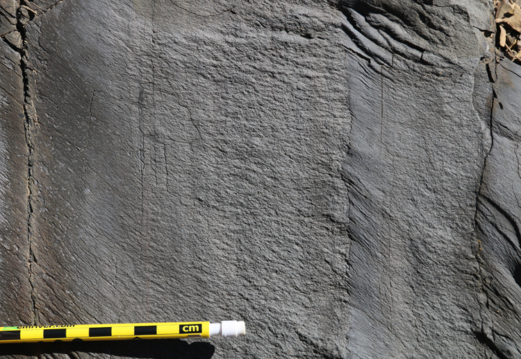
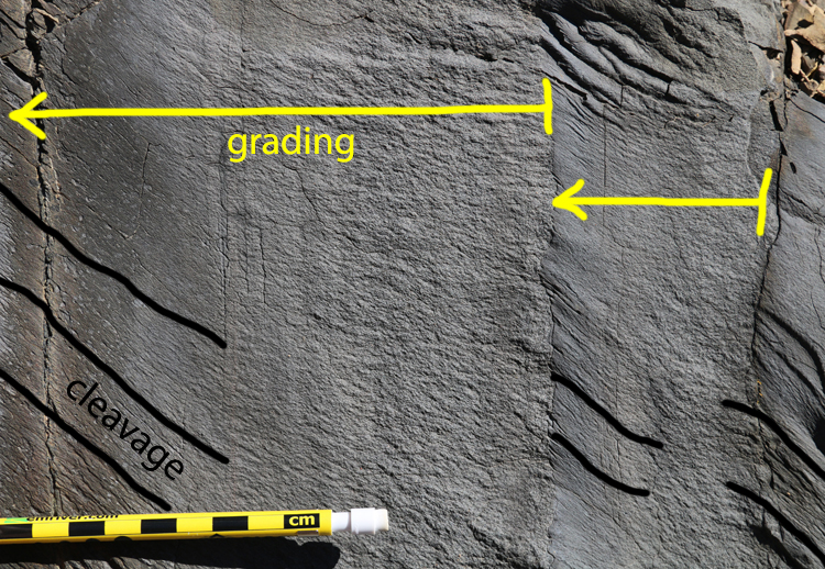
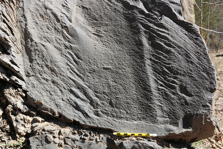
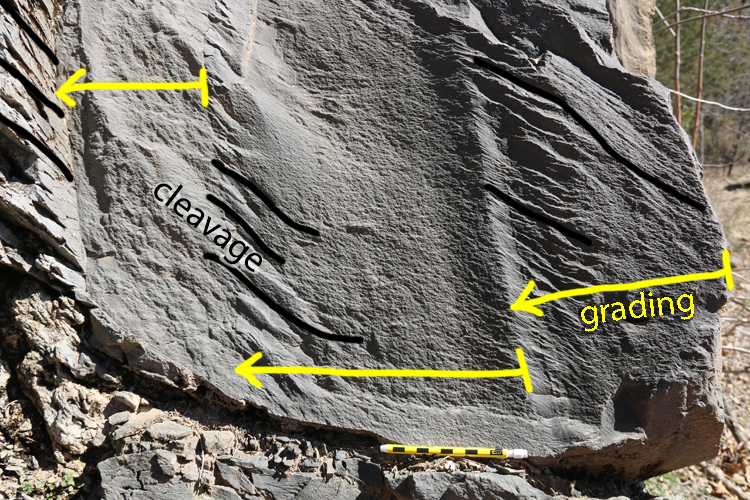
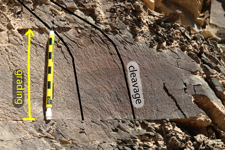
These packages of clastic sediment frequently accumulated in graded beds, reflecting pulses of turbid, churning water cascading into the still water of the deep sea. As the energy dissipated, the heaviest (~largest) grains settled out first, followed by finer and finer particles. This produced graded beds, a characteristic primary sedimentary structure:
Another:
…A few of them:
A set of graded beds in a vertical orientation:
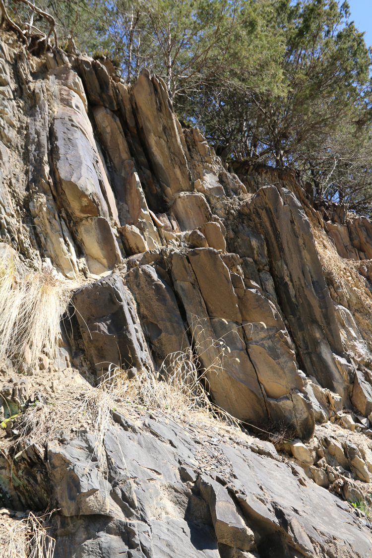
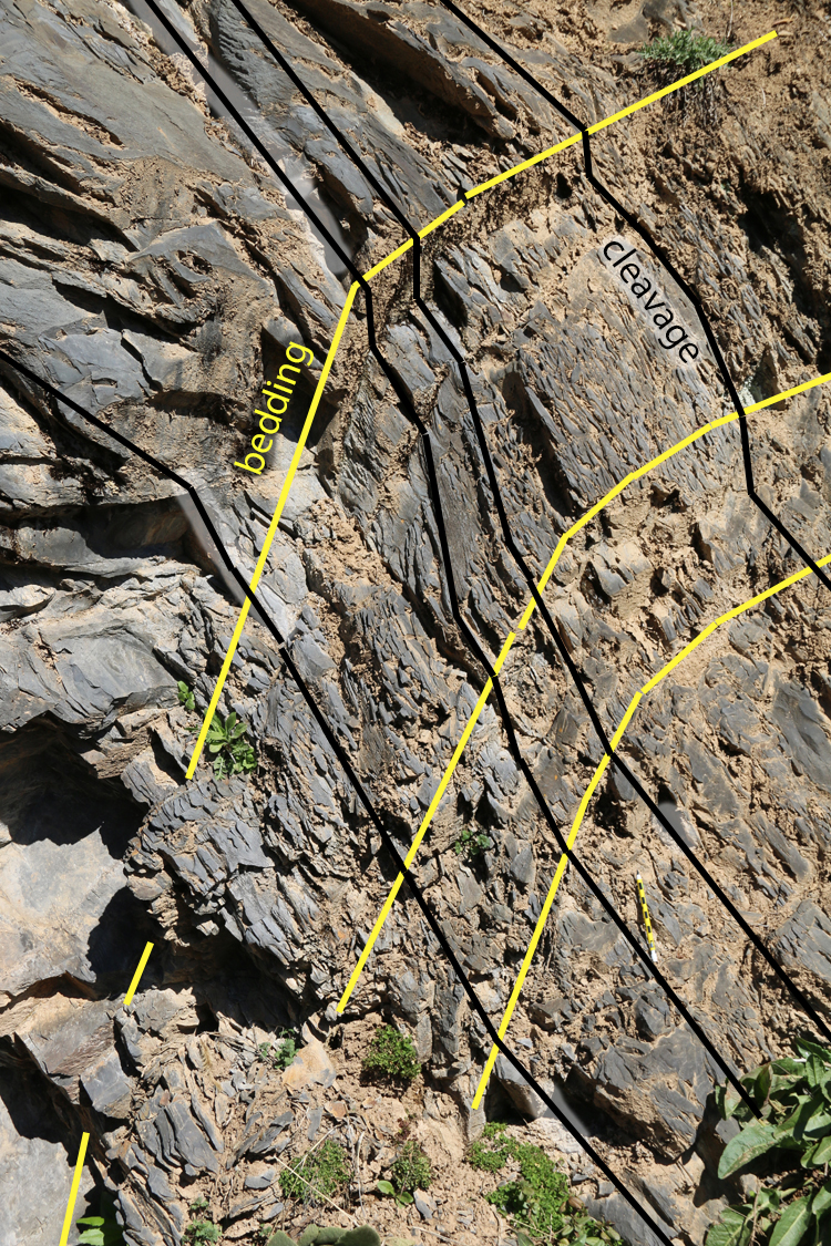
Later mountain-building (the late-Paleozoic Alleghanian Orogeny) squeezed these pre-existing strata, folding them into a massive regional down-warping called the Massanutten Synclinorium, but also imparting a tectonic cleavage. In the next photo, the strata are vertical, but the cleavage dips steeply to the lower right:
Ditto:
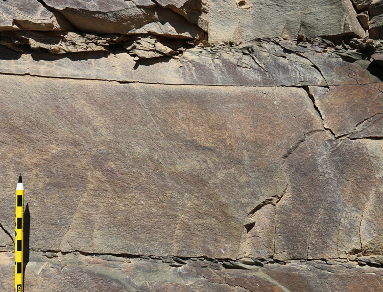
The cleavage is much more pronounced in the muddier portions of the turbidite, and less obvious in the sandier portions:
One more example:
Here’s a switch in perspective. Now we will look at the bedding plane itself, not a cross-section of it. In this next photo, our perspective is looking up through the uppermost parts of a lower graded bed (fine-grained scraps projecting from the outcrop face) and seeing into the very bottom-most parts of an upper graded bed (coarse-grained, more distant rock).
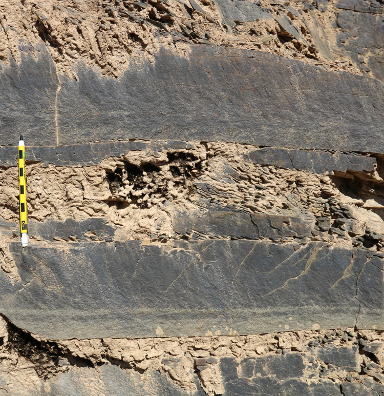
Here’s another bedding plane, this one bestrewn with graptolite fossils. We found this slab as float,
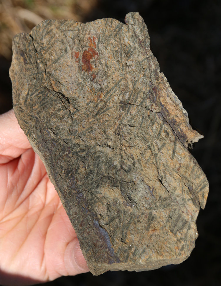
Here’s a GIGAmacro image I made of it, if you’d like to explore:
Link 1.38 Gpx GIGAmacro by Callan Bentley
Russ, a paleontologist, traced the fossil fragments uphill and found the stratum they originated from, in situ in the outcrop:
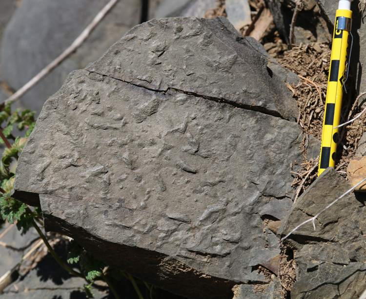
Another bedding plane, showing another fossil – but this time it’s trace fossils protruding as little nubs from the bottom of the overlying bed:
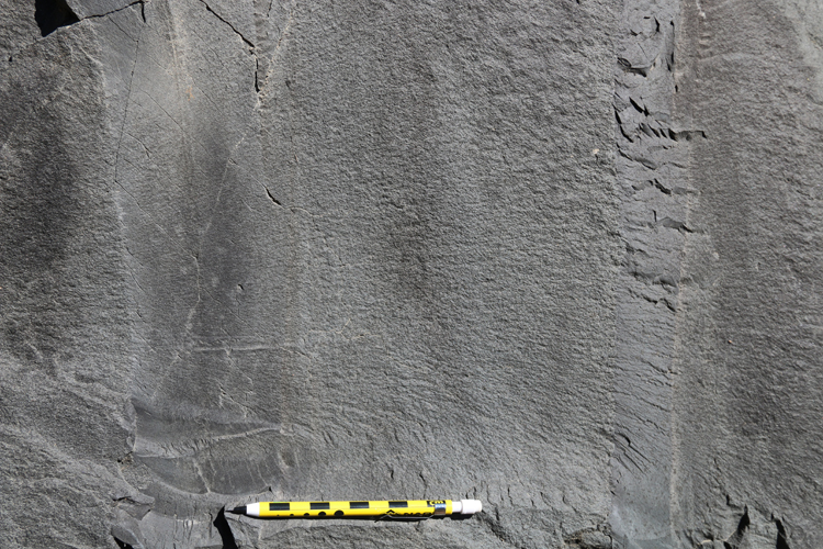
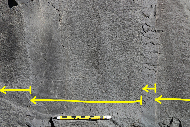
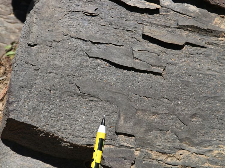
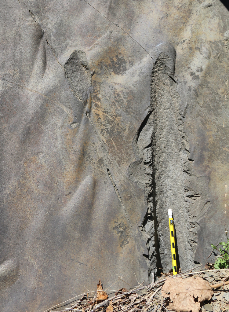
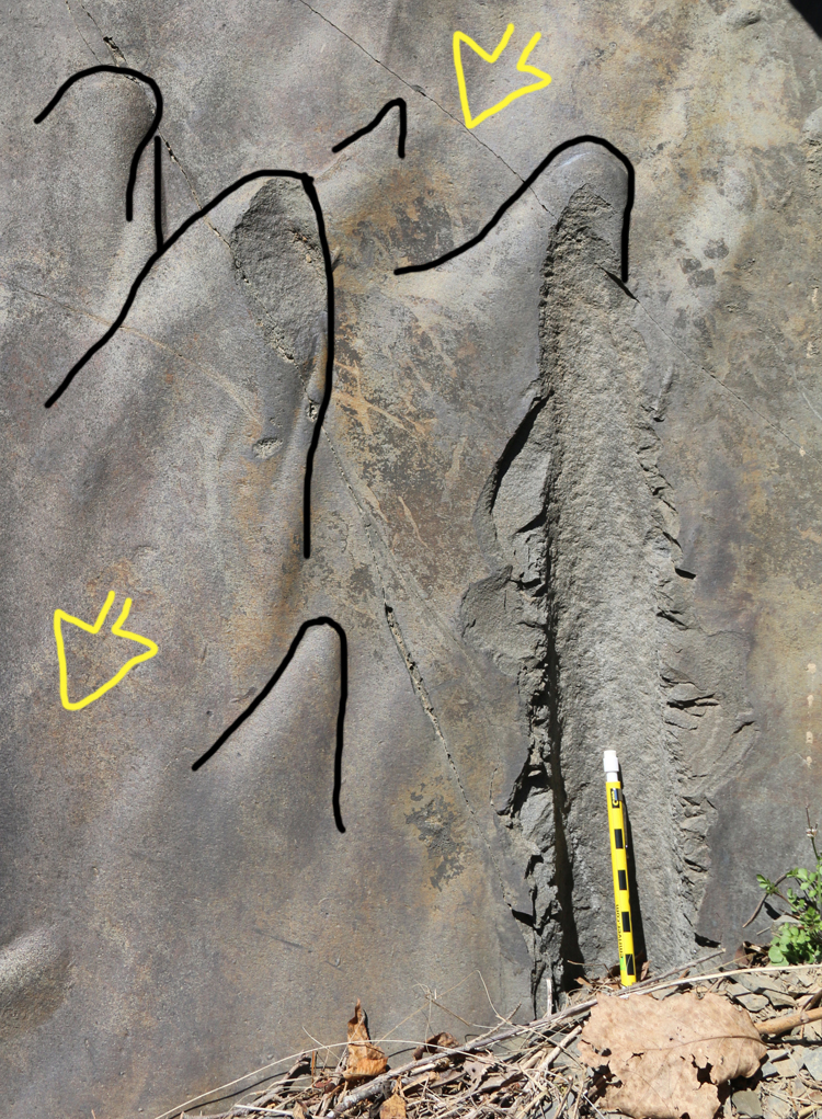
Another bedding plane feature we noticed were these excellent flute casts on the underside of one bed:
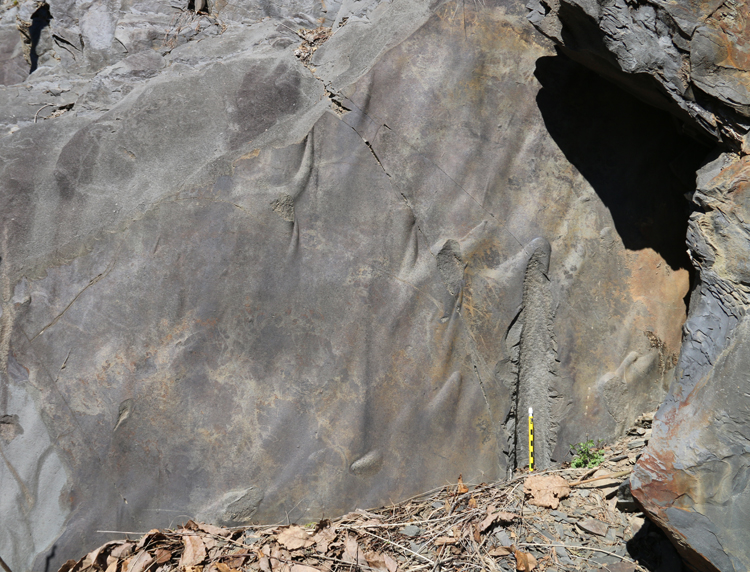
…Zooming in:
Annotated to show interpreted current flow direction with yellow arrows:
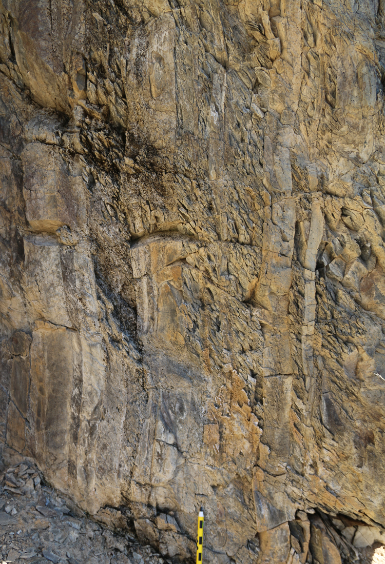
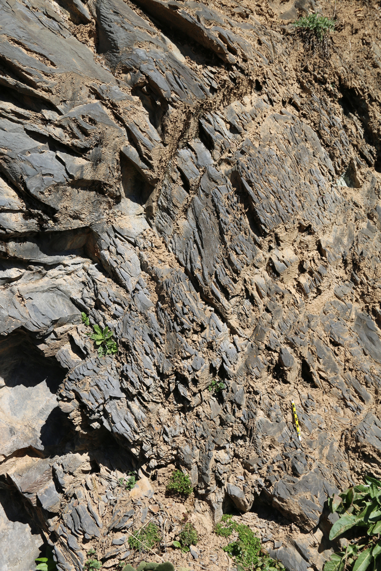
And there were other structures to be seen, too.
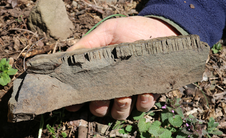
Here’s a neat example of closely spaced jointing, perpendicular to bedding in a silty package (atop a graywacke layer):
We also saw evidence of folding. Here’s one limb of an anticline:
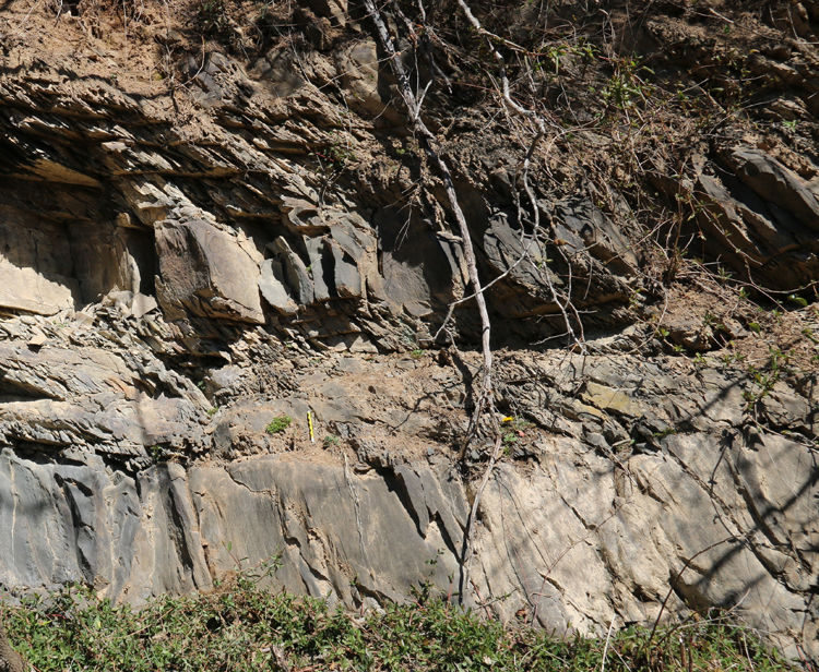
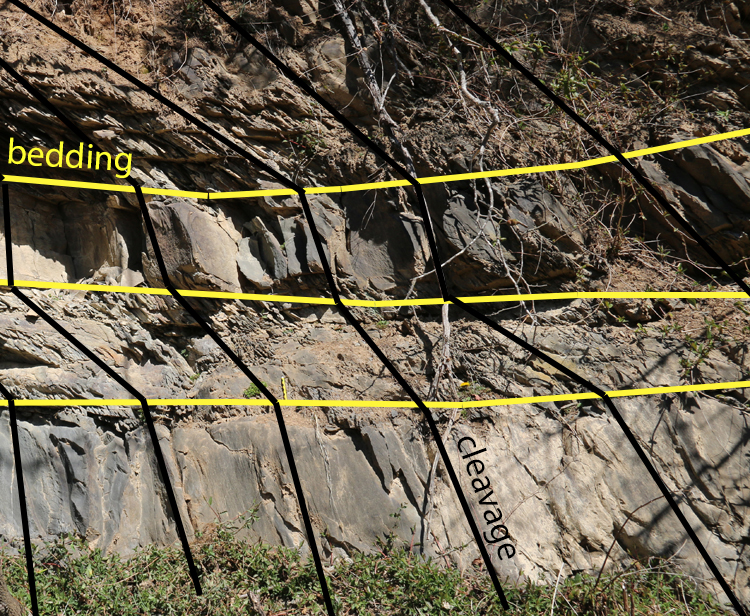
… And then if we walked down the road to the right, we saw this:
Crudely, those fit together something like this: 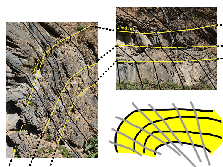
Two outcrops showing different bedding/cleavage relationships, allowing the interpretation of a fold that’s larger than either outcrop, and a cleavage fan overprinting it.
All told, this was a day well spent. The rocks had diverse clues to offer up, and I was delighted to add these outcrops to my ‘mental map’ of the region’s geology.
 Callan Bentley is Associate Professor of Geology at Piedmont Virginia Community College in Charlottesville, Virginia. He is a Fellow of the Geological Society of America. For his work on this blog, the National Association of Geoscience Teachers recognized him with the James Shea Award. He has also won the Outstanding Faculty Award from the State Council on Higher Education in Virginia, and the Biggs Award for Excellence in Geoscience Teaching from the Geoscience Education Division of the Geological Society of America. In previous years, Callan served as a contributing editor at EARTH magazine, President of the Geological Society of Washington and President the Geo2YC division of NAGT.
Very easy to understand and so interesting!
Really excellent set of photos and explanations. Very helpful and understandable for students.
Nice job! Thanks!
In some of the photos (#8, 10, and 11, e.g.), there’s a series of lines that is roughly perpendicular to bedding, in at least one of the beds. (In photos 10 and 11 they’re in the thinnest bed, toward the right side of the photo.) The perpendicular lines look similar to the hackles of a plumose structure, but I don’t see them continuing much into adjacent beds, and I don’t see the rest of the features I would expect in a plumose structure. Do the lines indicate cleavage direction, or something unrelated? Is there a reason they seem to be confined to a particular bed?
Drove to Washington County Maryland to look for Martinsburg shale. Went to the old stone Bridge over Concocheague Creek next to old rt. 40. The limestone on the west side of the creek at the old stone Bridge is near vertical. I think it is Chambersburg limestone. Shale was nowhere to be seen. Drove up to Broadfording Road and crossed the creek heading west to east. There was a small quarry on the north side of the road on the east side of the creek but it was heavily posted with no trespassing signs. It looked like there was shale overlaying limestone.