
19 October 2018
Friday fold: the Brooks Range, Alaska
Posted by Callan Bentley
Today is another reader-contributed Friday fold:
Riia Chmielowski. a Senior Research Engineer/Laboratory Manager at the Laser-Ablation ICP-MS Laboratory, Lulea University of Technology in Sweden.
Riia writes,
Here are three from my Master’s work in the Brooks Range. My field area was the West Fork of the Atigun River, in the Brooks Range, Alaska.
I note that these images carry a special charm, since they are scanned from slides. That’s the way we used to take field photos, kids!
Riia’s descriptions follow…
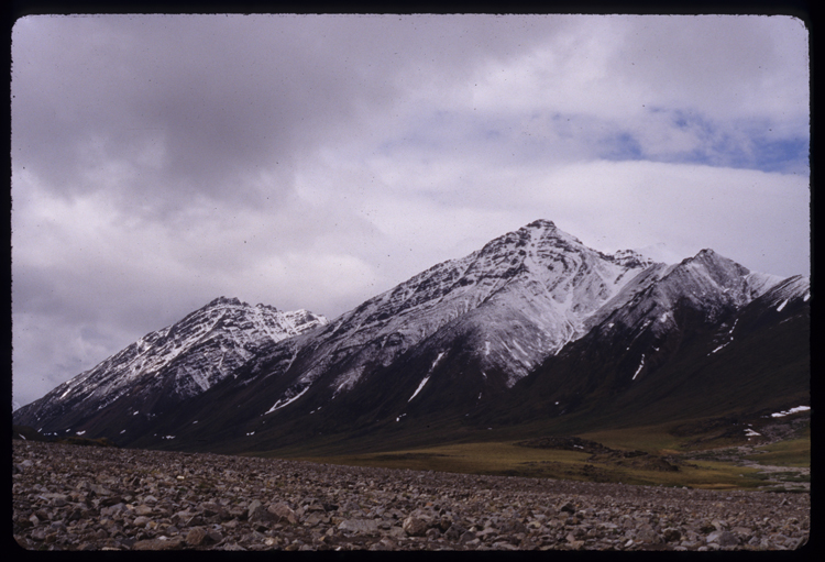
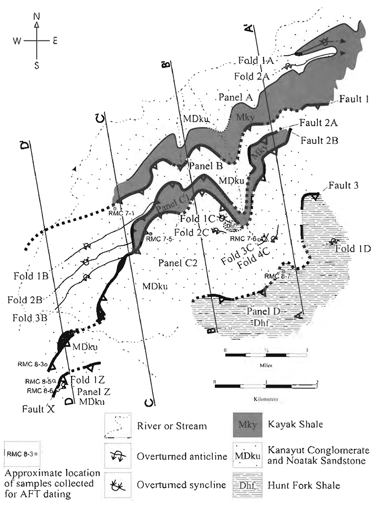
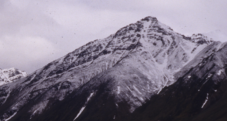
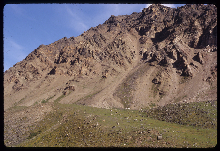
Photo A12 is of the ridge labelled Fold 2A and Fold 1 A on figure 3 of the attached paper, and is approximately located at 68.245509, -149.521162 (according to GoogleMap’s “what’s here” button).
Here is the figure she references:
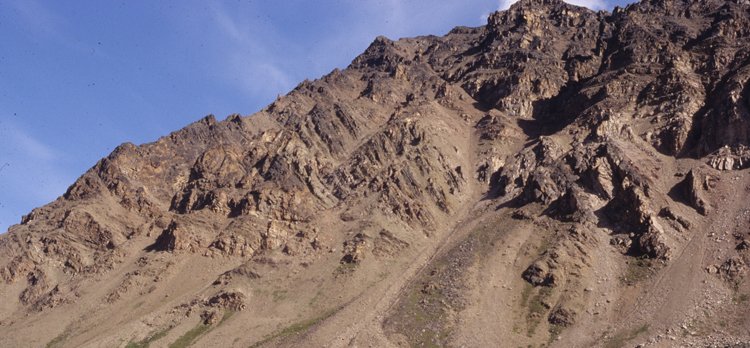
Zooming in on the fold:
Annotated to show the trace of bedding in red:
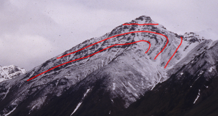
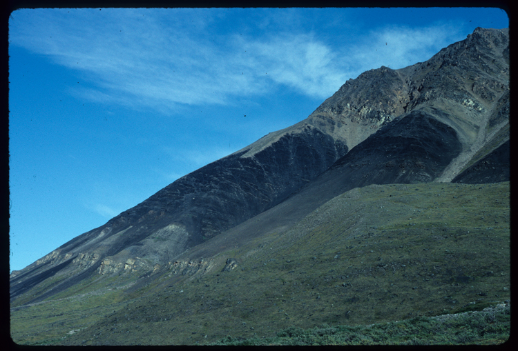
Photo E14 is of the set labelled Fold 1B, 2B, 3B on that figure, and is approximately located at 68.240801, -149.550688
Zooming in on the folds:
Here’s my armchair annotation of that one – Hopefully I’ve sussed the trace of bedding out correctly!
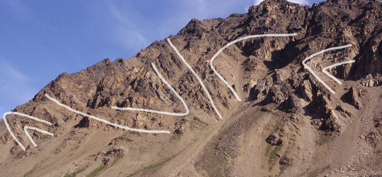
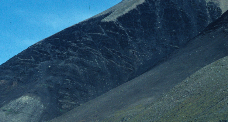
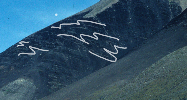
Photo H23 is of the segment of the Kayak Shale just north of the label “Panel B” in that figure (approximately 68.244300, -149.541418), and shows parasitic folds that are only visible in perfect lighting conditions. That photo was taken from camp, and most days that summer that was a featureless black hillside.
Zooming in on the folds:
And, a set of annotations, showing the trace of bedding in white:
Thanks for sharing, Riia!
Other readers: Do you have cool folds to share with the Mountain Beltway audience? If so, shoot me an email to share them: cbentley at nvcc dot edu. Thanks in advance!
Happy Friday to all. Enjoy the weekend.
 Callan Bentley is Associate Professor of Geology at Piedmont Virginia Community College in Charlottesville, Virginia. He is a Fellow of the Geological Society of America. For his work on this blog, the National Association of Geoscience Teachers recognized him with the James Shea Award. He has also won the Outstanding Faculty Award from the State Council on Higher Education in Virginia, and the Biggs Award for Excellence in Geoscience Teaching from the Geoscience Education Division of the Geological Society of America. In previous years, Callan served as a contributing editor at EARTH magazine, President of the Geological Society of Washington and President the Geo2YC division of NAGT.
Nice tracing of the folds, thanks!
If anyone wants to see the paper from which that figure was taken, it is:
Chmielowski, R. M., et al. (1999). Duplex structure and Paleocene displacement of the Toyuk thrust zone near the Dalton Highway, north-central Brooks Range, Alaska. Short Notes on Alaska Geology 1999. D. S. Pinney and P. K. Davis, Alaska Division of Geological and Geophysical Surveys: 11-13.
and is on line here: http://www.dggs.alaska.gov/pubs/id/2682
The figure also appears in my Master’s thesis, a paper copy of which should still be at the University of Alaska Fairbanks Library:
Chmielowski, R. M. (1998). The Structural Geometry and Evolution of the Toyuk thrust zone, Brooks Range, Alaska. Department of Geology and Geophysics. Fairbanks, University of Alaska: 92.