
26 March 2018
Raider of the Lost Anticlines
Posted by Callan Bentley
Yesterday, I took a hike in search of anticlines.
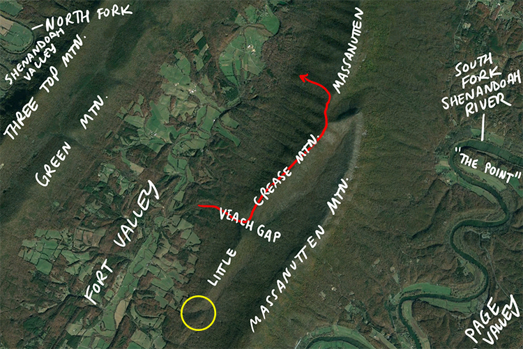
I started off in Veach Gap, a place where I bring students and where there are four excellent 3D outcrops showing SW-plunging anticlines of ~human size in the Massanutten Sandstone. (They are presumably buffered by intervening synclines, but those don’t crop out well in Veach Gap.) Then I headed NE up the hill, hiking along the trail-less crest of Little Crease Mountain before joining up with the Massanutten Trail before dropping down off the ridge, again without a trail, into my neighborhood. The red line on the map shows my route. The yellow circle shows another water gap that cuts across Little Crease Mountain; I intend to go check that out someday soon, along with the “south face” of Veach Gap.
I chose yesterday to do this hike because it’s still winter here, and that means the trees (dominantly deciduous hardwoods) haven’t yet leafed out for spring. The way through the forest, and the views out over the surrounding landscape are thus relatively clear and relatively non-green. Also: there are no ticks out yet! And yet, the snow had melted at my house (elevation ~1200′) which led me to think that the going would be relatively easy. (It turned out that there was still a substantial amount of snow up on the ridge, and I had very cold, wet feet by the time I got home.)
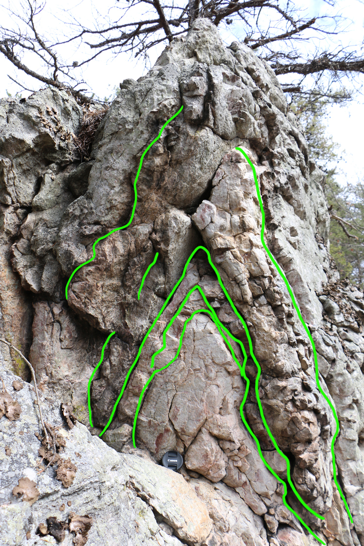
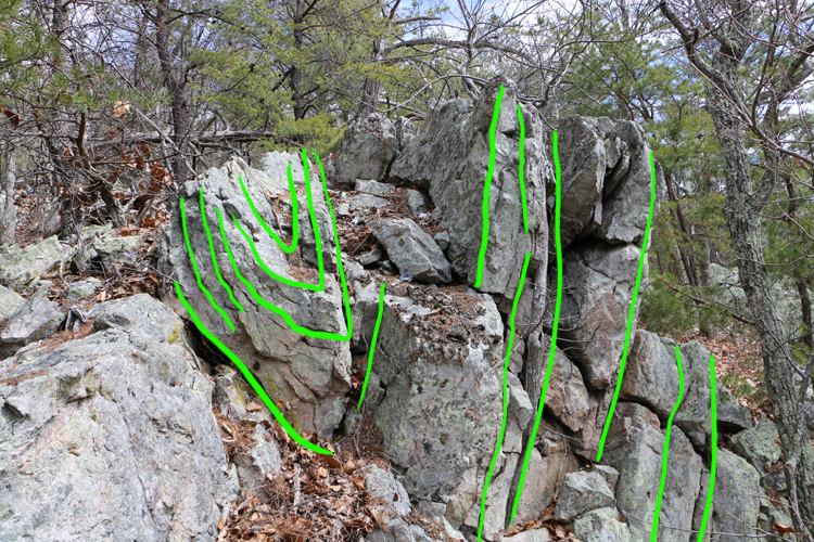
All these photos are taken looking NNE (~030°) along the axis of the ridge. I’ll show each one in its raw form, and then in an annotated state, using bright green to trace the bedding out.
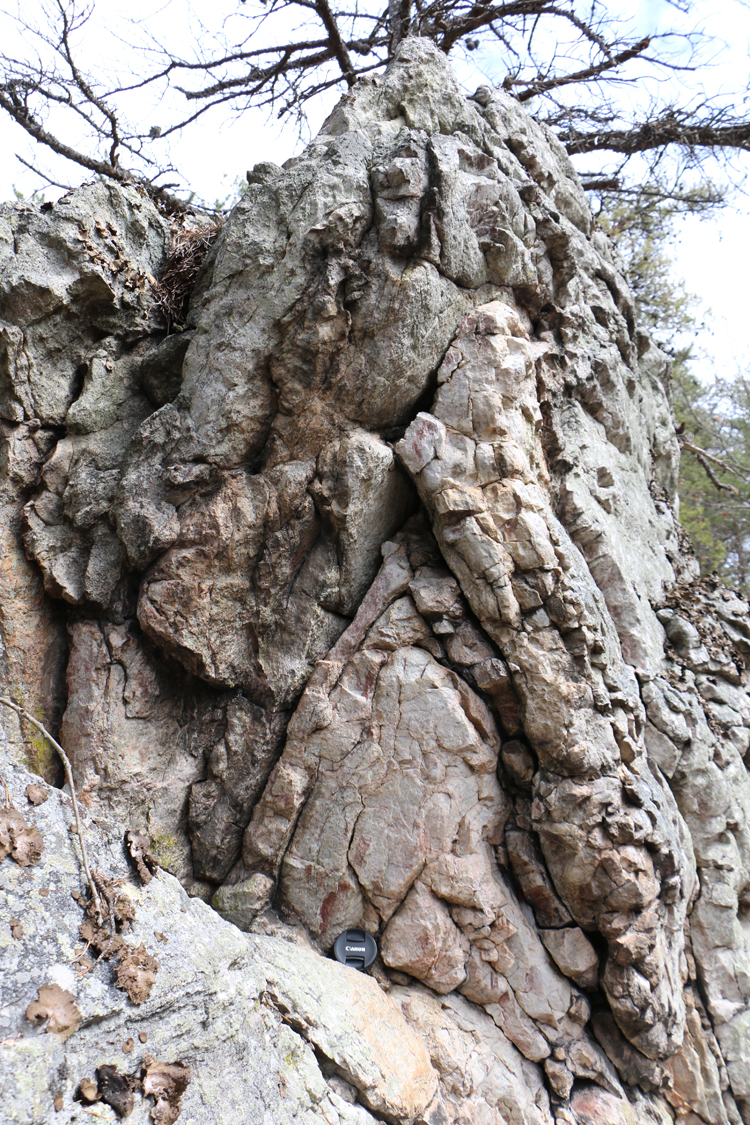
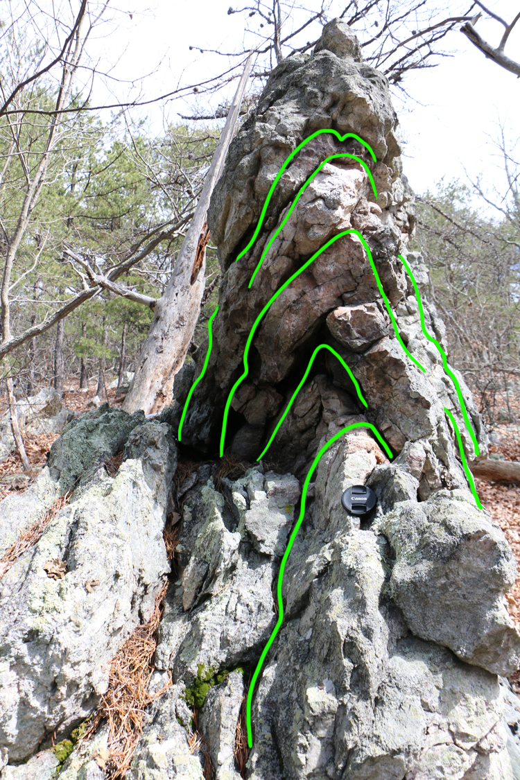
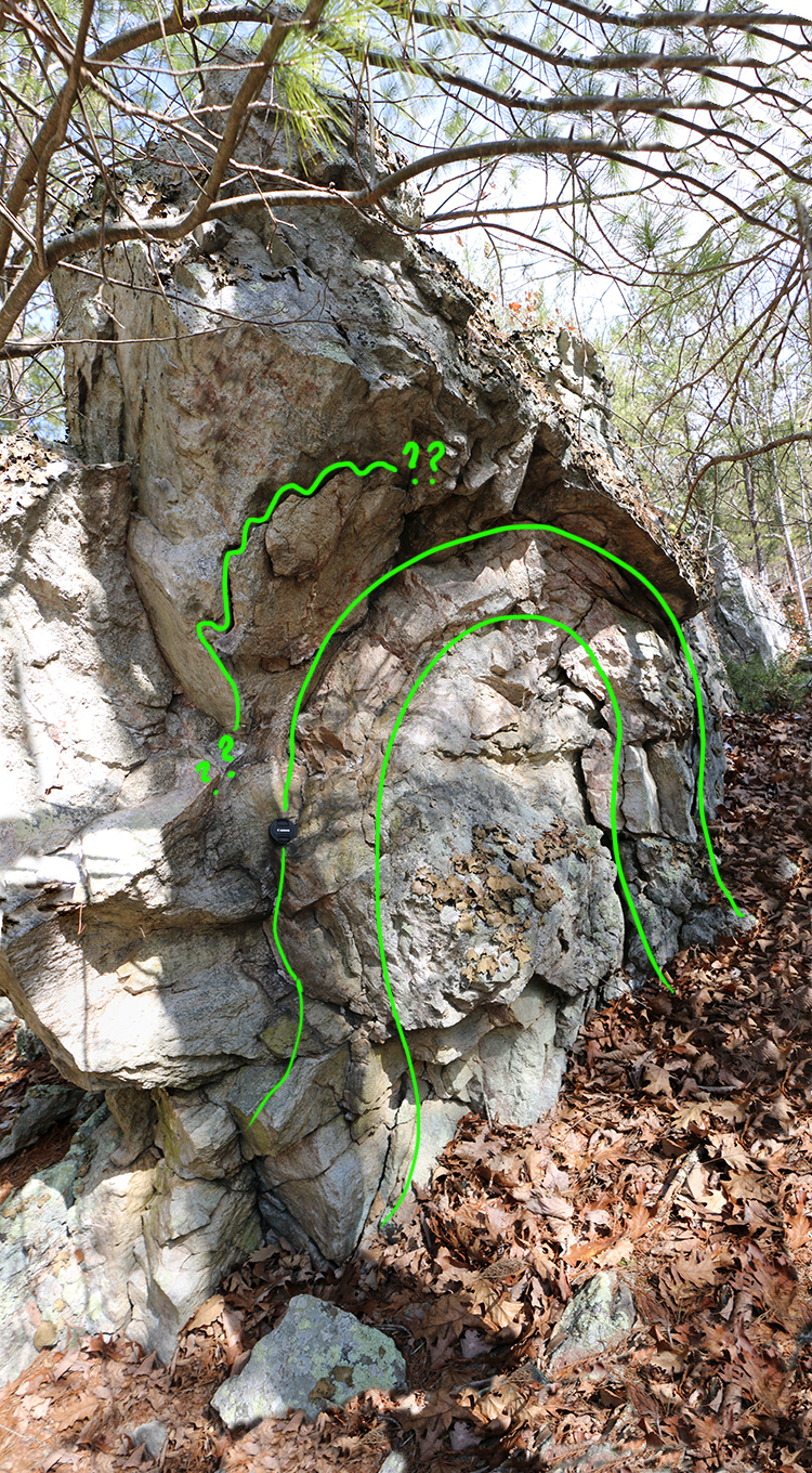
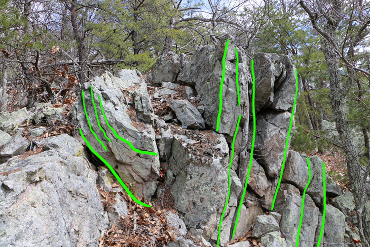
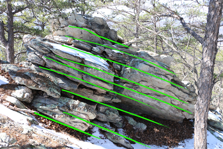
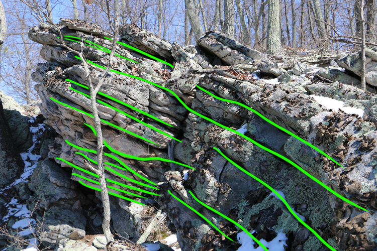
Here is a portrait of the profile plane of the best example my excursion revealed:
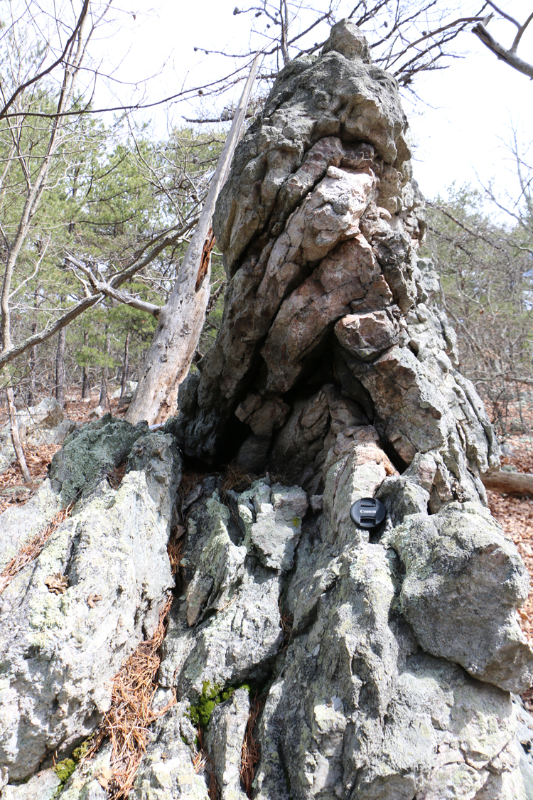
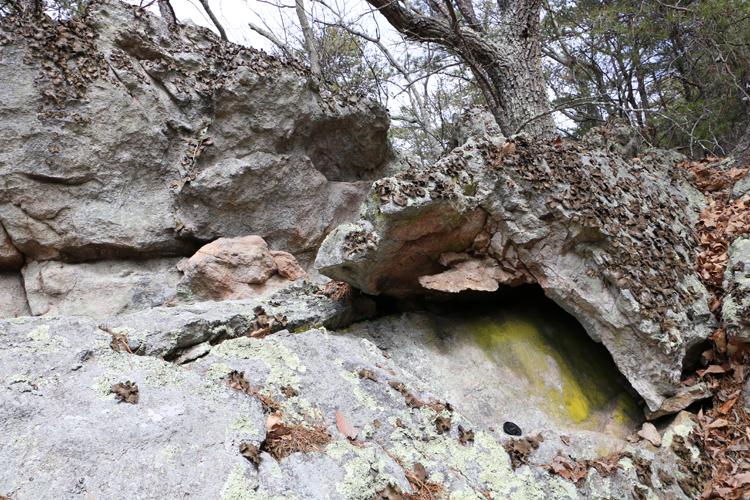
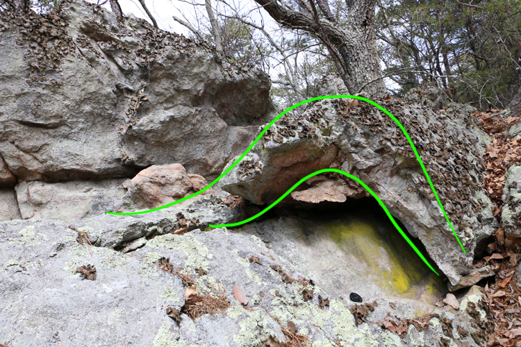
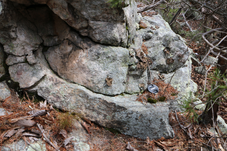
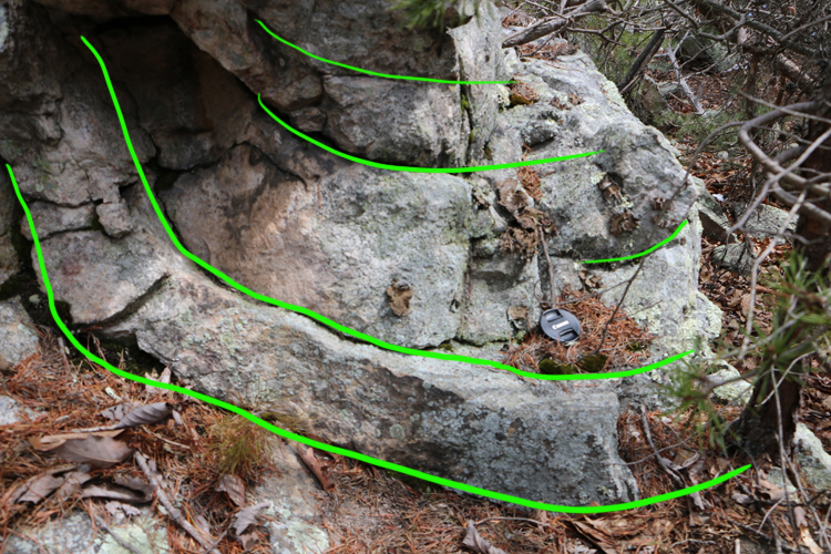
And here is the same structure, on a different outcrop, further downhill by about 40 feet:
I made a 3D model of this one:
That gives you a pretty good sense of the thing, right?
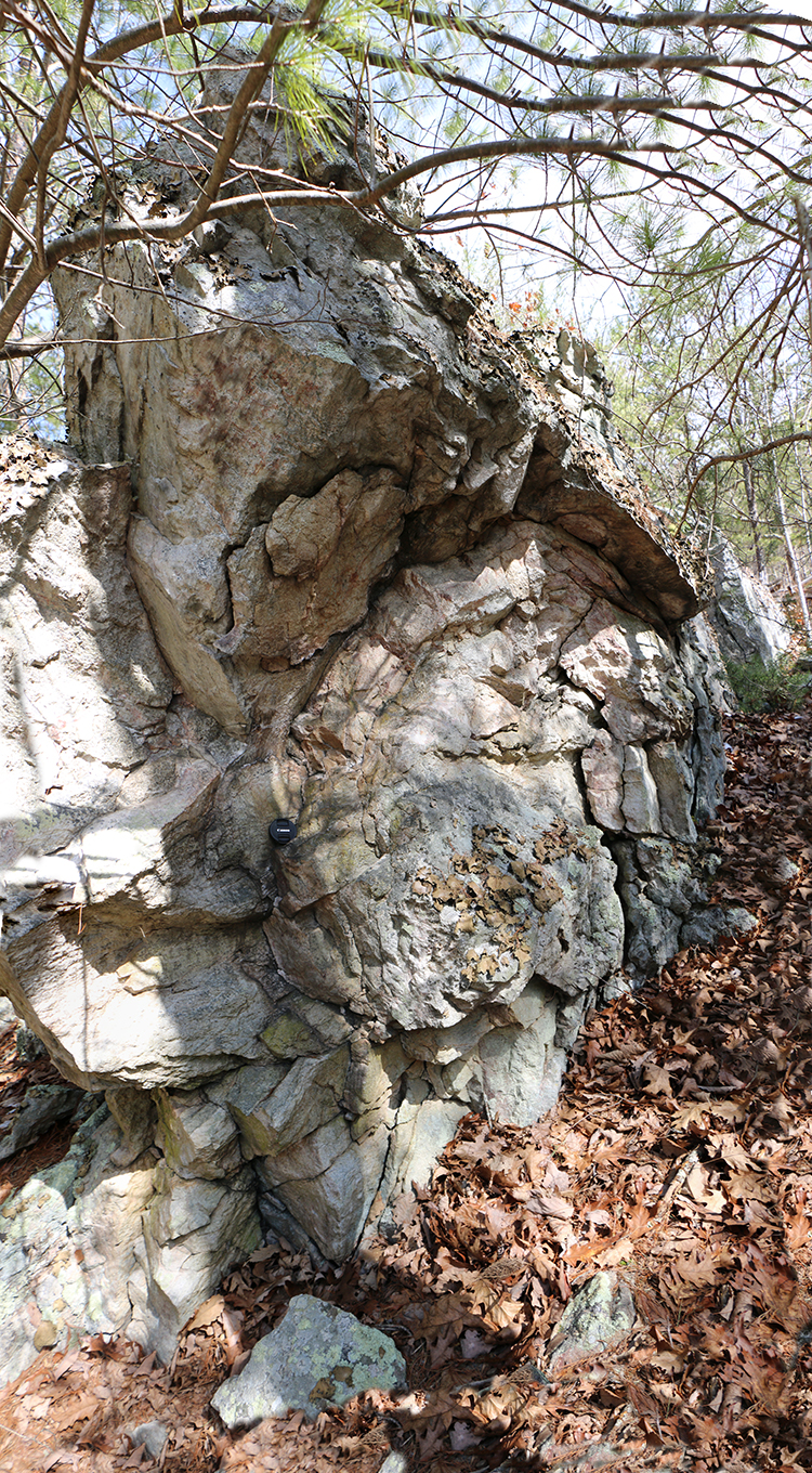
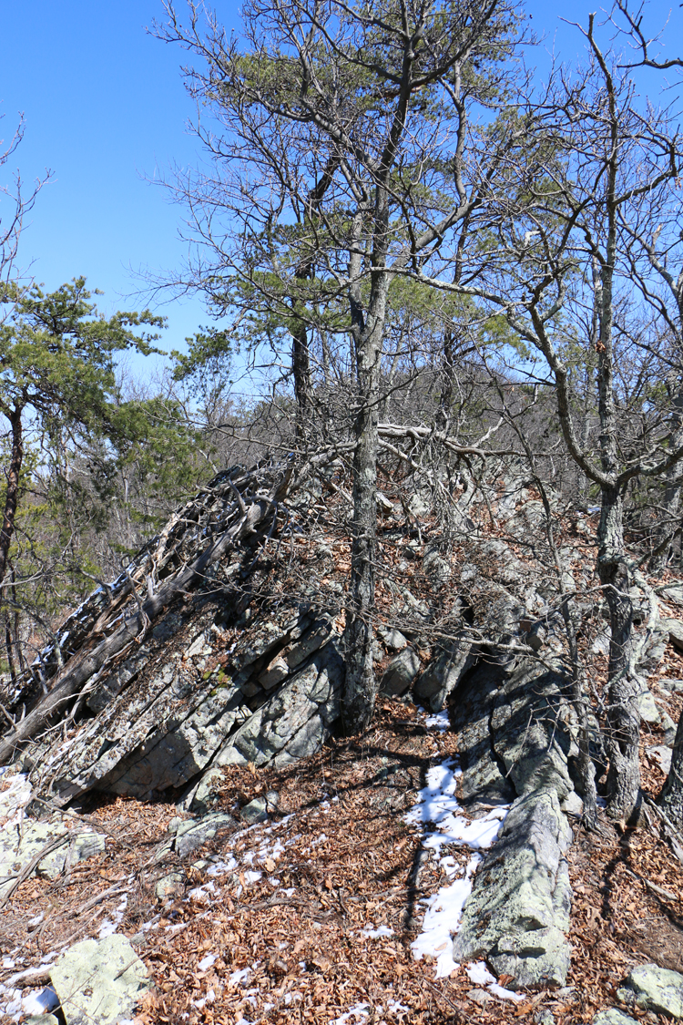
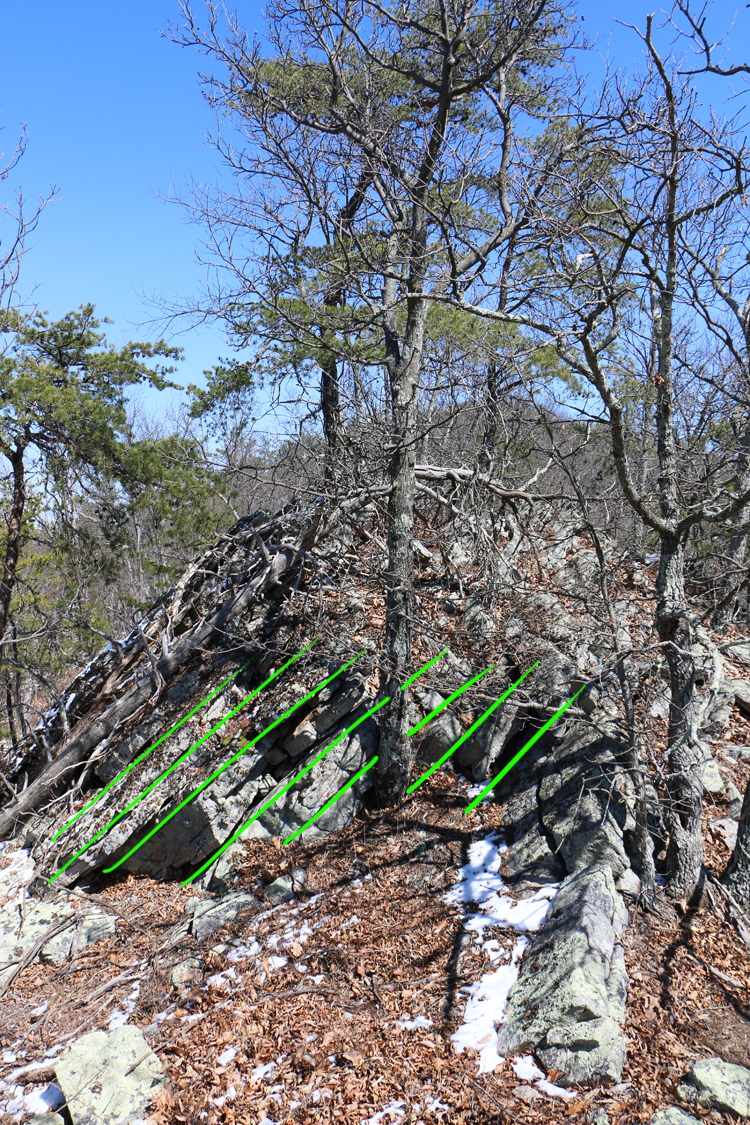
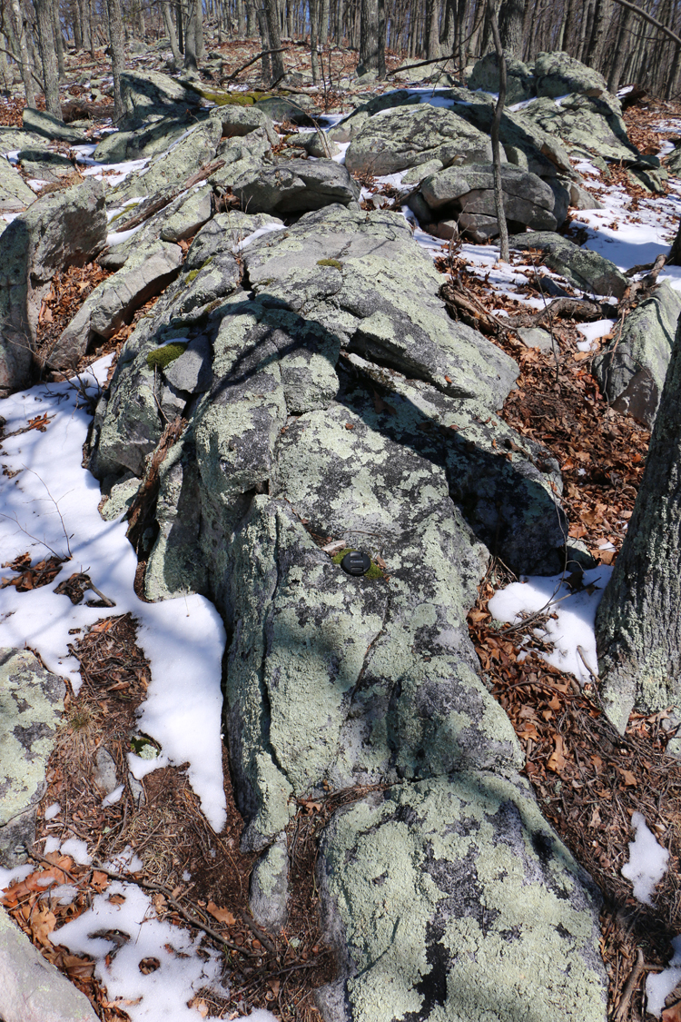
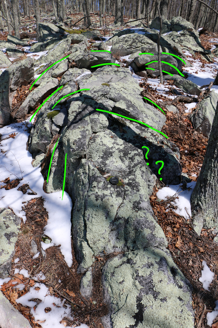
Another anticline, not quite as impressive, but still showing a well-developed arc to the bedding:
And here’s the last clear, blatant anticline I spotted, a composite image from 4 input images (hence the weird repeating branch in the upper right):
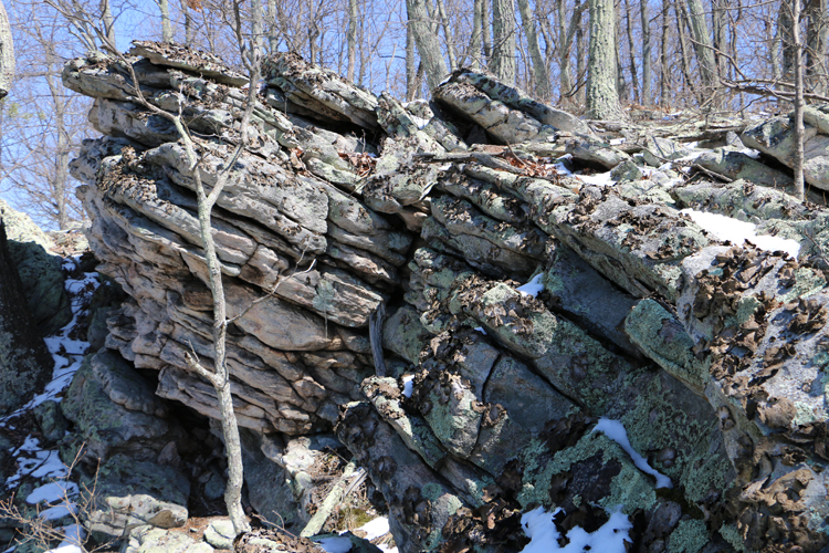
I also found a syncline:
Another perspective, about 40 feet away on the same syncline:
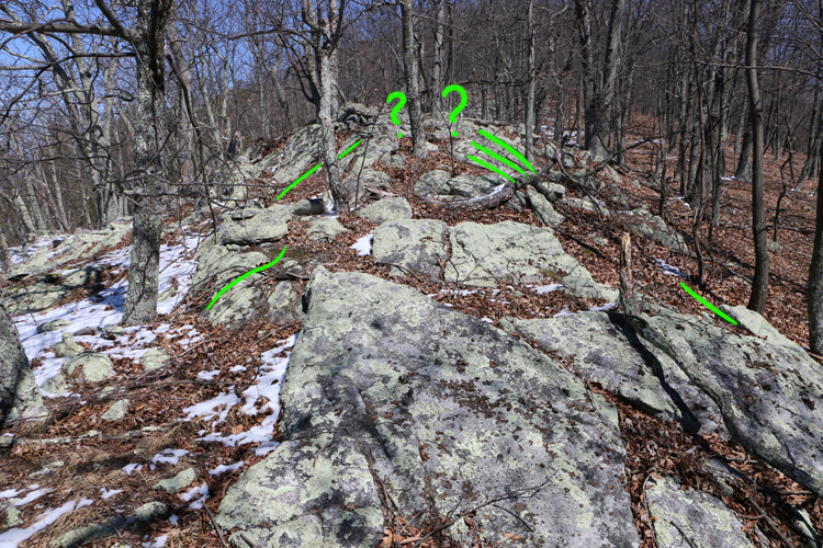
I wasn’t sure exactly what was going on in the middle of this one; was it like this?
…or was there a fault in there, making it impossible to trace bedding across the middle of the structure?

Those were the main outcrops of interest I discovered while ascending the “north face” of the gap.
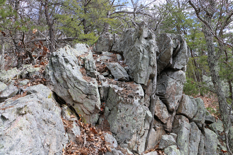
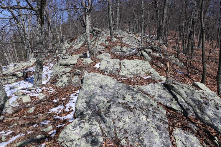
Once I got up out of the gap, up on the ridge crest itself, the outcrops looked like this:

It was pretty consistently dipping to the NW, and I thought I was done with matters of structural interest.
But then I went through a stretch of outcrop-poor forest, and it had shifted to dipping to the SE:
Clearly, I had cross the trace of the fold axis without realizing it. I hiked on.
But then it shifted back to NW-dipping:
And back again to the SE…
So the main fold axis and the ridge were approximately but not exactly coincident.
There were also a few spots where I could almost convince myself that I was on the axis of a fold, like this one:
…and this one:
But you can see that the quality of these outcrops wasn’t great. The beds are massive and jointed, and everything’s been spheroidally weathered to some extent, not to mention covered in lichens of a half dozen varieties, and buried beneath fallen leaves and rotting logs. So I wasn’t positive that these spots were structural highs as well as topographic highs.
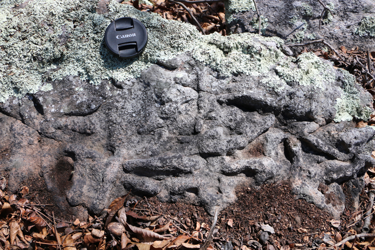
There were plenty of cross-beds to use as geopetal indicators:

Also, I found this lovely set of Arthrophycus bedding-parallel trace fossils:
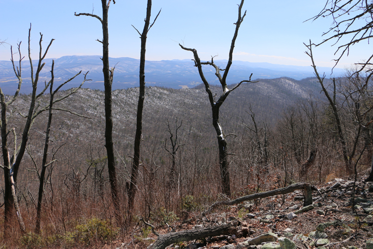
Also, it’s probably worth mentioning the views. Thanks to the bare trees, I could actually see out over the surrounding landscape. From here on to the end of the blog post, the “default” orientation to the photos no longer applies. These next images look every which way.
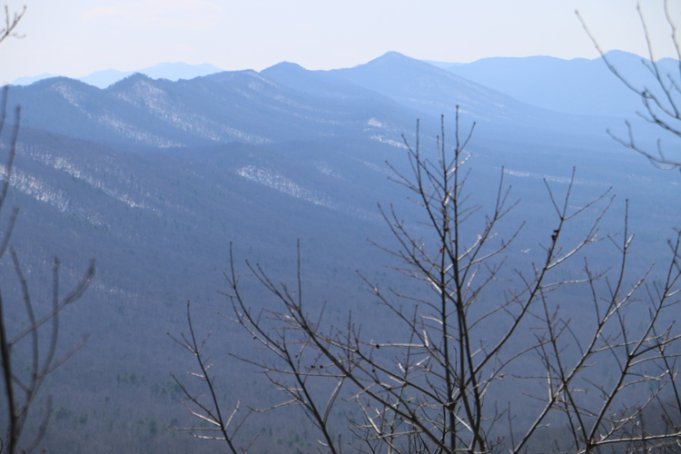
Here’s a shot looking ~southeast, across the small valley cut by Mill Creek, over Massanutten Mountain, across the Page Valley, and toward the Blue Ridge on the horizon:
The Fort Valley, looking NW across strike:
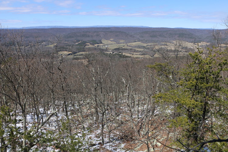
The southern Fort Valley, looking south oblique to strike, Kennedy Peak prominent as a knob along the ridgeline:
The craggy Blue Ridge, looking east:
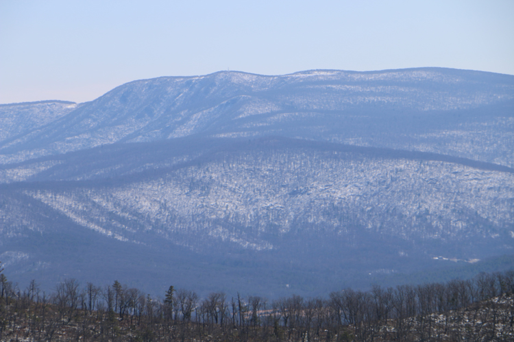
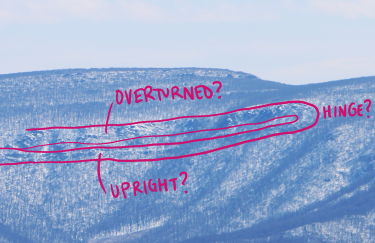
The snow highlighted things in new and enticing ways. For instance, there’s a ridge-parallel belt of resistant rock cropping out here in the western Blue Ridge, that I had never noticed before:
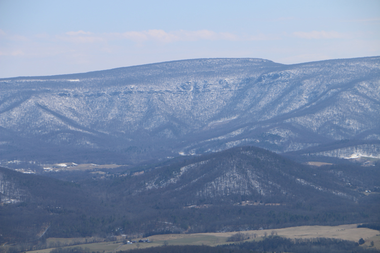
It appears to curve over on its southern end, suggesting it’s a very tight overturned syncline.
This is what I love about exploring – I go off and finally visit a region I’ve been seeking to visit for a while, and I see something else, on yon distant ridge, that plants the seed for another day’s adventure.
Here’s a handheld GigaPan of this view, hosted and annotated in the GIGAmacro viewer:
Finally, let’s look SSW, across Veach Gap, at the dismembered southern tip of Little Crease Mountain. This is just after I got up out of the gap and onto the ridge proper:
 Click to enlarge
Now east is on the left and west is on the right.
There are outcrops up there! (and they appear to dip to the west).
I wonder if there are any anticlines to be seen?
I guess I know where I am heading on my next free day to explore!
 Callan Bentley is Associate Professor of Geology at Piedmont Virginia Community College in Charlottesville, Virginia. He is a Fellow of the Geological Society of America. For his work on this blog, the National Association of Geoscience Teachers recognized him with the James Shea Award. He has also won the Outstanding Faculty Award from the State Council on Higher Education in Virginia, and the Biggs Award for Excellence in Geoscience Teaching from the Geoscience Education Division of the Geological Society of America. In previous years, Callan served as a contributing editor at EARTH magazine, President of the Geological Society of Washington and President the Geo2YC division of NAGT.
This is an outstanding educational post, Callan. Bravo!