
6 April 2017
Stac Fada
Posted by Callan Bentley
Here’s a funny rock you might meet in Scotland’s North West Highlands:
This is the Stac Fada member of the Clachtoll Formation, in the Stoer Group. It’s a very poorly sorted sedimentary deposit which some workers have interpreted as a volcanic mudflow deposit (a lahar), and others think is a meteorite impact deposit.
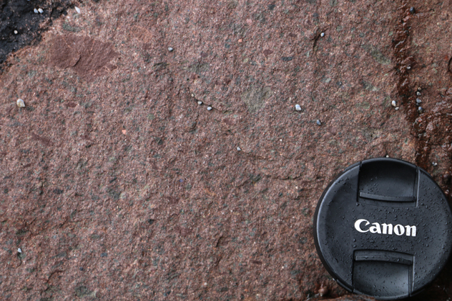
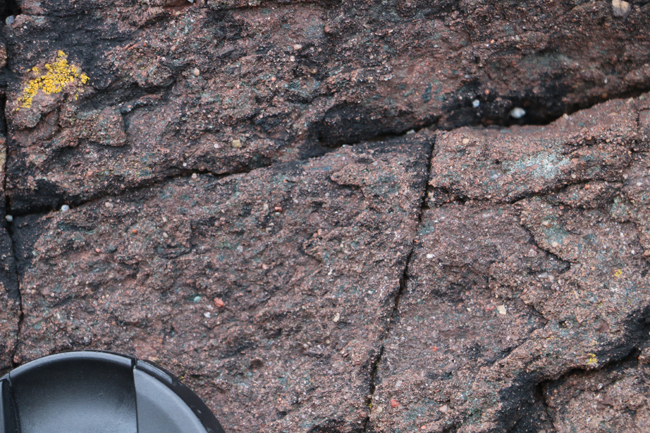
Eroded cobbles of it can be found all along the Minch coast of the Stoer Peninsula. They look like this:
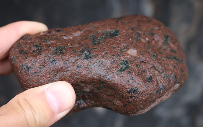
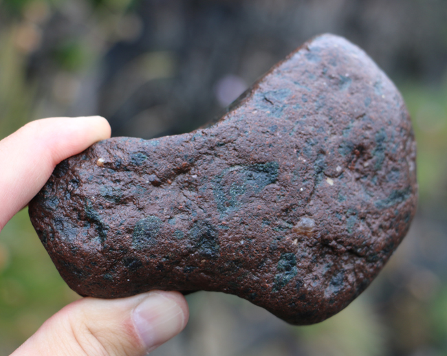
Note the angular greenish blobs? Those are devitrified glass. But was it volcanic glass (obsidian) or meteorite impact glass (suevite)?
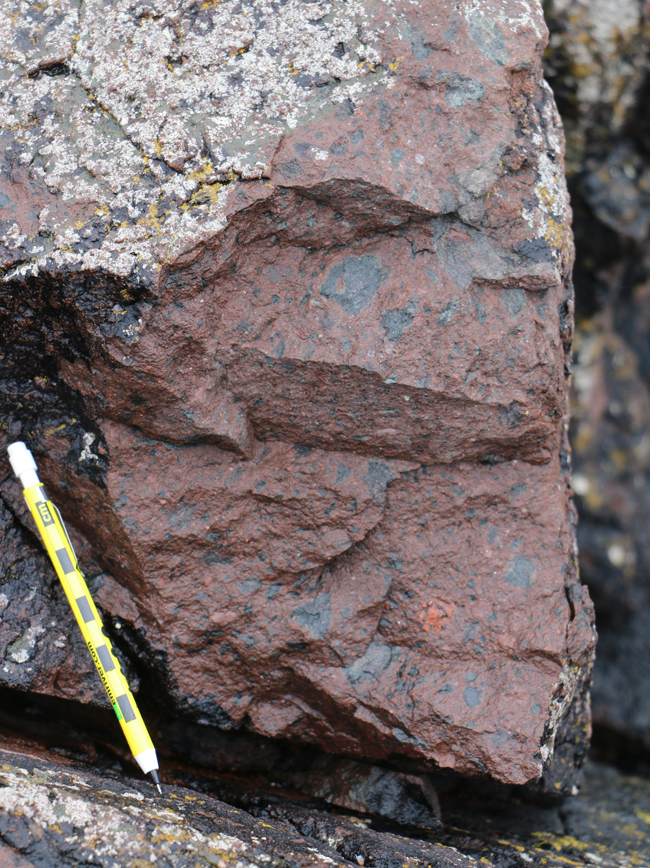
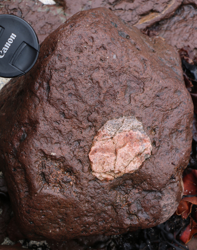
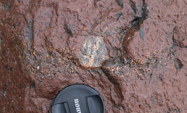
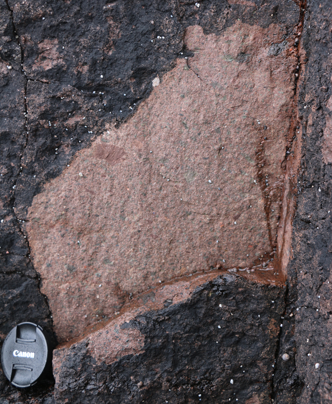
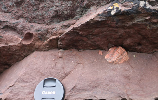
The light-colored bits are chunks of the Lewisian gneiss basement, as seen a little better in these examples:
Let’s go to the source to investigate! It’s up-section from the MISS which are the oldest fossils in Britain, and just a scootch up along the bay.
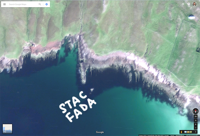
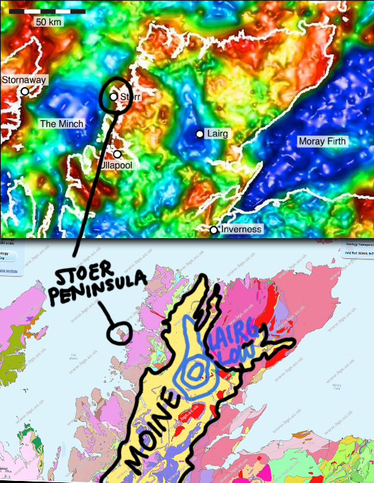
Here’s a map of the namesake peninsula where this distinctive rock can be found: Stac Fada, north of Clachtoll on the Stoer Peninsula of the North West Highlands.
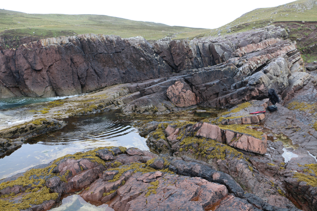
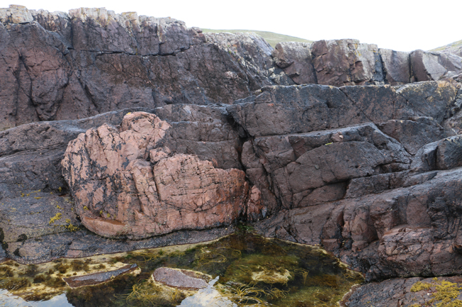
When you get there, you’ll see both weathered and fresh exposures of the green-glass-bearing sandstone and conglomerate:
…And you’ll find big pieces of the Lewisian basement present, too:

You’ll also note these astounding folded “rafts” of sandstone:
(Note the black-raincoat-covered GigaPan at the right of the image above, and the yellow pencil near the middle of the next two images for a sense of scale.)
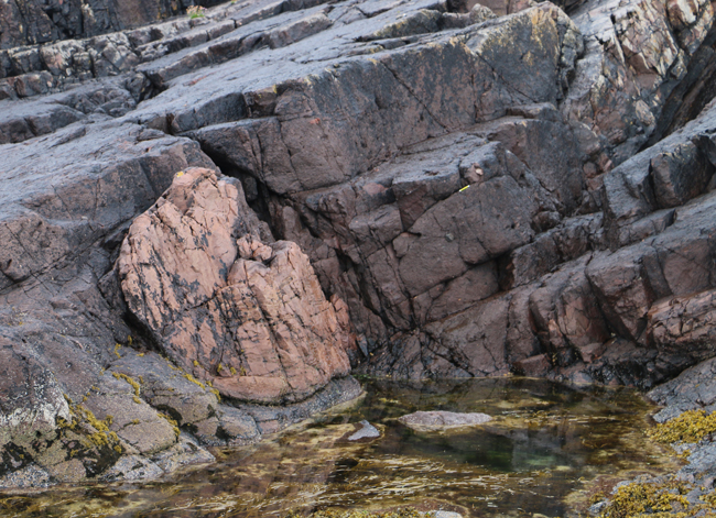
Getting something that big (literally the size of a Zodiac raft) in a unit that’s otherwise glass-chunk-rich conglomerate is a puzzler. That a chunk this coherent could survive complete disaggregation by the violence of a meteorite impact boggles the mind.
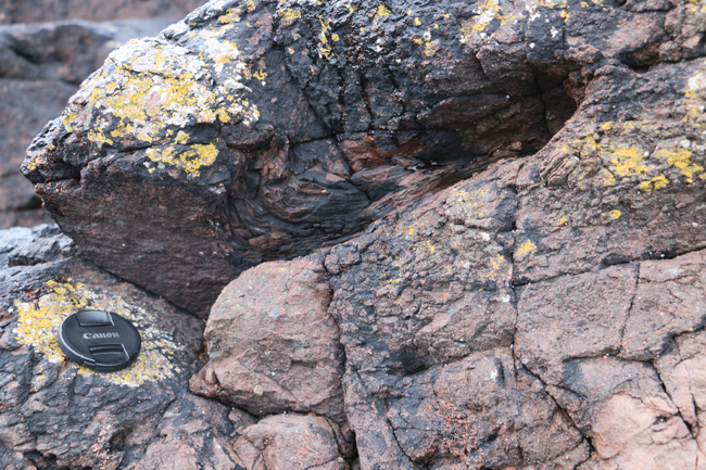
Here’s a smaller one – look for the layering and the change in texture – both the folded sandstone and the coarser matrix are both hidden beneath black and yellow lichens on the outcrop surface:
Evidence to support the meteorite impactite interpretation comes from mineralogy and geophysics. First to consider is the mineral reidite, which is found in the unit. It’s described by Reddy, et al. (2015) as “unambiguous evidence of shock pressures in excess of ∼30 GPa.” Then there’s the crater (probably): not too far to the east we find the Lairg Gravity Low, which is the sort of geophysical signature we might expect for a crater. Here’s a look at the Bouguer Residual Gravity field for northern Scotland from Rollin (2009), republished in Simms (2015). The dark blue areas are gravity lows deeper than -15 mGal. Pretty striking, right? However, we can’t see the crater directly, because it’s hidden beneath a shield of Moine schist which was later thrust over the top of the hole, as seen here (yellow colors) from the BGS’s Geology of Britain viewer:
That’s frustrating. If I were king of world geological funding, I might be tempted to pierce the Moinie and insert a drill core into that Lairg Gravity Low, as the USGS has done with the Chesapeake Bay Impact Structure in several places, part of one of the cores of which was petrographically evaluated by students in my department.
Anyhow, I’ll bet you’re itching to explore the poor sorting, the glassy shards, and the sandstone rafts on your own. So now let’s go to the GigaPans & GIGAmacros for a closer look… Same routine for posting them as I’ve been doing lately: Both non-Flash and Flash-based embed options for you. Click through to the source if neither one shows up on your browser! 🙂
Outcrops:
Link 1.03 Gpx GigaPan by Callan Bentley
Link 0.51 Gpx GigaPan by Callan Bentley
Specimen (front and back):
Link 0.50 Gpx GIGAmacro by Callan Bentley
Link 0.65 Gpx GIGAmacro by Callan Bentley
Also, I’d be remiss if I didn’t point out this lovely suite of GigaPans of thin sections of Stac Fada ejecta by Paul Guyett.
Soon I hope to have some thin section GIGAmacros of my own to share… Stay tuned!
 Callan Bentley is Associate Professor of Geology at Piedmont Virginia Community College in Charlottesville, Virginia. He is a Fellow of the Geological Society of America. For his work on this blog, the National Association of Geoscience Teachers recognized him with the James Shea Award. He has also won the Outstanding Faculty Award from the State Council on Higher Education in Virginia, and the Biggs Award for Excellence in Geoscience Teaching from the Geoscience Education Division of the Geological Society of America. In previous years, Callan served as a contributing editor at EARTH magazine, President of the Geological Society of Washington and President the Geo2YC division of NAGT.