
27 January 2017
Friday fold: the Bradshaw Layered Amphibolite
Posted by Callan Bentley
Martin Schmidt offers us this lovely guest Friday fold. He writes:
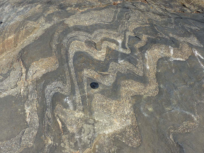
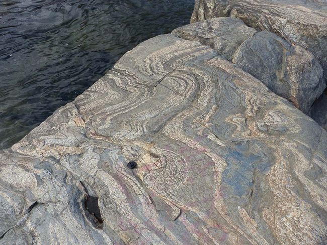
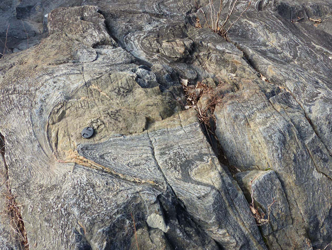
This is the Bradshaw Layered Amphibolite. This rock was part of the offshore island arc in the Cambrian, and on the geologic quad is mapped as part of the Baltimore Mafic Complex.
It’s a good looking unit!
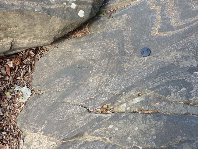
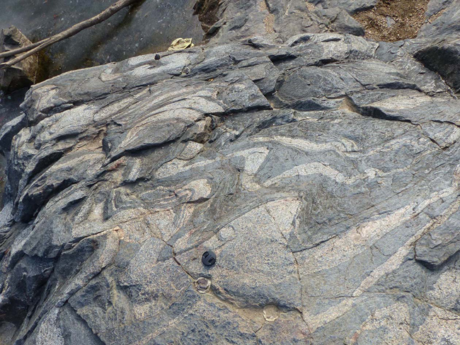
The Piedmont province is full of fascinating rocks like this: rocks which started off as oceanic rocks of some flavor, that were then baked and masticated in the tectonic maw of the young, virile Appalachian mountain belt. While most of the modern “peaks” of the Appalachian Mountains lie west of Baltimore in the Blue Ridge and Valley and Ridge provinces, these rocks are the highest metamorphic grade, and often show the most deformation. Therefore, they represent the ancient ‘core’ of the mighty Appalachian Mountain Belt. These rocks suggest that mighty peaks once towered in Alpine or Himalayan fashion above the spot where today we find Baltimore, Washington, DC, and Richmond.
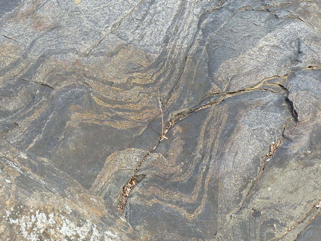
Deep in the heart of Permian-aged Pangaea, the Bradshaw Layered Amphibolite buckled and squirmed and recrystallized beneath massive mountains. Those mountains decreased in elevation to the west, and were drained by Mississippi-sized rivers that transported their sloughed-off sediment far to the west. The Petrified Forest in Arizona was buried in Appalachian-derived sediment, if you trust the testimony of its detrital zircons.
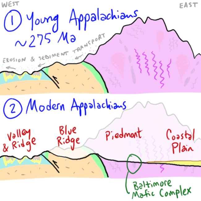
Then Pangaea broke up, and there was a much shorter path to the sea for the rivers draining the eroding mountains. Soon, eastward-draining rivers took over most of the Appalachian mountain belt (though there are still holdouts like the extremely inappropriately-named New River of North Carolina, Virginia, and West Virginia). The Atlantic-draining rivers incised deep into the crystalline core of the mountain belt, exposing the high-grade, high-strain rocks that formed deep in its guts. That’s what we look at when we gaze upon a scene like this.
Want to visit yourself? Martin offers directions:
These are located at -76.395071, 39.412562 on the Big Gunpowder Falls (River), and at an actual (!) Coastal Plain-Piedmont border because it’s the first rocks & rapids coming upriver on the Gunpowder from the Bay. A couple of bends above this point the river is nearly all potholed rocks and rapids, especially at low water. The red, blue, or white letters in several images are graffiti.
Thanks, Martin.
A friendly reminder to readers that I’m happy to display your guest Friday folds here.
 Callan Bentley is Associate Professor of Geology at Piedmont Virginia Community College in Charlottesville, Virginia. He is a Fellow of the Geological Society of America. For his work on this blog, the National Association of Geoscience Teachers recognized him with the James Shea Award. He has also won the Outstanding Faculty Award from the State Council on Higher Education in Virginia, and the Biggs Award for Excellence in Geoscience Teaching from the Geoscience Education Division of the Geological Society of America. In previous years, Callan served as a contributing editor at EARTH magazine, President of the Geological Society of Washington and President the Geo2YC division of NAGT.