
4 July 2016
Virtual field trip to Kinkell Braes, Scotland
Posted by Callan Bentley
Walking along the shore east from St. Andrews, Scotland, along the seaside sandstones of Kinkell Braes, you encounter several extraordinary examples of geology. It’s a great place for the next stop on our Grand Tour of the geology of the British Isles.
Here’s the scene:
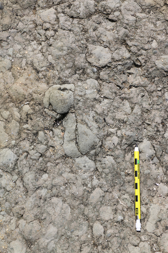
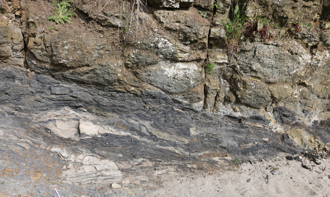
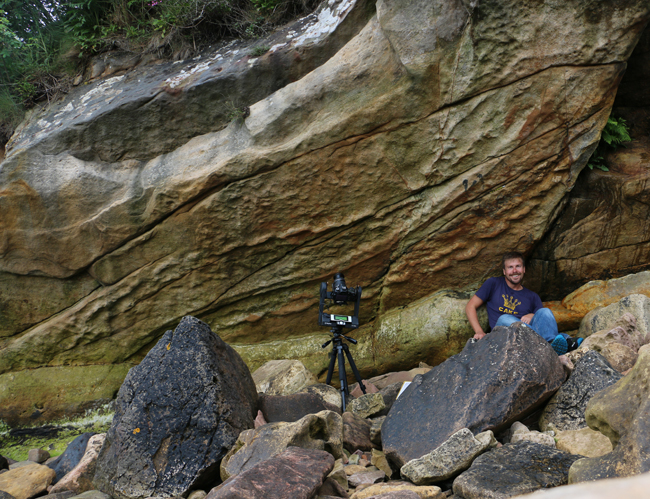
The first stop is a giant eurypterid trackway, potentially the largest invertebrate trackway in the world (Whyte, 2005), on the underside of an overhanging sandstone slab that’s only accessible at low tide. Even then, you can slip on the many slimy seaside rocks, something I can personally attest to having done twice during my visit. The trackway features multiple sets of sea scorpion footprints, three on each side of the critter’s body, plus a long central groove made as its telson dragged through the sand:
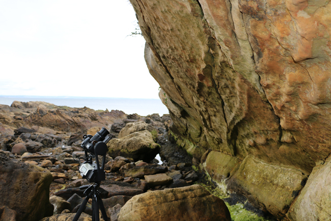
I made two GigaPans of the trackway:
Link GigaPan by Callan Bentley
Link GigaPan by Callan Bentley
And here are two Theta 360° spherical photos of the outcrop:
Giant eurypterid trackway, Scotland – Spherical Image – RICOH THETA
Giant eurypterid trackway, Scotland – Spherical Image – RICOH THETA
Those should convey a sense of how difficult it was to image this thing – but once again, the 3D model comes to the rescue. Using a photo set I shot on the site, lying on my back on the slimy rocks, my student Marissa used Agisoft Photoscan to make this:
Photoscan model by Marissa Dudek
That’s the next best thing to being there!
Now, that trackway alone is probably enough for one day, but if you were to continue your stroll around the next major headland, Kinkell Ness, you’d see something else that’s quite remarkable:
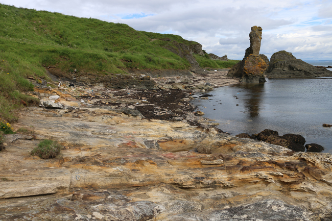
Let’s make this the second stop on our virtual field trip. Here’s a Theta 360° spherical photo of the scene:
The Rock and spindle: Permian volcanic vent complex intruding Mississippian sandstone, Kinkell Ness, Scotland #theta360 – Spherical Image – RICOH THETA
The prominent sea stack is a feature called the Rock and Spindle – it’s a resistant bit of a volcanic vent complex that intruded through the sandstones in the late Carboniferous or early Permian. In the photo above, you can see the light-colored stratified sandstones (with some shale) in the foreground, and the relatively dark volcanic rocks (basalt and agglomerate) starting about halfway along the bay.
The Rock and Spindle is a glorious, albeit phallic, thing:
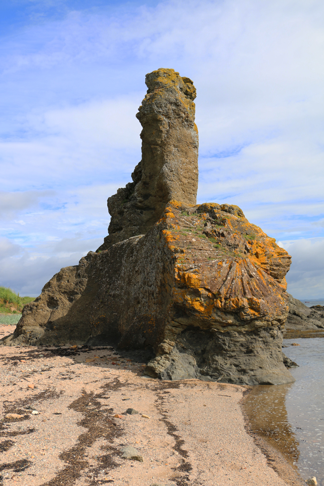
The most striking thing about it is the completely radial columnar jointing seen at the base:
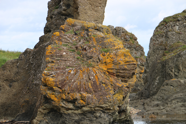
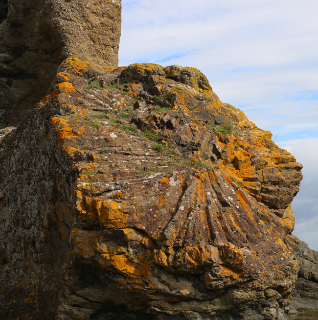
That’s just amazing – a beautiful set of columns, indicating a circular cooling front – perhaps originally a cylinder shaped intrusion or a dome-like hemispherical bulge.
Here’s a GigaPan of the Rock and Spindle:
Link GigaPan by Callan Bentley
The beach east of Kinkell Ness is a great place to look at intrusive relationships. In 1867, Archibald Geikie brought Charles Lyell and Roderick Murchison here to show them these great plutonic relationships. There’s plenty of agglomerate to be seen immediately adjacent to the Rock and Spindle, as these images show:
Hand sample of the agglomerate:
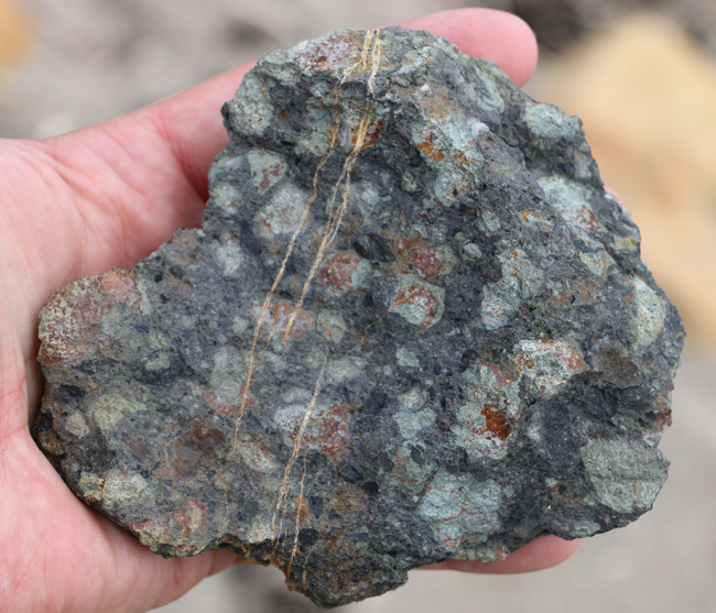
GIGAmacro of the sample sample (added 8/18/2016 to this post):
Link GIGAmacro by Callan Bentley
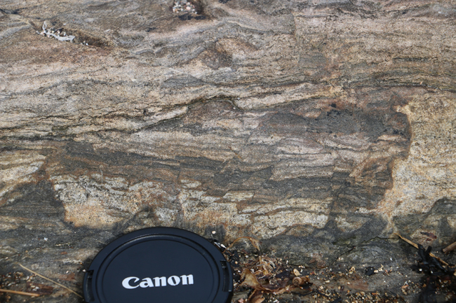
Some contains xenoliths of sandstone – the same sort of sandstone that preserved the eurypterid trackway:
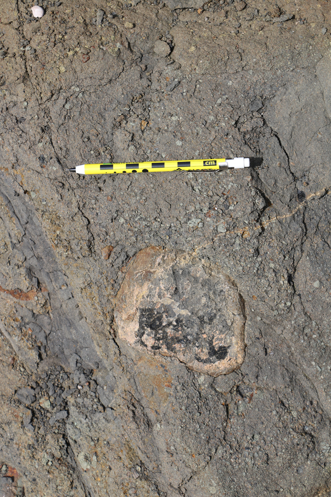
Here’s a Theta 360° spherical photo of this outcrop:
Sandstone xenolith in volcanic rock, Kinkell Ness, Scotland #theta360 – Spherical Image – RICOH THETA
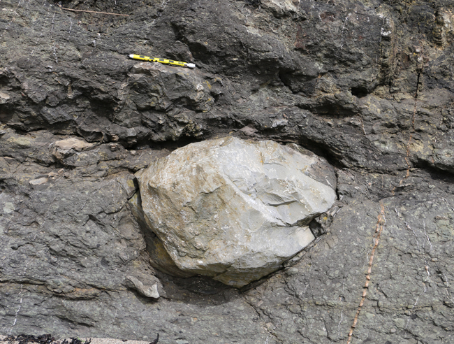
…And (why not?) a 3D model of it, too… scooting in underneath will allow you to see the bedding plane of the sandstone.
Photoscan model by Marissa Dudek
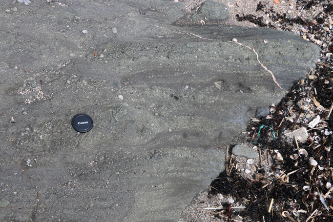
But a short distance away from all this volcanic mayhem are outcrops of the staid sandstone (and shale) with which we started the trip:
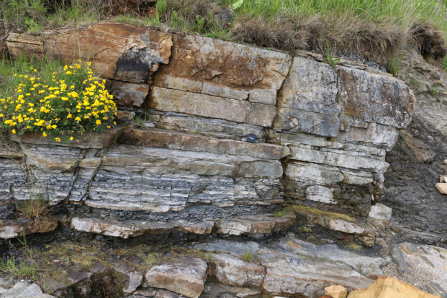
There’s a low cliff showing the contact between Permian volcanic agglomerate (top right) and Mississippian sedimentary rocks (lower left):
I made a GigaPan of this instructive outcrop, of course:
Link GigaPan by Callan Bentley
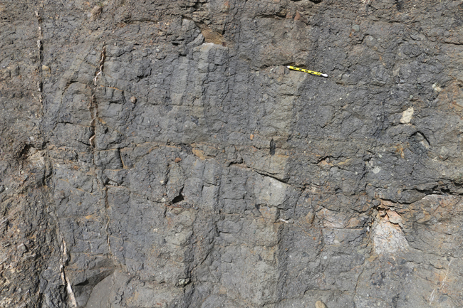
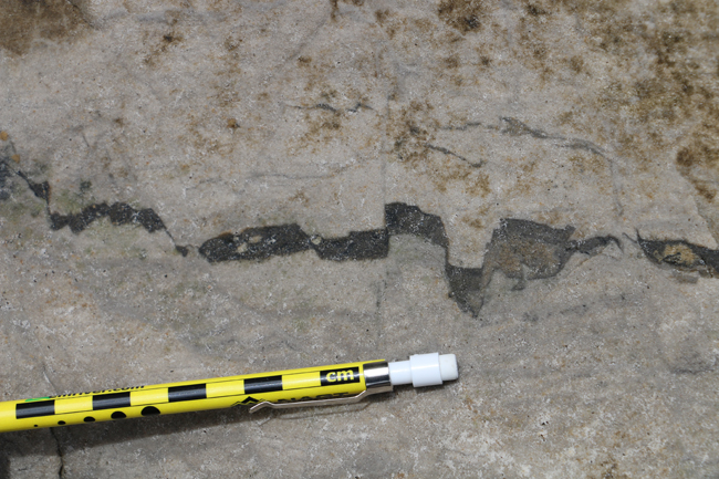
One thing that’s clear in that outcrop is that the sandstones and shales were deformed a bit by the intrusion. I found some sweet examples nearby of small faults offsetting sedimentary layering, which I provisionally interpret as resulting from the stresses of the magma pushing its way through, kind of like the situation we observed last week in Dunbar with a different package of sandstone.
I found similar small conjugate sets of wee faults in another nubbin of sandstone, but here they were offsetting a small volcanic dike – probably synchronous with the intrusion – the crack opening up along the faults like a set of interlocking teeth in a monstrous maw:
The same sandstone outcrop showed a beefier dike cutting though it (left to right through the middle of the image). It’s a bit hard to see because it’s been preferentially eroded away…
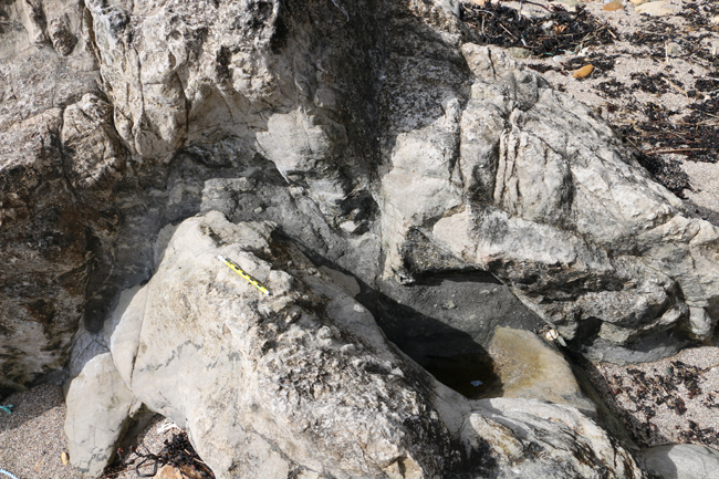
Here’s a good use of the Theta 360° spherical photo medium – get your perspective into that crack and see how it’s eroded out along the dike:
Permian volcanic dike intruding Mississippian sandstone, Kinkell Ness, Scotland #theta360 – Spherical Image – RICOH THETA
UPDATE: Finally, here’s a GIGAmacro image of sand from this beach – a blend of quartz from the sedimentary host rocks, volcanic lithics, and shell material:
Link GIGAmacro by Robin Rohrback
All told, you could do worse than to lace up a sturdy pair of virtual boots and follow in the footsteps of Geike, Lyell, and Murchison to explore this exemplary place. Thanks for joining me on another virtual field trip!
 Callan Bentley is Associate Professor of Geology at Piedmont Virginia Community College in Charlottesville, Virginia. He is a Fellow of the Geological Society of America. For his work on this blog, the National Association of Geoscience Teachers recognized him with the James Shea Award. He has also won the Outstanding Faculty Award from the State Council on Higher Education in Virginia, and the Biggs Award for Excellence in Geoscience Teaching from the Geoscience Education Division of the Geological Society of America. In previous years, Callan served as a contributing editor at EARTH magazine, President of the Geological Society of Washington and President the Geo2YC division of NAGT.