
9 May 2016
Three GigaPans from Heard Island
Posted by Callan Bentley
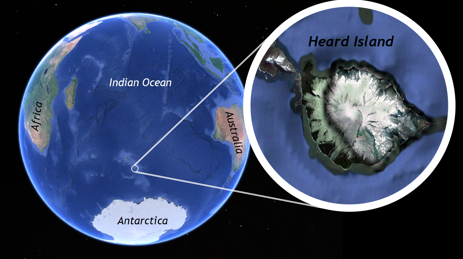
Heard Island is a glaciated volcanic island that is part of the Kerguelen Plateau in the Southern Ocean. It is a remote spot on our planet.
Mountain Beltway blog reader Bill Mitchell (Twitter: @i_rockhopper) knew he was headed to Heard Island soon when he read here last year about the GEODE GigaPan loaner program. He requested a GigaPan from me. I gladly said “yes!” Bill and his colleagues have now returned from their expedition, and he has three GigaPans to share. Here they are:
Looking south-southeast at the volcano Big Ben from Atlas Cove, Heard Island. In the foreground at left are the Azorella Peninsula lava flows, and across the bottom is the nullarbor, a large sand and gravel plain.
Link
Weathered lava flows on Azorella Peninsula, Heard Island. A concrete footing from the 1947-1953 ANARE base is located near the center of the image.
Link
Close-up of a wind-blasted rock face at Windy City, Heard Island, with notebook (with scale) for scale. Prevailing winds here are right-to-left.
Link
These are some great looks at a part of the world that very few people will ever see. Thanks, Bill.
Anyone else going someplace interesting and willing to make some GigaPan images while you are there? Get in touch with me for a free loaner rig!
 Callan Bentley is Associate Professor of Geology at Piedmont Virginia Community College in Charlottesville, Virginia. He is a Fellow of the Geological Society of America. For his work on this blog, the National Association of Geoscience Teachers recognized him with the James Shea Award. He has also won the Outstanding Faculty Award from the State Council on Higher Education in Virginia, and the Biggs Award for Excellence in Geoscience Teaching from the Geoscience Education Division of the Geological Society of America. In previous years, Callan served as a contributing editor at EARTH magazine, President of the Geological Society of Washington and President the Geo2YC division of NAGT.