
15 April 2014
Bloomsburg Formation exposed near Elizabeth Furnace
Posted by Callan Bentley
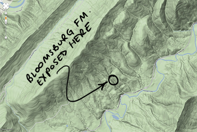
As noted previously, I live in a regional scale fold: the differential erosion of the Massanutten Synclinorium has produced the ridge of Massanutten Mountain, which separates the Fort Valley from the Shenandoah and Page valleys on either side.
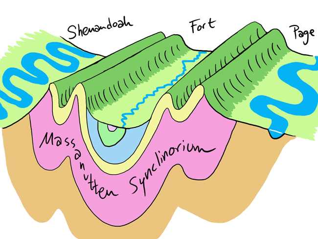
The Fort is “fort” like because the strata which underlie it are relatively friable, soluble, or otherwise erode-able.
The ridge-forming layer is the Massanutten Sandstone, a Silurian-aged quartz arenite. Here’s a boulder of it:
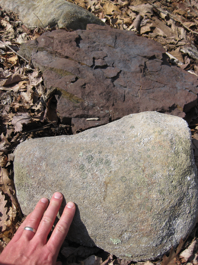
…But what’s that red rock, so much finer grained, in the background?
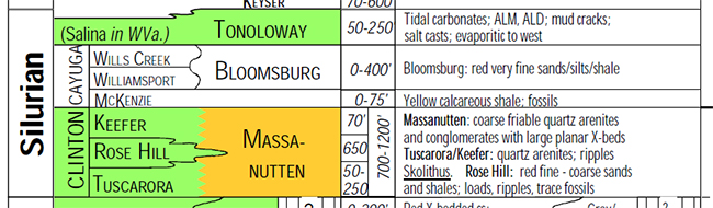
That’s the Bloomsburg Formation: red very fine sands, silts, and shale. It overlies the Massanutten. Here’s a look at a detail from Lynn Fichter’s masterful stratigraphic column for the Valley & Ridge:
It crops out along a stream my family and I crossed on a hike last weekend. Here’s a four-shot panorama, looking upstream:
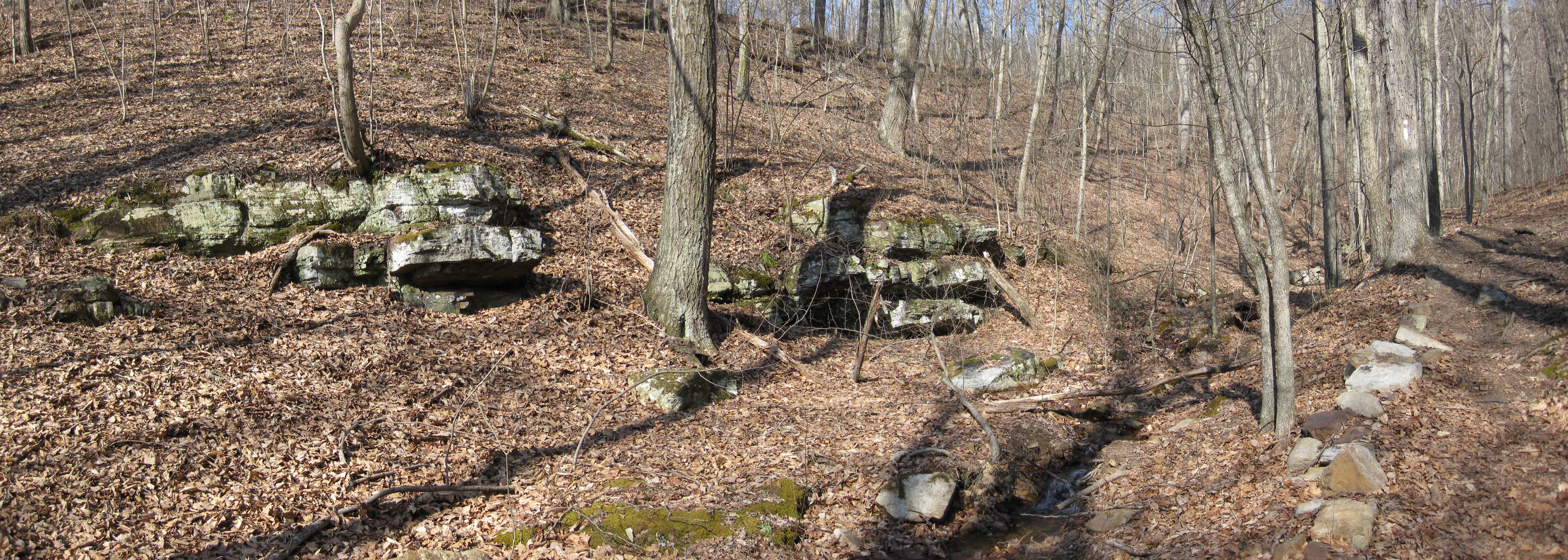 Click to enlarge
That’s in this little tributary valley:
And downstream, a similarly- lichen-encrusted and moss-draped exposure:
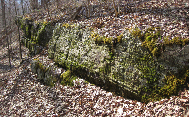
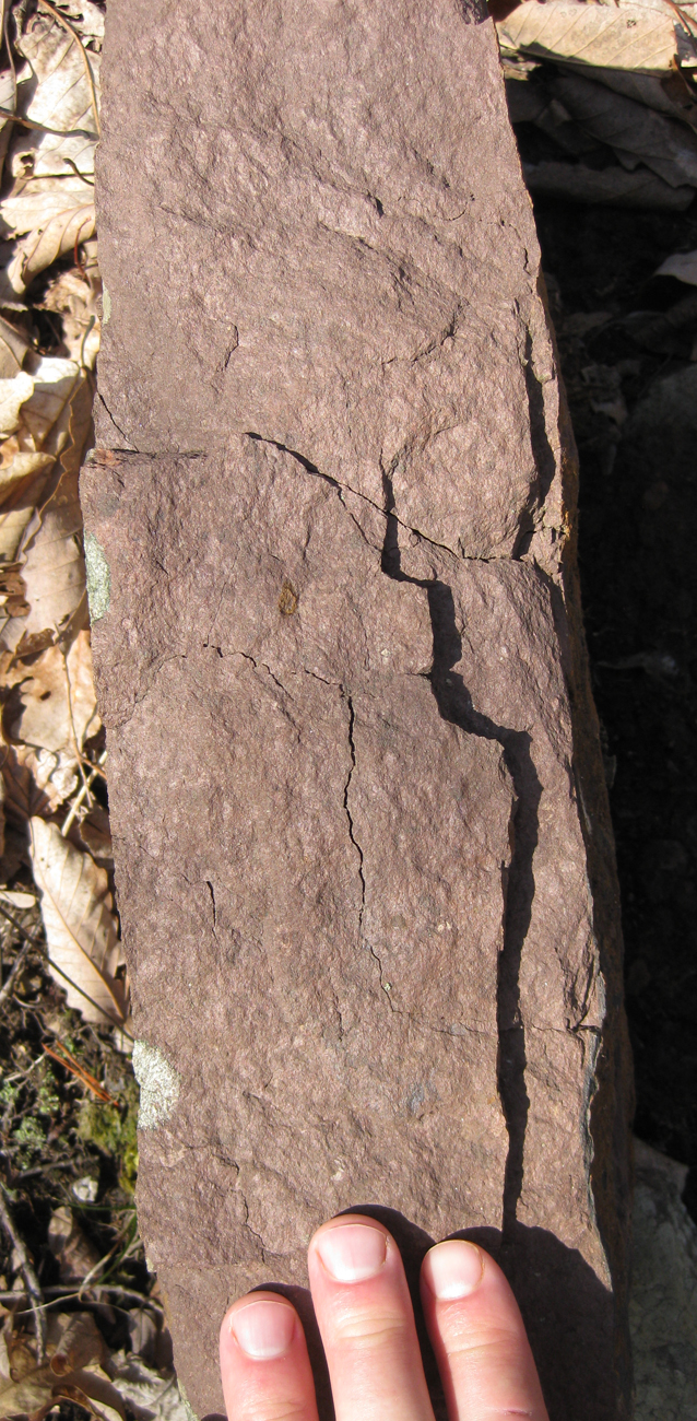
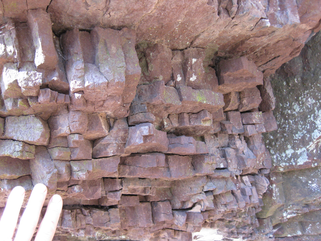
You can see some pronounced differential weathering even there. Certain strata are more susceptible to erosion than others. I looked underneath a shady overhang at this site, and saw red siltstone with jointing orthogonal to bedding (that’s the orientation of the shortest fracture to break a tabular layer).
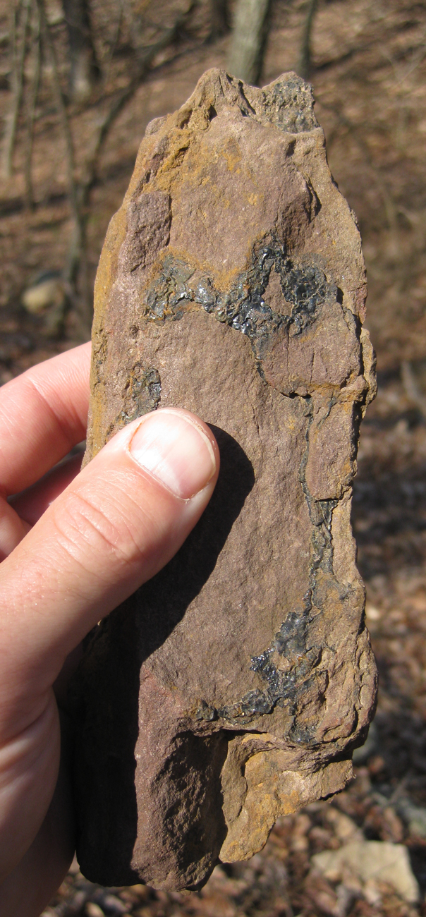
Elsewhere, I found a piece of float on the trail, showing Bloomsburg with manganese oxide deposits on/in it:
It’s a treat to find another piece of the puzzle, another layer in the stack. I’ve only seen redbeds like this cropping out in one other place in the Fort Valley. I’ll be keeping my eyes peeled for more of the Bloomsburg on future peregrinations around the Fort.
 Callan Bentley is Associate Professor of Geology at Piedmont Virginia Community College in Charlottesville, Virginia. He is a Fellow of the Geological Society of America. For his work on this blog, the National Association of Geoscience Teachers recognized him with the James Shea Award. He has also won the Outstanding Faculty Award from the State Council on Higher Education in Virginia, and the Biggs Award for Excellence in Geoscience Teaching from the Geoscience Education Division of the Geological Society of America. In previous years, Callan served as a contributing editor at EARTH magazine, President of the Geological Society of Washington and President the Geo2YC division of NAGT.
Wow, in your panorama shot, those resistant sandstone beds look like they have some really nice – either bar-form or hummocky cross-bedding.