28 February 2013
Unconformity seen in the field yesterday
Posted by Callan Bentley
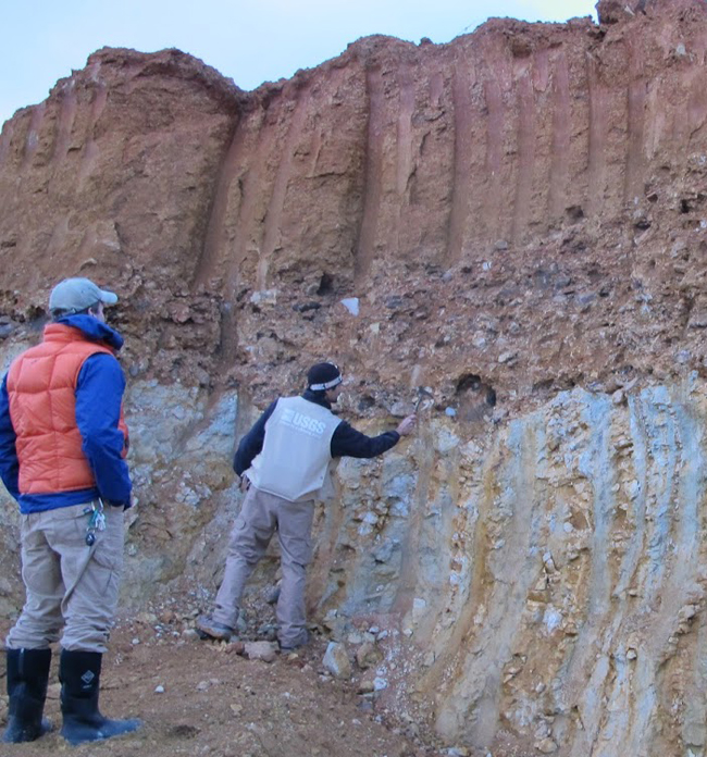
I was out in the field all day yesterday with Dan Doctor (USGS) and Alan Pitts (University of Camerino). We were puzzling over some deformational features, but what I wanted to show you today was something we saw at the end of the day (hence the subdued lighting): a classic angular unconformity, exposed in a quarry wall east of Front Royal:
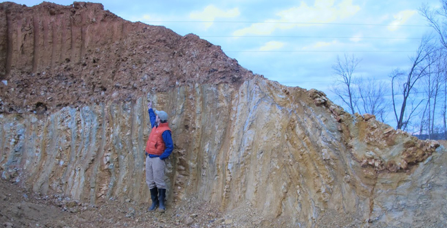
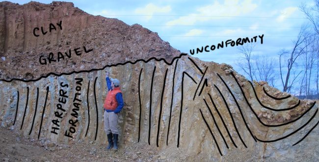
The bedding of the Harpers Formation (Cambrian mud + sand layers) are upright and folded. A nice anticline / syncline pair can be seen at right, with the anticline cut by a small fault:
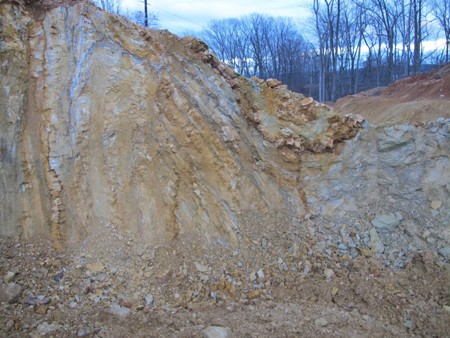
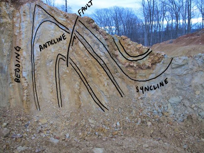
These strata must have been deposited more or less horizontally, then buried deep in the Earth. Later, they were deformed (folded, faulted, and tilted) during a tectonic event, most likely the late Paleozoic Alleghanian Orogeny, and then erosion chewed its way down to them, eventually exposing the tilted strata at the surface. The surface regime shifted from erosion to deposition, and a layer of well-rounded river cobbles were deposited atop the erosional surface. These where subsequently buried in sand and clay.
The exposure we observe here was made by excavation equipment in the quarry. It is more than a hundred feet above the level of the modern Shenandoah River. So at some point AFTER the events described in the previous paragraph, the Shenandoah cut down anew, chewing through these old terrace deposits and down into the bedrock beneath.
We chuckled to see that the teeth on the excavator bucket have approximately the same spacing as the width of the sand and mud layers in the Harpers.
What’s the age of the terrace gravel deposits? That’s a great question, and one I’d love to know the answer too. They could conceivably be as old as Cretaceous, based on regional erosional history, and the deposition of the basal layers of the Coastal Plain during the Cretaceous east of here. The level of chemical weathering suggested to Dan that they were younger, maybe Paleogene. We would love to have a cosmogenic nuclide date on this unit!
All photos in this post by Alan Pitts.


 Callan Bentley is Associate Professor of Geology at Piedmont Virginia Community College in Charlottesville, Virginia. He is a Fellow of the Geological Society of America. For his work on this blog, the National Association of Geoscience Teachers recognized him with the James Shea Award. He has also won the Outstanding Faculty Award from the State Council on Higher Education in Virginia, and the Biggs Award for Excellence in Geoscience Teaching from the Geoscience Education Division of the Geological Society of America. In previous years, Callan served as a contributing editor at EARTH magazine, President of the Geological Society of Washington and President the Geo2YC division of NAGT.
Wow, fantastic exposures. Do people still talk about peneplains these days?
I wonder if there’s any correlation with the gravels above the New River further west: http://gsabulletin.gsapubs.org/content/103/1/73.abstract
I’m the wrong guy to ask. Not my academic area, despite being in my physical area. Gotta learn more!
Hi, Callan! Nice pictures, as always! I’d like to try to answer the peneplain question. The Davisian theory is outdated for sure, because it needed an unrealistic steady state over a long period of time. The notion of a cycle, with an isolated uplifting event and a new erosional phase, proved also to be too simplistic and too theoretical. However almost (pene in Greek) flat (plain) erosion surfaces do exist (e.g. in the Appalachian Piedmont) and the term peneplain applies very well to them. The problem is it’s difficult to not associate the word peneplain with a Davisian process, hence the widespread demise of this term.
Oh, wait, I see, these are east of Front Royal…
Sweet! Yes, it would be interesting to know the age of these sediments. They are definitely not related to any of the Mesozoic rift basin fills? If Paleogene, that would be very cool as there isn’t much of that age preserved around the region, right?
Cosmogenic radionuclides would only be helpful to figure out the very recent exposure history (in this case, the age when the quarry was made). Unless there’s a possibility that these sediments are Plio-Pleistocene.
The cobbled material looks glacial. A valley glacier deposit, sorted by water running under the ice with the over clay deposited in a backed up lake at a bit latter date when the under ice water flow got stopped up. Higher elevations were lousy with valley glaciers during our recent ice ages. I came across outwash glacial material bedded in terraces along the road in some high Guatemalan countryside this past month. My guess for what it is worth.
Hi Norm,
Thanks for your input. This isn’t really “high” elevation. While I’m no expert at Quaternary geology, it didn’t look like any glaciofluvial deposit I’ve seen. And my colleagues seemed to be in the “fluvial terrace” camp, too. I mean, the river is within sight of this outcrop. Why invoke a glacier? Seems like overkill.
C