29 January 2013
Trona Pinnacles, California
Posted by Callan Bentley
South of Searles Lake is a distinctive landform: the Trona Pinnacles. This multi-image photomosaic is too small for GigaPan, but I’ve made a medium-sized version of it that can be hosted here. You’re going to have to click through to see it large, though.
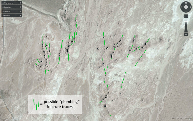
These are tufa towers (like we saw at Mono Lake), all in a cluster. If you view it from above, you can see that they are arranged in many places where multiple towers appear in a line. This linear arrangement bespeaks a network of fractures in the ground below, through with the calcium carbonate-bearing solution flowed, and emerged, presumably, at the bottom of a larger version of Searles Lake, precipitating the tufa over time. The fracture orientation is more or less the same as the basins and ranges of the surrounding landscape, which is a nice demonstration of Pumpelly’s Rule (structural orientations are scale independent):
As the climate in this area dried out, Searles Lake shrank (and got saltier!) and the tufa towers of the Trona Pinnacles were exposed in the open air, where we can see and wonder about them.


 Callan Bentley is Associate Professor of Geology at Piedmont Virginia Community College in Charlottesville, Virginia. He is a Fellow of the Geological Society of America. For his work on this blog, the National Association of Geoscience Teachers recognized him with the James Shea Award. He has also won the Outstanding Faculty Award from the State Council on Higher Education in Virginia, and the Biggs Award for Excellence in Geoscience Teaching from the Geoscience Education Division of the Geological Society of America. In previous years, Callan served as a contributing editor at EARTH magazine, President of the Geological Society of Washington and President the Geo2YC division of NAGT.