17 August 2012
Guest post: Turtle Mountain and the infamous Frank Slide
Posted by Callan Bentley
A guest post by Nicholas Rossi, a student in Callan’s Canadian Rockies field course.
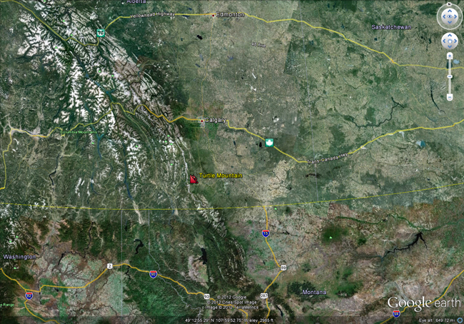
Turtle Mountain is located in the Blairmore Range in Alberta Canada about 160km south of Calgary.

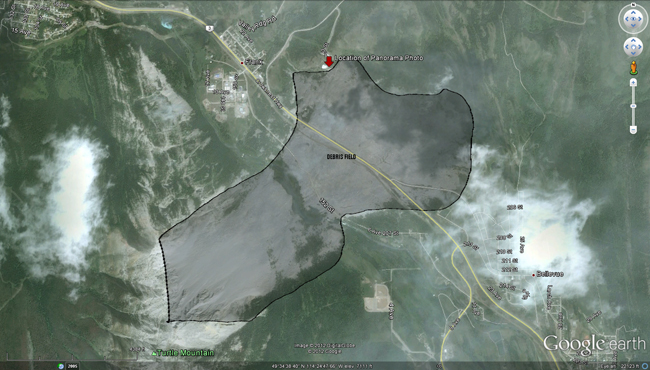
It is the site of the Frank Slide, a landslide of over 90 million tons of rock that gave way on Turtle Mountain’s East side and covered part of the small coal mining town of Frank in about 100 seconds! An estimated 90 people were killed, making it Canada’s deadliest landslide.
 Photo credit: Lindsey Preston
In this panorama, the extent of the debris is readily apparent. This debris is primarily made up of fossiliferous limestone and dolostone of the Livingstone formation.
Here is an annotated version of the same panorama (Click to enlarge).
Turtle Mountain was formed during the Laramide orogeny. At which time the Paleozoic carbonates of the Rundle Group (Livingstone Formation and Mount Head Formation) were thrust up above the much younger Mesozoic clastics: the Fernie shales, and the Kootenay Group, creating what is now called the Turtle Mountain thrust fault. This sort of thrusting, with much older rock overlying younger clastics, is repeated throughout the Canadian Rockies, as seen in this great cartoon from the Burgess Shale Foundation.
 Photo credit: Rob Taerum, Burgess Shale Geoscience Foundation
The Turtle Mountain thrust created an anticlinal form that rests atop the fault. The axial portion of this anticline formed massive fractures, due to outer arc extension, which weakened the steeply dipping carbonates from the top. Because of freeze/thawing of water and normal erosional processes, these fractures are still slowly tearing the mountain apart. The fractures are monitored closely with very precise and sophisticated tools, in the hopes that with enough warning the area can avoid loss of life with any future wasting events.
To make matters worse, the last major glaciation scoured out the area and split Turtle Mountain from its twin Bluff Mountain. This glaciation left the eastern side of Turtle Mountain much more exposed than it had been in the past. The Crowsnest river now runs between these two mountains and is working it’s erosional magic.
These factors left the steeply hanging Livingstone formation even more prone to collapse. So now Turtle Mountain has two major areas of weakness, the fractures at the top and the steeply dipping beds of carbonates that are poorly supported by weaker clastics below. Additionally, an earthquake in 1901 in the Aleutian Islands is thought to have added stress to this system which contributed to the slide.
That being said, people still decided to mine the invaluable coal deposits in the Kootenay Group below the Turtle Mountain thrust. Nor did the First Nations Blackfoot tribe’s name for Turtle Mountain: The Moving Mountain sway anyone away from mining there. While somewhat disputed, many agree that mining operations, in conjunction with the precarious placement of the carbonates, contributed to the rockslide.
The debris covers about three square kilometers to a depth averaging fourteen meters.

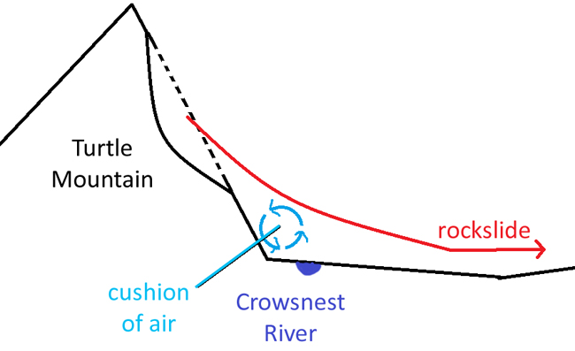
Surprisingly, the 90 million tons of debris didn’t dam the Crowsnest River that runs near the base of Turtle Mountain. It is thought that due to the speed and volume of the debris a cushion of air was created underneath the flow which padded the debris flow and much of it was able to flow over this cushion of air and across the river. Here is a simple cartoon showing this effect:

Other explanations for how the debris made it across the river have been put forth, but the consensus appears to be the cushion of air hypothesis.
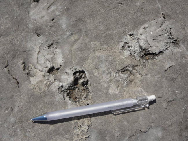
Earlier I mentioned that the Livingstone formation was fossiliferous, here is a shot of some (presumably) Rugosa found by the side of Crowsnest Highway in the debris field. Many other fossils were found in the debris that day including, fenestrate bryozoans, crinoids, and brachiopods.
 Photo credit: Lindsey Preston


 Callan Bentley is Associate Professor of Geology at Piedmont Virginia Community College in Charlottesville, Virginia. He is a Fellow of the Geological Society of America. For his work on this blog, the National Association of Geoscience Teachers recognized him with the James Shea Award. He has also won the Outstanding Faculty Award from the State Council on Higher Education in Virginia, and the Biggs Award for Excellence in Geoscience Teaching from the Geoscience Education Division of the Geological Society of America. In previous years, Callan served as a contributing editor at EARTH magazine, President of the Geological Society of Washington and President the Geo2YC division of NAGT.