17 March 2012
Lageson goes up
Posted by Callan Bentley
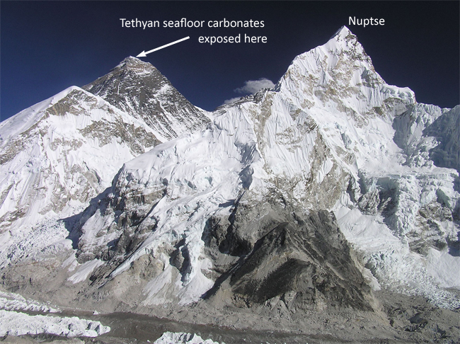
Last summer, I posted a picture of a rock sample collected by the mountaineer Conrad Anker on the summit of Mount Everest. It was passed on to me by Montana State University structural geology professor Dave Lageson, who sat on my second master’s committee. Dave has kindly continued to advise me over the years since my MSSE with advice about good field sites for my summer Rockies field course, like Block Mountain and Sandy Hollow. Dave was the one who recommended I check out Swift Dam. I’ve been grateful for that mentorship.

Photo by Conrad Anker, annotated by me.
Another person Dave has been mentoring is Anker himself. The two met several years ago skiing at Bridger Bowl outside of Bozeman, and discovered a mutual interest in mountains, how they form, and how fun they are to explore. Now Anker is a graduate student in Dave’s lab, and Anker will be leading his adviser up the tallest peak in the world. Here’s a press release from Montana State describing their research plan (and ancillary education program), and the expedition has its own Facebook page.

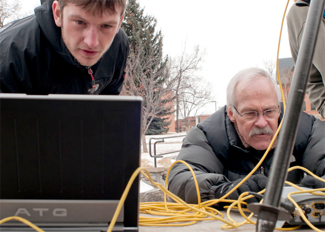
MSU graduate Travis Corthouts, left, and geology professor Dave Lageson test global positioning equipment on the MSU campus in advance of their expedition to Mount Everest. The equipment will be used to accurately measure the height of Mount Everest. (MSU photo by Kelly Gorham).
When I saw Dave at GSA in Minneapolis in October, I noticed that he looked leaner and meaner, the result of training for the expedition. He told me that the plan was to head out in the spring semester, and that in order to compensate for being away from campus for the whole semester, he was teaching a double load of classes in the fall. We also talked about what great sorts of PhD projects were likely to result from this initial foray into the Himalayas. If I were to pursue a PhD at this point (I don’t need one, but there is an ego element in my wanting to have one regardless), I would be sorely tempted by a Himalayan structure and petrology project.
All of this popped back up on my radar yesterday, when Dave Lageson and Conrad Anker both appeared on NPR’s Science Friday, discussing the upcoming trip and its goals. I recommend listening to the whole thing: it’s enjoyable and interesting. Not only is Dave definitely aiming for the summit (this was in some question when we met in October), but he plans to make definitive new measurements as to its exact elevation: a lofty goal indeed!
I wish the expedition the best of luck. I can’t wait to hear what they find up there!


 Callan Bentley is Associate Professor of Geology at Piedmont Virginia Community College in Charlottesville, Virginia. He is a Fellow of the Geological Society of America. For his work on this blog, the National Association of Geoscience Teachers recognized him with the James Shea Award. He has also won the Outstanding Faculty Award from the State Council on Higher Education in Virginia, and the Biggs Award for Excellence in Geoscience Teaching from the Geoscience Education Division of the Geological Society of America. In previous years, Callan served as a contributing editor at EARTH magazine, President of the Geological Society of Washington and President the Geo2YC division of NAGT.
Of course, the arrow is not pointing to Everest, but Nuptse. Everest is the pyramid in the background.
Oopsie Nuptse! I fixed it. Thanks for the peer review!!
Its hard to imagine a better guide than Anker and a more exciting trip.
No joke, right? I’d definitely love to do something like this myself some day.
Of course, the most structurally exciting part of the Everest is the two detachment faults which dissect the massif. The arrow annotation is actually doing a really good job showing the displacement direction along the upper, brittle detachement (the photo is taken basically perpendicular to the tectonic transport direction with left=north, right=south). This brittle detachment is located between the Tethyan sediments and the lighter colored rock (Yellow Band marbles). Out of the picture, the lower, ductile detachment juxtaposes sheared felsic intrusives and the greenschist facies schists seen directly beneath the Yellow Band. Recently estimated ductile dip slip displacement along the lower detachment using deformed isotherms is up to ~200 km!
http://www.sciencedirect.com/science/article/pii/S0191814111001532