20 January 2012
Friday fold: one from Romney (West Virginia)
Posted by Callan Bentley
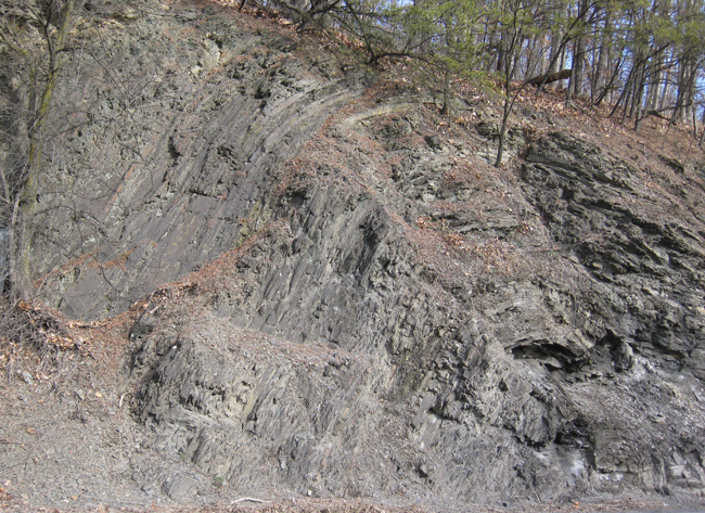
Last weekend, my wife and I joined friends for a weekend of cross-country skiing in the wonderful Canaan Valley of West Virginia. On the way back, between the towns of Burlington and Romney, West Virginia, I saw this folded shale on the north side of Route 50:
You can click on that panorama to make it a thousand pixels tall, if you want to explore it a bit. There are some nice groundwater seeps on the far right (east), making icicles in the cold air.
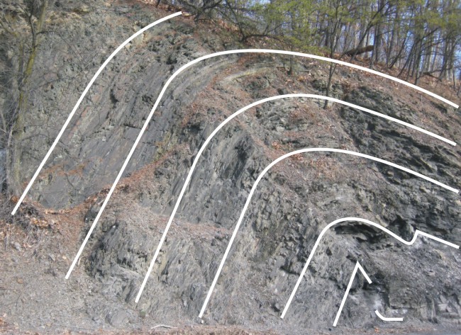
… Or we can just zoom in on the central portion, the short steep limb that interrupts otherwise shallowly-east-dipping strata:

With bedding annotated:

Happy Friday! May you make a serendipitous geologic discovery of your own this weekend.
Oh, and in case you’re wondering, I counted up the “Romney for President” signs that I saw in the town of Romney, West Virginia. There were zero.


 Callan Bentley is Associate Professor of Geology at Piedmont Virginia Community College in Charlottesville, Virginia. He is a Fellow of the Geological Society of America. For his work on this blog, the National Association of Geoscience Teachers recognized him with the James Shea Award. He has also won the Outstanding Faculty Award from the State Council on Higher Education in Virginia, and the Biggs Award for Excellence in Geoscience Teaching from the Geoscience Education Division of the Geological Society of America. In previous years, Callan served as a contributing editor at EARTH magazine, President of the Geological Society of Washington and President the Geo2YC division of NAGT.
I’m curious how the cross country skiing went, considering there isn’t a flake of snow visible in these photos.
Quite well! There was zero snow the Thursday before we went out, and then it started snowing Friday, and was still snowing as we drove in, and then it kept snowing all day! Awesome! Still not much of a base, and my skis got scratched 🙁 but it was much better than we had been hoping. The Canaan Valley sits much higher than Romney – so don’t think that these photos are representative of conditions in Davis, WV.