16 January 2012
What I saw there
Posted by Callan Bentley
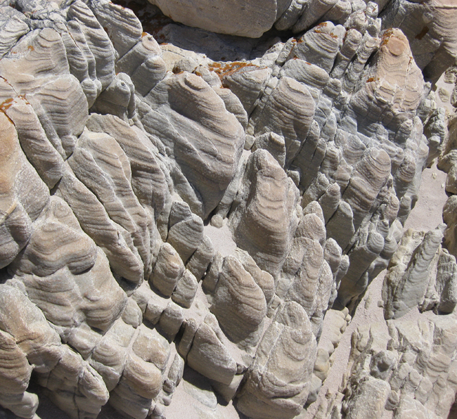
Yesterday, I showed you this picture and asked what you saw there:

Today I’ll give you my impressions. This is an outcrop of sandstone of the Table Mountain Supergroup, seen on the beach in the idyllic village of Rooiels, on the eastern side of False Bay, north of Cape Hangklip, in South Africa.The field of view (scale purposely avoided) is about half a meter.
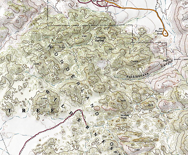
Visually, it struck me as being a “match” for a topographic map of its own miniature “landscape.” Compare the patterns in the photo with this detail from a National Geographic map of Joshua Tree National Park’s “Wonderland of Rocks,” for instance:

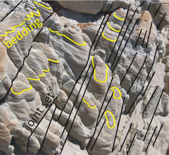
You see there a similar pattern of closed circles and ovals, generally arranged in a grid-like pattern. In the case of the beach at Rooiels, we’ve got sandstone cropping out, and that sandstone bears bedding traces on the outcrop surface. These curvy lines, highlighted in yellow in the annotated photo below, are intersections between the more-or-less planar primary layering in the sandstone, and the curved outcrop surface:

Why is the outcrop surface curved into so many elliptical knobs? Two reasons: first, the sandstone was fractured in a characteristic way, with several joint sets cross-cutting the bedding at more or less perpendicular angles. I’ve highlighted one of these joint sets in black on the annotated photo. The other is pretty much orthogonal to it. Between these three planar items (the bedding, joint set 1, and joint set 2), the sandstone is subdivided into a series of cubes. These cubes are far more likely to be broken down (weathered) along their corners, because they have three times as much surface area exposed to the elements on a corner than they do in the middle of one of the cube faces. As the corners preferentially get weathered away, the cubes take on a more and more spherical shape. This is called spheroidal weathering.
The bedding traces now “wrap around” these semi-spheroidal blocks of sandstone, like the rings of contour lines wrap around the little hills on the topographic map. That visual match was what inspired my camera-trigger finger to twitch.


 Callan Bentley is Associate Professor of Geology at Piedmont Virginia Community College in Charlottesville, Virginia. He is a Fellow of the Geological Society of America. For his work on this blog, the National Association of Geoscience Teachers recognized him with the James Shea Award. He has also won the Outstanding Faculty Award from the State Council on Higher Education in Virginia, and the Biggs Award for Excellence in Geoscience Teaching from the Geoscience Education Division of the Geological Society of America. In previous years, Callan served as a contributing editor at EARTH magazine, President of the Geological Society of Washington and President the Geo2YC division of NAGT.