
25 May 2010
Vector maps by Eric Fischer
Posted by Callan Bentley
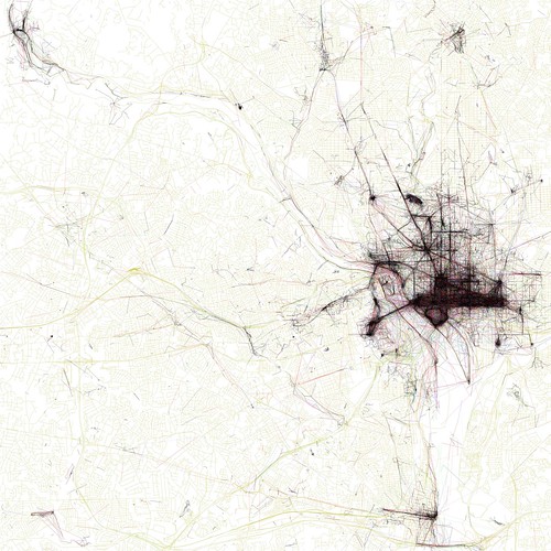
“The Geotaggers’ World Atlas #8: Washington, DC” by Eric Fischer
If you like maps, you should go check out these images by photographer Eric Fischer. (via here) The different colors represent different modes of transportation: Black is walking (less than 7mph), red is bicycling or equivalent speed (less than 19mph), blue is motor vehicles on normal roads (less than 43mph); green is freeways or rapid transit.
 Callan Bentley is Associate Professor of Geology at Piedmont Virginia Community College in Charlottesville, Virginia. He is a Fellow of the Geological Society of America. For his work on this blog, the National Association of Geoscience Teachers recognized him with the James Shea Award. He has also won the Outstanding Faculty Award from the State Council on Higher Education in Virginia, and the Biggs Award for Excellence in Geoscience Teaching from the Geoscience Education Division of the Geological Society of America. In previous years, Callan served as a contributing editor at EARTH magazine, President of the Geological Society of Washington and President the Geo2YC division of NAGT.