
17 May 2010
"Geology of Skyline Drive" w/JMU
Posted by Callan Bentley
I mentioned going out in the field last Thursday with Liz Johnson‘s “Geology of Skyline Drive” lab course at James Madison University.
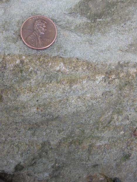
We started the trip south of Elkton, Virginia, at an exposure where Liz had the students collect hand samples and sketch their key features. Here’s one that I picked up:
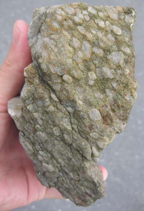
Regular readers will recognize those little circular thingies as Skolithos trace fossils, which are soda-straw-like in the third dimension. Rotate the sample by 90°, and you can see the tubes descending through the quartz sandstone:
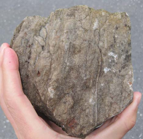
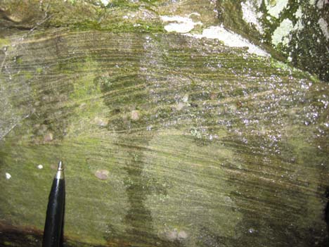
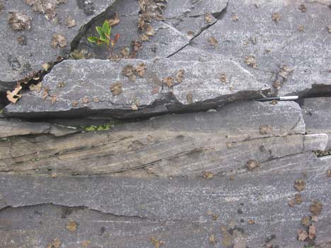
This is the Antietam Formation, a distinctive quartz sandstone / quartzite in the Blue Ridge geologic province. But at this location, on the floor of the Page Valley and butted up against the Blue Ridge itself, we see something else in the Antietam:
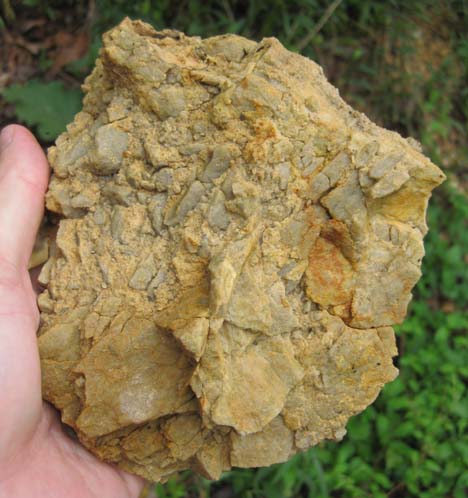
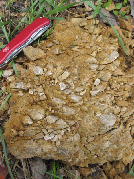
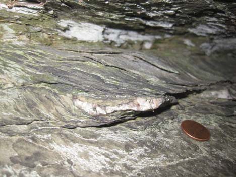
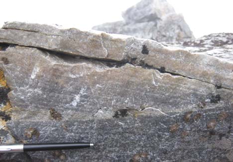
Parts of this outcrop are pervasively shattered: a variety of sized clasts of Antietam quartzite are loosely held together in porcupine-like arrays of fault breccia. Turns out that this is the structural signature of a major discontinuity in the Earth’s crust: the Blue Ridge Thrust Fault. This is the fault that divides the Valley & Ridge province on the west from the Blue Ridge province on the east. And here, thanks to a roadcut on Route 340, we can put our hand on the trace of that major fault. Here’s another piece of the fault breccia:
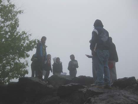
After grokking on the tectonic significance of this fault surface, we drove up into Shenandoah National Park, to check out some outcrops along Skyline Drive itself, but it was really foggy. Here’s a typical look at the team in the intra-cloud conditions atop the Blue Ridge:
We checked out primary sedimentary structures in the Weverton Formation at Doyles River Overlook (milepost 81.9), like these graded beds (paleo-up towards the bottom of the photo)…
…and these cross-beds. You can see that it was raining on us at this point: hence the partly-wet outcrop and glossy reflection at right:
Cutting through this outcrop was a neat little shear zone where a muddy layer had been sheared out into a wavy/lenticular phyllonite, with a distinctive S-C fabric visible in three dimensions:
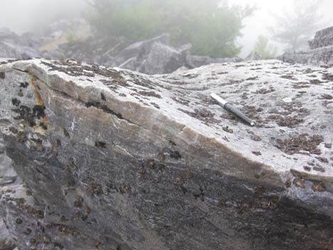
Finally, we went to the Blackrock Trail, which leads up to a big boulder field of quartzite described as Hampton (Harpers) Formation. In some places, exquisite cross-bedding was visible, as here (pen for scale):
Here’s a neat outcrop, where you can see the tangential cross beds’ relationship to the main bed boundary below them:
…And then if you spin around to the right, you can see this bedform (with internal cross-bedding) in the third dimension. I’ve laid the pen down parallel to the advancing front of this big ripple:
That last photo also shows the continuing influence of the fog.
Thanks much to Liz for letting me tag along on this outing! It was a great opportunity for me to observe another instructor leading a field trip, and also to discover some new outcrops in the southernmost third of the park.
 Callan Bentley is Associate Professor of Geology at Piedmont Virginia Community College in Charlottesville, Virginia. He is a Fellow of the Geological Society of America. For his work on this blog, the National Association of Geoscience Teachers recognized him with the James Shea Award. He has also won the Outstanding Faculty Award from the State Council on Higher Education in Virginia, and the Biggs Award for Excellence in Geoscience Teaching from the Geoscience Education Division of the Geological Society of America. In previous years, Callan served as a contributing editor at EARTH magazine, President of the Geological Society of Washington and President the Geo2YC division of NAGT.
Take a look at the 2:00-2:20 presentation!
Lockwood; hope you will attend and report on the content. Via Bob Lillie, I encouraged this project and encouraged use of my Shenandoah web resources… Looking forward to seeing the results!!
[…] shales beneath the Home Thrust in the Sevier fold-&-thrust belt of western Montana, and even in sheared-out greenstone of the Catoctin Formation in Shenandoah National Park. This was another lovely example of the anastamosing cleavages that phyllosilicate-rich rocks can […]