
17 May 2015
Faults from the air
Posted by Jessica Ball
Sometimes I spend so much time out looking at geological features in the Bay area that I forget to blog about them. But this weekend I had the chance to go for a wonderful tour of the South Bay and Peninsula via Cessna, and I’m convinced that it’s an awesome way to check out geology. (Of course, anyone who’s seen Michael Collier’s photographic work knows that already, but in case you needed convincing, take my word for it. Also, not having to brave security at the airport is lovely.)
To start off our tour, here’s the south end of the Bay, which is an estuary between (mainly) the Hayward Fault in the east and the San Andreas Fault in the west. The Bay is salty, but it’s also fed by the Sacramento and San Joaquin Rivers, so it’s not as salty as the Pacific – sort of like the Chesapeake Bay back where I grew up on the East Coast.
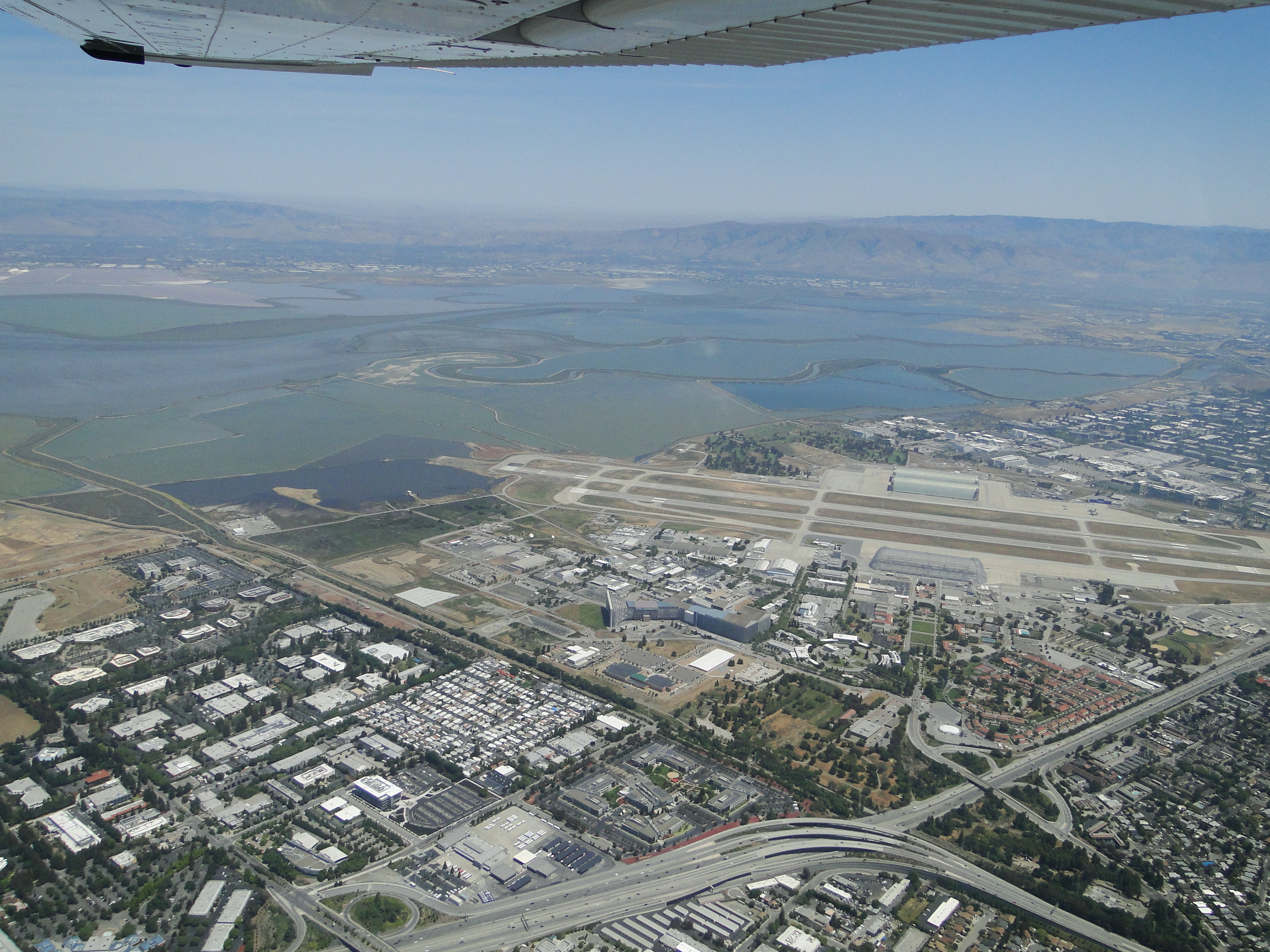
The south end of the Bay, with Moffett Airfield in the foreground.
The Bay area is full of scientific facilities like NASA’s Ames Research Center, which operates out of Moffett Airfield. The most visible part of the facility is Hangar One, which was built in the 1930s to house the airship (blimp) USS Macon. It’s so big it covers six football fields’ worth of space and when it was enclosed, sometimes had fog form near the roof. Google recently leased it for some purpose or other.
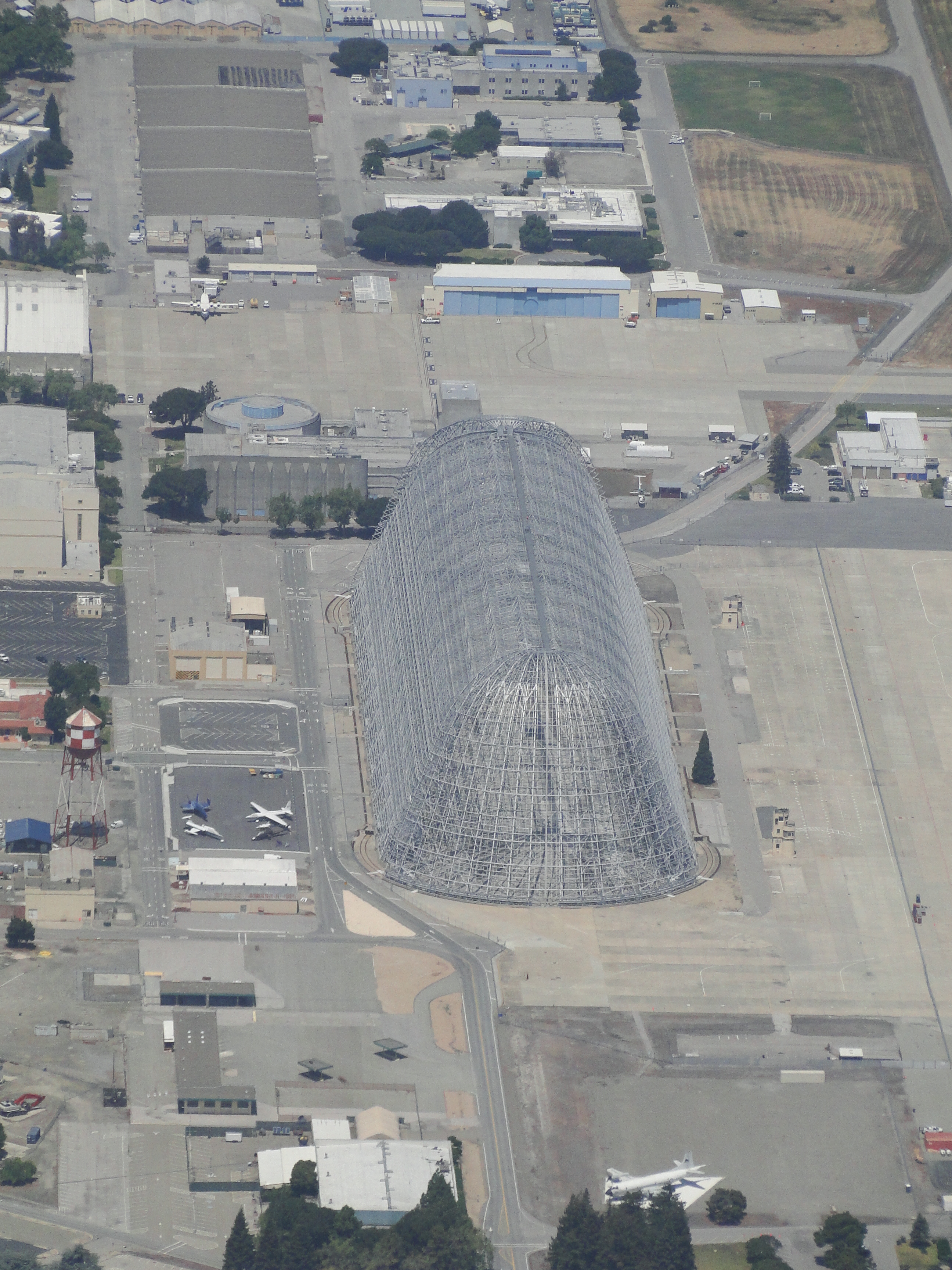
The blimp hanger at Moffett
But there are more geologically interesting things visible on either side of Silicon Valley. Toward the Bay, you start seeing salt collection ponds, where brackish Bay water is enclosed and allowed to evaporate, leaving brines and then salt behind. They’re brightly colored because certain kinds of algae and bacteria become the dominant microorganisms as the brines become more and more concentrated. Some of these are supposedly operated by Cargill, but I’m not sure if this particular set belongs to the company.

Salt collection ponds
Speaking of science-y infrastructure…here’s where I work!
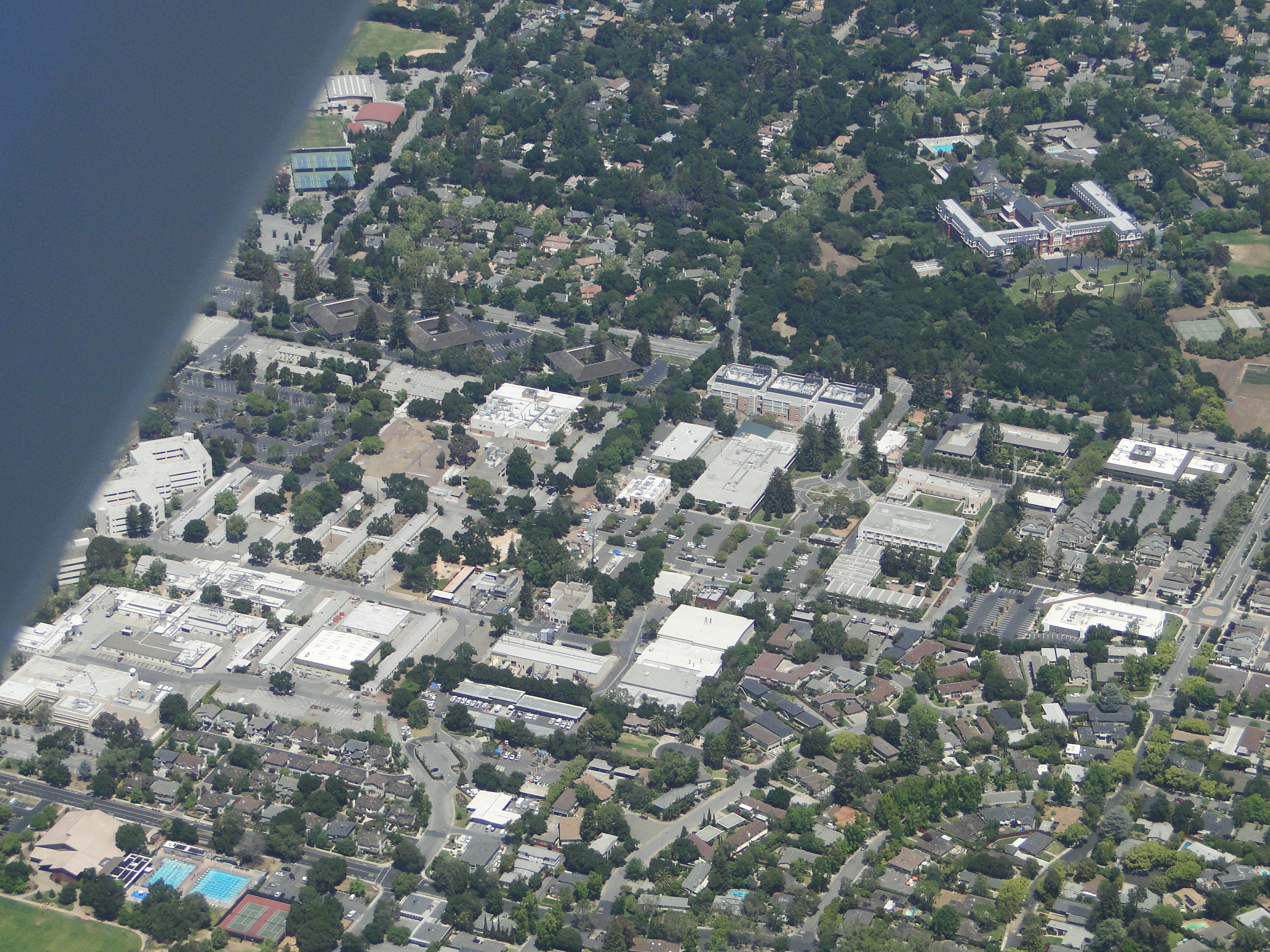
The USGS Offices in Menlo Park (mostly on the right and in the center).
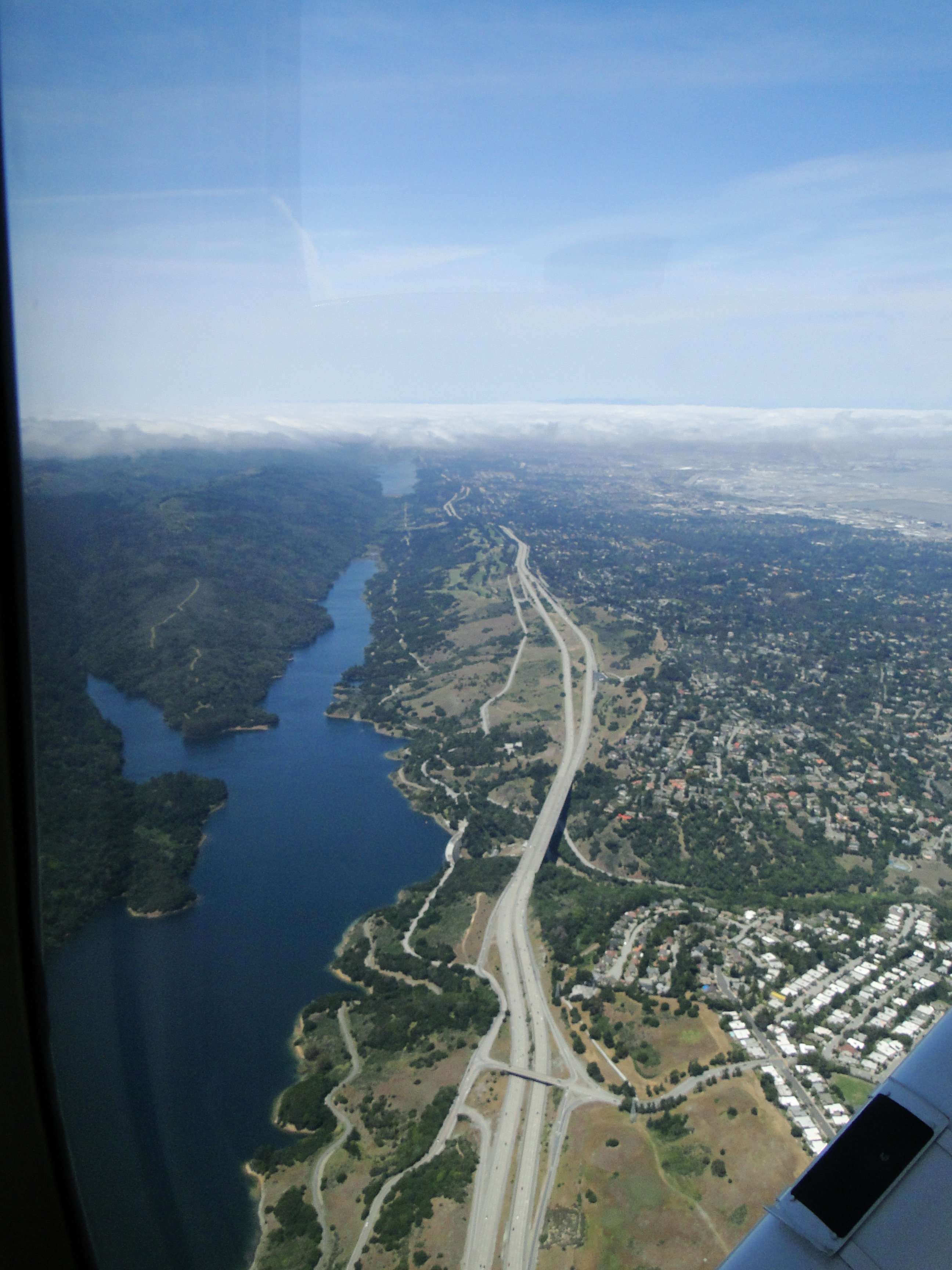
But the coolest geological feature is definitely the fault zones. They’re ridiculously obvious, especially if you’ve ever been somewhere like Salt Lake City where there are mountain ranges fronted by faults. I present a beautiful rift valley:

Crystal Springs Reservoir and the San Andreas & Pilarcitos Faults
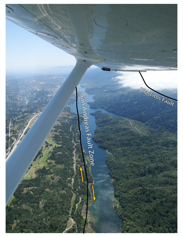
But this is arguably one of the most famous fault zones in the world, and it’s pretty darn dramatic. To give you a better idea of where the fault trace is, here’s an annotated version of the previous photo:
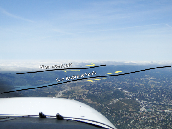
With some annotation…
The fault motion here is a dextral or right-lateral transform fault, meaning that if you were standing on one side of the fault and watching it move in real time (not something I’d want to experience firsthand!), you would see features on the other side moving to your right. It traces a path from the Salton Sea in southern California all the way to the Mendocino triple junction off the coast of Northern California – more than 800 miles long!
Nice linear features with mountains behind them = fault zones. Looking to the north along Crystal Springs Reservoir.
It’s a sobering thing sometimes to live so close to this massive fault zone (and the other faults in the Bay Area). The San Andreas is capable of a M8.1 earthquake – about the same as the earthquake that affected Indonesia in 2009 or Kobe, Japan in 1995. That doesn’t mean that size of earthquake is going to happen, but it’s possible. And there are a lot of other smaller faults in the area that pose an even greater risk of rupturing (like the Hayward and Calaveras Faults on the other side of the Bay).
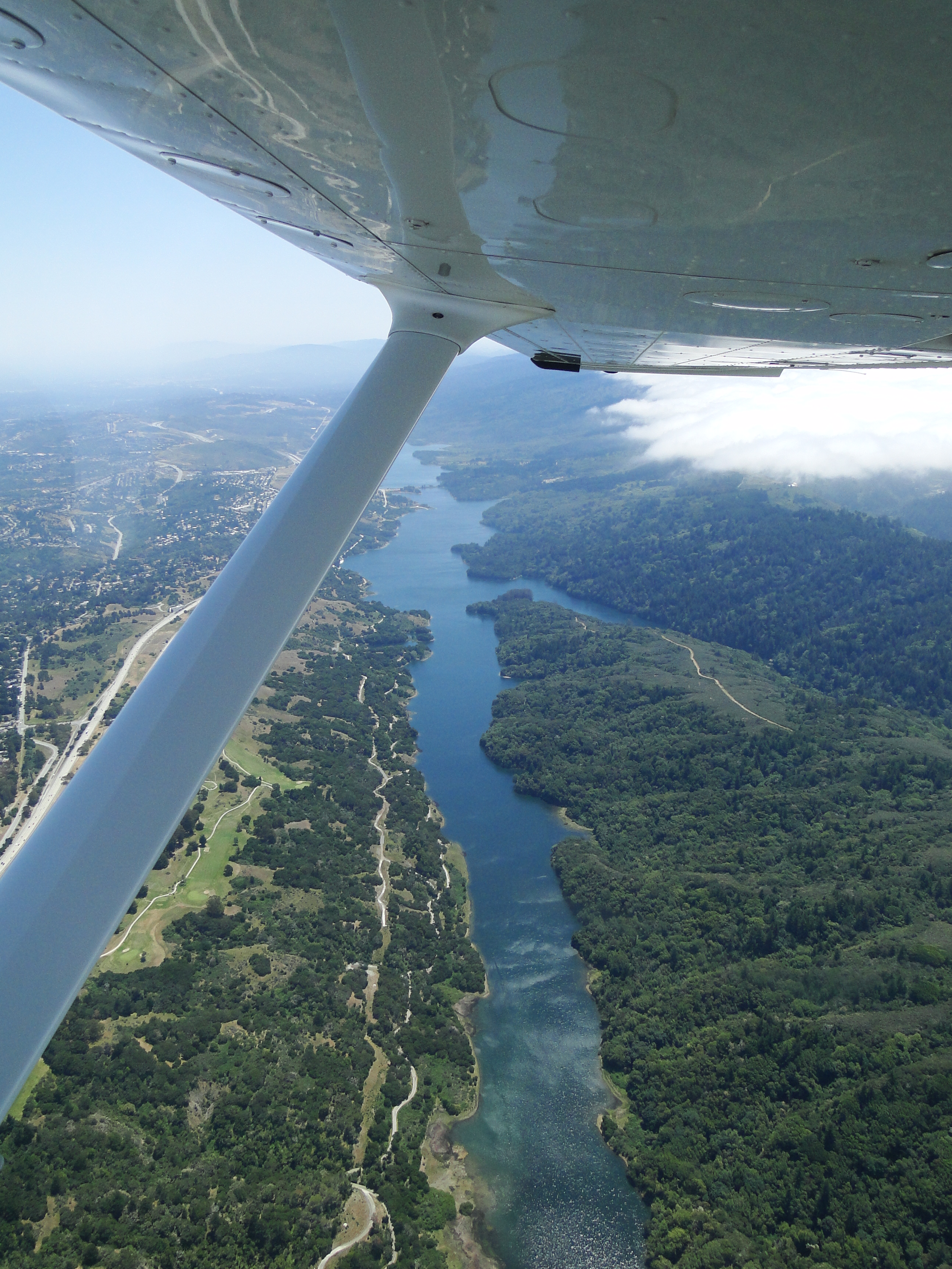
Another good shot of the reservoir (looking to the south)
It’s not easy to tell just from looking at this reservoir that we’re in a four-year-and-running drought. The water here comes both from runoff and local creeks and from the Hetch Hetchy Reservoir in Yosemite National Park. Right now that reservoir is at about 70% of capacity – but there’s almost no snowpack in the Sierras, which is where Hetch Hetchy’s water comes from. It’s a really worrying situation, and I’m glad the state government is finally getting serious about enforcing water restrictions.
…and annotated. (Yes, the annotations are different, I was experimenting with the Wacom, shut up.)
On the way back to San Jose, we flew over the Stanford Campus, which meant we had a great view of the Stanford Linear Accelerator (SLAC). The linac accelerator is two miles long, and it actually crosses two fault traces (the Hermit fault and an unnamed fault). Fortunately, they haven’t been historically active.
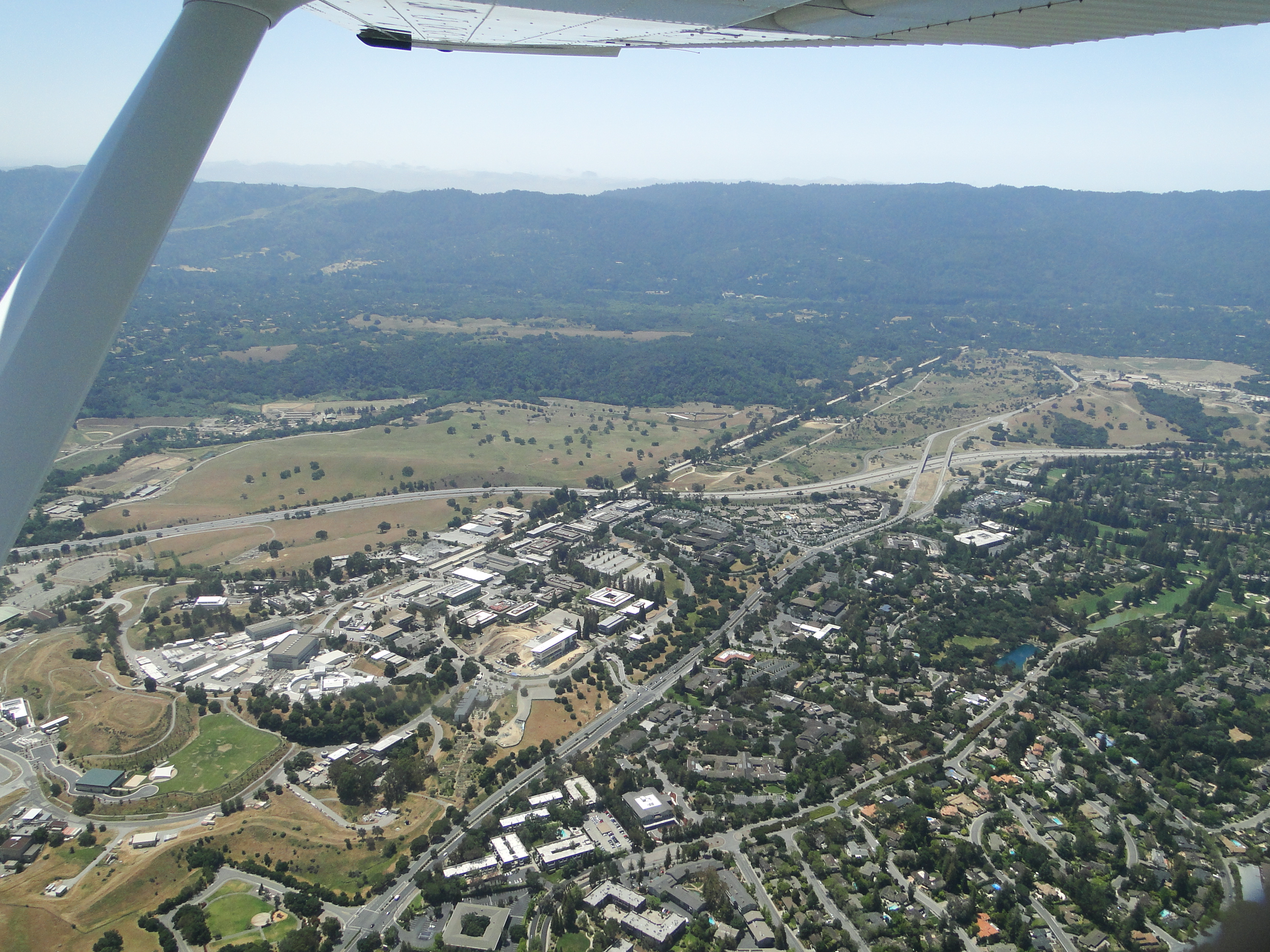
A favorite for another geeky reason – this is the Stanford Linear Accelerator!
And finally, to round out our science-y tour, we passed by the Stanford Dish, a radio telescope that once communicated with the Voyager spacecraft and is now used for astronomy and commanding and calibrating satellites.

A telescope, a couple of faults and the Santa Cruz Mountains make a scenic ending to the day.
Thanks to Rick for the flight, and a new perspective on some Bay Area geology!
 Jessica Ball is a volcanologist at the U.S. Geological Survey, researching volcanic hydrothermal systems and stability, and doing science communication for the California Volcano Observatory. She previously worked at the Geological Society of America's Washington DC Policy Office, learning about the intersection of Earth science and legislative affairs. Her Mendenhall postdoc and PhD focused on how water affects the stability of volcanoes, and involved both field investigations and numerical modeling applications. Her blogging covers a range of topics, from her experiences in academic geosciences to science outreach and communication to her field and lab work in volcanology.
Also, Mike Rymer might have the best fault air photo collection out there:
https://www.flickr.com/photos/38037974@N00/albums