30 June 2012
Accretionary Wedge #47: Nostalgia for notetaking
Posted by Jessica Ball
Jennifer at Fuzzy Science is hosting this month’s Accretionary Wedge, and this time we’re talking about field notes. For me, this is a pretty nostalgic discussion, since I haven’t been out do to field work for my own research since 2010. I’ve been on field trips since then, certainly, but notetaking sometimes gets sidelined in favor of other trip activities when you’re not doing it for work or research. Also, my research right now involves a lot of time dealing with computer simulations, so I still take lab notes, but they’re not like recording a field experience.
Still, going back and looking at my old field notes was kind of fun (and messy; I used to use mechanical pencils a lot more than I remembered, apparently). I’m also quite hard on my field notebooks, because the older ones were looking pretty beat up when I started flipping through them.
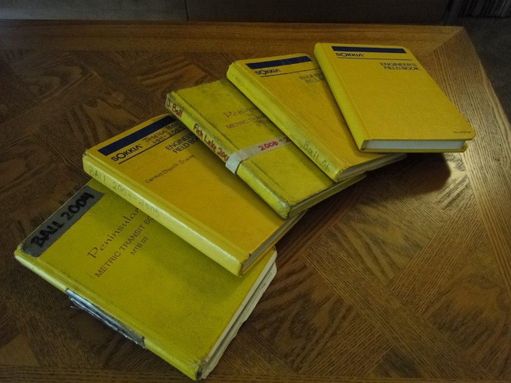
Notebooks from 2004-2007, along with one yet to be filled. I must have really abused 2004, because it's completely out of its binding now.
I scanned a few pages from the books I had at home. Here’s one from my very first field course, a 3-1/2-week-long circuit of the Colorado Plateau. This page is from a discussion of terrace dating for the Fremont River on the Fish Lake Plateau, where I’d go on to do my senior research two years later.
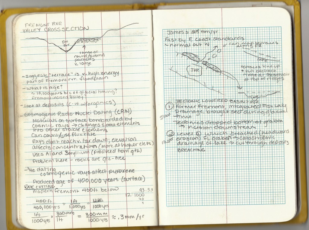
At this point, I doubt I'd ever discussed cosmogenic radionucleide dating, as I managed to misspell it. I think I did a pretty good job on the drawings for someone who'd just finished freshman year, though.
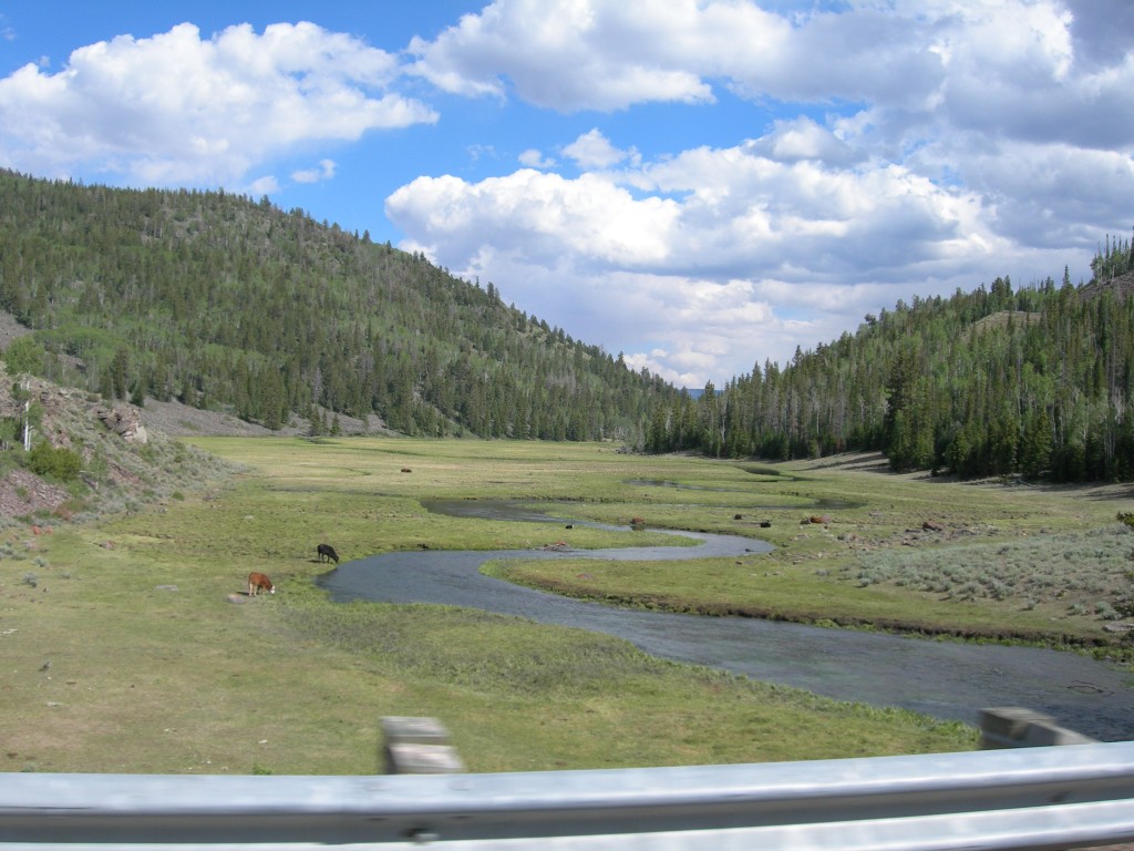
For some reason I didn't take photos at that stop the first time around, but here's a photo taken in 2006 of the Fremont River Valley (with cows). Photo by Chris Bowles.
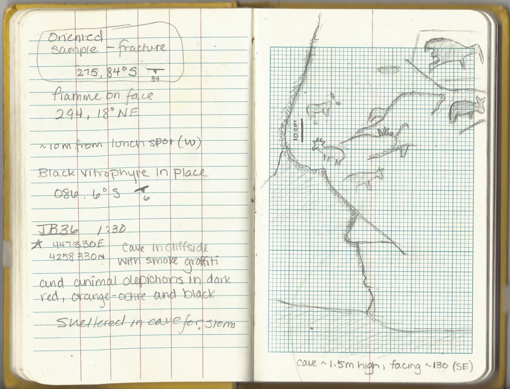
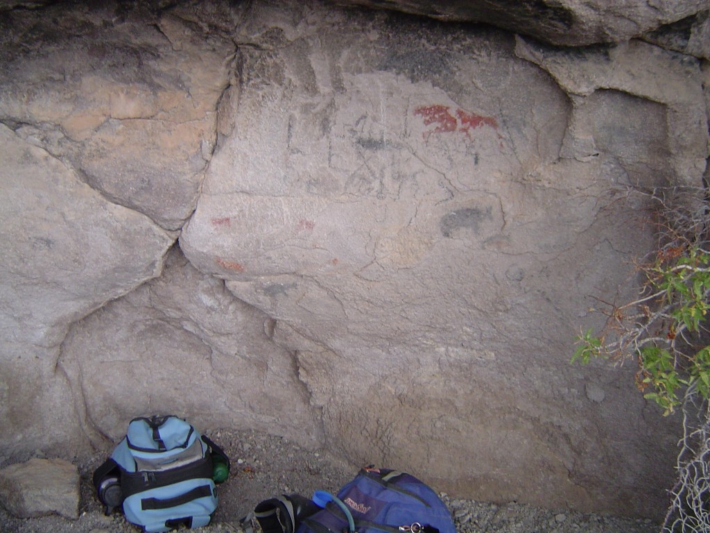
My senior research involved a very different setting on the same plateau: investigating the Osiris trachyte, a volcanic tuff that shows up at much lower elevations, mostly on the edges of the plateau. It’s quite prone to forming caves, which are very useful when you get caught in a rainstorm. At one location, the cave even had some art in it.
This area was the center of the Fremont culture (which was native to the area around 700-1300 AD), so the drawings could have been quite old. There was also some modern graffiti in the cave, however, so I’m not sure about this. Here are more photos of the cave:
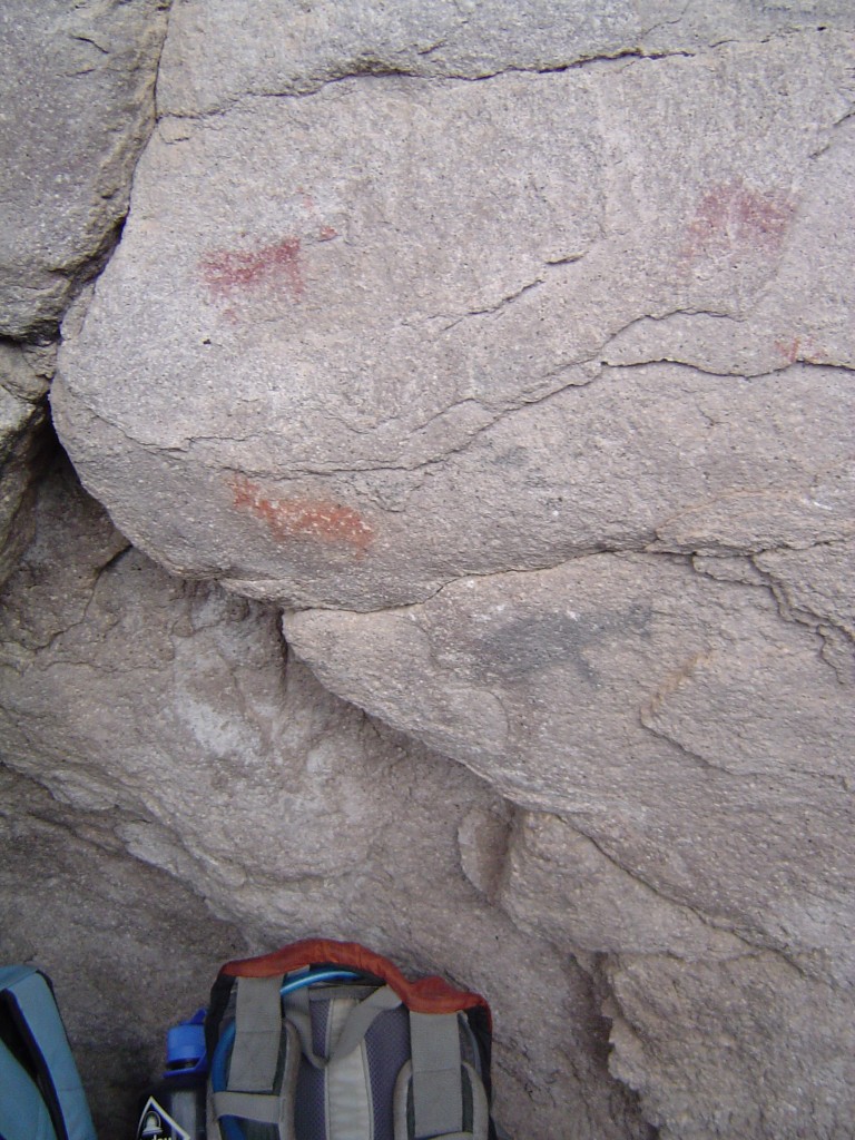
A little closer. You can also really see the phenocrysts in the Osiris (lots of sanidine and biotite), although there aren't many fiamme in this spot (the point of this hike was measuring the orientations of pumice fiamme to figure out local flow fabrics).
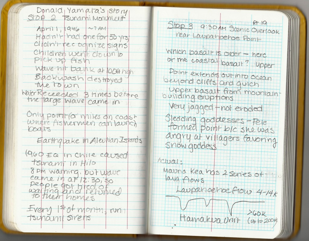
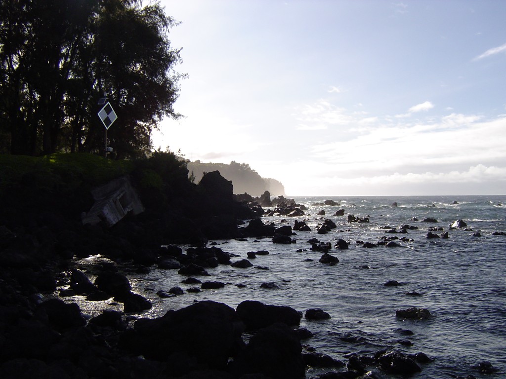
It’s amazing what you come across on these trips. Another neat encounter happened on a field trip to Hawaii in 2006; we were camping at Laupahoehoe Park on the Big Island, and it happened to be on Memorial Day weekend. Joining us at the campground was Donald Yamata (or Yamato; I may have misspelled it) and his family, and it turned out that they had gathered, as they did every year, to remember another event: the 1946 Aleutian Tsunami, which Mr. Yamata survived.
Mr. Yamata was kind enough to sit down with our entire group and tell his story, and reminded us that no matter how excited we got about geology (and who wouldn’t get excited on Hawaii?), there’s still a darker side to consider.
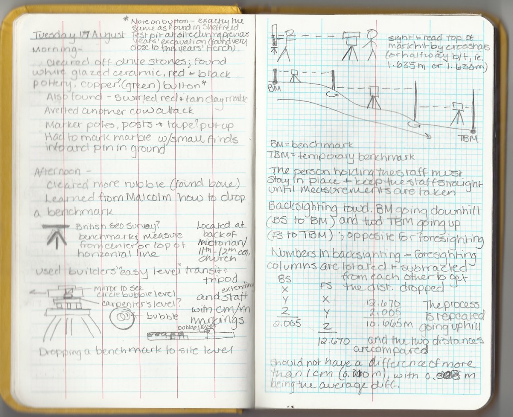
Going through my notes, I noticed that a lot of them are interspersed with historical and archaeological tidbits. In one reversal, though, the first time I really learned how to use a transit and a Jacob’s staff was on an archaeological dig in England. After I went on the Colorado Plateau trip in 2004, I spent 3 weeks in rural Yorkshire digging up a medieval longhouse on the grounds of an old country estate. In archaeology, all your measurements are made from a benchmark, and in our case the nearest benchmark was up a hill, across a cemetery and around the back of an old church. Naturally, this meant we had to create a more useful second benchmark, and that meant doing a little surveying.
Even with the benchmark, it wasn’t a particularly easy site to work on, since we were halfway up a hill and had to spend a lot of time fighting off cows. But that’s typical of archaeology and geology, so it was good to get used to it early on.
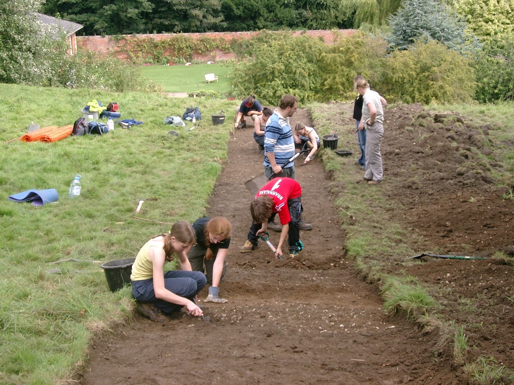
The trench we excavated using the dropped benchmark. This was probably post-cow, considering how untidy the walls are.
One thing that I wish was different about my note-taking is the handwriting. I’m pretty decent at sketching, but my handwriting inevitably deteriorates the longer I spend writing the notes (or the longer I’ve been on the trip, or the worse the weather gets, or the more tired I get, etc.) Perhaps that’s something I’ll work on this summer – even if I am doing most of my geology on a computer!


 Jessica Ball is a volcanologist at the U.S. Geological Survey, researching volcanic hydrothermal systems and stability, and doing science communication for the California Volcano Observatory. She previously worked at the Geological Society of America's Washington DC Policy Office, learning about the intersection of Earth science and legislative affairs. Her Mendenhall postdoc and PhD focused on how water affects the stability of volcanoes, and involved both field investigations and numerical modeling applications. Her blogging covers a range of topics, from her experiences in academic geosciences to science outreach and communication to her field and lab work in volcanology.
Your handwriting looks pretty good to me! I’ve had to decipher field notes where the handwriting was *much* worse.
For my Oman field trips, I actually typed up a good portion of my notes– to help me think and to make sure I could read my handwriting while I still remembered what I had written. My handwriting isn’t terrible, but it’s not the best either.
This post was very fun– I look forward to putting together my own AW entry, probably on Monday.
I love seeing your progression! The drawings are excellent, and I’m jealous of seeing the pictographs.
I’ve been in my current job as a field geologist for a state agency for over 22 year now. On a shelf next to my desk are 43 full field notebooks (plus one in use) that record every single site visit I’ve made during that time. Sometimes on slow, rainy days I thumb through the older ones just to see if I can remember those trips.