
18 May 2011
National Geographic’s “X-Ray Earth”
Posted by Jessica Ball
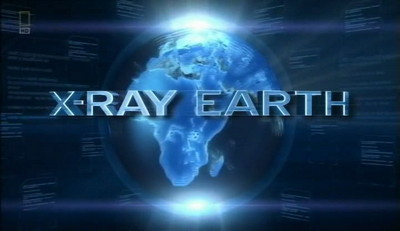
On Sunday night, I watched the National Geographic Channel’s new special “X-Ray Earth”. From the commercials advertising it, I thought the show might be interesting; it looked like there would be a significant part devoted to remote sensing techniques that I (and other Earth scientists) are familiar with using – and the show didn’t disappoint me. NatGeo’s own summary bills the show as follows:
Similar to the way doctors use X-rays to diagnose unseen medical problems, scientists are using an army of sensors located underground, in the sky, the ocean and our cities to monitor the Earth more than at any other time in our history. From the undisturbed far reaches of the planet to the busiest cities on the globe, X-RAY EARTH uses technology and CGI to give us a new view of our world.
The show runs for two hours, and covers a number of different technologies. It covers a variety of topics, including seismic tomography (with a nice feature on the EarthScope USArray network of seismometers), satellites and airborne sensors used to monitor hurricanes, seafloor sensors which track the proliferation of deoxygenated zones, assessment of CO2 uptake by plant life through fractal mathematics, and more. If you’re more interested in the Earth science applications of the show, then I’d stick with the first hour. The second hour goes into the use of technology for social science applications, such as using video cameras to prevent crime and studying whether our entire environment (homes, workplaces, cities, etc.) can be fitted with sensors of various types. There is an neat segment about citizen scientists collecting data on air quality using self-contained backpacks with GPS and gas sensors.
I was somewhat impressed with the touted CGI graphics, although the “Earth’s interior” sequence was a bit overdone (they went beyond the Earth as onion-type graphic and literally exploded the planet). I was also impressed with the seismic tomography sequence in that the narrator did not refer to the mantle as ‘molten’, but rather described it as “plasticized rock”. (Not quite accurate, but better than completely wrong.) There is also an overarching theme of climate change – nicely presented, not as a controversy, but as a reality well-supported by numerous avenues of research. One segment about time-lapse photography of glaciers was particularly striking, and reminiscent of the USGS’s Repeat Photography Project, which documents retreating glaciers over a nearly century-long timescale.
Overall, I found that while the show skipped around quite a bit in terms of subject matter, the topics were well-explained and the segments entertaining. The CGI could be distracting at times, but did help illustrate some pretty tricky concepts. The focus on remote and semi-remote sensing was a refreshing take on Earth science topics that have been done to death in other documentaries, and it’s a great way to introduce viewers to some very modern research tools.
 Jessica Ball is a volcanologist at the U.S. Geological Survey, researching volcanic hydrothermal systems and stability, and doing science communication for the California Volcano Observatory. She previously worked at the Geological Society of America's Washington DC Policy Office, learning about the intersection of Earth science and legislative affairs. Her Mendenhall postdoc and PhD focused on how water affects the stability of volcanoes, and involved both field investigations and numerical modeling applications. Her blogging covers a range of topics, from her experiences in academic geosciences to science outreach and communication to her field and lab work in volcanology.
Good review. I agree with the positive aspects & further feel that it will be a great tool for kids on the fence about pursuing math & science for practical reasons to which they can relate.
Wow the first hour was great,but I missed the second hour. When are you going to re-play ? A MUST….
Looks like it will be airing again on Sunday May 22 (the NatGeo website has a “next airing” date at the top of the program page).
Thank you for the time you spent,and will be looking forward on the up coming show!! thanks again.
Hi. Great website. Its a shame our school systems can’t change the way there teaching our future. I have 4kids& 4grandchidren. I teach them about sink holes, the trash that eats our earth, what’s not biodegradable. Which they take to heart. Thank god. Our sciece teachers should be ahead of the ball game. Our government keeps all in limbo. Its sad. keep watching national geo. Im proud of u jessica. Keep learning and sharing.
thought the show looked a great idea until i watched it ,then i found that it was nearly impossible to hear the narration because of the overwhelming noise of the sound effects and music.can the producers please tone it down or better still ditch the sound effects,because it would be good to hear what the people were talking about.
here`s hoping.
Yes, great show, so I ordered the DvD from NatGeo to show my math classes. But the disc won’t play in my dvd player, nor on my PC, nor on my school laptop. So they sent me two more discs which also didn’t work, then gave me a refund. Turns out these discs only play on DvD play-only devices, none of which are compatible with my projector hook-ups at school or home. Too bad they limit the acessibility so tightly. I get the disc-copying thing and the need to protect copyright, but good grief… now I’ll have to find a bootleg on the ‘net to show in class.