
9 September 2022
Using social media to collect data on landslides in near real-time
Posted by Dave Petley
Using social media to collect data on landslides in near real-time
Before I start my post today, as a British Citizen I want to express my sadness at the passing of Queen Elizabeth II. She has reigned for all of my life and much more. She was the best of us.
As loyal readers will know, for many years I collected data on landslides that cause fatalities. I started that work in 2003, and it has been widely published and cited. That work was made possible by the emergence of online news sources, and the ability to scan them, plus social media. Others have also collected this sort of data on a global scale, most notably the team at NASA, and of course there has been a range of efforts to compile similar data at national and regional level.
These types of studies have changed our understanding of landslides in time and space. But collecting the data is immensely time consuming (meaning that I have ceased to do so, given my other commitments). So, in recent years there have been attempts to automate the process. In a paper (Pennington et al. 2022) just published in the International Journal of Risk Reduction, Catherine Pennington from the BGS and an international team have taken this work a significant step forward using Artificial Intelligence (AI). This research has also been reported in an excellent article in EOS.
The work is clever. An algorithm continually scans social media for posts on landslides using a very wide range of terms in multiple languages (usefully the article provides the full list of these words). It then harvests images from posts that provide a positive indication. AI is then used to analyse the image to determine whether the post involves a true landslide.
The algorithm has been trained with a large set of landslide images that were evaluated and classified as landslide or other by human observers. Whilst far from perfect, the algorithm is performing well.
The team now have a demonstrator running at, using Twitter data: https://landslide-aidr.qcri.org/service.php#home
Take a look, it’s petty cool. This is the map of landslides that it has detected in the last seven days:-
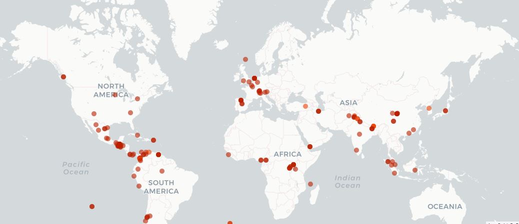
Landslides detected from Twitter over a seven day period using the algorithm of Pennington et al. (2022). Image from the Global Landslide Detector.
.
Inevitably there are some challenges, notably including how to differentiate between, for example, tweets that show recent landslides and those that show the outcomes of landslide mapping, and thus that are older. But science is iterative, and this is an important and interesting step.
.
Reference
Pennington, C.V.L., Bossu, R., Ofli, F., Imran, M., Qazi, U., Roch, J. and Banks, V.J. 2022. A near-real-time global landslide incident reporting tool demonstrator using social media and artificial intelligence. International Journal of Disaster Risk Reduction, 77, 103089. https://doi.org/10.1016/j.ijdrr.2022.103089.
 Dave Petley is the Vice-Chancellor of the University of Hull in the United Kingdom. His blog provides commentary and analysis of landslide events occurring worldwide, including the landslides themselves, latest research, and conferences and meetings.