
18 February 2022
Planet satellite image of the urban landslides in the Alto da Serra area of Petrópolis, Brazil
Posted by Dave Petley
Planet satellite image of the urban landslides in the Alto da Serra area of Petrópolis, Brazil
Planet have very kindly captured a new high resolution satellite image of the 15 February 2022 landslides in Petrópolis in Brazil. These are 50 cm resolution images, providing very high level of detail. The first of the two images was taken in the area of Alto da Serra – the centre of the image is at about -21.516, -43.169:-
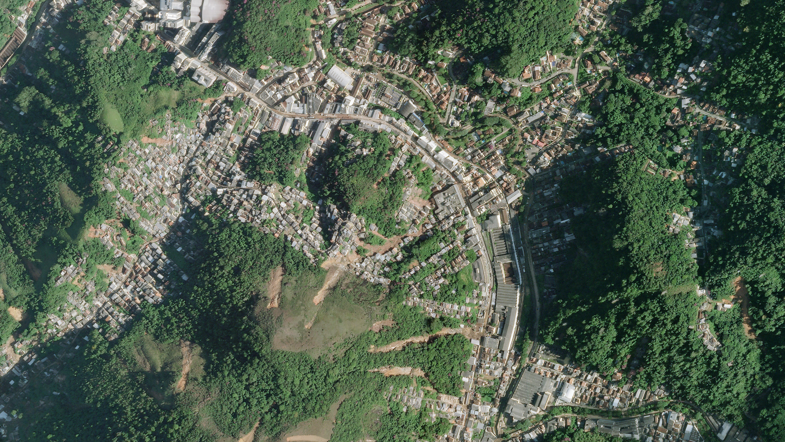
High resolution satellite image of the landslides in the Alto da Serra area of the city of Petrópolis in Brazil. Image copyright Planet, used with permission.
.
In the centre of the image are multiple shallow landslides, starting on the hillsides but descending into the inhabited areas. There are also several landslides on the western side of the image. The landslides in the centre of the image are worth examining in more detail:-
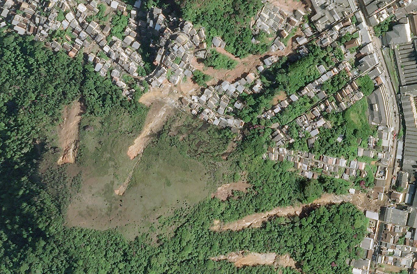
High resolution satellite image of the urban landslides in the Alto da Serra area of the city of Petrópolis in Brazil. Image copyright Planet, used with permission.
.
In most cases these are smallish, shallow slips that have entrained debris along the track to form channelised flows. The long landslide in the lower eastern corner is interesting – it appears to have damaged buildings and to have deposited debris on the road.
Planet has also captured an image to the south of the above image, close to Morro da Oficina:-
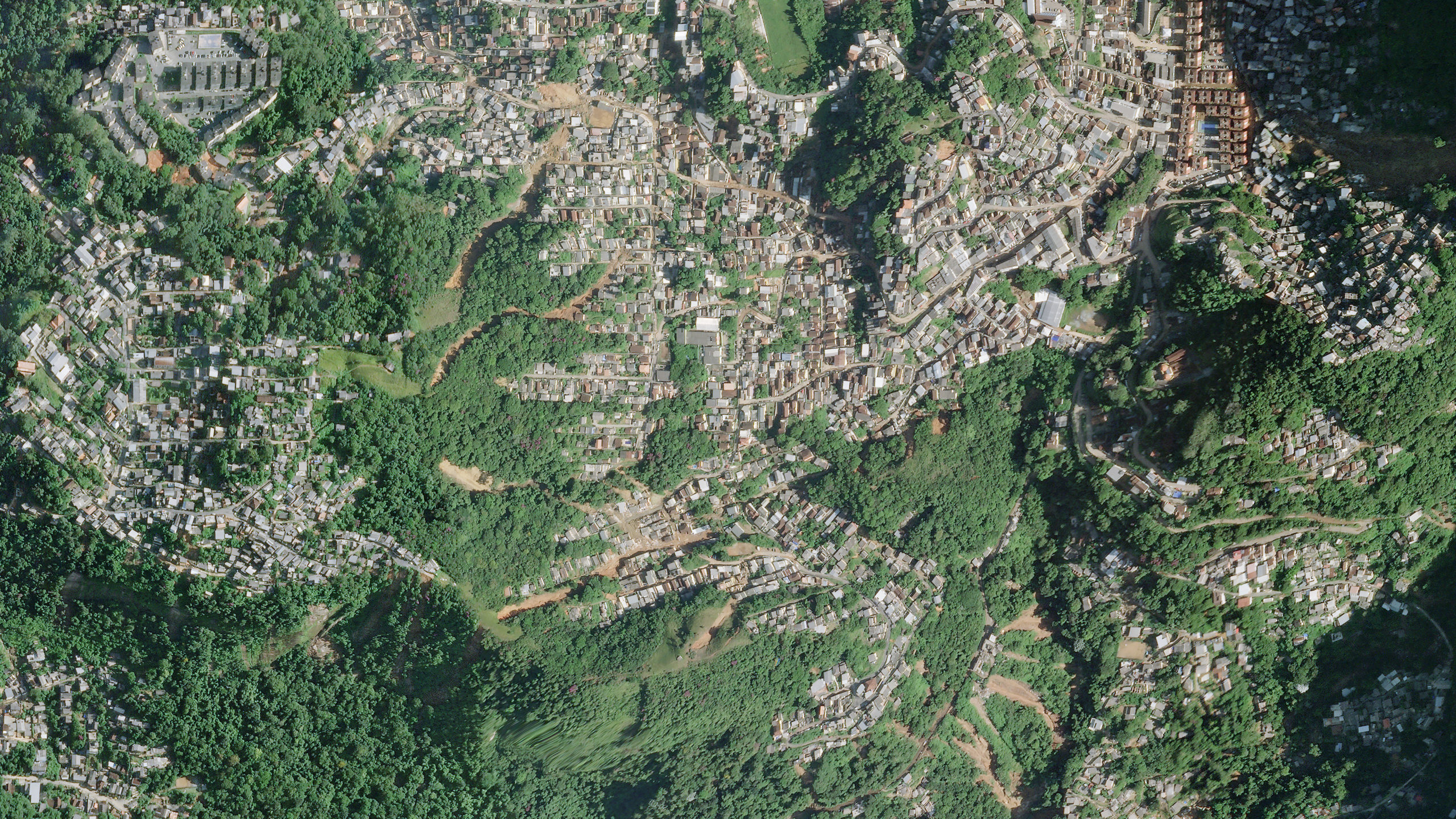
High resolution satellite image of the landslides in the Alto da Serra area of the city of Petrópolis in Brazil. Image copyright Planet, used with permission.
.
The lower portion of the large landslide at Morro da Oficina is just visible in the northeast corner of the image. But note the multiple landslides in the centre of the image and towards the upper part. Again, these slides have started in unpopulated areas but the debris has flowed into the inhabited regions. As the image below shows, there is evidence of serious structural damage in places:-
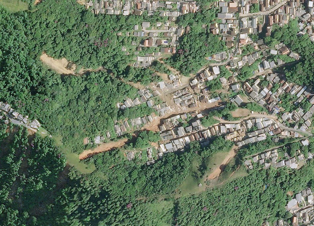
High resolution satellite image of damage caused by the landslides in the Alto da Serra area of Petrópolis, Brazi. Image copyright Planet, used with permission.
.
These multiple landslides are extremely hazardous for the local population and are difficult to manage in an emergency situation.
The latest news from the city makes grim reading. There are now 117 confirmed deaths, with a further 140 reported to be missing. Some reports indicate that the number missing may be as high as 700 people, although it is not unusual for the number missing to be far too high at this stage of an emergency. It is not clear how many of these died in the landslide at Morro da Oficina, but the toll there is undoubtedly substantial given that 80 houses were destroyed. So far, 269 landslides have been identified, and a further 56 “landslides and falls of trees” have been recorded.
.
Acknowledgement
Planet Team (2022). Planet Application Program Interface: In Space for Life on Earth. San Francisco, CA. https://www.planet.com/. Thanks in particular to Robert Simmon for his help in acquiring and preparing these images.
 Dave Petley is the Vice-Chancellor of the University of Hull in the United Kingdom. His blog provides commentary and analysis of landslide events occurring worldwide, including the landslides themselves, latest research, and conferences and meetings.