
15 February 2022
Multiple landslides at East Cape in Gisborne District, New Zealand
Posted by Dave Petley
Multiple landslides at East Cape in Gisborne District, New Zealand
Yesterday I wrote about heavy rainfall in the early part of this month, caused by the passage of Cyclone Dovi, and the landslides in the Southern Alps that resulted. Dr Murry Cave, the Principal Scientist at Gisborne District Council, has very kindly highlighted another set of events, this time in the East Cape area of Gisborne District. The Gisborne Herald has a good article about the landslides, which have cut off five houses in an area that is sparsely populated.
Murry has provided some excellent images and information about this event.
First, this is the hourly rainfall record for East Cape, which indicates a peak hourly intensity of 45 mm and a total storm rainfall of about 300 mm:-
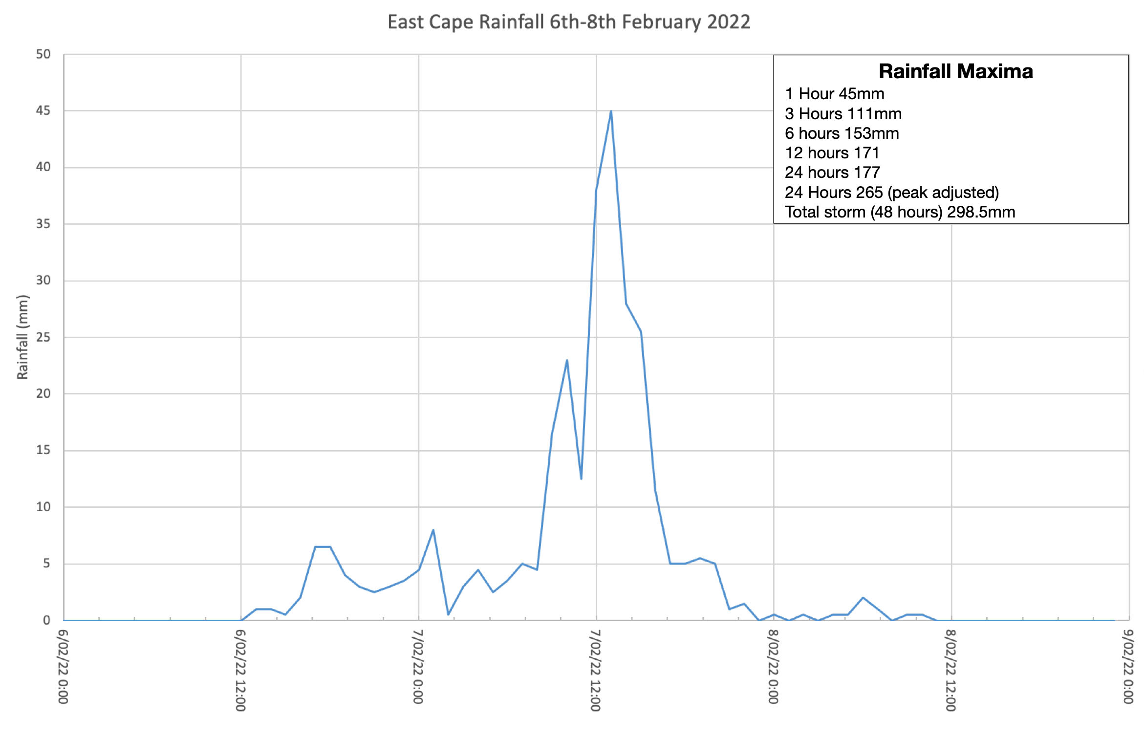
The hourly rainfall record for East Cape. Image provided by Dr Murry Cave..
The following three images show the landslides triggered by the rainfall in the East cape area:-
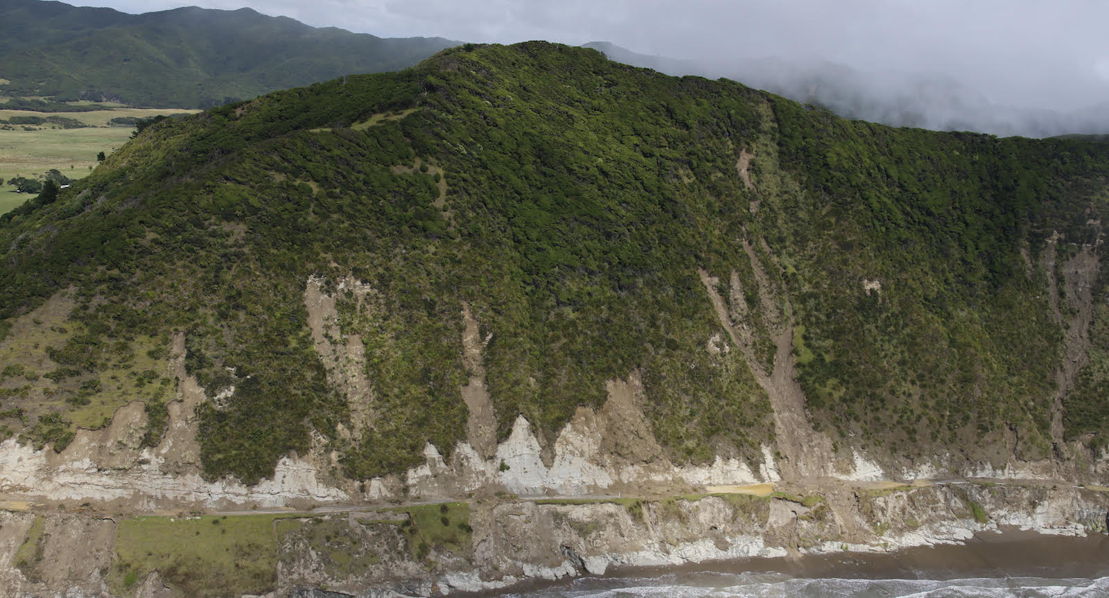
Landslides triggered by heavy rainfall from 6 to 8 February 2022. Image courtesy of Dr Murry Cave.
.
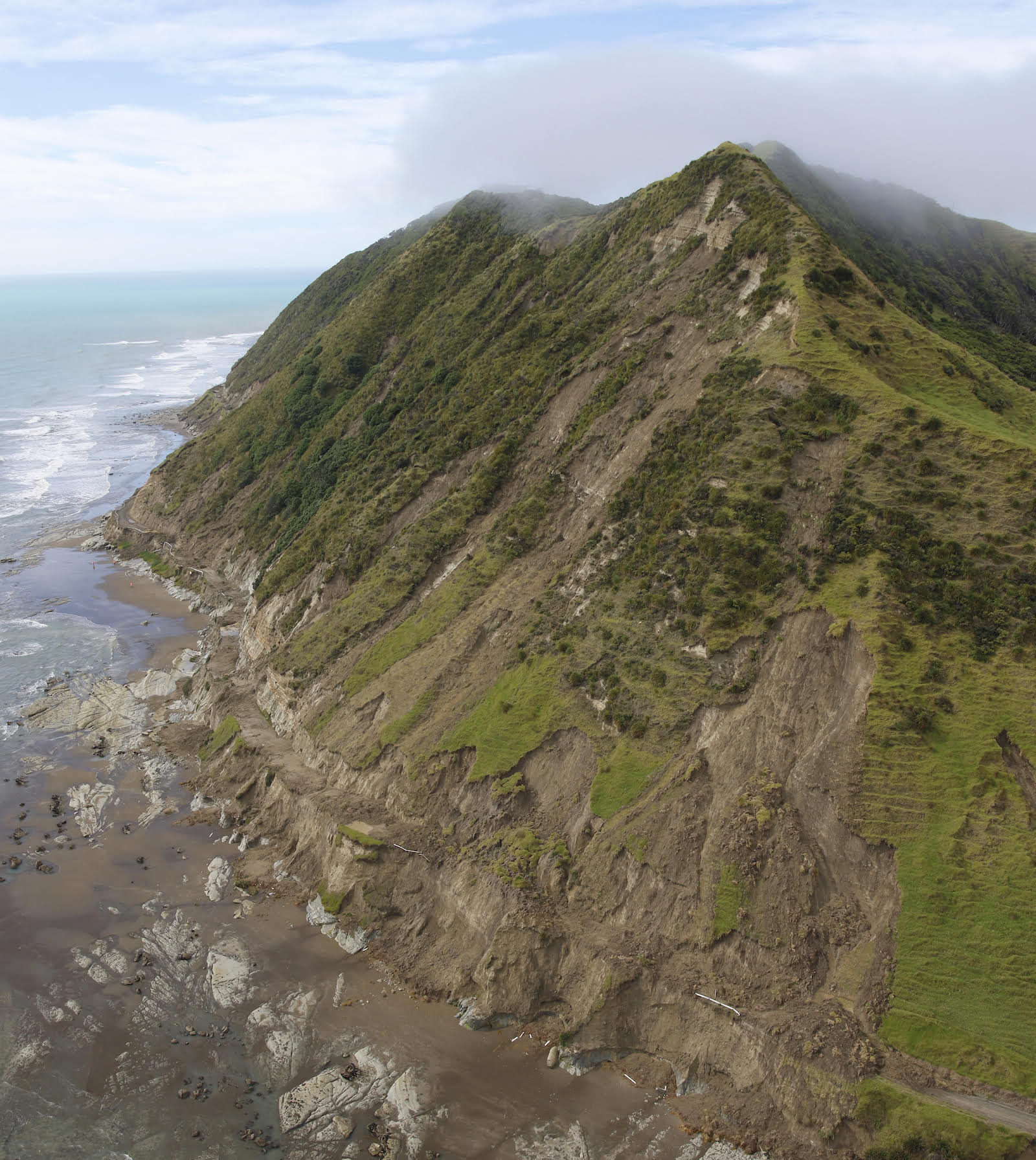
Landslides triggered by heavy rainfall from 6 to 8 February 2022. Image courtesy of Dr Murry Cave.
.
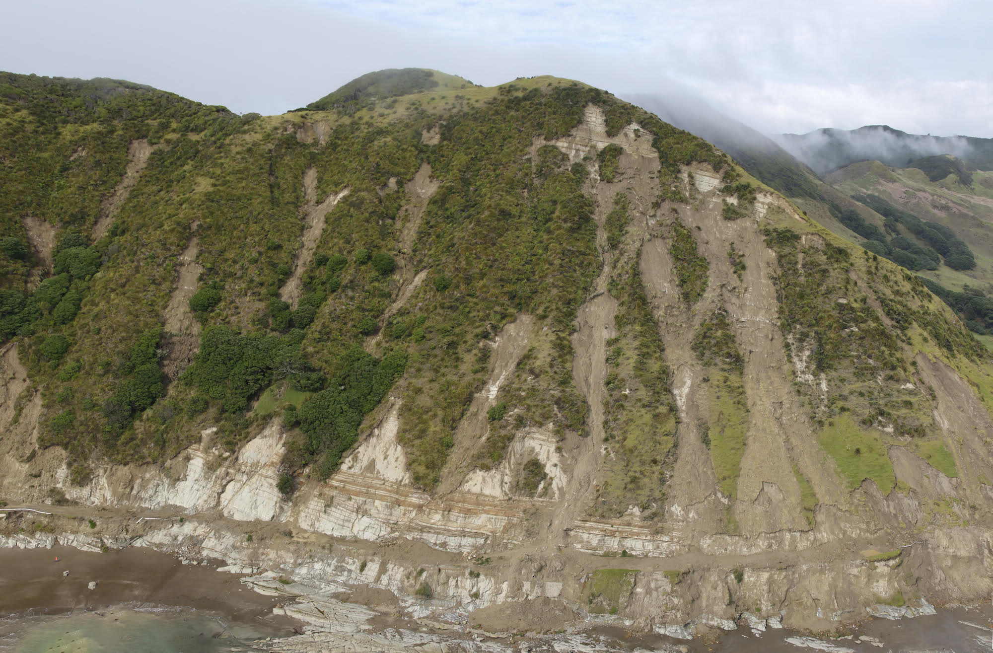
Landslides triggered by heavy rainfall from 6 to 8 February 2022. Image courtesy of Dr Murry Cave.
.
These landslides would probably be characterised as disrupted slides of earth, rock and debris. Most appear to originate in the soil / regolith cover on these very steep slopes. On the lower slopes the width of the failures is much higher. Note that the hills in the background have not suffered landslides to this degree, suggesting that this was driven by a highly localised rainfall event and/or by a local geological factor.
Geonet is asking New Zealanders to help them to identify other landslides triggered by Cyclone Dovi.
I have previously posted about another set of landslides in the Beach Loop area to the south of Whareongaonga, about 30 km from Gisborne. Brenda Rosser at GNS Science has led work investigating these landslides – there is a fantastic 3D model of the failures on the sketchfab website, resulting from mapping via a drone.
 Dave Petley is the Vice-Chancellor of the University of Hull in the United Kingdom. His blog provides commentary and analysis of landslide events occurring worldwide, including the landslides themselves, latest research, and conferences and meetings.
It also seems that all failed slopes feature a cut base by road alignment?!