
19 November 2021
The 29 October 2021 Kameng River rock and ice avalanche in India
Posted by Dave Petley
The 29 October 2021 Kameng River rock and ice avalanche in India
Back at the start of the month I highlighted an interesting event in northern India in which the Kameng River had seen a dramatic increase in turbidity and extensive fish mortality, based on an original post on the Discovering Aranchal blog. I suggested that this was likely to be a landslide or glacial event, but the source area was covered in cloud. Yesterday, the ever observant Dan Shugar noted that Planet captured a cloud free image on 17 November 2021, finally unveiling the sequence of events:
https://twitter.com/WaterSHEDLab/status/1461327866948321284
.
This is the Planet image that shows the area. Dan’s annotations in his tweet above indicate the source of the landslide that affected that Kameng Valley:-
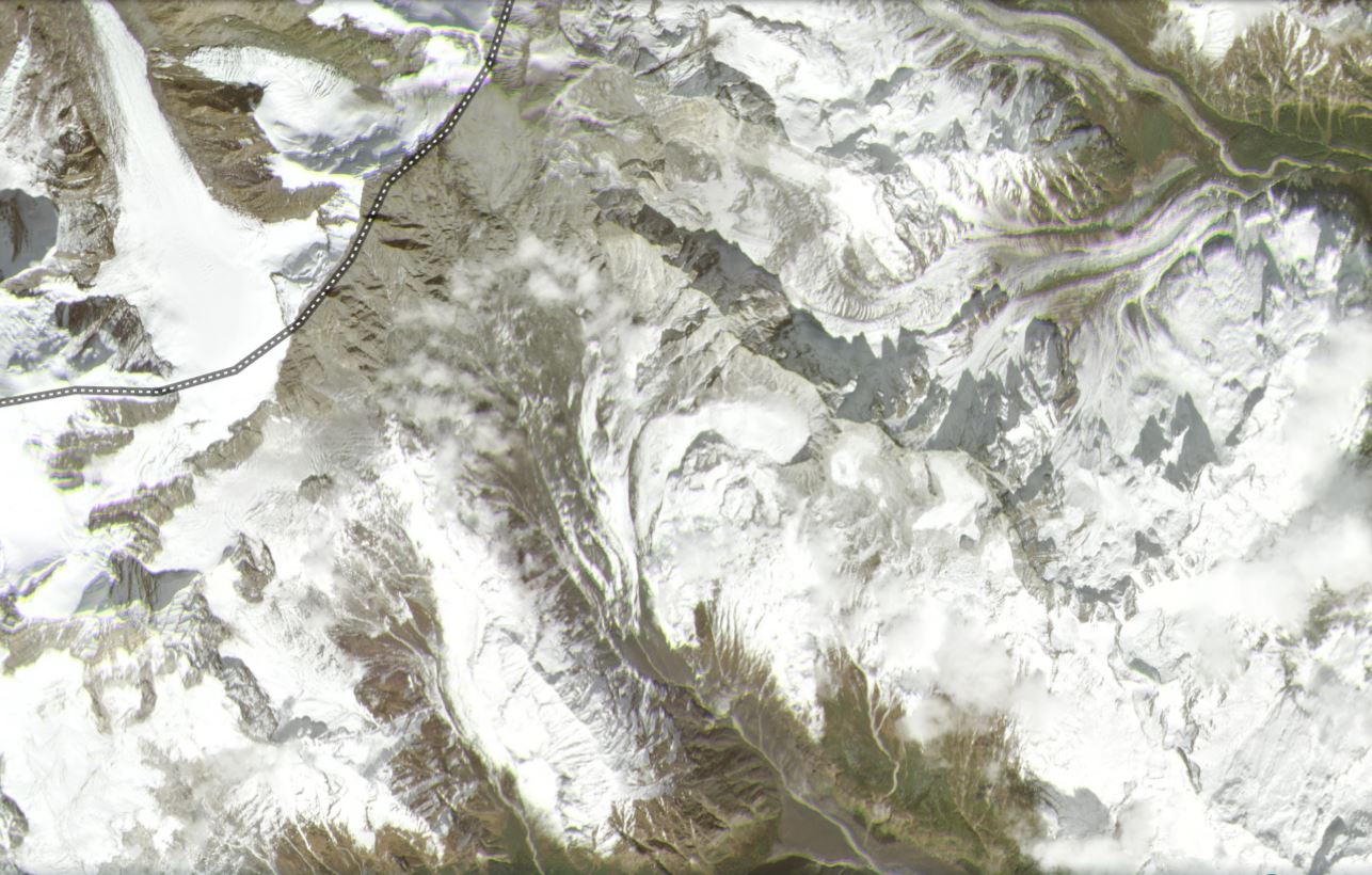
Satellite image, captured on 17 November 2021, showing the landslide affected area in the headwaters of the Kameng Valley. Image copyright Planet, used with permission.
.
It is useful to compare this with another Planet image of the same area, from November 2020:-
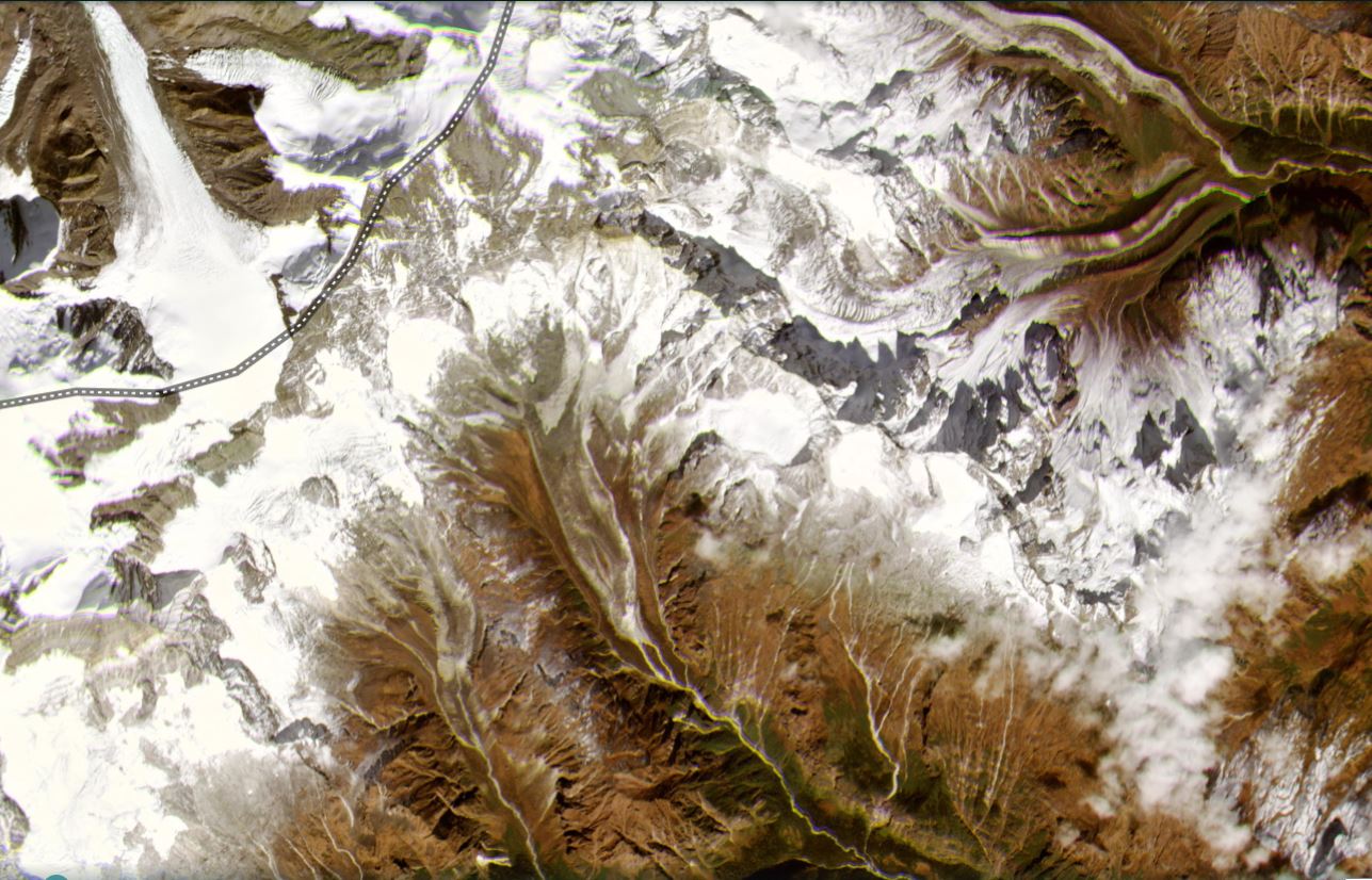
Satellite image, captured on 13 November 2020, showing the landslide affected area in the headwaters of the Kameng Valley. Image copyright Planet, used with permission.
.
And below is a slider that should allow the images to be compared:
.
The source of this event, as highlighted by Dan, appears to be a high altitude bowl. This feature is very clear in the Google Earth imagery:-
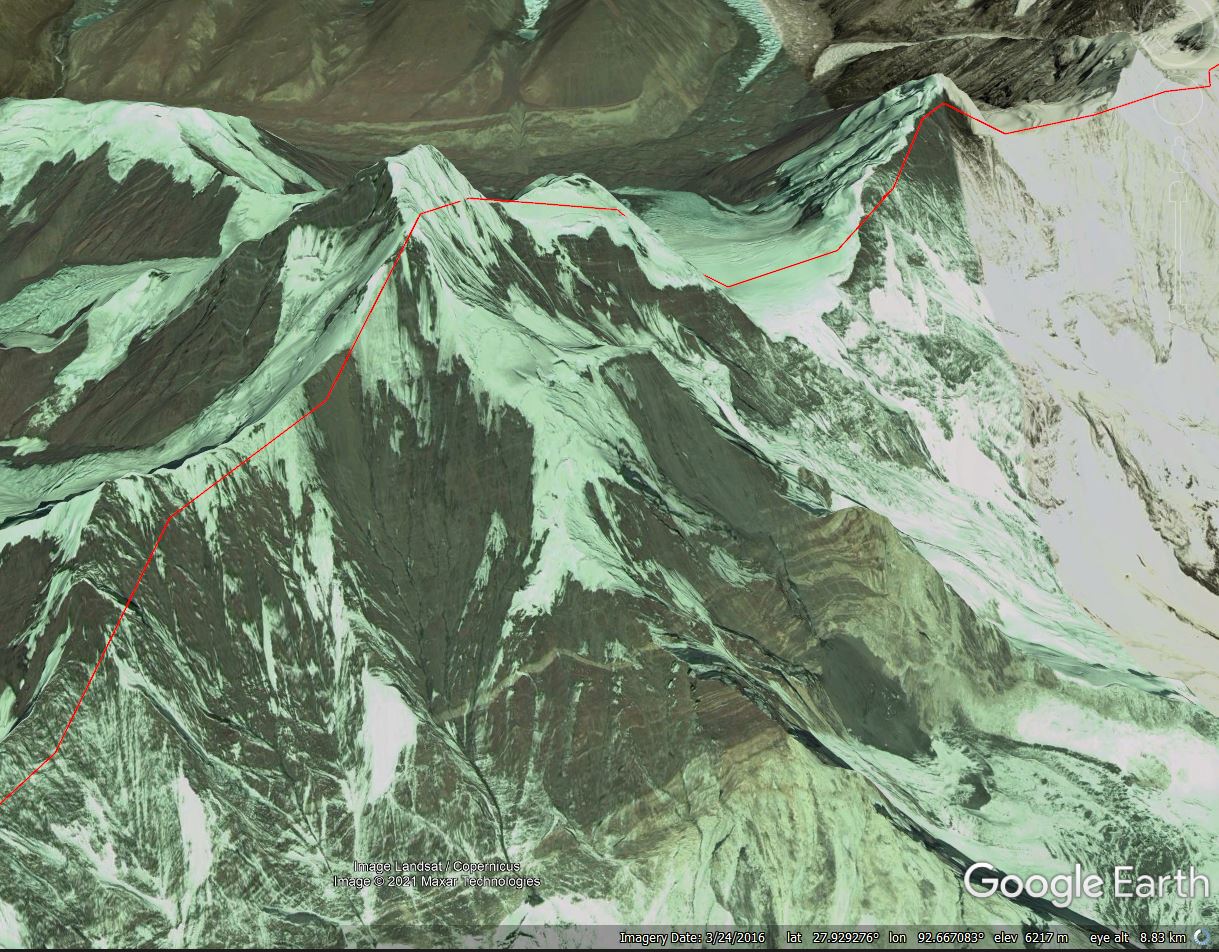
Google Earth image of the potential source of the landslide in the headwaters of the Kameng Valley.
.
A very provisional analysis is that some sort of slide appears to have developed in this area, which is about 600 m long and 700 m wide. This appears to have descended as near vertical slope onto the head of the glacier in the valley below. The vertical distance from the top of the peak to the top of the glacier is about 1,700 m. The images indicate massive fragmentation at this point, and the formation of a rock and ice avalanche that swept down the glacier, entraining material en route before transitioning into the flow that was observed down valley.
Provisionally this is broadly similar to the 7 February 2021 Chamoli event, although the mechanism of the initial failure is not clear at present.
.
Acknowledgement
Planet Team (2021). Planet Application Program Interface: In Space for Life on Earth. San Francisco, CA. https://www.planet.com/
 Dave Petley is the Vice-Chancellor of the University of Hull in the United Kingdom. His blog provides commentary and analysis of landslide events occurring worldwide, including the landslides themselves, latest research, and conferences and meetings.
Thank you for posting and sharing me for your coment about Rockaend Snows Freased and avalanched in northern indean regions.I ask simply are these naturally phenomena as an extraordinary in Hindukosh near Himalayan Counties Which there are faulted zones.in the Alpain-Himalya’s as the greatest earthquakes with potentiality 6.30 to 9 Richters .I think there may be the periodicals earthquakes historically powerfully earthquakes are being in occurrence..Best Regards.