
2 November 2021
The Tonghua landslide in Sichuan Province, China
Posted by Dave Petley
The Tonghua landslide in Sichuan Province, China
A paper just published in the journal Landslides (Cheng, Yang and Du 2021) describes the Tonghua landslide, which is located at 37.575, 103.414, in Sichuan Province, China. This landslide occurred on 8 August 2017. The authors used InSAR to extract pre-failure creep with rates in the order of 15-25 mm per year in the three years prior to the failure event.
This is a really interesting landslide – the image below shows the slope that failed before and after the event:
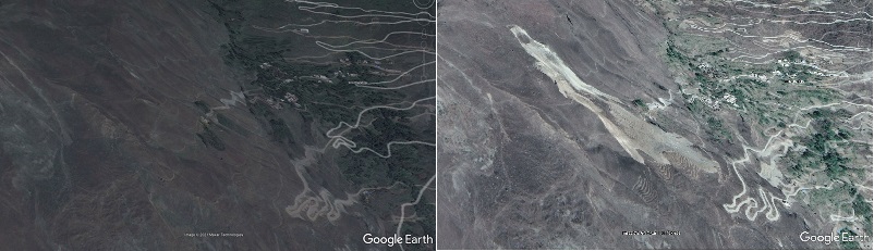
Google Earth images showing before and after the Tonghua landslide in China
.
The image below shows the landslide itself in more detail:
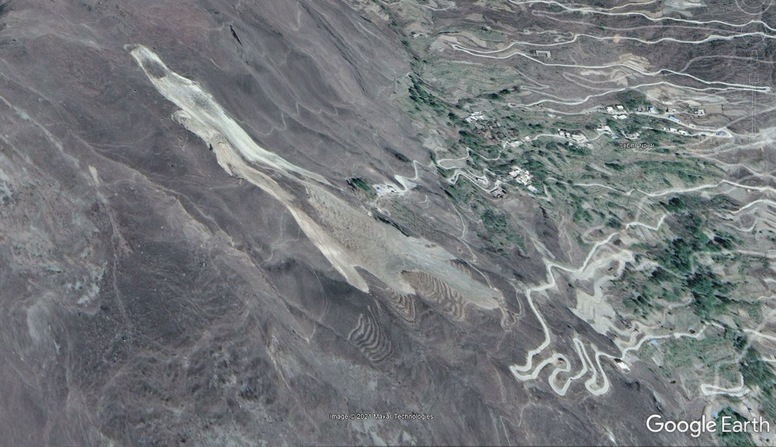
Google Earth image showing the 8 August 2017 Tonghua landslide in Sichuan Province, China.
.
As the image above shows, the Tonghua landslide is a 600 m long translational debris slide in moraine deposits, with a volume of about 220,000 cubic metres. The analysis of Cheng, Yang and Du (2021) suggests that three earthquake events are associated with the landslide. The epicentre of the M=8.0 2008 Wenchuan earthquake was 59 km south of the landslide, whilst the epicentre of the M=7.0 2013 Lushan earthquake was located 158 to the southwest. On the day of the landslide, the M=7.0 2017 Jiuzhaigou earthquake was located 195 km to the northeast, but as this occurred ten hours after the failure, it was not a factor. The first two earthquakes may have played a role in preparing the slope for failure.
Perhaps the most interesting aspect of the landslide is the trigger. Cheng, Yang and Du (2021) note that there was no seismic event that coincided with the failure, and that rainfall in the 30 days prior to the collapse was not exceptional. There was no heavy rainfall event in the days immediately preceding the collapse. However, 25 days before the failure event, drilling and blasting commenced for the CNH G4217 Tonghua No. 1 tunnel, close to the site. In the days leading up to the failure event, Cheng, Yang and Du (2021) record 13 blasting events, with the last occurring about one hour before the failure. They conclude that ground vibrations associated with the tunnel construction were responsible for the failure.
Since the main failure event the Tonghua landslide has continued to creep and to expand. Initially rates were high, but they have now declined to rates in the range of 0.1 – 1.0 mm per day. The image below, from Cheng, Yang and Du (2021), illustrates how the landslide has evolved since the initial failure event:
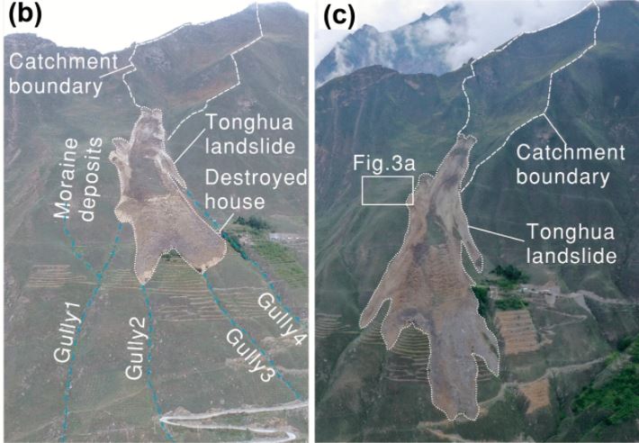
The evolution of the Tonghua landslide in China post-failure, from Cheng, Yang and Du (2021). The left image was taken on 9 September 2017, after the failure, whilst the right image was taken on 30 May 2019.
.
Reference
Cheng, Q., Yang, Y. & Du, Y. Failure mechanism and kinematics of the Tonghua landslide based on multidisciplinary pre- and post-failure data. Landslides (2021). https://doi.org/10.1007/s10346-021-01770-x
 Dave Petley is the Vice-Chancellor of the University of Hull in the United Kingdom. His blog provides commentary and analysis of landslide events occurring worldwide, including the landslides themselves, latest research, and conferences and meetings.
How many died from this landslide and what were the costs and property losses?
Coordinates you gave seem off. Coordinates arent even for a location within Sichuan Province
Indeed, I’m working with this landslide and it seems to be located at 31.575, 103.414, I believe there is a typo here !
Regards
I’m sorry to answer your question so late. The landslide posed serious safety concerns for the under-construction CNG4217, and caused rerouting of the highway. No human casualties in the landslide event.
The landslide is located at 31.575, 103.425