
11 October 2021
An updated landslide inventory map for Attica Region in Greece
Posted by Dave Petley
An updated landslide inventory map for Attica Region in Greece
Guest post by Nikolaos Tavoularis, Engineering Geologist at NTUA, Greece
A new web GIS platform has been recently constructed for the Attica region in Greece, whose importance is increasing after the recent mega-fires that happened in north and western Attica county in the the first days of August 2021. This platform is going to be the basis upon which hazard and risk maps will generated for the area based upon dynamic trigger factors such earthquakes and rainfall. Attica region is a territory of 3810 square kilometres, in which almost half of the Greek population and more than 60% of the industrial production in Greece and high value properties and infrastructure is concentrated (Figure 1).
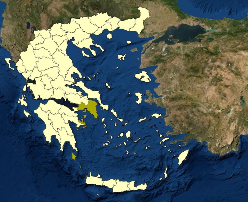
Figure 1: Map showing the location of the Attica region (Green) in Greece (yellow).
.
The cartographic products, as well as the GIS platform, will be used by civil protection agencies, public works authorities, planners, civil engineers, and researchers in landslides for urban planning and designing mitigation measures against potential slope failures caused by fires, floods and earthquakes (Figure 2).
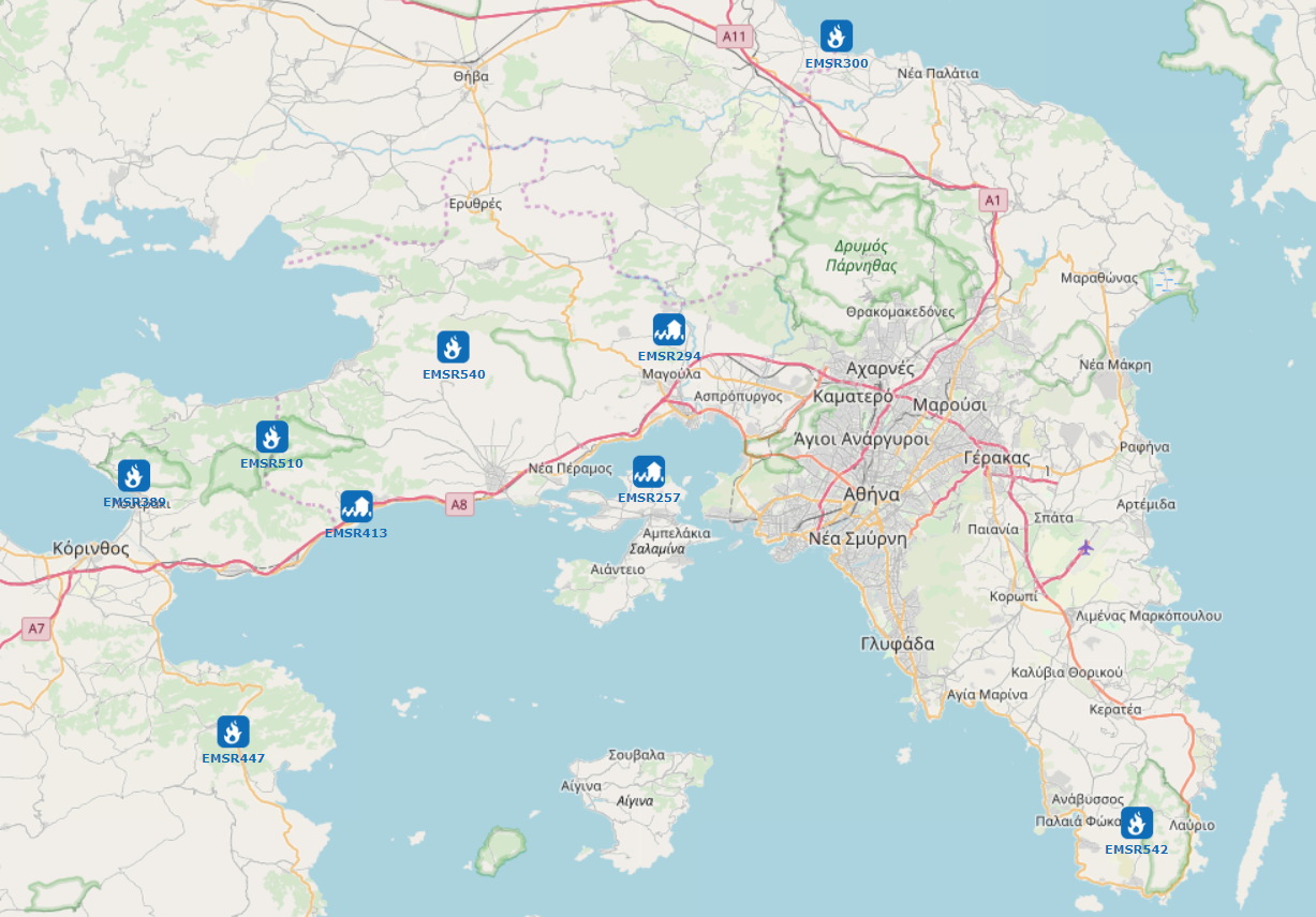
Figure 2. Floods and fires (which can be related to potential slope failures) that have occurred over the last three years in the Attica Region (Copernicus – Emergency Management Service – Mapping, 2021). The figure has been taken from Map of EMS Rapid Mapping Activations | COPERNICUS EMERGENCY MANAGEMENT SERVICE.
.
For the time being, the landslide inventory and the resultant susceptibility map (depicted in a 1:100.000 regional scale in Figure 3) of the Attica Region has been generated. The research project, named DIAS, which was co-financed by Greece and the European Union (European Social Fund – ESF), covers a chronological period from 1961 up to 2020.
The identified slope failures were stored in a GIS database as spatial and tabular data, including information per slope failure such as: (i) geographic details, (ii) lithological composition – active faults, (iii) mass movement date – field survey date, (iv) type of movement, (v) triggering factor, (vi) landslide causes, based on Working Party on World Landslide Inventory (1990) findings.
Given that over the next five to ten years, very important civil engineering projects will be constructed in Attica county, the existence of a regional-scale landslide susceptibility map could be a very useful tool for supporting decisions in order to prevent the location of high-value constructions in unsuitable locations.
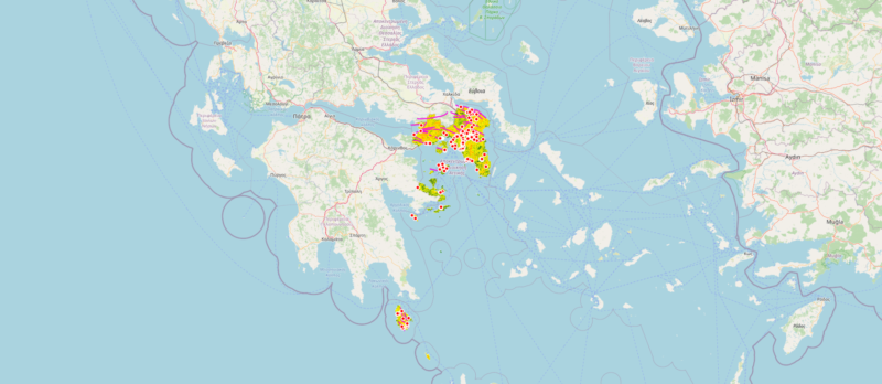
Figure 3. An excerpt from the landslide WebGIS platform for Attica Region, Greece.
.
This work has been undertaken under the auspices of Democritus University of Thrace, Civil Engineering Department and the fruitful co-operation with George Papathanasiou (Associate Professor of Democritus University), Athanasios Ganas (Researcher at National Observatory of Athens, Institute of Geodynamics) and Panagiotis Argyrakis (Researcher from Peloponnese University).
Additionally, characteristic slope failures from this research were presented at the Safe Greece 2020 on-line conference, which took place on 14-16 October 2020 in Athens.
 Dave Petley is the Vice-Chancellor of the University of Hull in the United Kingdom. His blog provides commentary and analysis of landslide events occurring worldwide, including the landslides themselves, latest research, and conferences and meetings.