
5 August 2021
Understanding the recent monsoon landslides in Maharashtra, India
Posted by Dave Petley
Understanding the recent monsoon landslides in Maharashtra, India
Last month, heavy rainfall in the Maharashtra area of India triggered a number of deadly landslides. The most serious of these occurred at Taliye village, where at least 53 people, and possibly as many as 84 people, were killed. However, this was not the only substantial landslide; there were at least another six fatal landslides, which took an additional 50 lives.
My friends at South Asia Network on Dams, Rivers and People (sandrp.in) have done a heroic job in collating information about these landslides, their locations and impacts. I have used their information to produce a quick Google Earth map of the landslide locations:
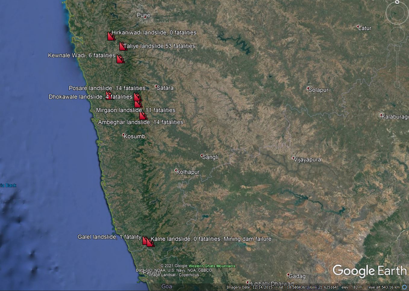
A map of the landslides in the Maharastra area on India in late July 2021. Map based on information from Parineeta Dandekar of South Asia Network on Dams, Rivers and People.
.
I have included two significant non-fatal landslides as well. It is interesting to compare the landslides to a map of the rainfall. The map below is a 3 day rainfall total for the period ending 24 July 2021 (the Taliye landslide occurred on 22 July 2021), from the NASA Global Precipitation Measurement mission:
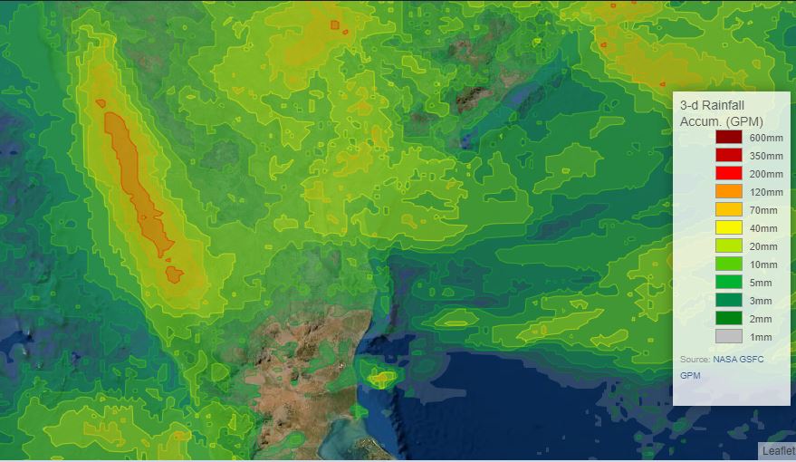
3 day accumulated rainfall for central India. This is GPM IMERG 3-day data from NASA, plotted using the visualizer.
.
The cluster of high rainfall totals exactly where the landslides were triggered is clear. The map below (from Researchgate) shows the topography of Maharashtra:
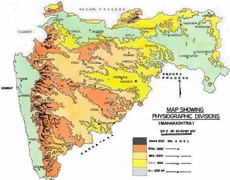
The topography of Maharashtra, from Researchgate.
.
The map shows that there is higher elevation ridge running approximately parallel to the coastline. It is clear that the high rainfall totals reflect this ridge (presumably due to an orographic effect), and of course it also provides the topography for the landslides. The main landslide cluster is to the southeast of Mumbai (Bombay).
But why were there so many landslides? The answer may well lie, at least in part, in degradation of the environment. Removal of natural vegetation, cutting of slopes, quarrying and road building are taking a huge till across the upland areas of India (and indeed across the hilly parts of much of South Asia). As usual, in the aftermath of monsoon landslide disasters there is discussion about warning systems and suchlike (which in general have a very patchy success rate in rural settings in less developed countries). Although they can and do have a role, this is to miss the salient point, which is that we need to work on preventing increases in susceptibility as a priority, mainly through better management of slopes.
Climate change is going to exacerbate these problems at pace, as will continued damage to slopes. If we are to reduce these disasters, we need manage the slopes properly.
Acknowledgement
Many thanks to my friends at the South Asia Network on Dams, Rivers and People, and in particular Parineeta Deshpande-Dandekar, for help with the data in this post.
 Dave Petley is the Vice-Chancellor of the University of Hull in the United Kingdom. His blog provides commentary and analysis of landslide events occurring worldwide, including the landslides themselves, latest research, and conferences and meetings.
Degradation of land by tree cutting, constructing roads and houses on the hill slopes are the main causes of slope failures in these areas. Population explosion has forced people to built their shelters in places which are prone to landslides and their human activities further trigger the slope failure due to cutting of slopes and removal of top soil and vegetation.
recent increase in landslides in Himalayas are mainly due to road construction causing old landslides mass to be disturbed and heavy rainfall causes the slope failure. Almost all river valleys in Himalayas are full of old landslide dams causing impounding of water and making the river valley as very wide floodplain.
Its well define