
19 April 2021
Landslides from the 18 April 2021 M 5.9 earthquake near to Bandar Genaveh, Iran
Posted by Dave Petley
Landslides from the 18 April 2021 M 5.9 earthquake near to Bandar Genaveh, Iran
On 18 April 2021 a M=5.9 earthquake struck the port city of Bandar Genaveh in Iran. The earthquake was centred on the town of Bandah Rig. There are some reports of damage in Bandah Genaveh, and five people were injured.
A couple of videos have been posted of landslides triggered by the earthquake. The best one is on Youtube:-
.
Inland from Bandah Genaveh there is a steep escarpment running sub-parallel to the coast:-
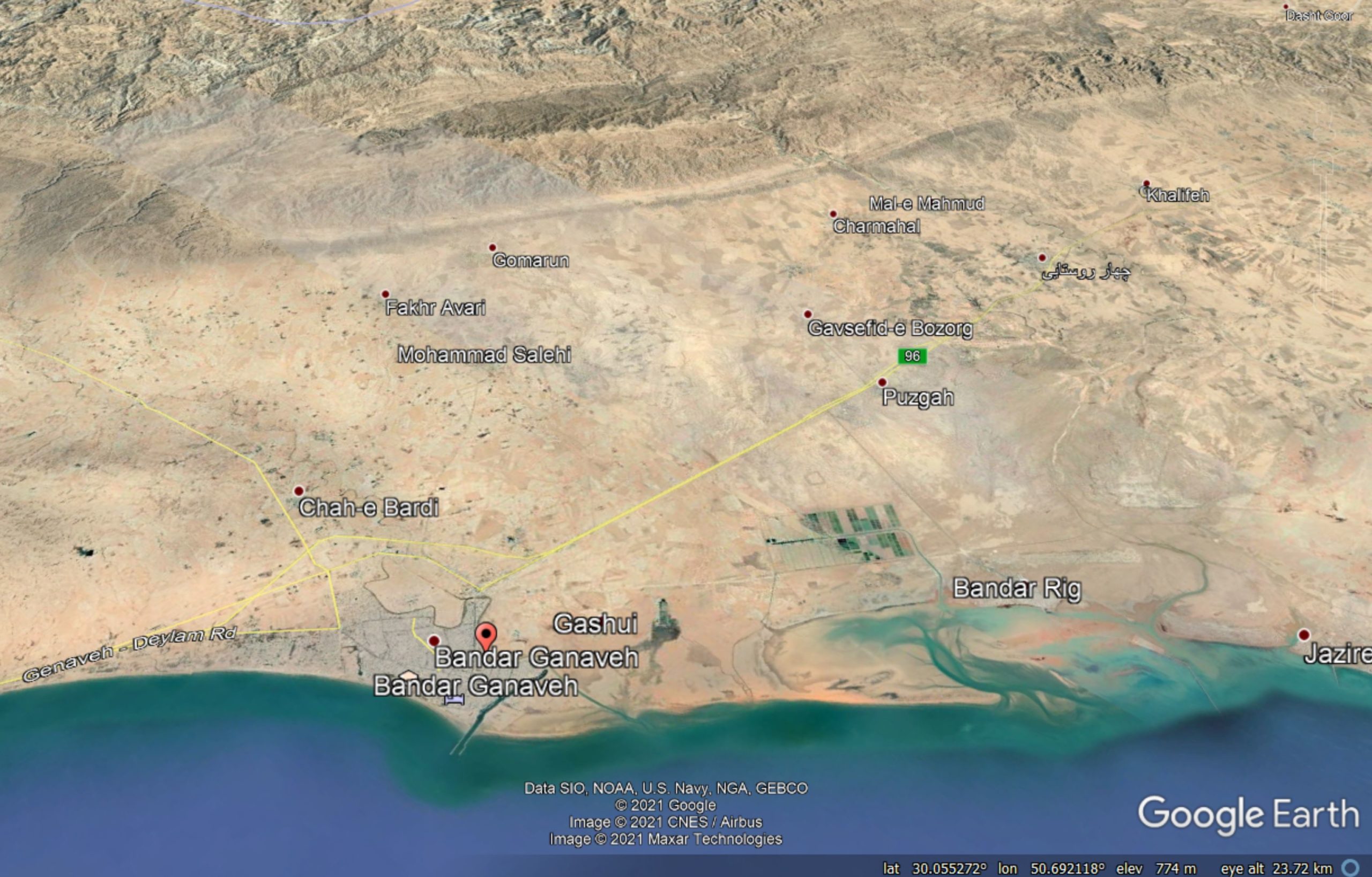
Google Earth image of the topography of the area inland of Bandah Genaveh, site of the 18 April 2021 earthquake.
.
It appears that the landslides have been triggered from this escarpment.
The video is very dramatic, but for the most part these are likely to have been shallow slides of quite low volume. The very arid conditions means that such slides generate very large quantities of dust, which looks dramatic in the videos. Nonetheless, it is likely that coseismic landslides are an important part of the erosive processes in this area.
There are other videos of this event on Youtube. One of them presents a compendium of events, although I am not sure whether they are all from this earthquake. It includes a sequence that includes this still:-
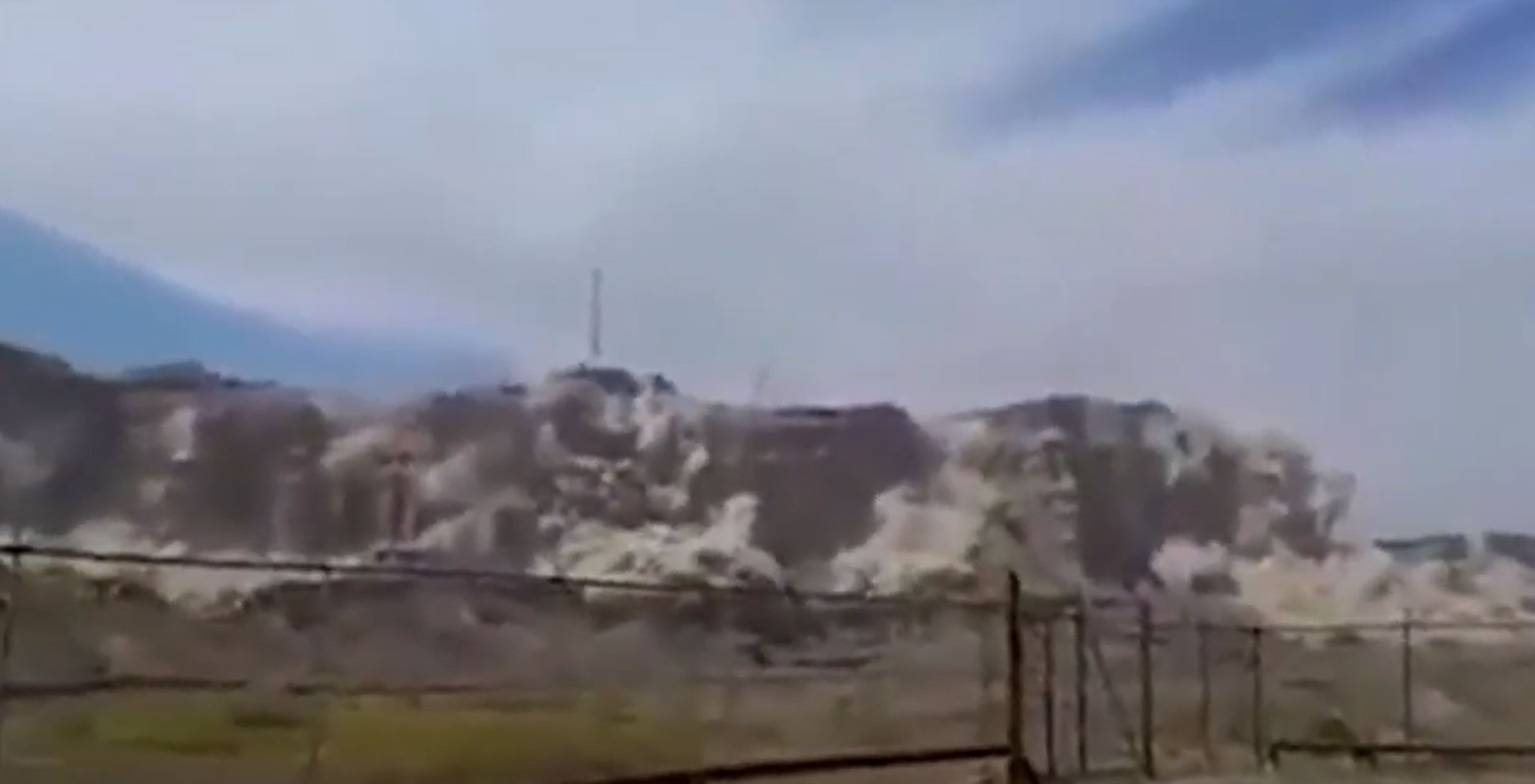
The landslides close of Bandah Genaveh in Iran on 18 April 2021. Still from a video posted to Youtube.
.
The image above does appear to be the same event as that posted in the first video, but providing a much closer view of the landslides.
An analogy for this event is probably the 2010 M=7.2 Sierra Cucupah earthquake in Mexico, which also triggered landslides in an arid mountain chain. Led by my former post-doc John Barlow, we investigated the landslides from that event. There is a description in Barlow et al. (2014).
.
Reference and acknowledgement
Many thanks to loyal reader Andrew Noad, who kindly highlighted these videos to me.
Barlow, J., Barisin, I., Rosser, N., Petley, D., Densmore, A. and Wright, T. 2014. Seismically-induced mass movements and volumetric fluxes resulting from the 2010 Mw = 7.2 earthquake in the Sierra Cucapah, Mexico, Geomorphology, 230, 138-145. http://dx.doi.org/10.1016/j.geomorph.2014.11.012.
 Dave Petley is the Vice-Chancellor of the University of Hull in the United Kingdom. His blog provides commentary and analysis of landslide events occurring worldwide, including the landslides themselves, latest research, and conferences and meetings.