
6 April 2021
Mount Lewotolok and Adonara island: up to 168 people killed by lahars and debris flows in Indonesia
Posted by Dave Petley
Mount Lewotolok and Adonara island: up to 168 people killed by lahars and debris flows in Indonesia
Very heavy rainfall in Indonesia over the weekend triggered two major landslides, both of which had multiple casualties. Information about the two remains quite patchy at present, but there is a good report on the MENAFN website. One of the events was a lahar from the flanks of Mount Lewotolok, located on Lembata island in in East Nusa Tenggara province. The reports indicate that 18 people are known to have died, and a further 62 people are missing. The MENAFN report states that:-
At least 18 people were killed and 62 missing after their villages were hit by cold mudflows from a volcano on Indonesia’s Lembata island, an official said on Monday. Volcanic debris from Mount Lewotolok engulfed homes on Sunday following heavy rain, Thomas Ola, the head of Lembata district in East Nusa Tenggara province, told dpa news agency
AP has this image of the aftermath of a part of the landslide:-
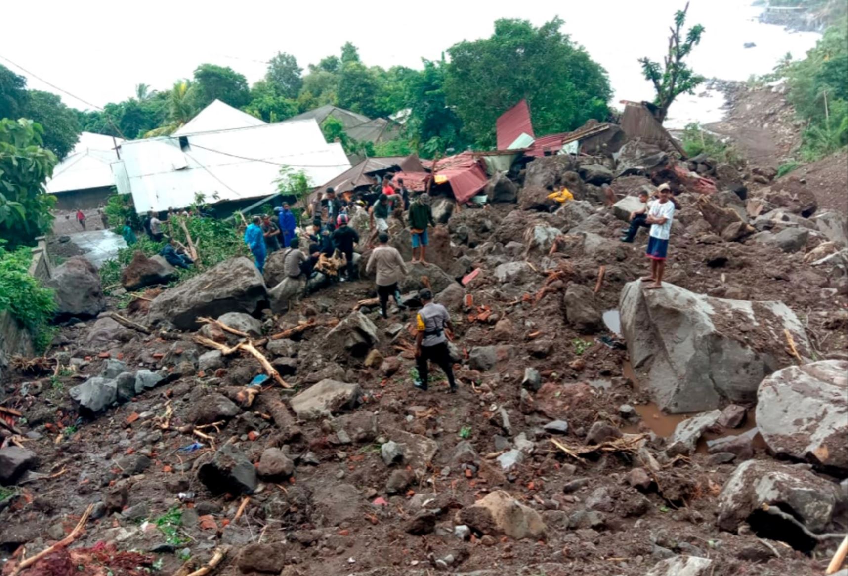
The aftermath of the lahar from Mount Lewotolok in Indonesia. Image from AP.
.
Reports suggest that this landslide struck a village in Ile Ape Timur on the flanks of Mount Lewotolok.
Meanwhile, there are also reports of a significant debris flow on Adonara island, also in East Nusa Tenggara province. Reports suggest that there are 69 known fatalities from this event, with a further 19 missing with rescue operations still underway. It appears that the debris flows, which have in some cases been described as flash floods, struck the village of Nele Lamadike and surrounding areas. It is not clear to me as to where on Adonara island this event was located, but there is at least one volcano on the island, suggesting that this could also have been a lahar.
Given the remote location of these islands, it is difficult to obtain accurate information about the losses and indeed the nature of the events. Satellite images might provide some help when the skies clear.
 Dave Petley is the Vice-Chancellor of the University of Hull in the United Kingdom. His blog provides commentary and analysis of landslide events occurring worldwide, including the landslides themselves, latest research, and conferences and meetings.