
26 March 2021
Raoul Island: landslides from the 5 March 2021 M8.1 earthquake
Posted by Dave Petley
Raoul Island: landslides from the 5 March 2021 M8.1 earthquake
Onn 5 March 2021 a M=8.1 earthquake occurred off the coast of New Zealand. Located close to the fault is Raoul Island, the largest and most northerly of the Kermadec Islands. The island, which has a surface area of about 29.4 km2, has been volcanically active in a geologically recent timeframe. It is hilly, with terrain extending to 516 m. As such it was likely that it would suffer landslides triggered by the earthquake.
Under the banner of Geonet, GNS Science researchers have released some initial information about landslides triggered by the earthquake, based upon field observations and the analysis of satellite imagery. In total they have mapped over 300 landslides triggered by the earthquake or its immediate aftershocks – quite a high number for a comparatively small area. They have released a map of the landslides, which cluster on steep terrain and along the coast. The image below was collected by Planet Labs, showing of a part of Raoul Island on 9 March 2021:
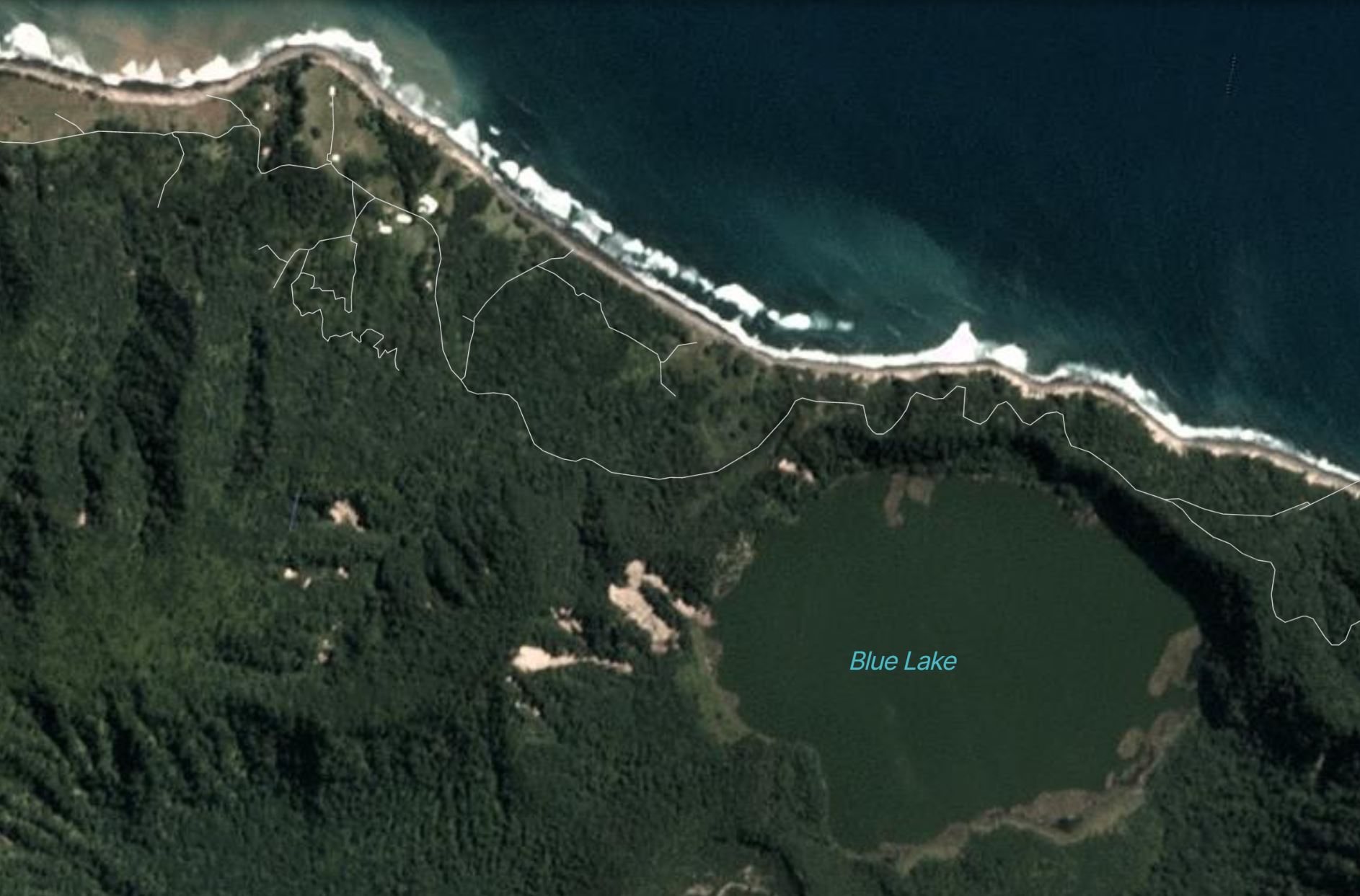
Coseismic landslides on Raoul Island. Image copyright Planet Labs, used with permission.
.
The Geonet report includes some photographs of the landslides seen in the Planet Labs image:-
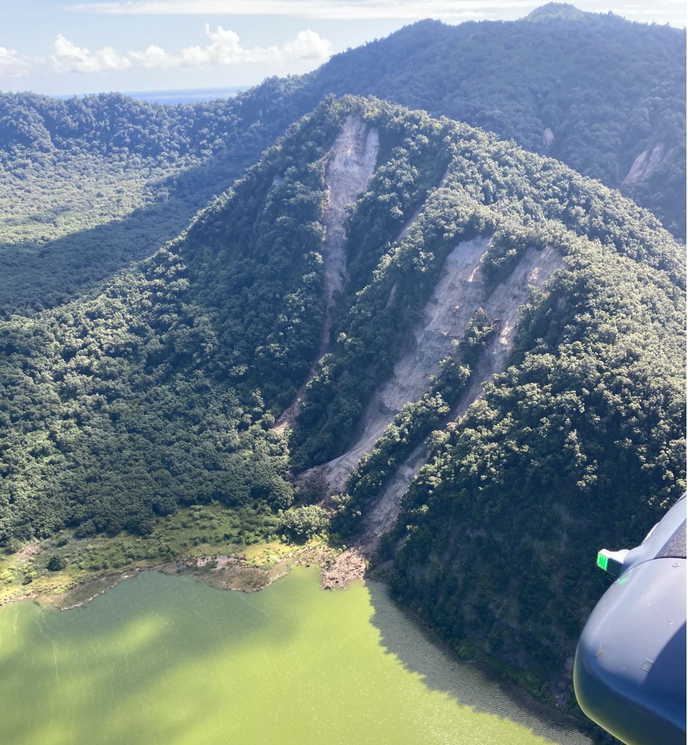
Landslides on the edge of Blue Lake on Raoul Island. Image from GNS Science / Geonet.
.
The research team have made the following observations about the landslides:
The most spectacular landslides were around Blue Lake, and along the rugged coastline. There was a significant slip at Bells Beach, where about 400 m of coastal cliffs collapsed, leaving a plume of sediment in the ocean. Most of the landslides were relatively small (100-200 m³) rock and soil avalanches and falls, but there were some larger ones up to about 20,000 m³. The largest landslides were on the north-east coast near Hutchison Bluff, and around the crater of Blue Lake, most landslides comprised rock and soil avalanches and falls.
Reference
Planet Team (2021). Planet Application Program Interface: In Space for Life on Earth. San Francisco, CA. https://www.planet.com/
 Dave Petley is the Vice-Chancellor of the University of Hull in the United Kingdom. His blog provides commentary and analysis of landslide events occurring worldwide, including the landslides themselves, latest research, and conferences and meetings.
Please, GNS, could the correct Geotechnical Engineering terminology landslide be consistently used.
‘There was a significant slip at Bells Beach, where about 400 m of coastal cliffs collapsed, leaving a plume of sediment in the ocean.’