
5 February 2021
Planet Labs high resolution satellite image of the Rat Creek Washout
Posted by Dave Petley
Planet Labs high resolution satellite image of the Rat Creek Washout
Planet Labs has once again very kindly captured a high resolution satellite image for this blog – as ever I am really appreciative of the help that they provide. On this occasion they have imaged the Rat Creek Washout in the Big Sur in California, which was caused by intense rainfall onto a post-wildfire area. The washout has closed the main coastal route.
This is the very beautiful Planet Labs SkySat image that shows the washout:-
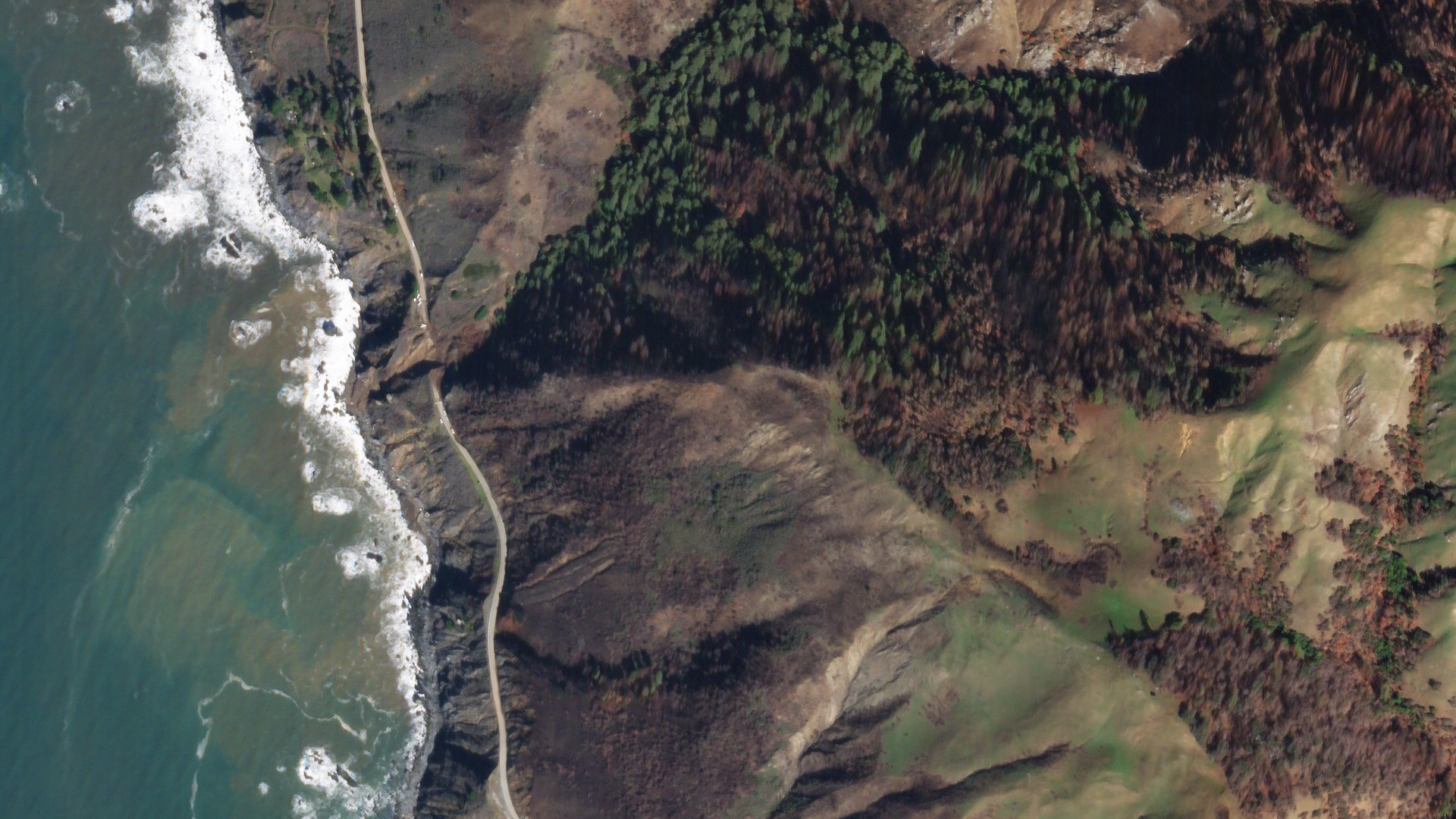
The Rat Creek Washout as imaged by Planet Labs. Planet Labs SkySat image, captured on 3 February 2021. Image copyright Planet Labs, used with permission.
.
The image captures the scale of the Rat Creek Washout, and illustrates the challenges of making this site safe. The complex pattern of burnt trees in the catchment is clear, with areas of burnt land coming close to the road. Note also the multiple shallow landslides in the landscape, especially on the coastal slopes, but also in the inland catchments. There are also some relict larger and deeper landslides as well.
This pattern is even more clear in an image that captures a larger part of the catchment:-
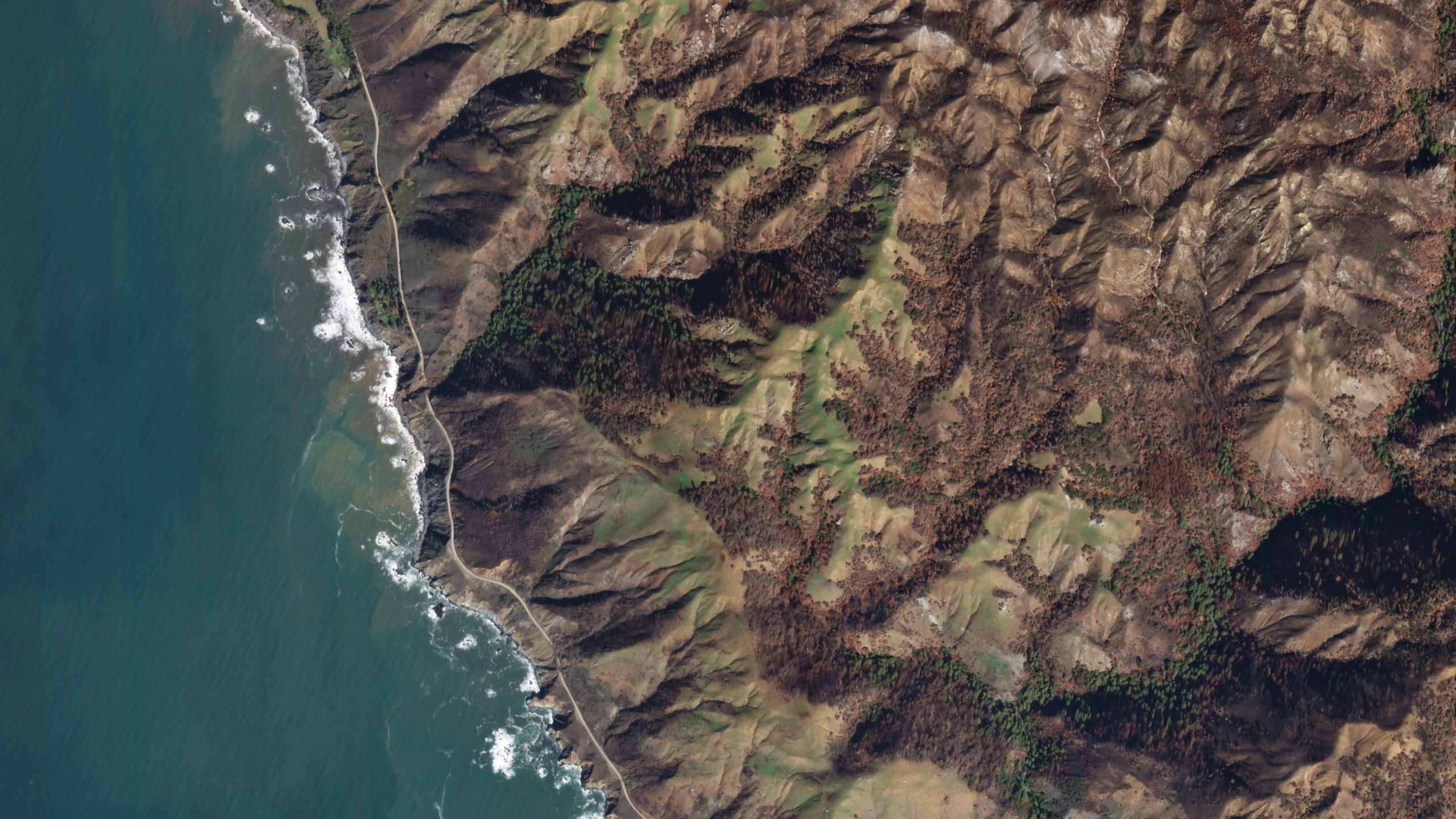
The watershed upstream of the Rat Creek Washout as imaged by Planet Labs. Planet Labs SkySat image, captured on 3 February 2021. Image copyright Planet Labs, used with permission.
.
The enormous area devastated by the 2020 wildfires is very clear in this image. Alongside other catchments, the one upstream of the washout is extensively burnt. It is no surprise that problems are developing in these areas.
According to KSBY, this event was the worst of many problems on State Highway 1:
That wasn’t the only place along the highway that suffered damage. Approximately 60 locations north and south of Rat Creek were affected by debris flows, slides, and flooding. Caltrans says road crews have been working from the north and the south to clear and repair drainage systems and stabilize damaged sections of the road.
The Planet Labs image appears to capture one of these areas, to the south of the washout:-
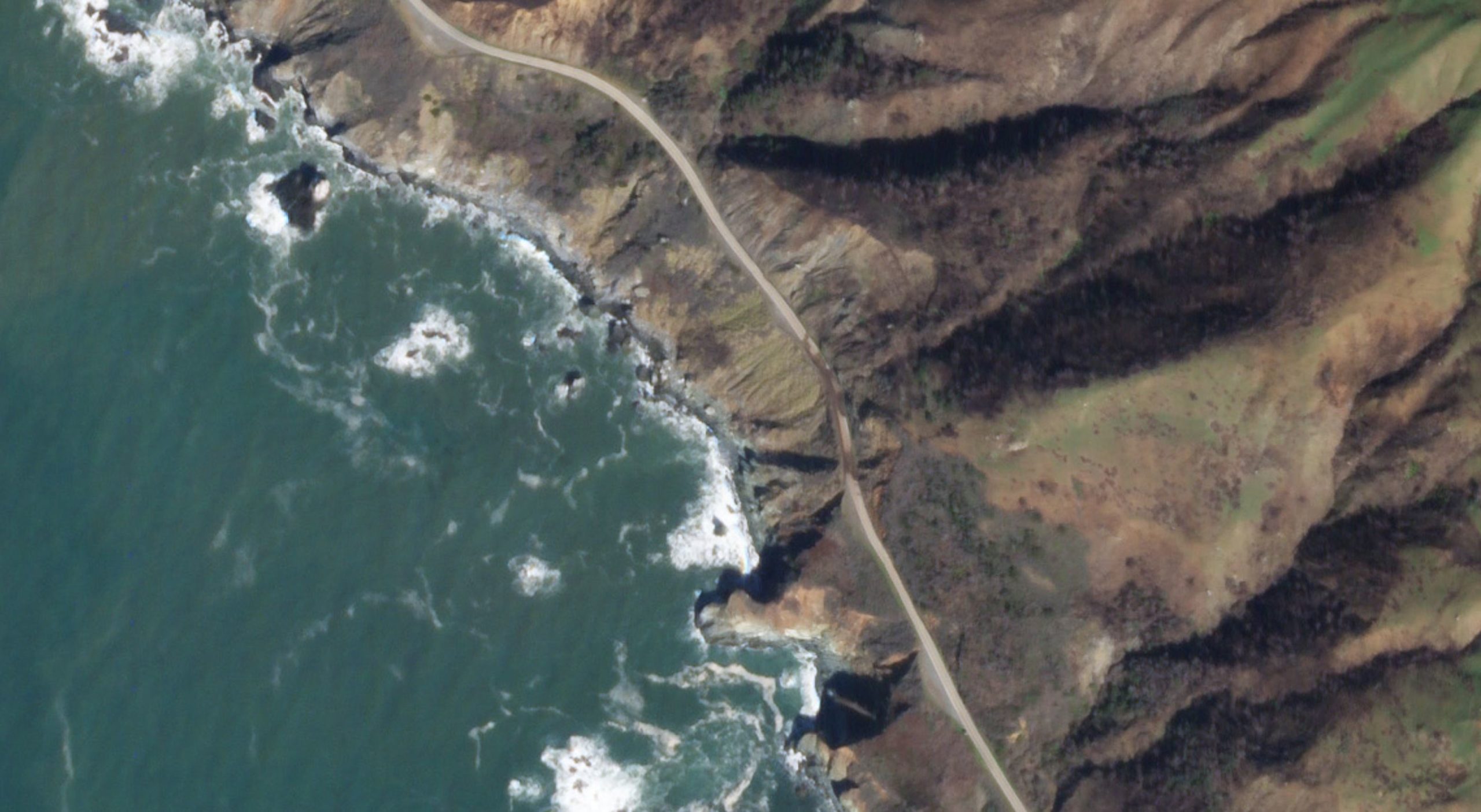
State Highway 1 damage as imaged by Planet Labs. Planet Labs SkySat image, captured on 3 February 2021. Image copyright Planet Labs, used with permission.
.
Reference
Planet Team (2020). Planet Application Program Interface: In Space for Life on Earth. San Francisco, CA. https://www.planet.com/
 Dave Petley is the Vice-Chancellor of the University of Hull in the United Kingdom. His blog provides commentary and analysis of landslide events occurring worldwide, including the landslides themselves, latest research, and conferences and meetings.