
10 December 2020
Mindu in Tibet: detecting precursors of an imminent landslide
Posted by Dave Petley
Mindu in Tibet: detecting precursors of an imminent landslide
With the possible exception of some landslides triggered by earthquakes, large slope failures generally develop strain (movement) prior to failure. The failure process involves the progressive deformation of the slope – a shear surface may form in the base of the landslide, tension cracks form, lateral scarps develop, etc. A classic case is the Barry Arm landslide in Alaska, where movement on the slope has led to the development of very large tension cracks. There is strong evidence that over time the rate of movement increases as failure approaches. This increase in deformation is the basis of various methods of prediction of the time of failure (with success in some circumstances).
One challenge of course is to use this knowledge to identify and monitor slopes that might be undergoing failure. The holy grail is to have a remote monitoring system that collects data at a regional or national scale and then identifies slopes that are actively deforming. InSAR provides one potential basis for this, and national scale deformation maps are now available, but identifying correctly slopes that might be dangerous requires more work and a better understanding.
Another approach, applicable for individual landslides at the moment, is to use imaged correlation approaches from optical satellite imagery. In this approach, pairs of images are compared. Perhaps surprisingly, image processing can allows deformations on the scale of 3 to 10% of a pixel to be detected. The Sentinel-2 satellites have an image resolution of about 10 metres, so deformation of less than a metre can be measured.
In an open access paper in the journal Natural Hazards and Earth System Sciences, Yang et al. (2020) have used image processing of Sentinel-2 imagery to examine the movement through time of a developing failure near to the town of Mindu in Tibet. This is a large area of slope deformation – this is the Google earth image collected in 2011 for example:-
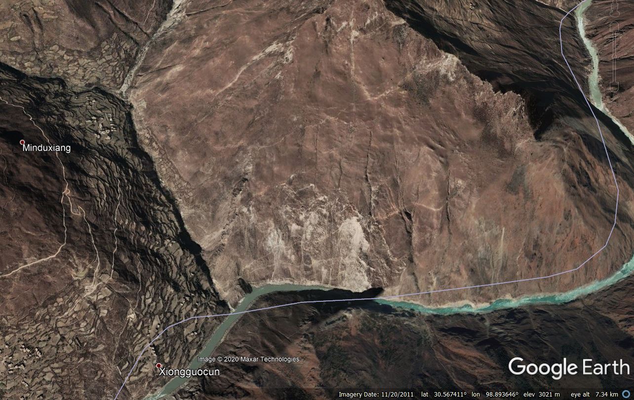
A Google Earth image of the landslide near to Mindu in Tibet.
.
The location of this landslide is 30.582, 98.925. Whilst there is little in the way of the landslide, clearly a major rock slope failure at this site near to Mindu would potentially block the river, creating a substantial hazard downstream.
The image processing by Yang et al. (2020) has demonstrated that this landslide is actively deforming. Perhaps most interestingly, between November 2015 and November 2018 the slope showed less than 2 metres of movement. However, between 2018 and 209 the slope moved over 6 metres. The research team were able to then look at a larger number of images in this more rapid movement period, finding that in the rainy season (summer and autumn) the movement rate accelerated.
This study demonstrates that processing of optical satellite imagery can allow high quality monitoring of dangerous slopes to be undertaken. It is another step along the way towards the goal of high quality early warning systems for slopes in high mountain areas.
 Dave Petley is the Vice-Chancellor of the University of Hull in the United Kingdom. His blog provides commentary and analysis of landslide events occurring worldwide, including the landslides themselves, latest research, and conferences and meetings.
There appear to be additional cracks snaking along the hillside leading all the way up to the ridgetop.