
8 December 2020
Landslide potential this winter? Satellite images of the wildfire areas of western USA
Posted by Dave Petley
Landslide potential this winter? Satellite images of the wildfire areas of western USA
The 2020 wildfire season in the western part of the USA has burnt over 33,000 square kilometres of land, killing at least 37 people. These fires, which have been associated with record-breaking heat, have had a devastating effect. In early October I posted some satellite imagery, collated by loyal reader Ken, showing the extent of the burnt areas. This post provides an update.
Ken has now undertaken the huge task of creating a mosaic of the images, derived from the Sentinel-2 satellites, and then collating these into a video that he has posted to Youtube:-
.
For each area the video provides an overview of the fires (which appear a light brown in these false colour images) and then provides a detailed view of the largest of them. This, for example, is the Archie Creek Fire:-
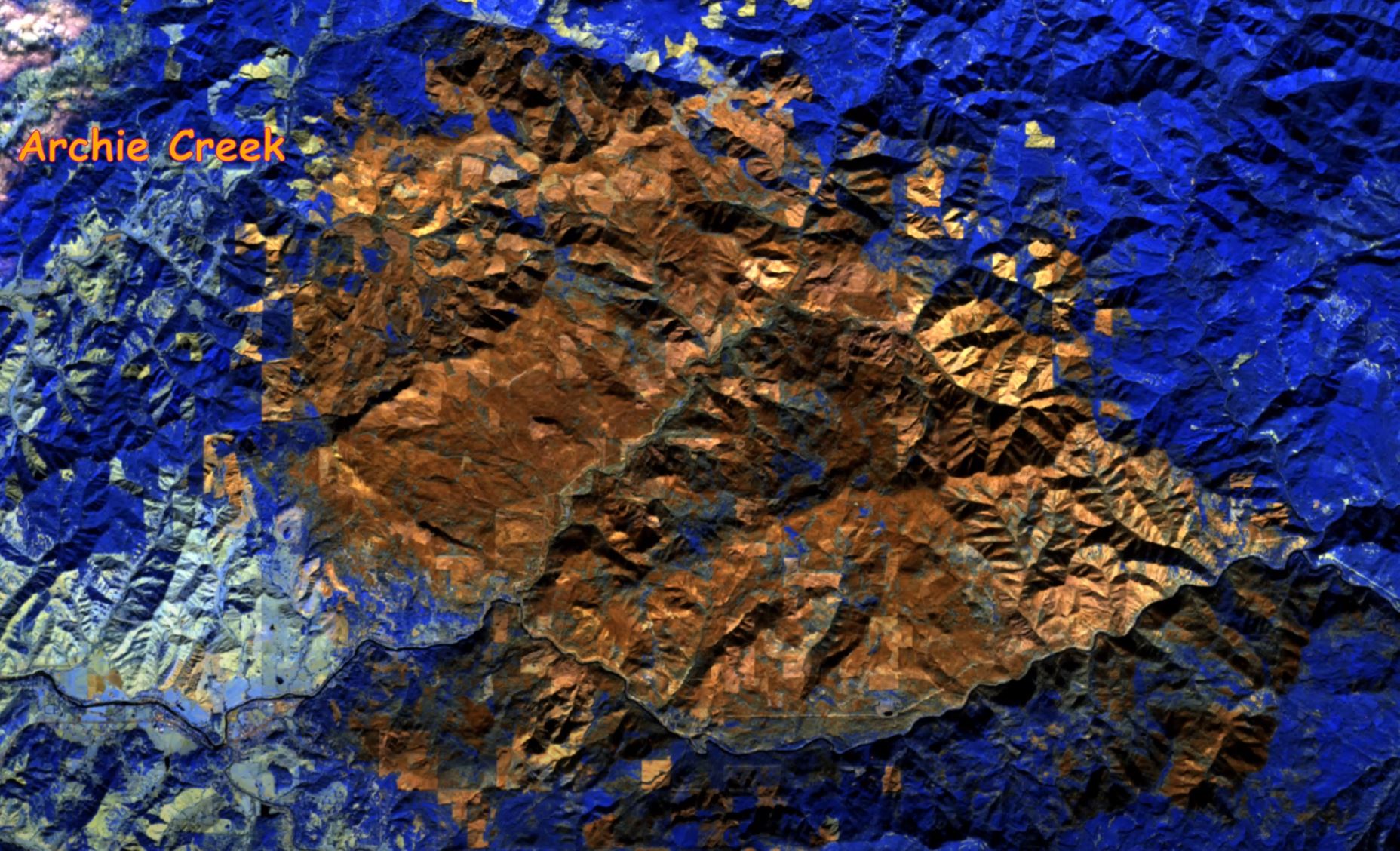
The Archie Creek wildfire scar. Image using ESA Sentinel-2 imagery, extracted from a video on Youtube by loyal reader Ken.
.
The scale of the area that has been left vulnerable to landslides from these fires is staggering. In 2018, California suffered extremely damaging mudslides in this situation; this winter the vulnerable area is much larger. Efforts are underway to assess the hazard. The Weather Channel has a good article outlining the perils that could lie ahead.
Of course the way that this pans out will depend heavily on the rainfall pattern this winter – the La Nina conditions might for example reduce rainfall in parts of California, but leader to wetter conditions in the northern part of the fire burnt area.
Ken has also posted another video which provides a scene by scene overview of the areas burnt by wildfires in 2020:-
.
Acknowledgement
Many thanks to Ken for the many hours of work that have gone into compiling this information.
.
 Dave Petley is the Vice-Chancellor of the University of Hull in the United Kingdom. His blog provides commentary and analysis of landslide events occurring worldwide, including the landslides themselves, latest research, and conferences and meetings.
Heavy rain predicted this weekend for western Oregon with small stream flooding and landslide and debris flow danger in the areas of the Beechie Creek, Riverside, and Holiday Farm fires from this year and the still-unstable Eagle Creek fire in the Columbia Gorge. It’s a warm storm so there may be a rain-on-snow component. We’ll see what happens.