
15 December 2019
Landslides on Mount Kinabalu from the 2015 earthquake
Posted by Dave Petley
Landslides on Mount Kinabalu from the 2015 earthquake
On 5 June 2015 Sabah in Malaysia was hit by a M=6.0 earthquake that triggered large numbers of landslides on Mount Kinabalu. These landslides were responsible 18 deaths (some reports suggest 19 people were killed); I blogged about these landslides, their effects on people on the mountain at the time, and the aftermath.
Google Earth now has some good quality imagery of Mount Kinabalu in the aftermath of the earthquake (the location is 6.073, 116.561). The image below was collected in January 2016, a few months after the earthquake. The very extensive landslides triggered by the event are clear, and are quite surprising:-
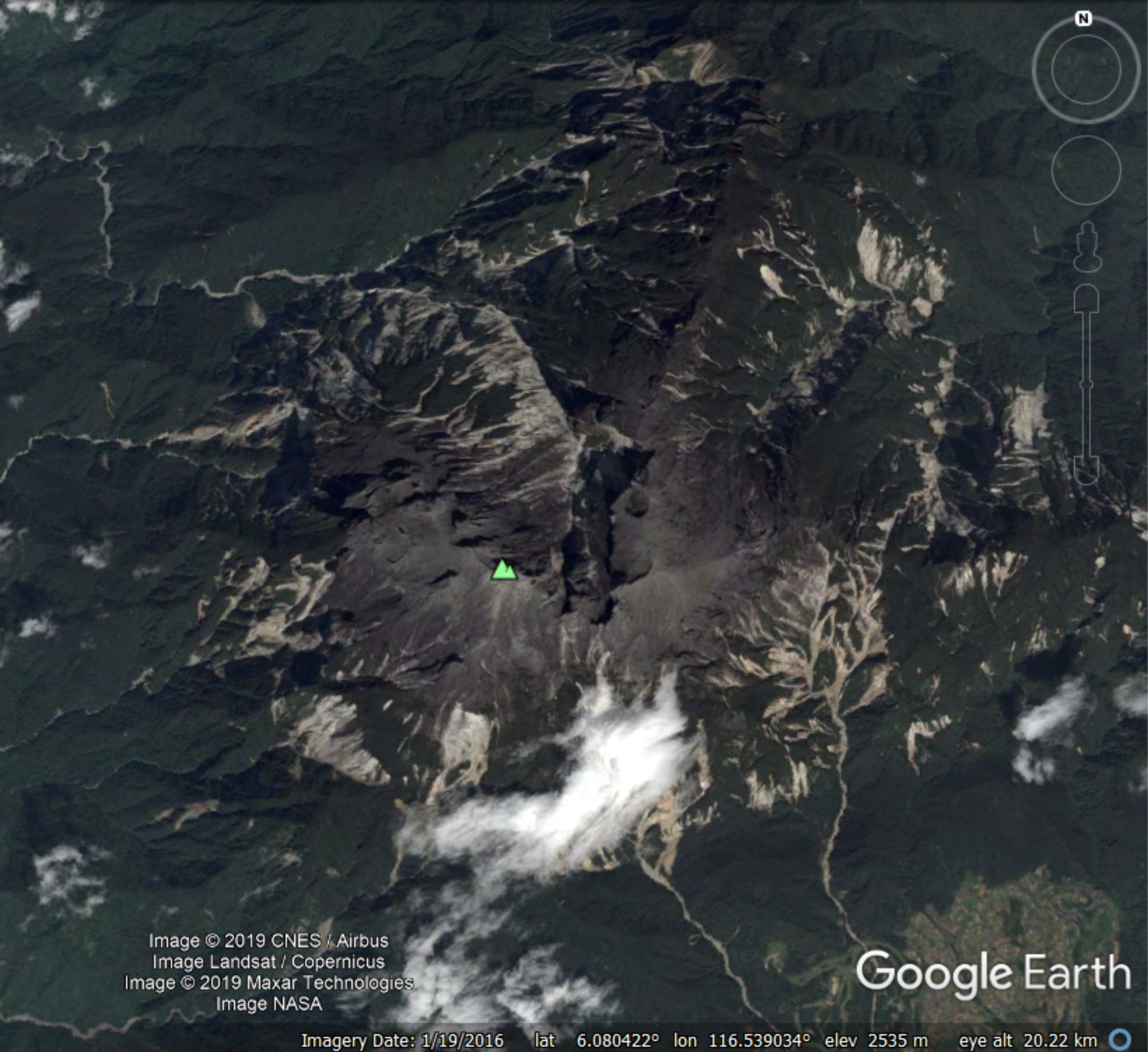
Google Earth imagery from January 2016 showing the extensive landsliding on Mount Kinabalu from the 5 June 2015 M=6.0 earthquake.
.
There are hundreds of landslides apparent on the imagery. These are most obvious on the middle, deeply vegetated slopes. It is interesting to see that there was massive landsliding in some of the high level valleys, such as this one:-
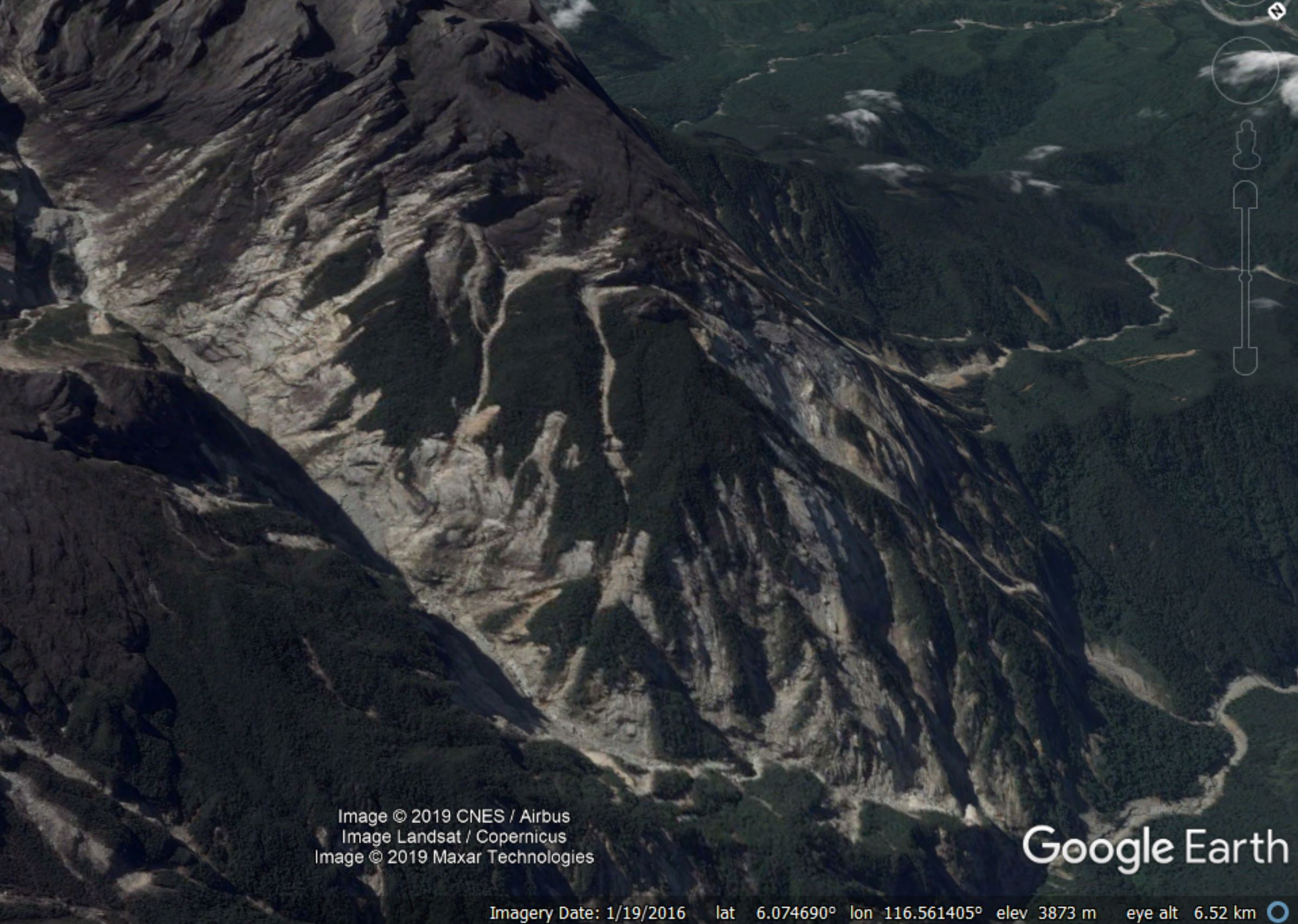
Detailed Google Earth imagery of the landslides on Mount Kinabalu triggered by the M=6.0 5 June 2015 earthquake.
.
Imagery from before the earthquake shows nothing like his level of landslides. This Google Earth image was taken in 2012; it shows very few landslides:-
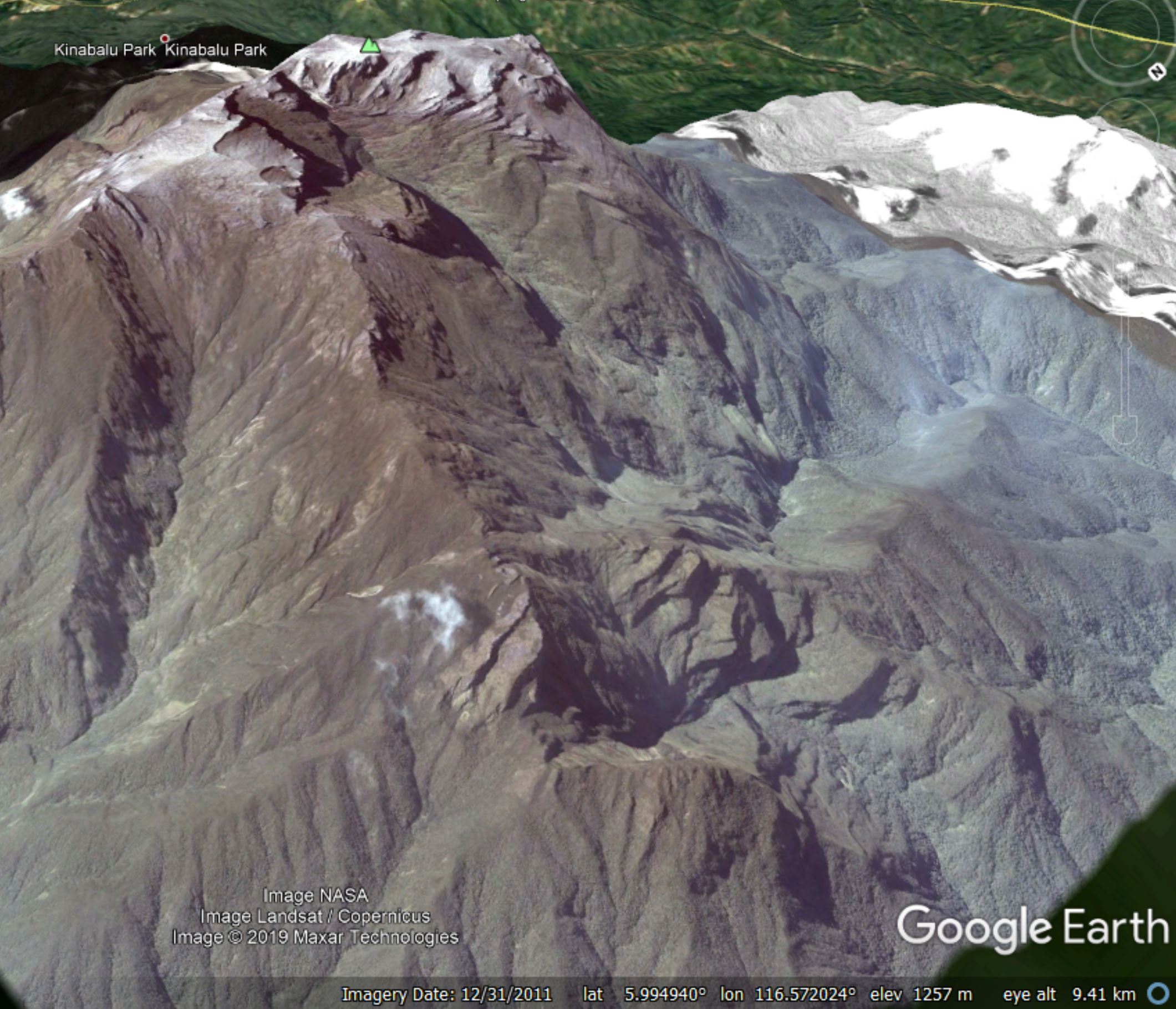
Google Earth imagery of Mount Kinabalu collected in 2012 before the 5 June 2015 M=6.0 earthquake.
.
It is interesting that an earthquake that was not particularly large was so efficient in triggering landslides. This may be in part because of the proximity of Mount Kinabalu to the earthquake epicentre. But it could also be that this is a mountain that experiences relatively few high magnitude earthquakes, meaning that those that do occur are able to cause large numbers of landslides. The only study of these earthquake-triggered landslides that I can find is in a paper about the tectonics associated with the earthquake (Wang et al. 2017 – the paper is Open Access).
The landslides would benefit from a more detailed investigation.
Reference
Wang, Y., Wei, S., Wang, X. et al. 2017. The 2015 M w 6.0 Mt. Kinabalu earthquake: an infrequent fault rupture within the Crocker fault system of East Malaysia. Geoscience Letters 4, 6 (2017) doi:10.1186/s40562-017-0072-9
 Dave Petley is the Vice-Chancellor of the University of Hull in the United Kingdom. His blog provides commentary and analysis of landslide events occurring worldwide, including the landslides themselves, latest research, and conferences and meetings.