
14 June 2018
Rattlesnake Ridge: new drone footage of the development of the landslide
Posted by Dave Petley
Rattlesnake Ridge: new drone footage of the development of the landslide
The WADNR has released a good video, captured by a drone on 31st May, showing the development of the Rattlesnake Ridge landslide. This video is available on Youtube and should be embedded below:-
.
As expected by those responsible for monitoring the landslide, it has continued to creep over the last few months, and judging by the images it has now displaced by a few metres:-
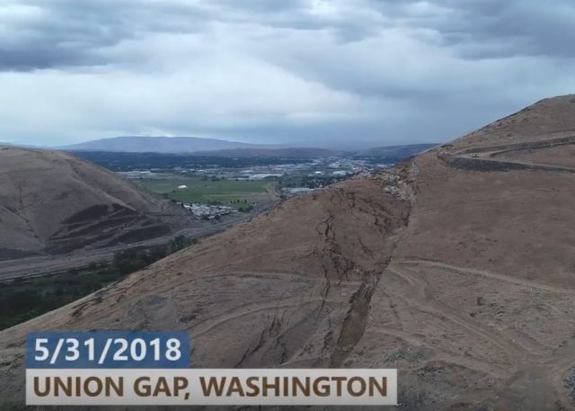
Displacement of the Rattlesnake Ridge landslide at Union Gap in Washington State. Still from a drone video released on Youtube by WADNR.
.
Note the displacement of the tracks across the landslide, which give a good indication of the total movement of this part of the landslide. The slide has now formed a very clear head scarp (actually a double scarp, which is not unusual):-
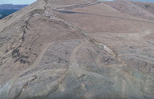
The double headscarp of the Rattlesnake Ridge landslide. Still from a drone video released on Youtube by WADNR.
.
The WADNR continue to monitor and manage the landslide, and they have a good website that provides details of their activities. I hope that in due course we will see a range of peer reviewed publications analysing the movement dataset that they are collecting.
 Dave Petley is the Vice-Chancellor of the University of Hull in the United Kingdom. His blog provides commentary and analysis of landslide events occurring worldwide, including the landslides themselves, latest research, and conferences and meetings.
Surely, the system is operating at a Factor of Safety close to unity? An elastic or plastic analysis will give results that a Code of Practice does not consider to be adequate. But then, most design codes are not capable of handling this situation.
So, this is where risk management comes in and the civil engineering academia is pretty much ill-equipped to understand, less properly teach any approach to examine these situations. Risk, with huge monetary ramifications comes to the fore. And with geotechnical situations, the solution has always been to kick the can down the road.
Bishop and Skempton notwithstanding, there are huge gaps in finding solutions.
So, who is going to pay for this? For the right money, a value for an assumed FS of maybe 1.05 will become the norm? Little research, no follow through and trust to luck, is it?