
30 October 2017
USGS mapping of landslide density for failures triggered by Hurricane Maria in Puerto Rico
Posted by Dave Petley
USGS mapping of landslide density for failures triggered by Hurricane Maria in Puerto Rico
The USGS has now posted online a map of the landslide density for failures triggered by Hurricane Maria in Puerto Rico in September 2017, following on from their earlier work on landslide impacts. The mapping has been undertaken using high resolution satellite images. At this stage the mapping has been undertaken on a grid square basis, with each square having an area of 4 km², with a simple three-fold classification of no landslides, fewer than 25 landslides per km², and more that 25 landslides per km². The resultant map is shown below:-
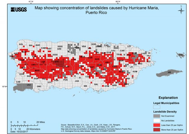
USGS mapping of landslide density in Puerto Rico as a result of Hurricane Maria
.
A simple comparison with the topography of Puerto Rico suggests that, at a first order, the landscape has been a key control on the occurrence of landslides (map via Dr Jose Javier Hernandez Ayala):-
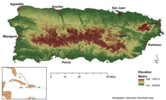
The topography of Puerto Rico. Map by Dr Jose Javier Hernandez Ayala
.
The Washington Post published a map of the precipitation deposited by Hurricane Maria in Puerto Rico:
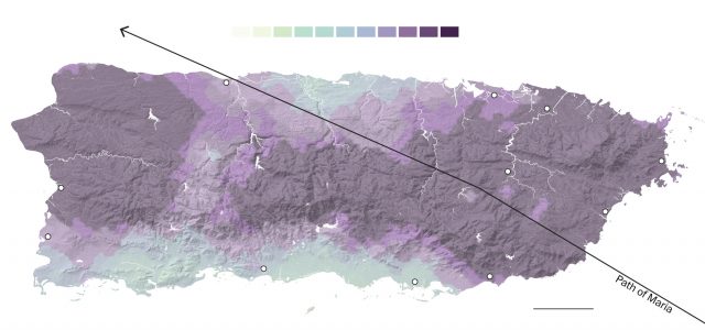
Total precipitation from Hurricane Maria in Puerto Rico, via the Washington Post
.
This suggests that the landslide distribution can be primarily explained by the coincidence of intense precipitation and steep topography, which is of course unsurprising. I am sure that a more detailed analysis will be undertaken in due course. The upshot is a profoundly altered landscape. This is a Planet Labs image of the area around Lago Caonillas taken on 12th September 2017, about a week before Hurricane Maria:-
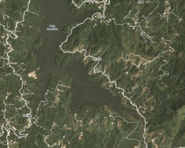
Planet Labs image of the area around Lago Caonillas in Puerto Rico, collected on 12th September 2017
.
And this is the same area, after the storm, on 4th October 2017:-
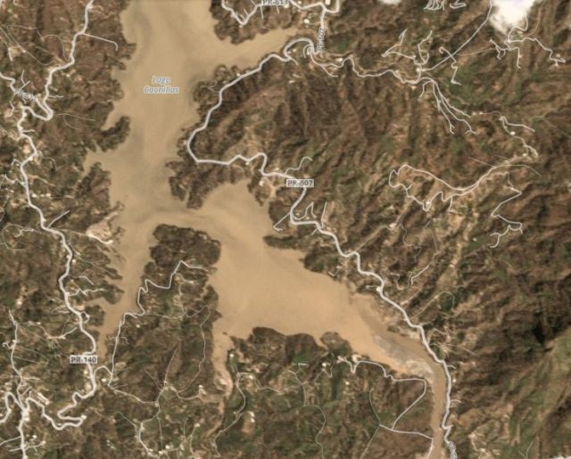
Planet Labs image of the area around Lago Caonillas in Puerto Rico, collected on 4th October 2017
.
References
Erin K. Bessette-Kirton, Jeffrey A. Coe, Jonathan W. Godt, Jason W. Kean, Francis K. Rengers, William H. Schulz, Rex L. Baum, Eric S. Jones, and Dennis M. Staley (2017). October 25, 2017: Map data showing concentration of landslides caused by Hurricane Maria in Puerto Rico. USGS: https://landslides.usgs.gov/research/featured/2017-maria-pr/
Planet Team (2017). Planet Application Program Interface: In Space for Life on Earth. San Francisco, CA. https://api.planet.com
 Dave Petley is the Vice-Chancellor of the University of Hull in the United Kingdom. His blog provides commentary and analysis of landslide events occurring worldwide, including the landslides themselves, latest research, and conferences and meetings.
A great job!