
23 December 2016
Jiuhaocha in Pingtung County – more on the impacts of landslides on a mountain village
Posted by Dave Petley
Jiuhaocha in Pingtung County – more on the impacts of landslides on a mountain village
Yesterday I blogged about the massive impacts of landslides and associated river-borne sediment on the village of Jiuhaocha in Pingtung County, Taiwan. In fact the element that I posted yesterday was only a small part of the story. C-Y Chen has a blog in Mandarin that describes landslide disasters in Taiwan – I hadn’t come across this before but it is very interesting (Google translate does a good enough job to make it readable without difficulty). Back in April he posted an article about the landslide problem in Jiuhaocha, which provides a very interesting description of the long term problem.
The history goes back to 1979 when the village was established as a “model village” on the river terrace. This of course explains the very organised structure of the community, with its grid-like street pattern, as shown in this Panaramio photo from 2009:
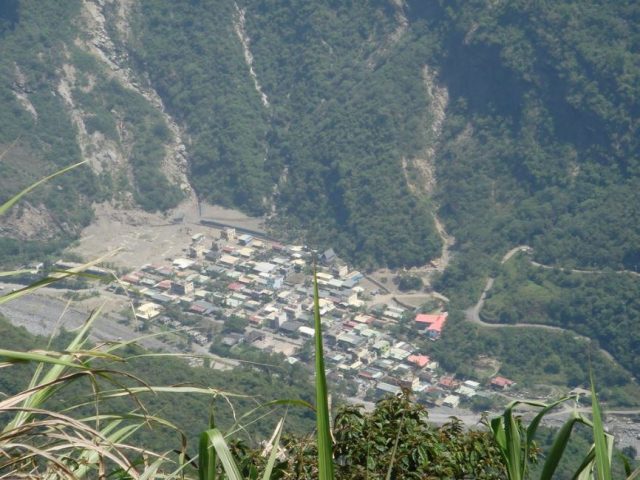
Panaramio image of Jiuhaocha village in Pingtung County from 2009
.
Th landslide story starts in 1996, when the area was struck by Typhoon Herb. I was in eastern Taiwan at that time – this event came close to killing me (but that is a story for another day) – but the village was very badly affected by landslides. In particular a slide near to the church (which is the large building with a red roof on the right side of the centre of the image above) crashed into the village, killing four people. C-Y Chen has an image of this landslide:
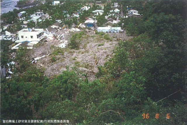
The 1996 landslide that struck Jiuhaocha in Pingtung County, via C-Y Chen
.
In 2003 a report by the National Cheng Kung University recognised the landslide dangers in this village, and also highlighted the risk of flooding from the river in extreme rainfall scenarios. By 2005 the river was rapidly aggrading (i.e.the river bed was rising as sediment accumulated) because of the landslides located upstream of the village. This was increasing the risk of a flood related disaster at Jiuhaocha. Heavy rainfall events in 2006 and 2007 saw further landslide activity in the area around the Jiuhaocha, meaning that some of the houses became partially buried in debris. C-Y Chen has this image of the damage:-
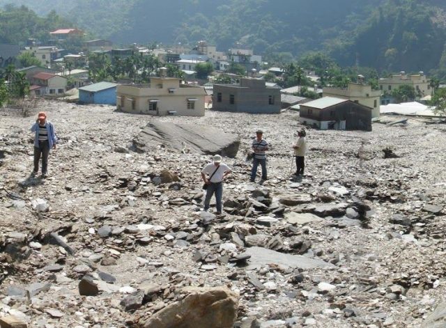
Landslide damage in 2007 Juihaocha, Pingtung County, via C-Y Chen
.
And then in 2009 Typhoon Morakot brought 1,900 mm of rainfall to Pingtung County, during which Jiuhaocha was completely buried, leaving only the church standing. By this time the river bed had aggraded by a staggering 40 metres as a result of the landslides upstream. The church is the one building that can be seen in the Google Earth image at that time:-
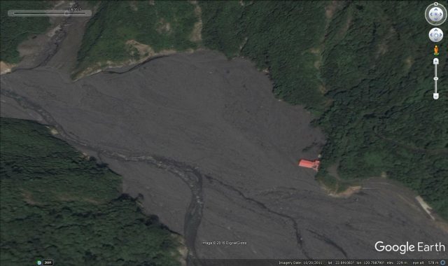
Google Earth image showing the church to be the only building standing in Jiuhaocha in 2009
 Dave Petley is the Vice-Chancellor of the University of Hull in the United Kingdom. His blog provides commentary and analysis of landslide events occurring worldwide, including the landslides themselves, latest research, and conferences and meetings.