
28 January 2016
Google Earth imagery of the Tbilisi landslide and flood
Posted by Dave Petley
Google Earth imagery of the Tbilisi landslide and flood
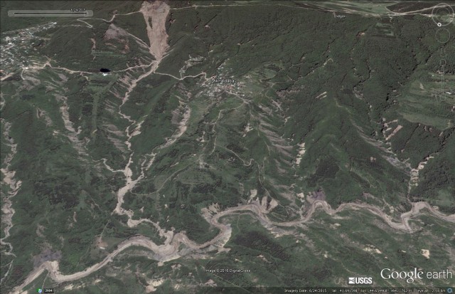
On 14th June 2015 a major flood swept through parts of Tbilisi in Georgia, causing the loss of 19 lives. The greatest damage associated with the Tbilisi landslide occurred at Tbilisi zoo – I blogged about this a few days later because the reported cause of the flood was a landslide that had blocked the valley, allowing a lake and then a dam break flood to develop. I noted at the time that there was a lack of clarity about exactly where the landslide that caused the disaster had occurred. Google Earth has now posted imagery of the area collected on 24th June 2015, about ten days after the disaster. This is an overview of the affected area from the south, the outskirts of Tbilisi are on the bottom left of the image:
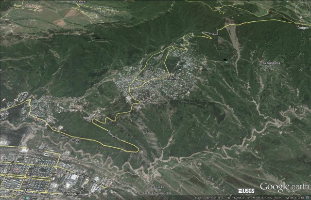
An overview of the Tbilisi landslide and flood disaster site via Google Earth
.
The most obvious feature here is a major landslide in the upper right portion of the image, with many smaller landslides in the vicinity. The path of the flood along the river is also clear. This is the same location in March 2014:
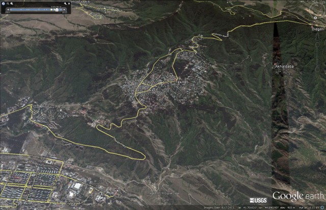
A Google earth image of the location of the Tbilisi landslide and flood from March 2014
.
The major feature is the large landslide that reportedly caused the disaster. This is a substantial feature that appears to be a comparatively shallow but extensive translational rock and soil slide. The main source appears to be in the vicinity of the road that crosses the upper part of the slope:
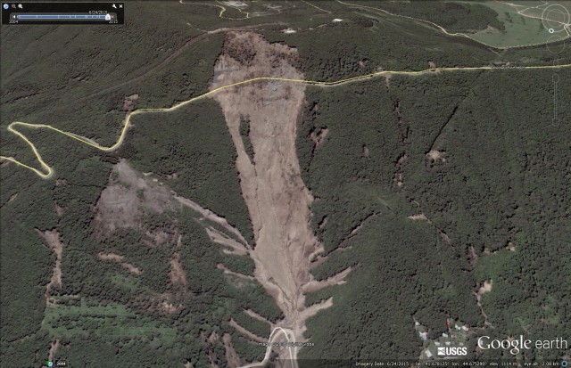
Google Earth image of the Tbilisi landslide
.
This landslide is about 1 km long and 300 metres wide at its maximum extend
The pre-landslide image of the same location gives little indication of the potential problems at this site, and there is no obvious sign that the road played a part in the failure:
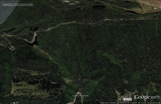
Google earth image of the site of the Tbilisi landslide
.
However, it is not obvious to me from the image that there was a major landslide dam event in this area, at least not associated with this landslide. Downstream there appears to be extensive evidence of shallow landslides and extensive flood scour on the river, but no obvious evidence of a dam and lake.:
Google Earth imagery of the Tbilisi landslide site
.
Thus, to me on first inspection it appears that the disaster might have been caused by a large debris flow and flood that originated in the landslide shown above, with contributions from many other smaller landslides and channels, rather than a valley blocking event.
 Dave Petley is the Vice-Chancellor of the University of Hull in the United Kingdom. His blog provides commentary and analysis of landslide events occurring worldwide, including the landslides themselves, latest research, and conferences and meetings.