
6 August 2015
Typhoon Soudelor – potential for landslides in China and Taiwan
Posted by Dave Petley
Typhoon Soudelor
In the western Pacific Ocean the strongest tropical cyclone of the year to date, Typhoon Soudelor, is now forecast to make a direct hit in Central Taiwan on Friday and Saturday. This the JTWC forecast track at the time of writing, on Google Earth:
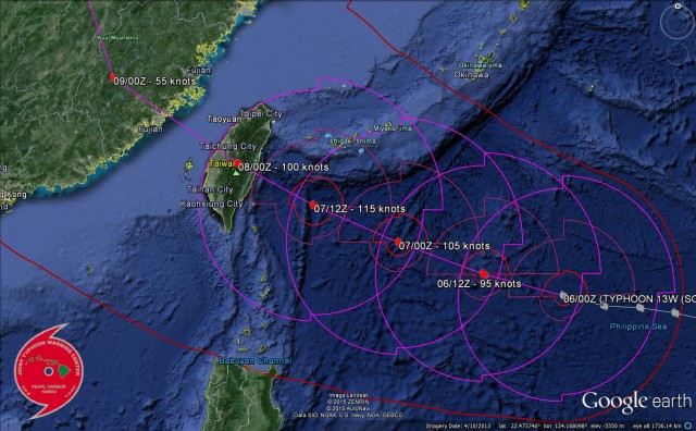
JTWC via Google Earth
.
The current forecast track takes Typhoon Soudelor straight across Central Taiwan, which is both mountainous and very landslide prone:
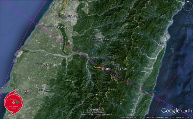
JTWC via Google Earth
.
Of course there is a great deal of uncertainty about the track at present, but a direct hit on Taiwan looks likely. Whilst the focus in terms of typhoon meteorology remains on wind, damage in typhoons is really caused primarily by water. This is especially the case in Taiwan. The extreme rainfall totals generated by typhoons combined with the steep mountain front in eastern Taiwan (which is both landslide prone and generates orographic intensification of rainfall) means that the landslide potential for Typhoon Soudelor is very high. In 1996 Typhoon Herb followed a similar, but slightly more northerly, track. When it came ashore in northern Taiwan, as a Category 4 typhoon, it generated truly epic rainfall totals – a monitoring station at Alishan in Central Taiwan recorded 1987 mm of rainfall associated with the typhoon. Fortunately Typhoon Soudelor will be a little weaker than this when it makes landfall, but still has the potential to generate very large rainfall totals. A great deal will depend on the rate of movement – at the moment the typhoon is forecast to pass over the island reasonably quickly, but if it stalls, as per Typhoon Morakot in 2009, then the rainfall levels have the potential to be very large.
After passing across Taiwan the typhoon will make landfall in China. Although weakened by the interaction with land, it has the potential to generate very large rainfall totals there as well.
Landslides are inevitable as Typhoon Soudelor makes landfall. The precipitation climatology will determine just how bad they are. It will be well worth keeping an eye on the CWB real time rainfall observation maps on Friday, Saturday and Sunday.
 Dave Petley is the Vice-Chancellor of the University of Hull in the United Kingdom. His blog provides commentary and analysis of landslide events occurring worldwide, including the landslides themselves, latest research, and conferences and meetings.