
20 September 2013
First images of the La Pintada landslide in Mexico
Posted by Dave Petley
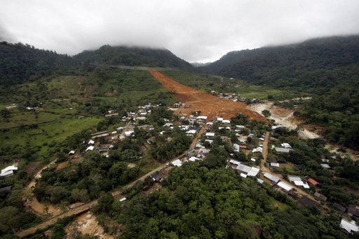
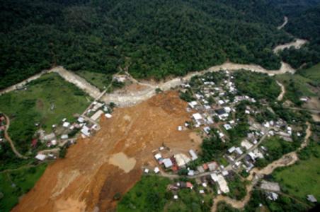
As expected, images have started to emerge of the La Pintada landslide in Mexico, which is now believed to have killed 68 people earlier this week. A good overview image that I have found is this one from AFP:
..
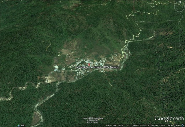
This does confirm the location that I identified yesterday:
 ..
..
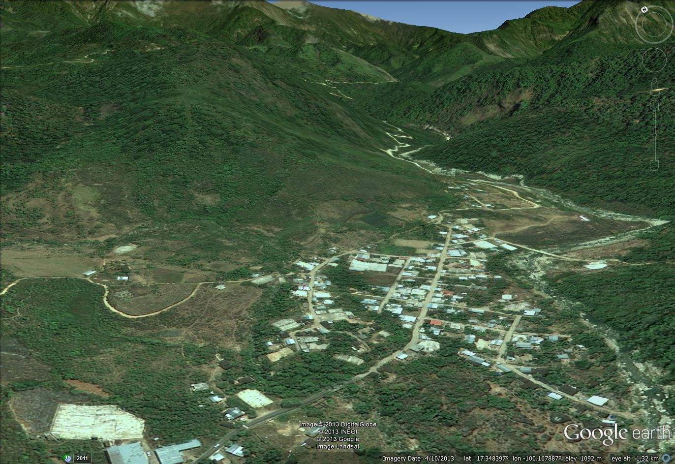
I have tried to reconstruct the viewpoint of the above photo in Google Earth:
..
It is clear from this image that the main part of the landslide has gone right through the middle of the town.
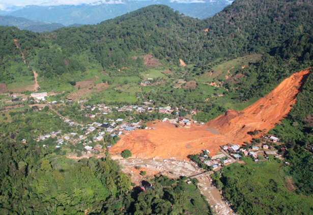
Meanwhile, the website http://www.novedadesacapulco.mx/ has this excellent image of the landslide:
..
The landslide source appears to be quite a large, comparatively deep-seated translational landslide in deeply weathered soil, which has then entrained debris to become a large flow. There is no sign of any geological structure in the source area, but at the toe of the source it appears to have over-ridden a topographical bench that is probably structurally-controlled. The same site has this more detailed view of the head scarp of the landslide, which is surprisingly deep:
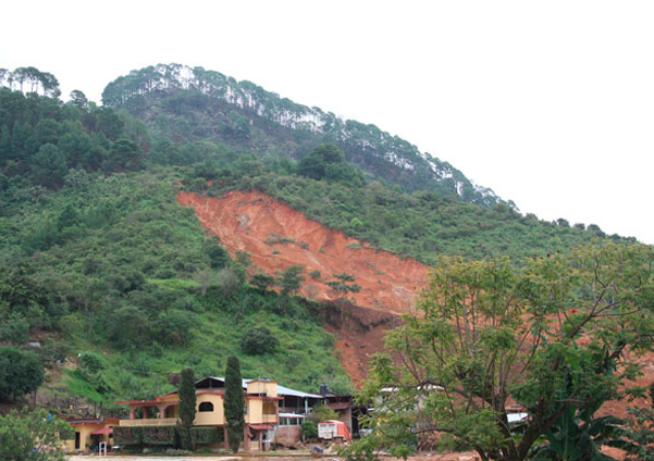
..
The Mexican website (in Spanish) eleconomista.co.mx has this rather low resolution image of the aftermath in the town at the toe of the landslide:
 ..
..
Again, I have tried to reconstruct that view in Google Earth:

..
There is a large number of buildings beneath the debris; the likelihood of there being any survivors of the landslide seems to be very low.
 Dave Petley is the Vice-Chancellor of the University of Hull in the United Kingdom. His blog provides commentary and analysis of landslide events occurring worldwide, including the landslides themselves, latest research, and conferences and meetings.