
3 September 2013
Over a century of rockfalls on a coastal cliff at Nobbys Head, Australia
Posted by Dave Petley
I have spent the last few days New South Wales in Australia courtesy of the University of Newcastle. This has been a great experience in a very interesting and picturesque city located by the sea. The region is blessed with beautiful beaches, but there are also some cliffs that are actively eroding. One prominent feature in Newcastle is known as Nobbys Head, an interesting former small island, now linked to the mainland through the dumping of fill and the construction of the harbour breakwater. Nobbys Head is formed from tuff with a cap of coal measures rocks; its overall form has been altered considerably through time as the top was removed to prevent sailing ships losing wind as they rounded the point to enter the harbour.
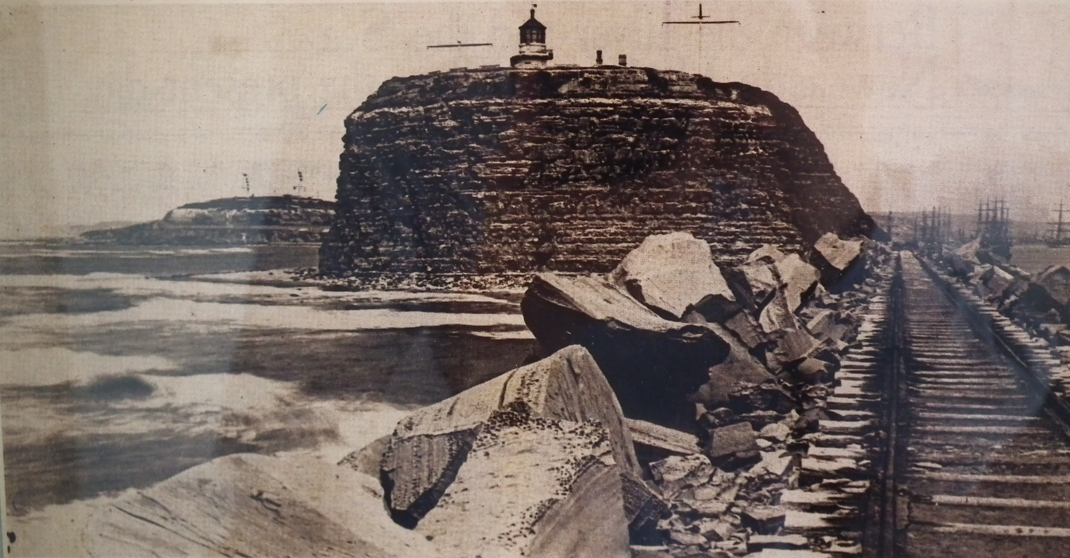
On Sunday I went up to the port buildings at the top of the point. Inside was a small exhibition of old photographs of Nobbys Head. This one, taken from the harbour breakwater caught my eye. It is dated 1892 – i.e. it is about 120 years old:
 ..
..
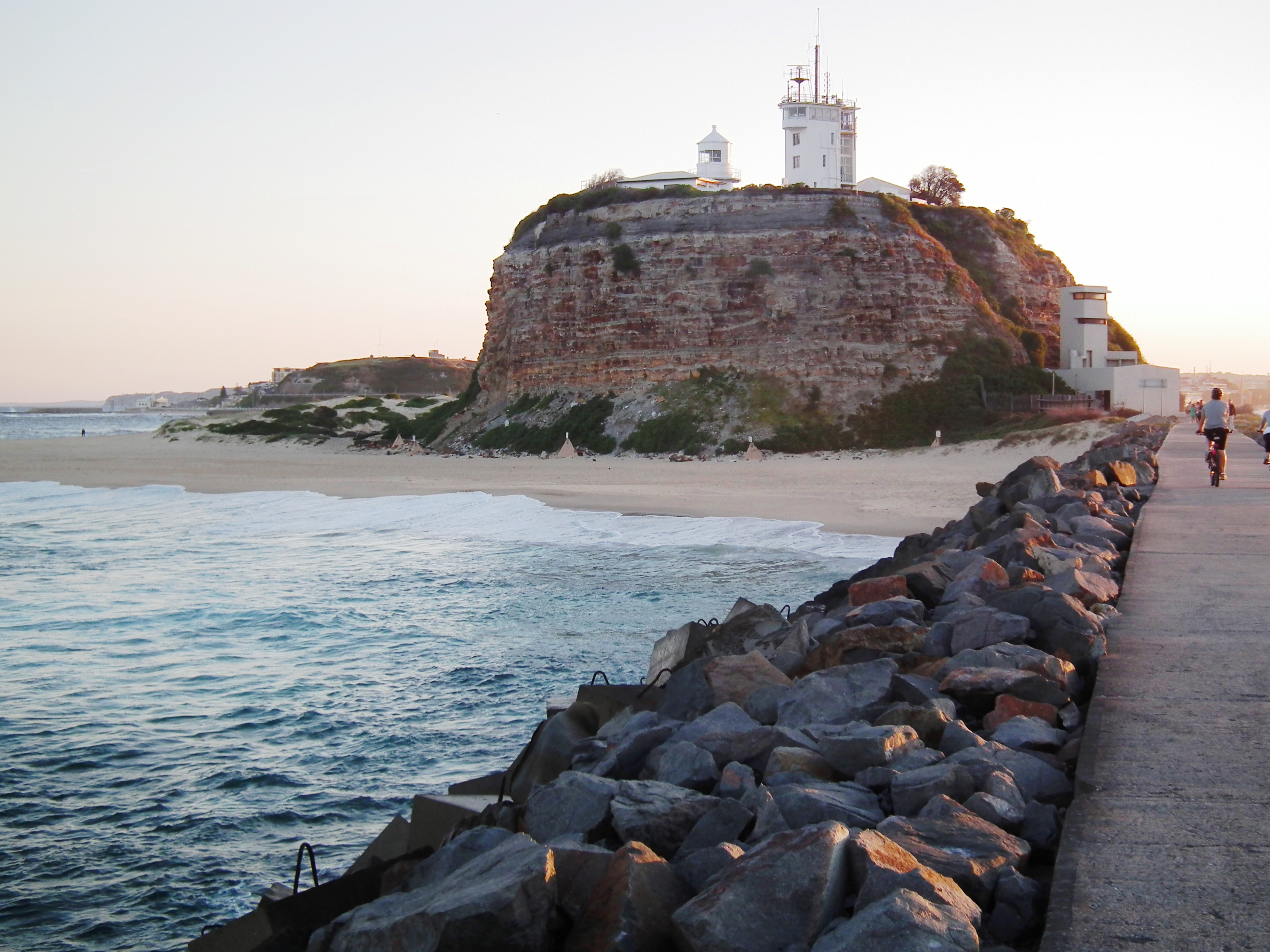
I thought it would be fun to try to recreate the photo to show the change in the cliff face over this time. This is quite tricky as the breakwater has been raised in the interim, and of course the railway line has been replaced with a paved walkway. Nonetheless I managed to get quite close to the same image:
 ..
..
There are some obvious superficial changes – new buildings and different mast configurations for example, but of much greater interest is the form of the rock mass. On first viewing it might be surprising that so little has changed – the profile is the same on both sides of the headland for example. This is easily explainable – rock slopes tend to find a stable form, often known as the threshold slope, and then to maintain this slope gradient as they erode. As an interesting aside, the classic paper on this was Carson and Petley (1970) – and in case you are wondering that Petley is not me (but we are closely related).
However, a more detailed look suggests that there are some notable changes. The first is that the modern picture has a great deal more beach around the foot of Nobbys Head. This is almost certainly a response to the construction of the breakwater, which would have created the right conditions for sand to be deposited. But look closer and you’ll see an even more significant difference. In the modern image a pile of scree has developed at the foot of the cliff, which has become partially vegetated. It is mostly rock but with some wind blown sand mixed in. I doubt that this means that the cliff is more active now than in the past, but rather that the beach is stopping the debris from being washed away.
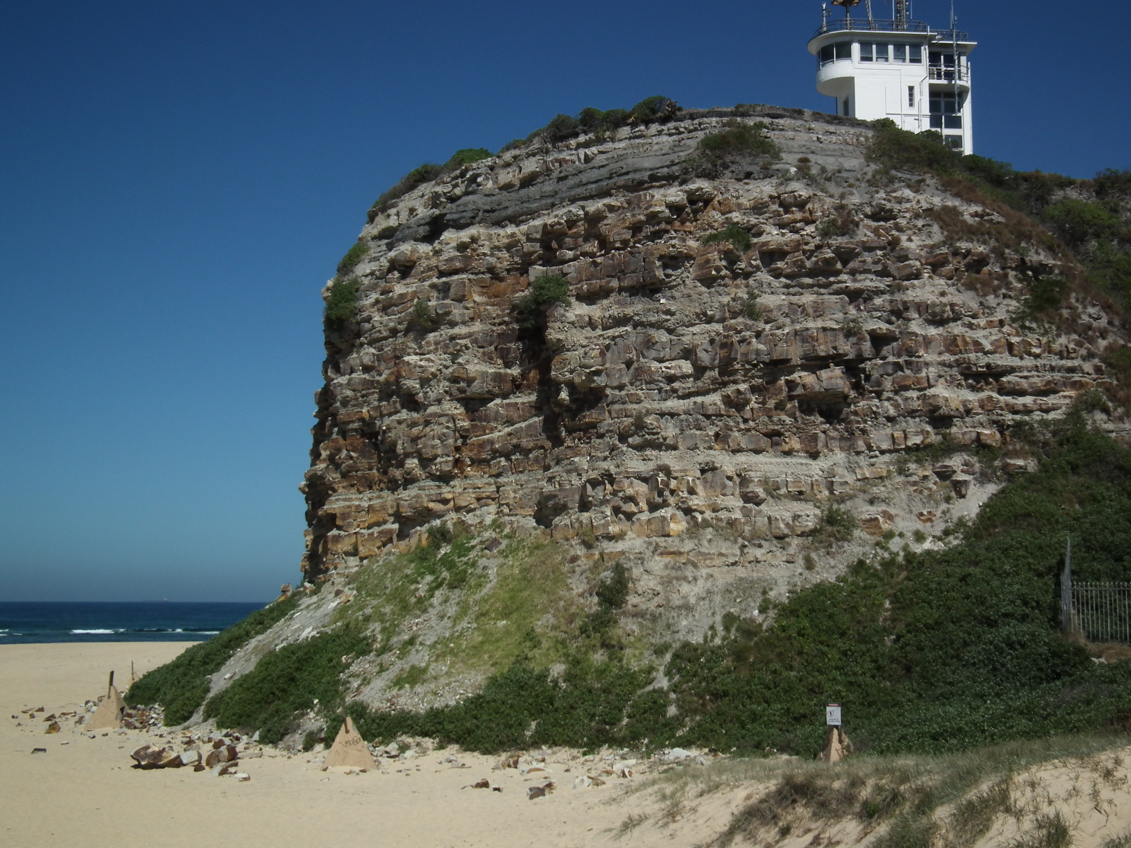
The aspect that I find most intriguing is this rockfall scar, directly, above the scree, which you can see in the contemporary image above:
..
This rockfall appears to have developed over a long period, and indeed judging by the debris is continuing today. The intriguing issue is that if you compare the contemporary image with the 1982 one you will see that the rockfall had not really developed (there is perhaps a hint of it around what is now the top of the scar), but the area in which the rockfall has developed can be clearly delineated.
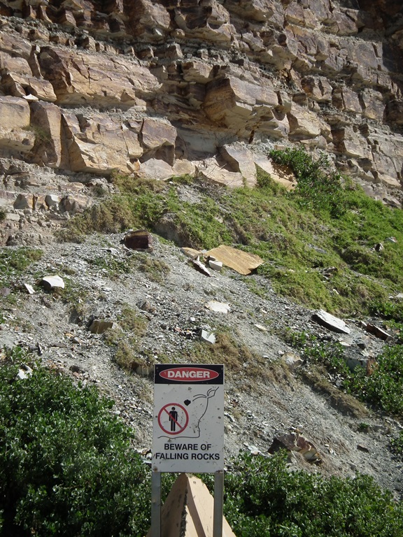
Rockfalls continue at this site today, necessitating warning signs on the beach:
Reference
Michael A. Carson and Derek J. Petley 1970. The Existence of Threshold Hillslopes in the Denudation of the Landscape. Transactions of the Institute of British Geographers
No. 49, pp. 71-95
 Dave Petley is the Vice-Chancellor of the University of Hull in the United Kingdom. His blog provides commentary and analysis of landslide events occurring worldwide, including the landslides themselves, latest research, and conferences and meetings.
Welcome to my neck of the woods. Did you get to see the rest of the beach cliffs to the south. And did you know that most of the city is undermined (during the convict era) and has to be grouted before multiple storied buildings can be constructed. Just a few interesting facts about the Steel City which keep a geo entertained.