14 March 2013
Managing landslide hazard – an example from Franz Josef in New Zealand
Posted by Dave Petley
![]()
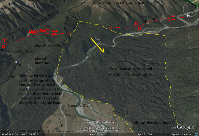
Nicolas Barth at the Department of Geology at the University of Otago has a paper (Barth 2013) in the journal Landslides about rock avalanches in New Zealand triggered by the Alpine Fault. The main topic of the paper is a fantastic ancient landslide known as the Cascade Rock Avalanche. This image is taken from his website, showing the landslide in all of its glory:
His treatment of this landslide is really interesting, and worthy of a blog post all of its own, but for me the most eye-catching element is a short section at the end of the paper in which he examines another potential large landslide at Franz Josef. This is an important tourist destination in South Island, the jumping off point for tours to the Franz Josef glacier. Although the town has only 330 permanent residents, this number increases to over 2000 in peak tourist periods. Barth (2103) notes that:
“Of particular note is the hillside above Franz Josef township, c. 150 km northeast of the Cascade Valley, which displays several of the structural characteristics identified at the Cascade and RT rock avalanches. At 700 m elevation, there is a linear trough-like break in slope with a c. 100 m-high scarp-like surface above and a bulging hillslope below. The Alpine Fault passes through the township and dips moderately beneath the hillside…The lateral distance to the town from the linear trough is 1,300 or 400 m measured from the base of the hill to the town. The mass of rock that could potentially fail at Franz Josef has comparable dimensions to the source of the Mt. Wilberg rock avalanche…a comparable event at Franz Josef would completely devastate the town.”
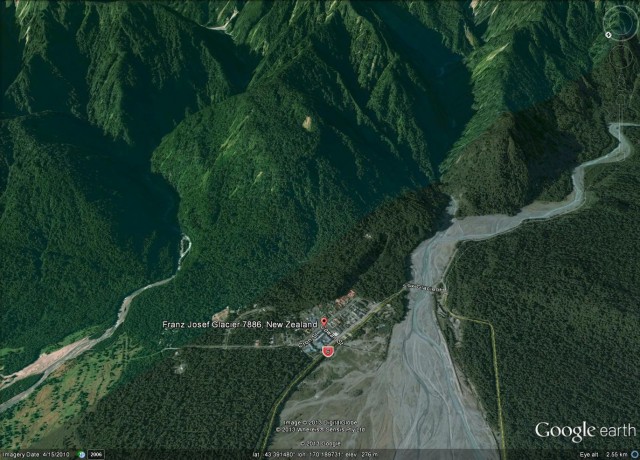
The slope in question is clearly shown in Google Earth:
The small township at the foot of the slope is clear on the image above. The area of concern is the forested slope behind the town, extending up to the ridge crest. The strange topography towards the top of the slope is likely to be deformation caused by creep of the slope.
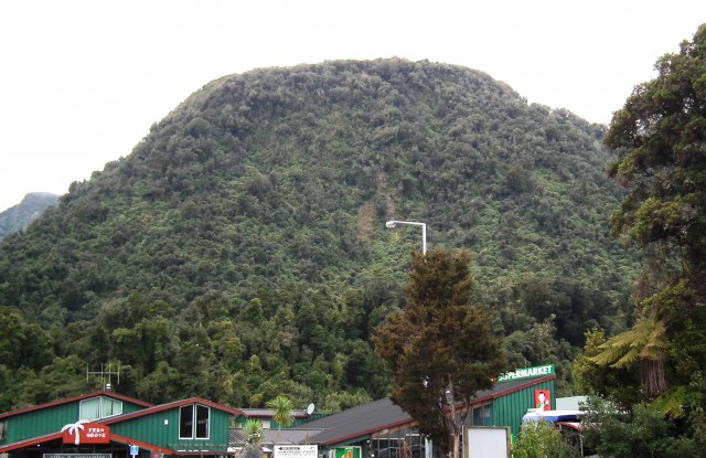
I was lucky enough to visit the town in September with colleagues. We spent some time mulling over the slope. From the ground it is much easier to get an impression of the nature of the slope and the rather unusual, bulging, geometry:
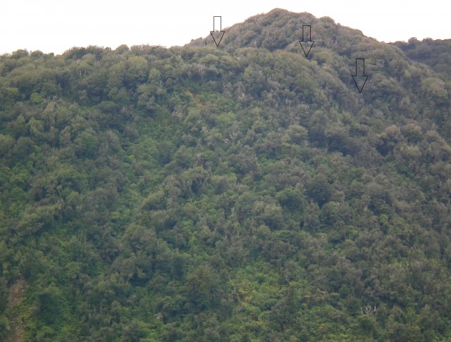
The reason that it causes concern is this depression at the top of the slope (highlighted with arrows below), which probably indicates that the slope has been creeping:
It is important not to blow the hazard here out of proportion – the slope has probably looked like this for hundreds and maybe even thousands of years, and it may continue to do so for thousands more. The likely trigger event for a collapse, should one ever occur, is an Alpine Fault earthquake (and given that the fault runs straight through the town, this would be a challenging event anyway). However, it is impossible to say whether the key trigger might be the next earthquake, one of the next ten earthquakes, or indeed whether it may never fail.
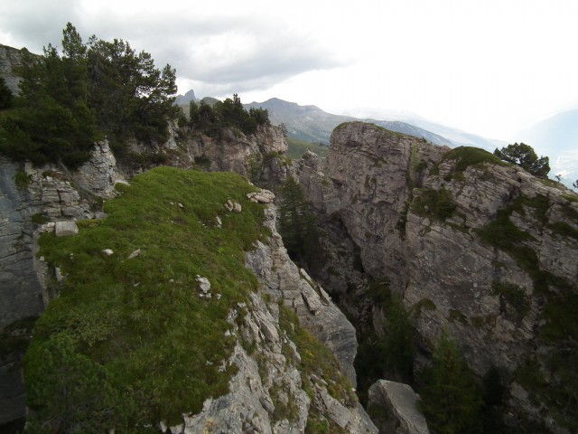
This rather neatly highlights the problems of assessing hazards from large, steep slopes in high mountain areas. In the Alps many slopes also show signs of deformation, many of which look quite alarming. This is an example from Switzerland:
Such slopes in the Alps very rarely fall down. Of course at Franz Josef the additional factor is the presence of a major active fault, so in my view it would be sensible to investigate the slope properly in order to assess the risk (though this is a far from easy task given the topography and vegetation).
In the meantime of course there is no reason to worry unduly about the slope, and there is certainly no reason not to visit the town, which is a well worth a trip. And do read the paper – it is excellent!
Reference
Barth, N. (2013). The Cascade rock avalanche: implications of a very large Alpine Fault-triggered failure, New Zealand Landslides DOI: 10.1007/s10346-013-0389-1


 Dave Petley is the Vice-Chancellor of the University of Hull in the United Kingdom. His blog provides commentary and analysis of landslide events occurring worldwide, including the landslides themselves, latest research, and conferences and meetings.