7 December 2012
Evaluating the causes of the Typhoon Bopha / Pablo disaster
Posted by Dave Petley
As the death toll from Typhoon Bopha / Pablo steadily mounts (the latest NDRRMC reports suggest that 418 people were killed and 383 are missing), the recriminations about the causes of the devastating debris flows that were responsible for so much of the loss has begun in earnest. In the worst affected area, Compostela Valley, an argument has started as to the degree to which mining was responsible for the loss. This is a legitimate question to ask, but in my view it misses the point. Let me show you why.
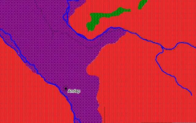
Lets take for example the village of Andap, which was devastated in the Typhoon., with at least 80 fatalities. The Philippine Mines and Geology Bureau has generated a useful set of hazard maps, and these are online here. This is an admirable task that is way in advance of that in most less developed, and indeed many developed, countries. This is the portion of the sheet for Andap:
.
The red areas are zones of high landslide susceptibility, the green areas of medium landslide susceptibility and the purple areas of high flood susceptibility. Now, I am quite sure that this is right – that is the case for all of these areas. However, it is not much use to those that live here – the maps basically indicate that everywhere is dangerous, with 90% of the land being highly dangerous. In an ideal world one might argue that all the people in this area should relocate, but leaving their villages and land is probably not practical – for example it will introduce many other risks to these peoples’ lives. These risks may well outweigh those associated with the natural hazards.
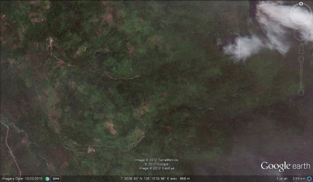
So let’s take a look at this area, suing the Google Earth imagery. This is an overview of the area (I am not sure exactly which village is Andap, but in this context it does not matter):
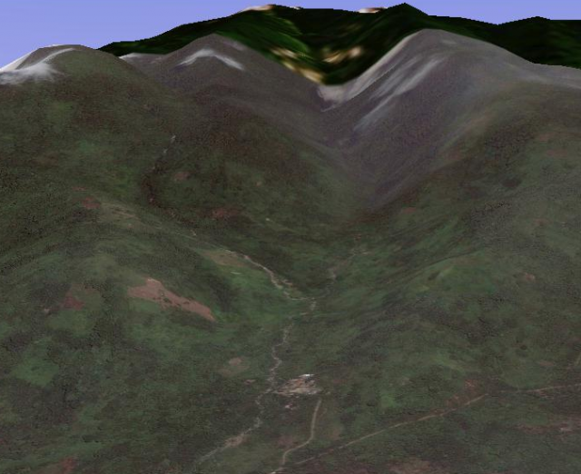
A perspective view is actually a little more helpful, let’s take the more southerly of the two villages above:
This is a classic debris flow channel, with steep slopes and a very narrow mouth. In very heavy rainfall, debris flows would come roaring down the valley, destroying everything in their path. The potential for the headwaters of the channel to be blocked with debris makes the hazards even more acute. In short, this is a very dangerous place to be at the bottom of valley in very heavy rainfall, irrespective of whether there has been mining upstream.
In that context, the location of the village is deeply concerning. Right by the channel at the mouth of the catchment is about the worst place this could be located. And this is common across the area, explaining why the losses were so high. Although the risk of landslides here is high everywhere, being away from the channel itself on the valley sides is much safer. Of course the maps do not indicate this.
So really the needs are clear. First, mapping needs to be undertaken on a case by case basis to determine which communities are most at risk. Second careful thought is then needed as to the best way to protect the people. This should not be a simple, blind relocation exercise – that does not work in most cases. It could be that the village can be relocated completely (if this is done with great thought and care), or it could be protected with a structure, or it could be that the local people can be educated as to how to respond (and where to move to) in heavy rainfall,etc. All of these are essentially social as well as technical solutions – the right approach is a combination of both Of course all of this costs money, and the Philippines is desperately poor, so external aid is needed to help with this. But if such an investment, in an area that we know is desperately hazard prone, would have been much cheaper than trying to deal with the mess in the aftermath of the typhoon, and of course at least 80 people would still be alive.
The frustrating thing is that I and many others have been banging this drum for years, but we have had very little traction. There is a host of people, including myself, willing to help; it is good to see that in the last year or so the national aid agencies have started to take this seriously. I really hope that this preventable event is the catalyst for the required action. It would be relatively simple, although time consuming and not wthout cost, to reduce losses at a place like this drastically.


 Dave Petley is the Vice-Chancellor of the University of Hull in the United Kingdom. His blog provides commentary and analysis of landslide events occurring worldwide, including the landslides themselves, latest research, and conferences and meetings.
Good report. I read in one article that only 10% of Mindanao remains forested and this was a prime cause of the terrible destruction by Sendong last year. Your article doesn’t talk about this though.
Also in my opinion the point is unprecedented climate chaos caused by runaway climate change. Mindanao has NEVER had a similar storm and SST, Surface sea temperatures have never been so high in December.
More on this here:http://thefreeonline.wordpress.com/2012/12/06/climate-chaos-caused-bophapablo-oil-companies-to-be-sued/