24 May 2012
Another teleseismic landslide – this time in Alaska on Monday 21st May 2012
Posted by Dave Petley
One of the key aspects of the work that Colin Stark and I, working with NASA, have undertaken over the last few days on the Seti River landslide was the fact that it was detected remotely on the global seismic network. This is part of a project that Colin and Goram Ekstrom have been undertakeing to develop techniques to detect remotely large landslides – as I have highlighted previously this is really very exciting work.
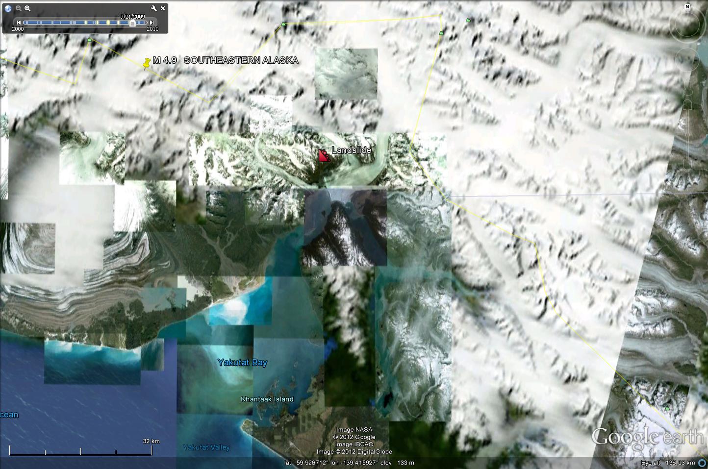
Amazingly, two days ago Colin identified a seismic signal that indicated another landslide event, this time ion the flank of the Hubbard Glacier fjord in the very south-eastern corner of Alaska. The landslide occurred at the location shown (courtesy of Google Earth) below at 14:25 UT (06:25 local time) on 21st May:
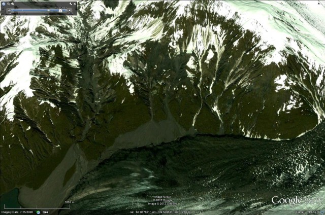
 The slope in question is shown in the Google Earth perspective view below:
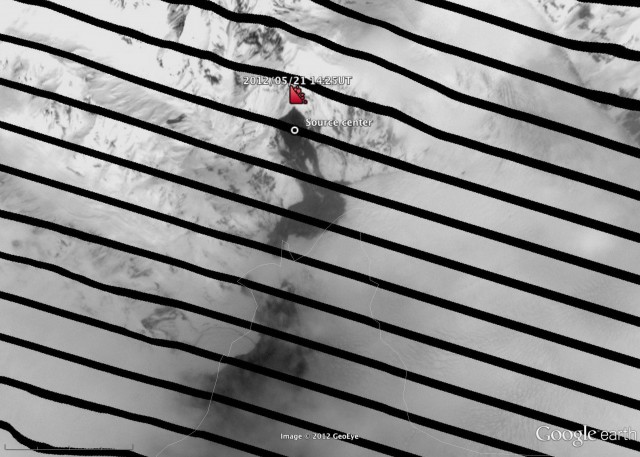
 This is a slope that has clearly had considerable small-scale landslide activity in recent times. Remarkably, the Landsat 7 ETM+ satellite overflew this area about six hours after the landslide, and managed to collect a good dataset. Colin has downloaded the data and has produced the image below of the landslide. Note that the imagery of course suffers from the same tiger striping problem that we saw in the Seti River dataset (this is a technical problem with the instrument), but despite this the landslide characteristics are clear:
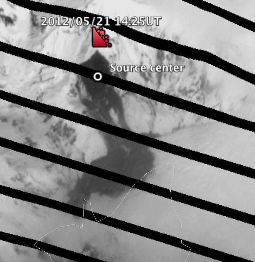
 And here is a close-up view of the landslide itself:
 Given the remoteness of the location I suspect that this event is undetected to date, but I’d be really interested to hear about any observations that have been made about it.


 Dave Petley is the Vice-Chancellor of the University of Hull in the United Kingdom. His blog provides commentary and analysis of landslide events occurring worldwide, including the landslides themselves, latest research, and conferences and meetings.
From the Google image, this landslide looks like it is on or very near to the Chugach-St. Elias fault or Boundary Fault. This area is in the collision zone of the Yakutat microplate, and landsliding is an important process that accompanies uplift and exhumation of rocks in this zone of intense tectonic activity. See recent paper on this specific area: Intense localized rock uplift and erosion in the St Elias orogen of Alaska, Enkelmann and others, Nature Geoscience, 2009.