8 April 2012
Images of the Three Gorges Dam ship lock wall
Posted by Dave Petley
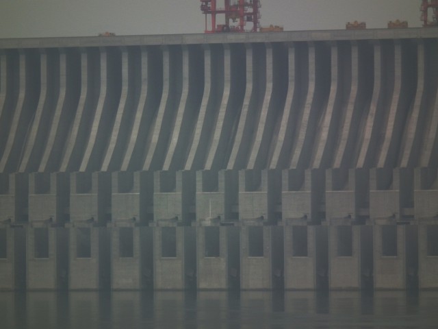
I am currently in China visiting the Three Gorges University to discuss research collaboration. The university is located within 45 km of the Three Gorges Dam site, and is responsible for monitoring many of the unstable and potentially unstable slopes on the banks of the reservoir. My hosts have been kind enough to take me to a few of the more notable sites over the last couple of days. The first was the cut slope on the walls of the flight of ship locks at the dam site itself. This is an image of the dam from the downstream:
This is the central part of the dam, which provides the spillways. As the flow is low in the spring the spillways are not being used. The dam is a strange structure – not aesthetically pleasing in any way, as many dams are. Indeed, I found it to be surprisingly brutal although, as in the image above, the geometrical shapes in the spillway do create some very strange optical illusions (the image is not altered at all).
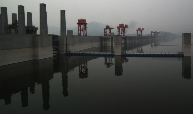
From the true left bank of the upstream side the dam looks like this:
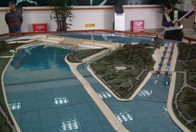
The scheme is truly epic in scale and ambition. The model below shows the layout:
This is the view from downstream (the cleaner is not a part of the actual scheme, in case you were wondering…). In the view the main dam is on the left side. It consists of three sections – a central section comprising the spillways and on either side sections that contain banks of electricity generators. On the right side of the main dam is a narrow channel leading to the ship lift, which is currently under construction. On the right side of the model is the two flights of five ship locks, cut through the hillside. This channel had to be sliced through the granite, which required the construction of an extremely high cut slope wall. This is the ship lock system as from the viewpoint between the locks and the dam. Note the superstructures of the ships just visible in the upper lock on the left side (this is the downstream direction for the ships). Note that you can only see two out of each of the two flights of five locks:
One of the great challenges of building this lock system was the creation of the box-cut that contains it. The total excavation depth is 170 metres, consisting of a lower 68 metre vertical section for the locks themselves (with of course a central island between them that is 57 m wide (note the crane in the above image for scale), and a 102 m benched slope above. The standards required here were very high – the river is an essential communication and freight route to Central China, so the loss of the locks is intolerable. Furthermore, the locks themselves are of course holding back the reservoir, so deformation of for example the lock walls that support the gates must be minimal.
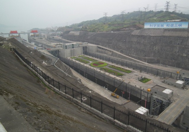
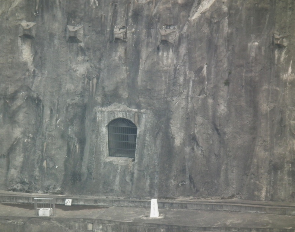
The walls are strengthened with about 2000 pre-stressed cables up to 60 m long and over 100,000 rockbolts before the slope face was sealed with concrete. The slope is drained with a set of tunnels, from which there is a set of boreholes drilled to provide complete coverage through the rock mass. These slope stabilisation measures can be seen in the image below, which shows a drainage tunnel and the heads of the pre-stressed cables:
Also visible in this image is the monitoring system now deployed to ensure the stability of the site. This includes both geodetic measurements using standard field techniques and GPS monitoring, plus measurement of the groundwater conditions. It has been reported from the site that the deformation of the slopes is minimal (generally less than 30mm).


 Dave Petley is the Vice-Chancellor of the University of Hull in the United Kingdom. His blog provides commentary and analysis of landslide events occurring worldwide, including the landslides themselves, latest research, and conferences and meetings.
[…] a part of my visit to China Three Gorges University, my hosts took me up the lower reaches of the Three Gorges reservoir to look at some of the large landslides that have occurred in and around the gorge. This is truly […]
There is a 3 Gorges Dam and Reservoir Symposium taking place at Univ of California, Berkeley next week – April 13 and 14.
the Berkeley Dept of Landscape Architecture and Environmental Planning does followup on dam project impacts and 3 Gorges is one of the their biggest followup projects. Experts from China are attending, including those involved in landslides and other geologic hazards, associated with the dam. There will be a proceedings published for the symposium. I will be attending as a discussant.
here is the website for the symposium:
http://laep.ced.berkeley.edu/3gd/