
18 October 2009
Typhoon Parma – rainfall and landslide maps
Posted by Dave Petley
NASA have recently produced a map of the distribution of rainfall from Typhoon Parma (Pepeng) in the Philippines:
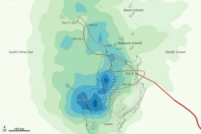
 The map has been produced from “the Multisatellite Precipitation Analysis, which includes rainfall observations from many satellites that are calibrated to match more detailed rainfall observations from the Tropical Rainfall Measuring Mission”. I am not sure how reliable this is, but it is certainly a useful first estimate.
I thought it would be interesting to compare the distribution of fatal landslides with this map. I have used the amazing NDCC daily reports to compile a map of the landslides that killed people. I can only locate the slides to within a couple of kilometres, but for this exercise that is good enough. So here is a Google Earth map of the fatal landslides:
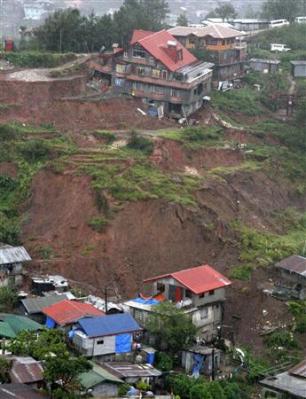 Each dot is a single fatal landslide – click on the image for a better view in a new window. Note the cluster in the centre of the image – this is Baguio City where there were many slides.
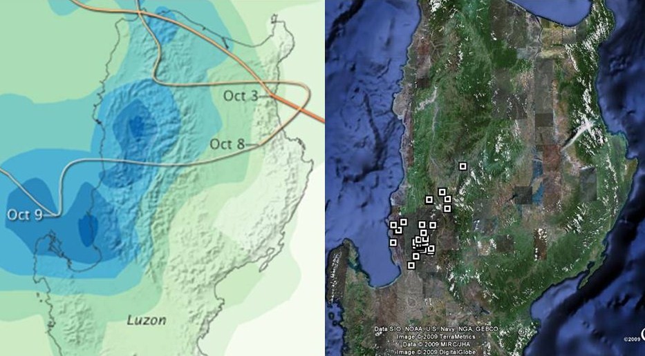
Not a bad relationship actually, but far from simple – but then fatal landslides are certainly not simple things.
Comments welcome.
 Dave Petley is the Vice-Chancellor of the University of Hull in the United Kingdom. His blog provides commentary and analysis of landslide events occurring worldwide, including the landslides themselves, latest research, and conferences and meetings.
This is a very interesting map you've prepared. May I post this in my blog?Is the landslide clustering around Baguio City a consequence of human activities, or are landslides generally natural occurrences in mountainous regions?
The weatherstore – yes, of course, no problem. Please acknowledge me, but feel free to use as you wish.Dave