
31 May 2009
Landslides and the Kailash Mansarovar yatra
Posted by Dave Petley
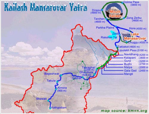
One of the great pilgrimages of the Hindu faith is the Kailash Mansarovar Yatra, which is a 400 km trek up to Lake Mansarovar in Tibet. This pilgrimage is very demanding – the lake is at 4550 m above sea level. It is undertaken in groups of 60 people over 26 days. Each year the first group sets off on 1st June.
The route is shown below (from here):
This year the pilgrimage is going to have an additional challenge. I posted back in February about the Chautuldhar landslide in northern India, which was causing major problems in the close area of Tawaghat in Dharchula. The landslide is not quite where I thought it was back then – it now looks as if it is on the section of slope shown on the Google Earth perspective view below:
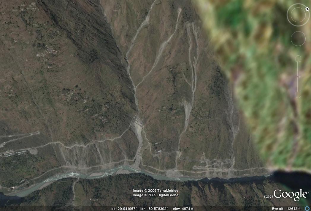
A close look at the map above will show that Tawaghat is right on the route of the pilgrimage. Unfortunately, the landslide remains active – indeed David Hopkins has been kind enough to send a translation of an article in a local paper for this area, dated 27th May:
“During the past sixty hours rocks and stones have been showering down from the mountain in Chautuldhar. Following the recent rains the mountain in Chautuldhar is on the move again. The temporary road made across the slide has been swallowed up by the river below. People are taking their lives into their hands to cross the slide. With two bulldozers of the BRO (Border Roads Organisation) stuck on the Tawaghat side problems have only increased. From Friday to Sunday following very heavy rains, rocks and boulders are continually raining down from the mountain.”
To deal with this problem a diversion has been created, but this is reported to be “treacherous” and likely to add two days to the length of the trek.
 Dave Petley is the Vice-Chancellor of the University of Hull in the United Kingdom. His blog provides commentary and analysis of landslide events occurring worldwide, including the landslides themselves, latest research, and conferences and meetings.
On the 18th August 1998 the worst landslide on the Indian Himalaya in recent years occurred at Malpa during the Kailash-Mansarova Yatra. Up to 380 (the figures vary) people were killed including a well-known dancer, Protima Bedi.
On the 18th August 1998 the worst landslide on the Indian Himalaya in recent years occurred at Malpa during the Kailash-Mansarova Yatra. Up to 380 (the figures vary) people were killed including a well-known dancer, Protima Bedi.