
26 May 2009
The Pareechu landslide and flood, 2005
Posted by Dave Petley
In July 2003 a landslide occurred on the Pareechu stream at 32.322N, 78.735E, a remote tributary of the Satluj River in Tibet (see Fig. 1). The landslide was quite large, blocking the river and allowing a lake to form that eventually breached. In this post I will try to use the range of satellite imagery and reports that are now available to describe the sequence of events.
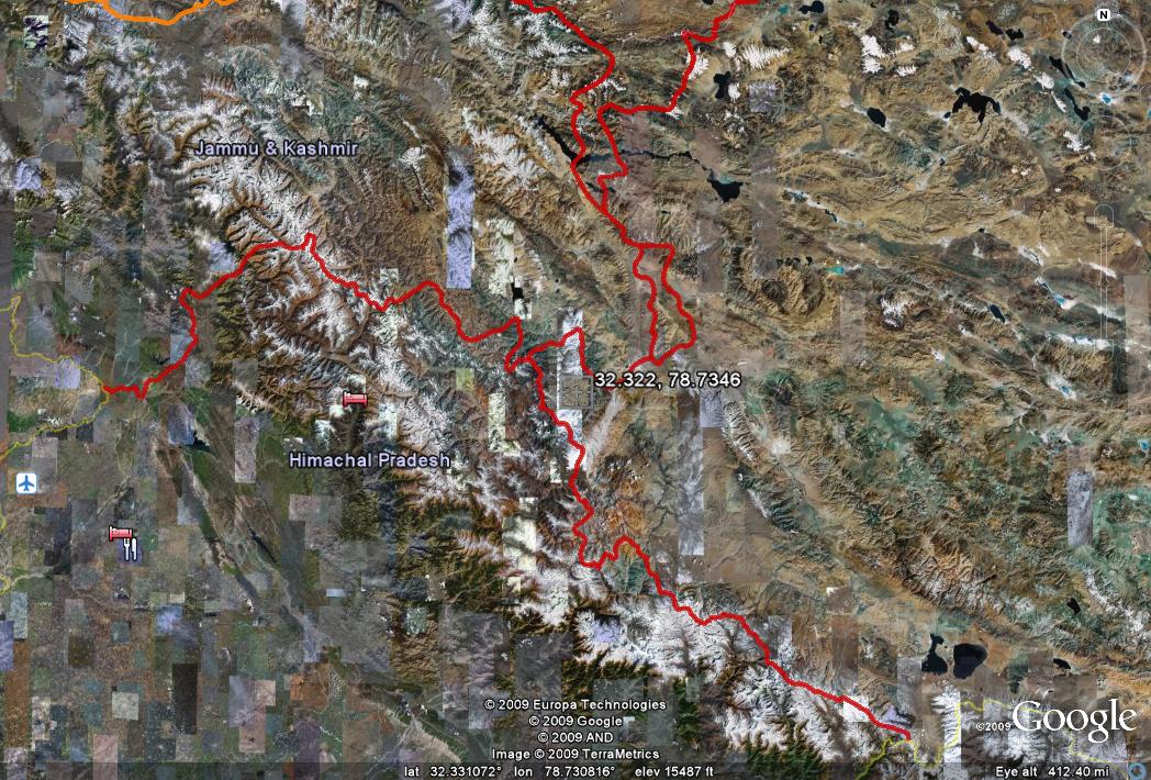 Fig. 1: Google Earth location map of the Pareechu landslide (click on the image for a better view in a new window)
NASA produced an ASTER image of the site that was collected in October 2003, before the landslide occurred (Fig. 2). This shows the rather strange landform at this site – i.e. a broadening of the river in which there has clearly been extensive sedimentation.
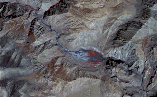 Fig. 2: NASA ASTER image of the Pareechu landslide site before failure
It is not clear what triggered the landslide, but another ASTER image collected in July 2004 very clearly shows the immediate aftermath of the slide (Fig. 3).
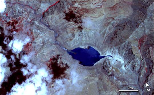 Fig. 3: NASA ASTER image of the Pareechu landslide site after failure
Note that the basin is now being filled by a lake. The landslide itself is not particularly clear, although the extensive dust kicked up by the slide is fairly obvious as a whitish colour mantling the slopes just to the east of the lake. It is certainly clear that the valley is blocked. An enlargement of this area helps a little (Fig. 4).

There is an image available in the following presentation (slide 7) that provides a view of the site in August 2004 (Fig 5):
http://www.managingclimaterisk.org/document/SAARC.pdf
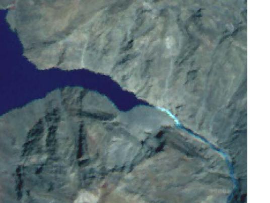 Fig. 5: Presentation image of the Pareechu landslide site after failure
The landslide is clearer here, but note also that there is water flow clearly evident, so presumably at this point the landslide had overtopped the barrier. Note also though that the lake is still present, so presumably the flow was not large enough to induce significant erosion.
The next available image is from 20th February 2005 (Fig. 6). Of course this is the middle of winter, so unsurprisingly everything is frozen up. Nonetheless the lake is clearly still present.
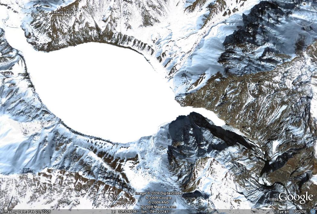 Fig. 6: Google Earth image of the Pareechu landslide site in February 2005. The site is of course mantled with snow.
It does appear that there is some flow in the river, but not over the dam, presumably indicating that some seepage was occurring. This high resolution image also gives the first opportunity to get a good look at the slide, especially when the Google Earth terrain model perspective view is used (Fig. 7).
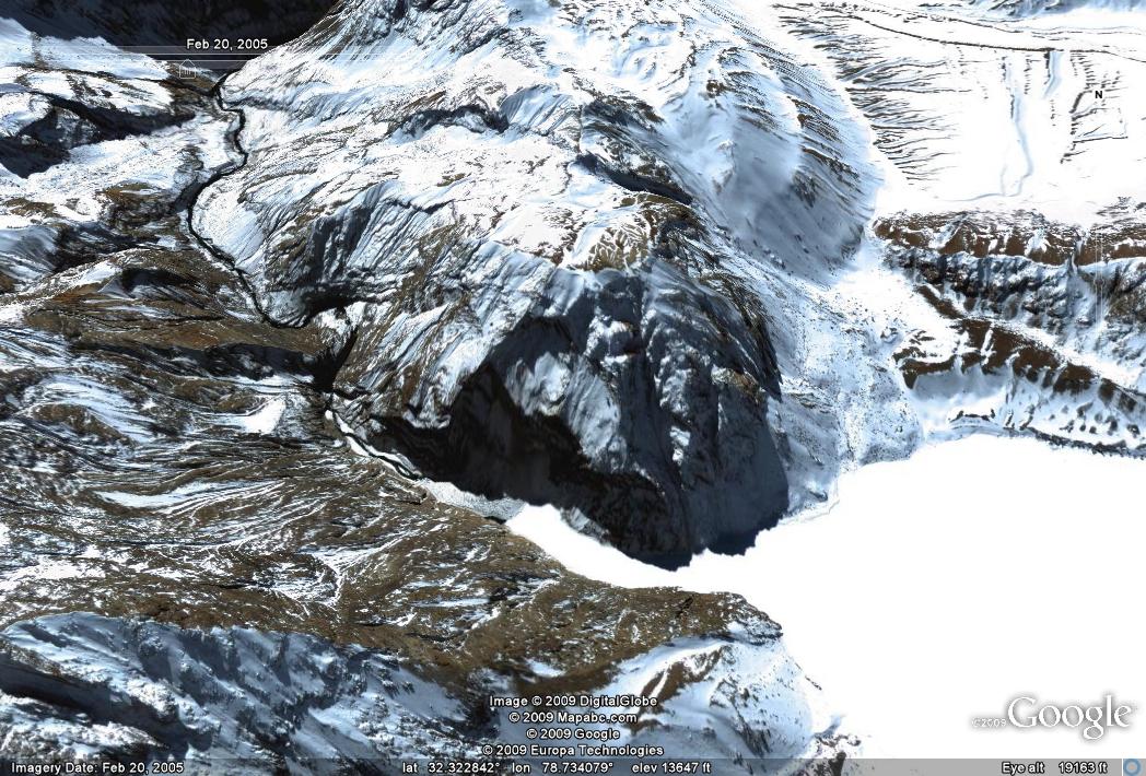 Fig. 7: Perspective Google Earth image of the Pareechu landslide site in February 2005.
 It is clear that the landslide here was actually a comparatively small failure of a much larger rock slope failure. However, in turn this active section is part of a much larger rock slope failure that is delineated by a large fracture running across the hillside. I have highlighted this on Fig. 8.
 Fig. 8: Annotated Google Earth image of the Pareechu landslide site in February 2005.
 At its maximum the lake was 2,100 m long, 1,100 m wide and about 40 m deep storing about 64 million cubic metres of water, according to Gupta and Sah (2008). The dam appears to have failed at about 11 am on 26th June 2005, releasing a flood wave down the river that had a maximum measured discharge of about 2000 cubic metres per second. Fortunately, according to Gupta and Soh (2008) no lives were lost, although press reports at the time indicated that a small number of bodies were washed into India from Tibet. In India the flood did wash away 8 bridges, 15 km of road and caused damage estimated at US$177 million. It is not clear how much damage was caused in Tibet.
The final image, also from Google Earth and dated 4th September 2006, shows the site after the dam breach (Fig. 9).
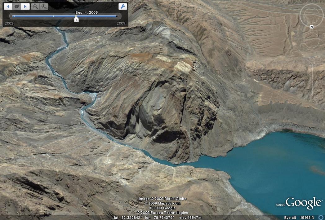
Note that the dam is still holding back a little water, but that this volume is now quite low. However, the slope above still looks highly unstable, so a repeat looks inevitable in due course.
Reference
Gupta, V. and Sah, M.P. 2008. Impact of the Trans-Himalayan Landslide Lake Outburst Flood (LLOF) in the Satluj catchment, Himachal Pradesh, India. Natural Hazards, 45, 379-90.
 Dave Petley is the Vice-Chancellor of the University of Hull in the United Kingdom. His blog provides commentary and analysis of landslide events occurring worldwide, including the landslides themselves, latest research, and conferences and meetings.