
19 March 2009
Coastal landslides and tsunami hazards (and the wonder that is Google Earth)
Posted by Dave Petley
Richard Tieuw and several of my former colleagues at the Geohazard Reserach Centre at Portsmouth University in southern England have published a nice, short article in EOS looking at issues associated with the generation of tsunamis by coastal landslides. EOS is subscription only, but the article has been covered quite well by New Scientist (available online here), although they look at a particular aspect (see below).
First, let’s take a look at the article itself. They highlight the hazards associated with a 1 million tonne (actually ton, but let not quibble) block that they have identified on the flanks of the Morne Aux Diables volcanic edifice in the north of the island. New Scientist have provided an image of the feature:
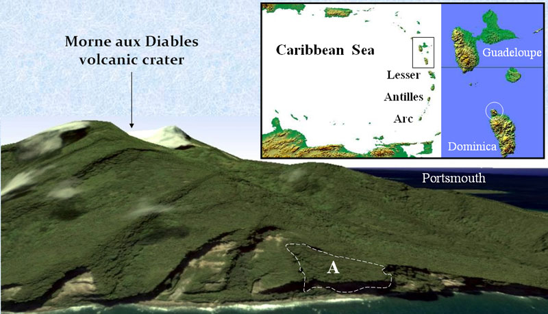 They suggest that failure of this block (marked A above) could trigger tsunami waves 2.8 m high (annoyingly they don’t specify whether these heights are proximal or at some distance from the collapse, which is fairly critical). They also hypothesise that the failure could trigger further, potentially larger events that of course have further to travel and so could generate a large wave. They note that the beaches of Guadeloupe are a few tens of kilometres to the north, although they do not specify how much the wave height would have dissipated by the time it got there (one feels intuitively quite a lot, unless you subscribe to the Ward and Day model).
So let’s take a quick look at the feature in question, using Google Earth of course. Here is is:
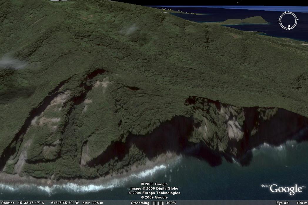 Based on this I would agree that there is a potentially unstable slope here – it’s a pretty good catch by Tieuw et al – although it seems to me that the distance to any major vulnerable population would imply that the direct risk is not too high.
The New Scientist article picks up on the more important aspect of the piece though. In the second part of the article Tieuw et al. note just how powerful Google Earth is proving to be in these kinds of studies. “Conventional” techniques, such as Lidar and high resolution satellite data are ruinously expensive and generate datasets that are immensely difficult to manage with high levels of skill and good quality hardware and software. This high res Google Earth imagery is free and can be handled very easily. In my opinion Google Earth has been the most important development in geohazard work in the last five years. It is thrilling to think that it is likely to get better and better as time goes on.
Reference
Tieuw, R., Rust, M., Solana, C. and Dewdney, C. 2009. Large Coastal Landslides and Tsunami Hazard in the Caribbean. Eos, 90 (10) 81-82.
 Dave Petley is the Vice-Chancellor of the University of Hull in the United Kingdom. His blog provides commentary and analysis of landslide events occurring worldwide, including the landslides themselves, latest research, and conferences and meetings.
Were you aware that the new version of Google Earth now allows you to view historic aerial photos? I think it may only cover the US for now (haven’t checked, though). This is another way Google Earth is so useful for geoscience work.
HELLO DAVE: WRITE FROM MEXICO, I’M IN OCEANOGRAPHY GEOLOGICAL RESEARCH IN THE MEXICAN NAVY. I’m very interested in GET A COPY OF PAPER: Tieuw, R., Rust, M., Solana, C. and Dewdney, C. 2009. Large Coastal Landslides and Tsunami Hazard in the Caribbean. Eos, 90 (10) 81-82. to apply is the investigations undertaken in the islands of the Revillagigedo Archipelago. BEST REGARDS LT. Martha Marin
Lt MartinPlease send me your email address and I’ll sort it out. Best wishes,Dave