
9 October 2008
Young River Landslide, New Zealand
Posted by Dave Petley
Interesting news from New Zealand, where for the last few months there has been some concern about a landslide dam on South Island. The landslide itself occurred in a fairly remote area of the Southern Alps at 4:40 am on 29th August 2007. The landslide, which is well-described in a GNS Science poster here (there are some great images and some good data on that poster), blocked the river valley to a depth of about 100 metres. This was a big debris slide, with a volume of about 11 million cubic metres and a runout distance of about 1.8 km. Interestingly it does not appear to have created an air blast as large slides of this type often do. This may mean that the mass moved as a series of events closely spaced in time, rather than one big, instantaneous failure.
Over time a lake built up behind it, finally overtopping on 5th October 2007. Understandably, there was concern about the possibility of an outburst flood. In this case there are few human assets at risk downstream, but this is a popular hiking area, potentially putting people on the trails at risk. As a result, the trails were closed by the Department of Conservation whilst the landslide was monitored in real time by GNS Science and Otago Regional Council. Unfortunately, such a closure was not good for the local community as it reduced the number of tourists.
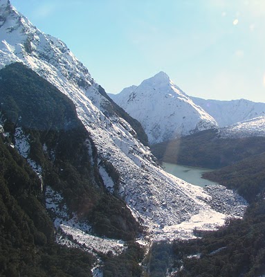
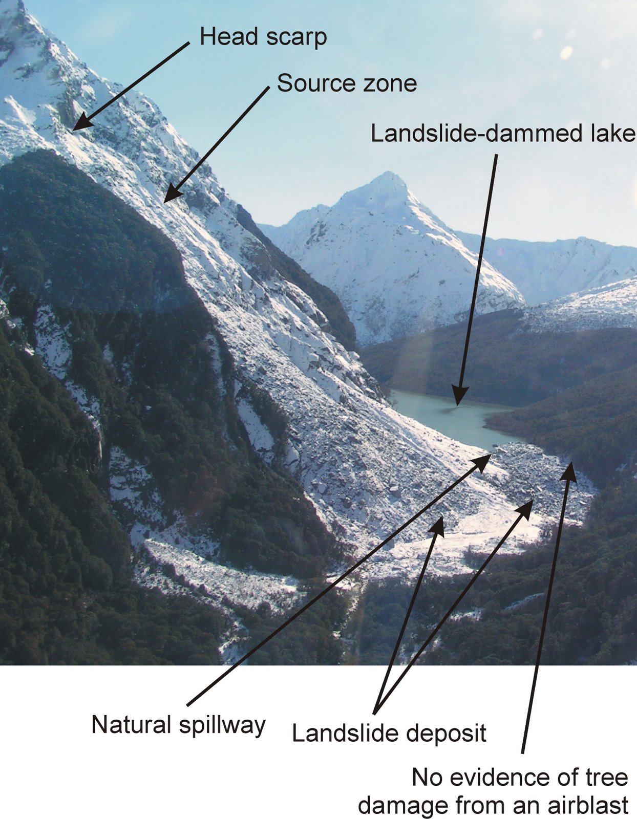
The images below show the landslide from the downslope side. I have annotated it below to show the key features. Note that the deposit has banked up on the right side (from this view). The natural spillway that has formed is just on the lee of this banked up deposit. This deposit is coarse-grained (bouldery), which may well be the reason why the channel has not eroded downwards to release the water.
 The image below is from the landslide dam itself looking across the lake. Note the size of the boulders – these are part of the landslide deposit. This does show that if the landslide dam is stable then the resultant lake can in some circumstances become an asset.
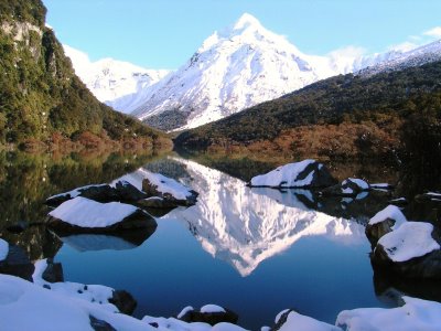
 This week it was reported here that a decision has now been taken to reopen the trails downstream of the landslide from 1st November (i.e. just before the start of the summer). Unsurprisingly, the local people are rather pleased: “Makarora Residents Association deputy chairman Devon Miller said the closed valley had affected some of the tourist operators in the township, so the decision to re-open was a welcome one.”It’s a good positive announcement and the community is happy,” he said.” (Otago Daily Times).
The decision to reopen the trails but to maintain some restrictions in heavy rain, using a new warning system, appears to be sensible. So often landslide management is about balancing risks – i.e. what is the risk of a collapse of the dam affecting someone on a trail compared to the risk to the local communities associated with the loss of tourism, etc. In this case the stability of the dam suggests that this risk has now dropped to close to the residual level. Note that this does not mean that there is no risk – there are hazards associated with spending time in remote mountains. The risk from the landslide dam is no greater, and may be substantially less, than those other risks.
All-in-all the approach taken by the parties involved in New Zealand has been exemplary, in terms of picking up the event in the first place, in terms of the ways that they have monitored it and in terms of the decision-making process to minimise risk.
 Dave Petley is the Vice-Chancellor of the University of Hull in the United Kingdom. His blog provides commentary and analysis of landslide events occurring worldwide, including the landslides themselves, latest research, and conferences and meetings.